
Runs with groups of others

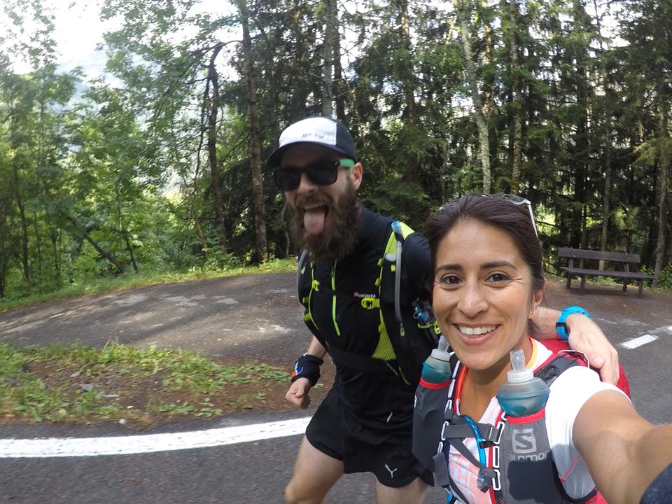
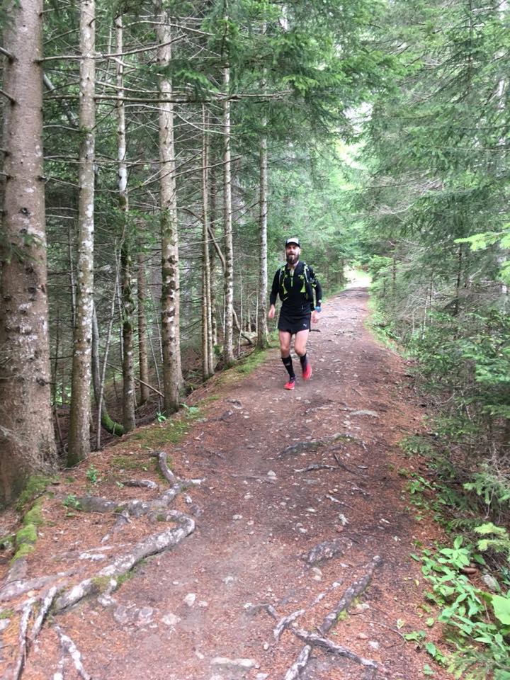
Whilst In Ireland for a wedding, Nick and I wanted a run. He was two weeks out from the Amsterdam marathon and I was flying out to Poland the following week for my next and (once again!) biggest challenge to date – 150km of the Lemkowyna ultra trail. Nick plotted a route of about 20km along the roads and we were set for Sunday morning, the day after the wedding. I wanted something different though. I wanted onto the local trails. So we did the run on the Saturday morning, pre-wedding, and I planned to go and do the 33km of the Foxford Way Loop on the Sunday. After such a great run on Saturday, Nick wanted in too, despite needing to be at the airport for 14:00.

With heavy heads and tired eyes we woke early and set out about 7am to follow the. routed I’d plotted on the Suunto 9. We drove to the nearest town, Foxford, where we could leave the car with our checked out luggage and loop back at the finish. We weren’t 100% sure of where the route should start so we parked up near the Centra in Foxford and set out in an anti-clockwise direction. We picked this direction as we knew the last 8km so from the run the day before and, if struggling for time, this would be useful knowledge and experience. A short jog along the main road and we were able to turn off onto the tracks…

The Foxford Way is intermittently marked with a trail sign – a yellow arrow and human hiker-figure. Mostly found on fence posts and markers about waist height. I say intermittently as they didn’t mark specific turns or intersections. Sometimes we’d go for a few kilometres without seeing any.

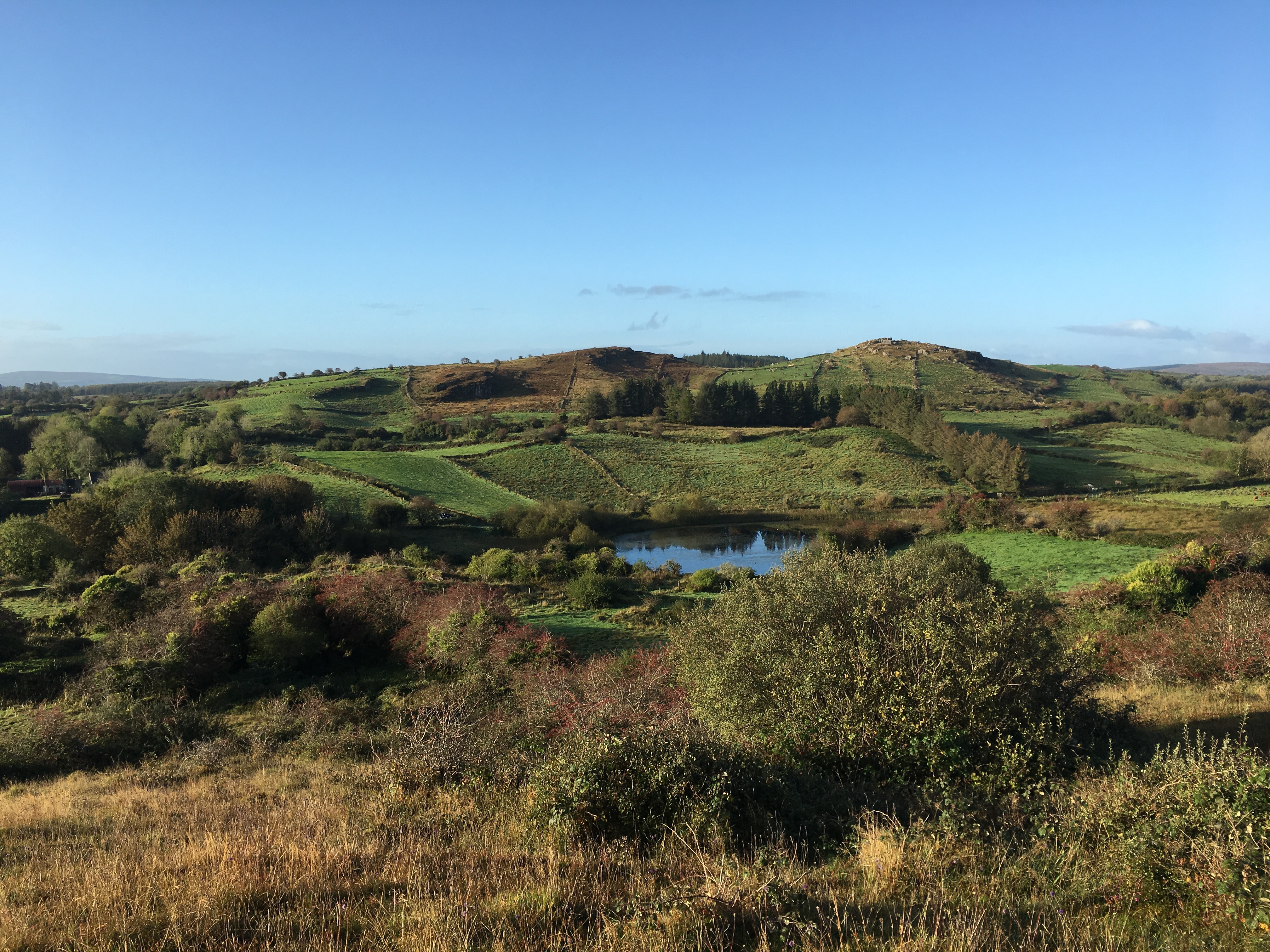
We set out up the N26 and soon turned right after a Mother of Mary shrine on the side of the road. The path began to climb and morning began to break. The climb was a wide, semi-pathed track and it wasn’t long before we reached the top and the path continued rolling across the hills and countryside. It was a chilly but dry morning and we could see we were going to in for a treat with spectacular views over West Ireland.

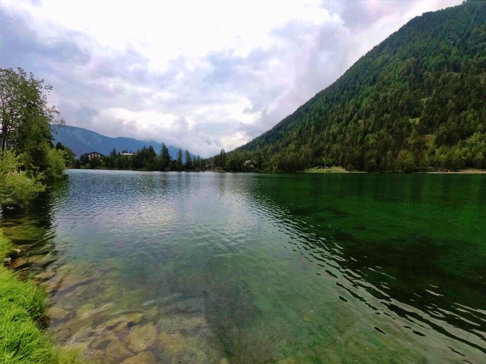
After a few Km we reached a Lake (Louch Muck) and followed the path to the right passed some beautiful houses with unobstructed views of the lake. The path was again wide and semi-pathed as it led around the lake, into some forests and beyond.
After a little while we reached the N26 again, crossed over and continued up a country road for a little while. We soon encountered our first challenge. As the route led us off the tarmac track and onto some wild and un-maintained tracks. The trail markers reassured us that we were going the right way and we took a moment to enjoy the stunning views as the sun began to shine. We were then presented with a very overgrown route.


The thorns and hedges, soaked with the morning dew, dew reached our knees and thighs and running became almost giraffe like. With high knees. The ground and foliage covered with a white layer of spider webs glistening in the dew. We were slowed to a fast walk. Maybe a km of this path was enough to frustrate us but I was hopeful it was a one-off and just a little used section of the loop.
The route followed some clear track again and we were walking up the road munching on flavoured KitKats when we noticed we were a little off course. Back tracking we found the path again – another overgrown route. We sighed and high-kneed it onward.
We came across another trail fence post with the way markers indicated. But we were momentarily confused as there were two different ways indicated. One across a make shift wooden plank bridge across a stream into a forest, the other straight on behind a tied up rusty cattle gate, into a tree-lined path, shaded from the sun’s reach. The watch said forward and so we climbed the gate and continued.


We soon cane to a halt as I exclaimed “Fuuuuuuck” and stopped. I’d lifted my head and glanced forward and saw, what looked to me like, a little girl, standing there in high-white socks and her long blond hair covering her face and shoulders. Just standing there, silently staring at us and not moving. Nick stopped and swore too as we quickly realised it wasn’t a little spooky girl but a small stumpy pony. As I went to photo it it ran towards us. It ran funny and looked a bit poorly cared for. It loved us and the attention though.
After petting the pony we realised we’d run passed the ‘turn off’. There was no turn though, so I started jogging back to the gate and the pony started chasing after me, excited to play. Nick leaped over the stream and escaped to the forest. I carried on slowly.
As I climbed the gate and headed across the wooden plank bridge Nick acknowledged he was stuck the other side of a farming ‘rope’ fence and another stream. We carried on along our separate sides and the pony ran off and left us. The route was on track, but it was no path and we just stumbled out way through the forest!
The forest looked enchanted and was littered with farming rope as the sun shone through the trees in the distance. The ropes ran both parallel and perpendicular to us and we climbed over and ducked under to continue, Nick to my left navigating his own route. To my right I could hear the ‘tick tick’ clicking of the rope dividers. They were electrified. As I looked up I momentarily freaked myself again as the pony was up ahead galloping (in its own funny way) through the forest towards me. Where and how it arrived I do not know. I petted it more and carried on weaving through the electrified roping. A fence post confirmed the right way but oddly, it didn’t match the route on my watch.

As I climbed over the last rope divider blocking my way, Nick arrived, in style. As he ducked under a rope fence he slipped and became stuck. I laughed as he limbo’d to free his bag from the rope with his feet sliding apart in the mud. The pony didn’t make a sound. As Nick freed himself I warned him about the electric fence. He discarded it claiming it wasn’t and he’d been touching them. To demonstrated this he grabbed the rope and immediately screamed and jumped about. Yep. I was right.
We continued in the direction of the signpost and emerged into a garden, well, field (it’s Ireland!). But the rope dividers continued. The route said we needed to first go diagonally across the land before joining a more prominent path and head left. There was no path across the field though so we walked to the farm building and across the land. I was hesitant knowing this was someone’s property and was glad to climb the boundary wall and hop onto the main path. We sighed some relief and then a dog came.
It was an old dog. Wheezing. Not barking. It wanted attention. So much attention, sitting on our feet. It moaned and wheezed and pushed against us when we tried to continue. Then it barked a loud screechy wheezy bark and wouldn’t shut up. We ran on. I looked back as we ran and saw a figure behind us standing on the track and watching us run away. It was some form of ‘heritage centre’ (‘Hennigan’s Heritage Centre’) but seemed almost abandoned and lacking any Heritage (to a passer by!). Either way, a little freaked out by the figure and conscious our trail through the ‘enchanted’ forest had cost us some time we ran fast along a country lane whilst many more aggressive dogs barked from within their fenced gardens. Thankfully unable to get at us!
After a short incline the path again indicated a turn to the right and the start of the second highest climb of our run. Again, despite the sign posting, the path was not feasible. Overgrown and thorny to at least waist height. We couldn’t go up it so instead we climbed a wall into the field running alongside, cautiously acknowledging the sign saying “beware, bull in field”.
We stuck as close to the path as best we could but it was far easier to walk parallel to it in the field. Whilst we would have needed a machete to navigate the path, we instead had to navigate lumpy boggy fields as we hiked to the top. Our feet were already wet but now so too we’re our legs from the knees down. There was no way to avoid the bogs.


As we traced alongside the wall ‘up’ we contended with the water-logged bogs and lumpy divets. The climb was slow but we kept going, occasionally turning around to absorb the views behind us. The higher we climbed, the worse it became though and we’d occasionally go right back to the overgrown track to confirm the directions.
Eventually we reached a wall by some old ruins and climbed over onto the most mainstream of roads we’d seen for quite some time (still a country lane). We turned right and ran on. We came upon a collection of houses and ran passed another trail marking. It indicated the path would turn left sooner than the map on my watch indicated. Whilst I went ahead and checked it out, Nick made a new friend. Another dog, black and shaggy (like ol’ wheezy’ only much younger’). I came back as the point the watch was suggesting was far less accessible than the area indicated by the trail sign.
We spent a few moments petting the dog which was silent and attentive with these big dark brown eyes that pierced you. We decided to trust the sign post best and climbed a wall to get onto the indicated route. We were back up to our knees in foliage yet again. Then we weren’t alone. The dog had come with us. He bounded through the wet grasses and stopped up ahead as if showing us the way.
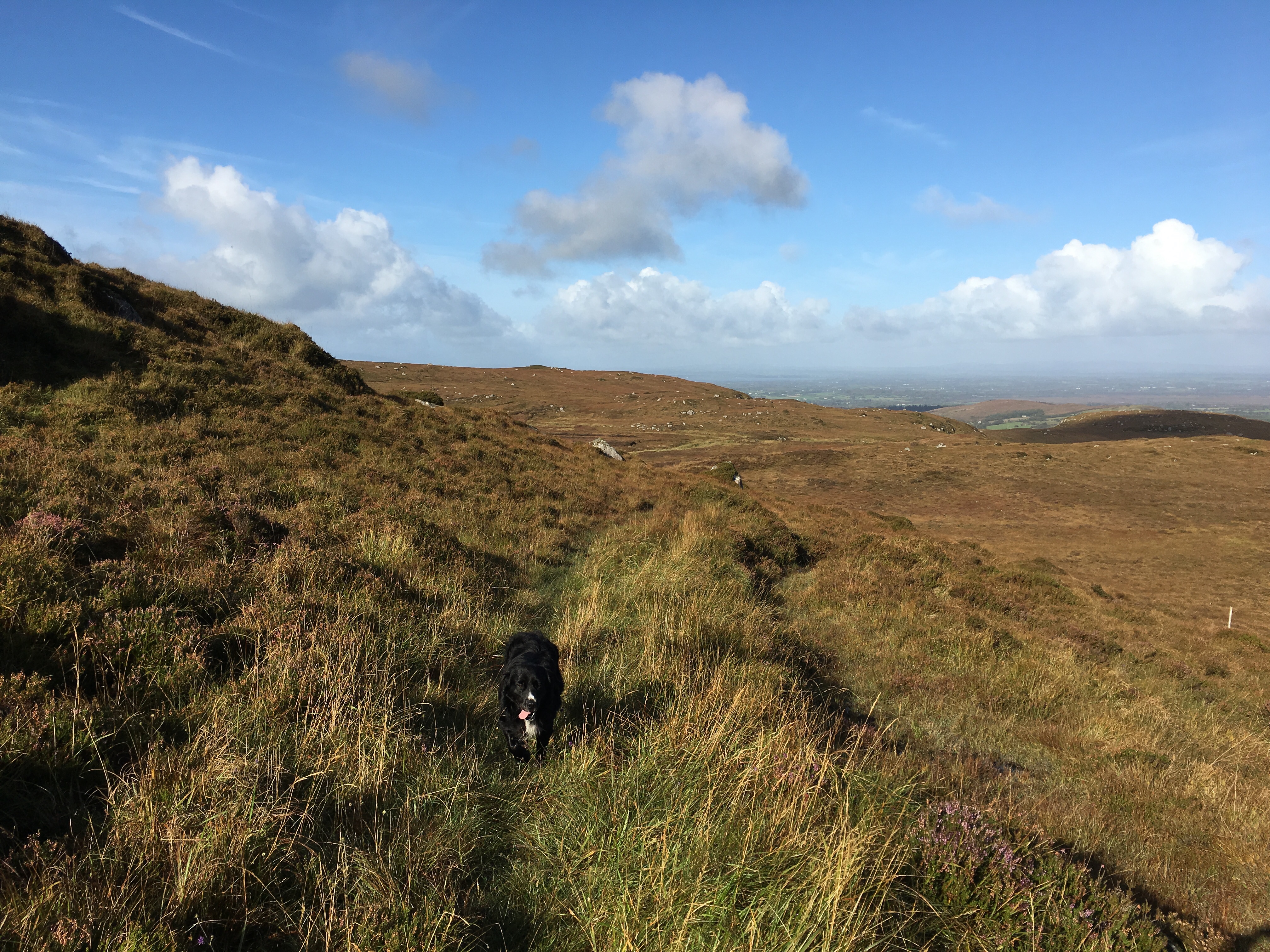
We kept trying to send he dog back but it wouldn’t. I was glad of the dog at this point. The route again was not clear and the dog became the marker. It was like he knew the way we needed to go and was helping to guide us. It was a little surreal but a huge insight to a dog’s mind. I believed it was telling us to follow him.
We continued on like his for the whole climb. A long climb. As we reached the top, soaked through from the waist down, we again tried to send the dog back. Sam, we called it Sam, was having none of it. So on we continued together. Again, I was thankful as we began to descend the hill as it was all off track and lumpy and muddy. The track was not clear or available at all. But Sam saw a way through and we followed. The last part of the climb was through a field covered and glistening with webs. Sam bounded through without a care in the world.

After what felt like ages of climbing and descending we reached a wide drive-able track. We tried to run on and recoup some time. As we struck a rhythm we turned left onto a slightly less mainstream track, still runnable though. We tried once more to ditch Sam. We failed. I looked back and saw the mountain (hill really) behind us becoming a distant shadow. I worried Sam wouldn’t get back. Nick was thinking the same and despite my protests was already planning how we’d return the dog. Whilst I was trying to put us first, I knew he was right – We had to get Sam home safely after the run.
The path opened into a small area of houses and buildings. Many being built. Many not looking that nice. A community. There were lots of dogs. Some looked aggressive. Some barked and began chase. Sam wasn’t phased. No comment. No sound. Just ran on ahead, guiding his “humans”. We were glad to get away from that area and all the dogs.
We hit a stream and whilst Sam refreshed we untied an old pallet crate makeshift fence and continued. I thought we’d lose him here, but to my surprise, Sam figured a way around and continue with us. At that point I accepted he be staying with us.
The path was over grown and we climbed gradually with the boggy, unclear track. Then a house. It felt once more like we were on someone’s land, but up ahead some metal steps had been built over the stone wall to guide the way. Once over, Sam was there looking at us wondering what went wrong and why we’d taken so long. Onward we went, to the right we climbed. A little more. Always a little more.
The track opened and we ran down. A nice section of wide trail paths that was very runnable. The views were beautiful. Sam up ahead. Every few hundred metres he was turning around and looking to see if we were following. At the bottom the biggest climb was about to begin. Now the green steps over the walls were marking the way. We went over, Sam went around. The route again was overgrown. My feet we’re wet and cold. My legs scratched to shit from all the brambles. We were embracing it though. Up and over this ‘mountain’. 200m. A baby. Head down and march on. Sam, diligently as ever kept stopping and waiting. Or running back and sitting at our feet. Eyes wide open, want a pat on the head. I desperately wanted to feed and water him but my fuel for the day was High5 isotonics and KitKats – not dog friendly!!
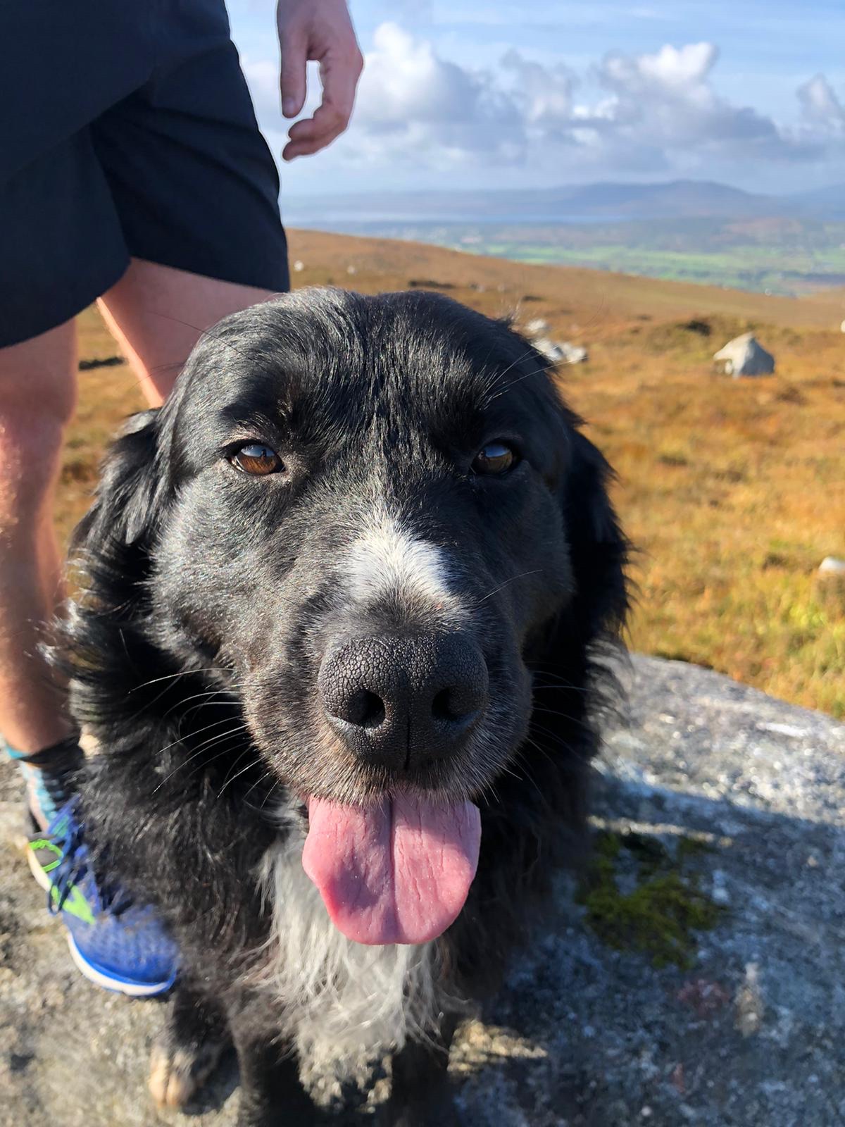
Eventually we reached the top and stopped to take pictures. Sam was all over this. Jumping on the rocks to join us and pose. A well deserved break and a moment to enjoy what the run has amounted too. A really off road adventure and a new friend too!


With time on our mind we cracked on. We now had less time than we’d planned. Whilst the run has taken longer than planned (with wrong turns, animal encounters and navigating around the unfeasible paths we’d added about 30 mins to our conservative estimate) we now had to taxi our new friend home also. We had no idea how long this might take but we knew we couldn’t abandon him now. He hadn’t left us for a close to two hours at this point. We picked up the pace and began to ran. Soon we were walking again though – the descent was very boggy and we were slipping all over the place.
Eventually we reached a pathed track and recognised the area from the previous day’s run. We knew where we were now. Soon the main road appeared and we had to control Sam as we crossed and ran a short distance along the country lanes with cars zipping passed.

Taking side roads Sam started to attract attention from more dogs (did everyone own dogs in this part of Ireland?!?) and took a particular shine to a dog being carried by two girls. Like a ‘dutiful owner’ I had to go back and drag Sam away. Whilst they were OK with the encounter, Sam didn’t look too impressed with me!
The final straight soon appeared and we knew we just had to run to the end of the road. One more obstacle though – the road was closed. Fenced off for building works. Bollocks. It was a bit of a trek back to circumnavigate around the road works so we made the decision to climb around the fencing, coaxing Sam to join us. We ran through the closed road, passed the Wollen Mill and arrived back where we started.

We realised we’d left the car unlocked (with all our stuff in it) and as soon as we popped the boot Sam jumped in. He didn’t stay long before leaping back out and seemingly wanted to play with the traffic instead, refusing to get back in until Nick picked him up. How he had so much energy left I don’t know – Sam ran with us for 18km and some 2.5 hrs!
Where he Ra


Nick started driving while I sat in back Sync-ing the activity from my watch and looking for where I thought we picked Sam up. Thankfully the unclear trail turning and climb were giveaways and I found where I paced up and down looking for the path and where we zigzagged up the mountain following Sam. Found it! 5 miles later we were at the houses where we met Sam, near a place called Cornageltha. We picked the house we thought he appeared from and Nick knocked on the door…

A little old lady came out, confirmed Sam was hers and laughed when she saw him sitting in the car. We let Sam out and he sat at my feet whilst we talked to the lady. She told us his name was Rocky. She explained he always goes off with strangers and walkers and that neighbours normally call her when he is found and that her brother has to go out and collect him from wherever he has decided to stop. She thanked us for looking after him and bringing him home. He jumped up and hugged us as we said good bye. We got into the car and made to leave.

As we left I overheard her talking to Rocky. She said something along the lines of “why do you always do this” pleading with him not to keep running off with strangers. “what will I do without you”. She questioned. I almost cried…
The route – Foxford Way Loop

We used http://www.mayowalks.ie to identify the loop and a visual representative from http://www.mayowalks.ie/media/Media,14140,en.pdf. A more detailed route can be found on Open Street Map – https://www.openstreetmap.org/relation/2859131.
The Foxford Way Loop is described as “a 33km long route, with the Ox Mountains on one side and the Nephin Mountain on the other; it is one of Mayo’s finest walks. Along the route a rich rich variety of flora and fauna and an exceptional archaeological and historical content is to be expected.” The terrain of the route will include bogs (wish we’d paid attention to that before hand!), mountains, rivers and lakes and breath-taking scenery to delight. This we can vouch for!
We decided to do the Loop in an anti-clockwise direction, although there seems to be no guidance as to the benefits of doing the loop in either orientation.
The Start / Finish – Foxford
Whilst http://www.mayowalks.ie describes the official start/finish point as being located in Foxford “beside the children’s playground in a car park just off the N26” we found this a little vague. So we parked up and started/finished on the N26 outside the ‘Centra’ shop, right in the middle of Foxford near the Wollen Mill.
We’ve split the trail notes into a few sections to provide guidance for anyone wanting to follow the route.
Section 1 – “Lough Muck” (Foxford to Lismorane). Distance from Start approx. 5.6 miles
From the Start in Foxford, the first section loops South from the N26, around Lough Muck before re-joining and crossing the N26 again just passed Lismorane.
From the Centra we headed East along the N26 in the direction of Swinford. The initial route ran alongside the N26 for about 0.8 of a mile. There is no pavement nor path for the majority of this section and we ran along the dotted lined/verge of the road. The turn off the N26 (on the right hand side of the road) was just after a religious shrine/monument and opposite “Noorey Park” road.
The trail here was wide and semi-pathed. It initially climbs to a height of about 400ft alongside the peak of Carranarah. The path continues in a South-Easterly direction from the N26 for about 1.5 miles before reaching Lough Much. From here the Trail continues South then in an Easterly direction (about 3.5 miles) until it reaches the N26 again. This whole section was well signposted with undulating trails. Easy to walk and run for all abilities.
Section 2 – “Cornageltha” N26 (Lismorane) to Cornageltha. Distance from Start approx. 11.2 miles
When the trail meets the N26 again just passed Lismorane, follow the N26 in an Eastern direction (again towards Swinford). Again, there is no pavement along this section of a busy road. Take the first left onto the ‘unnamed’ road after about 0.3 miles along the N26.
Follow the pathed road for about 0.5 miles (gradual incline) and turn right at the intersection. After about 0.7 miles of semi-pathed, down hill track, turn left. This section is single track and very un-maintained. The foliage was overgrown at waist height, the ground very lumpy and soft underfoot. The path continues like this for approximately one mile, emerging onto a small country road labelled “Graffy” in a North-Westerly direction.
Take the first right turn after about 0.2 miles along the Graffy. There should, almost immediately, be a trail heading off to the left of the path. This is signposted by the Yellow arrow/Hiker. Again this path is un-maintained and a little difficult to spot.
After about 0.3 miles the trail splits. There are two signs marked for the route, one straight beyond a closed and tied rusty farm gate, the other to the right across a small stream into a forest. Both probably lead to the same way, but the route to the right through the forest seems a better choice, if not a little ‘off-piste’. The forest is marked with electrified cattle rope and at the end you can see the yellow route / trail marker.
The route emerges from the forest into the fields/grounds of the Hennigan’s Heritage Centre. Leave the grounds and join the road ‘Rubble’. After approximately 0.5 miles, turn left at the road intersection onto Tiernunny. Follow the country road for 1 mile and then turn ‘Right’, shortly after the village of Derrynamuch, at the trail marker.
The section here is approximately 0.5 miles long. The official route indicates you should climb approximately 200ft along a marked route lined by a wall. You can see the route, however it is completely un-maintained and overgrown with brambles and (as of Oct 2019) not feasible to navigate along. We climbed a small, waist high, wall into the field (noting the sign warning “Beware of Bull” and made the climb through the field alongside the overgrown path. Whilst the field is easy to navigate (just keep heading ‘up’) it is very ‘lump’ and full of stream water and boggy. The Bogs in some places were knee height.
At the top of the climb you join the country road “Carrownedin” (just east of the village of Cornageltha) and head to the right/East for about 0.5 miles until you reach a small collection of houses on your right hand side and fields on your left. There should be a Trail marker/signpost indicating the route continues through the fields on the left.
Section 3 – “Carha” Cornageltha to Carha. Distance from Start approx. 17.5 miles
Cross/climb the stone wall into the fields inline with the trail marker. Whilst the path is not obvious and the fields are overgrown to about shin height with long grass, the way is clear – straight up!
Stick to the right-hand side of the field you start in and follow it for about 0.5 miles to a highest point of about 700ft. Be sure to look around and enjoy the views on this climb! There are 3 or 4 trail posts dotted along the climb that are visible and will aid directions.
When you reach the highest point, you should see a drop ahead towards a country road and a lake in the North-West direction. Again the way down is not particularly clear but you can see a feint boggy track leading down towards the country road and a few more trail markers will help reach it safely.
Once you reach the road the next part is easily navigated – Follow the ‘un-named’ road North and it will soon split. Take the left/West track and stick to it. The track here is semi-pathed and wide.
After a little more than 1.5 miles you’ll reach a (skewed) crossroad. Continue straight across (West direction) for another mile before reaching an intersection and turning left towards the village of ‘Muckroe’.
The trail markers will soon be visible, and you’ll take a left turn off the country road back onto single track trails. From here the route climbs to its highest point of approximately 830ft. The path is clearly navigated, first through boggy fields with occasional green metal step ladders to enter/exit the fields. After the field section the route continues up the climb through open countryside. Again trail markers are occasionally visible to navigate by. After about 1 mile of climbing you’ll reach the summit.
From here the path down towards Carha is visible and clear. Easy to follow with occasional trail markers the whole way. It is very ‘lump’ soft ground with plenty of bogs to enjoy.
After another mile and descending approximately 500ft you’ll reach a country lane (again not labelled) and turn left towards Carha about 0.3 miles away.
Section 4 – “Home stretch” Carha to Foxford distance approx. 21.8 miles
As you reach Carha, take the first left, continuing on the same unnamed country lane. Follow this lane for about 1.5 miles due South-West. You’ll reach an intersection of a main road (which runs parallel to the N26). Cross the road and keep left, taking the split of the road which heads further South-West towards the River Moy.
After 1 mile turn Right towards the village of Rinnaney. Follow the road left through the village then take the first right. After 0.3 miles turn left onto Green Road.
Follow Green road for just over a mile along the River Moy as it becomes Lower Main Street. Here you will pass the Foxford Wollen Mill, Leisure Centre and return to the N26 Swinford Road where it all started.

When A friend asked if I was available to ‘help out’ at the Trail festival at Box Hill I didn’t think twice. I checked the calendar and I was straight in there. I probably would have bought a ticket anyway. A few days later when the confirmation came through and I was asked if I was OK to support the 50km guided run I chuckled. Yeeeeah sure. Why not. I was smiling. I love, despite what life throws at me, that I’m now ready. Ready to run. Ready to keep going. Ready to say yes to running, no matter what the distance. It’s a great feeling.
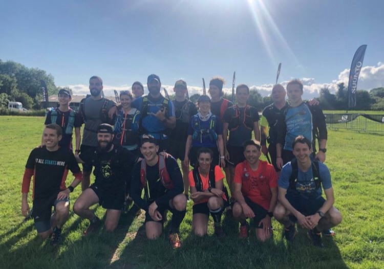
Saturday soon came around and I made sure I was there early to ‘check in’ and meet the others. As I walked to the festival Village I conveniently bumped into Matt who was behind much of the organisation. As I arrived so did the many familiar faces who were either leading the runs (all the Salomon Athletes/Ambassadors) and others like myself who were there to support them.
It was great to finally meet Tom who was the lead for the 50km and who told me we’d be joined by Mark (another familiar person I’m vaguely connected to but had yet to meet in person).
As we grouped and welcomed the 17 runners who’d make up our group, we immediately had one drop out after she realised this one might be beyond her. With everyone else ready to go Tom led us off. We’d be running a clockwise route and expected to be back around 16:30 or so.
As we left the field it became immediately apparent to me how varied the group was in terms of ability and experience. This was to be expected and wasn’t a problem, it was a guided social run after all. But something very important to be aware of – there was a long day ahead of us and fundamentally we were responsible for everyone’s health and safety and return! Spotting the ability and assessing each runner is important to ensure everyone has a great time.
It was like we’d done this all before as a team – Tom, Mark and I set off and split ourselves out. Tom Leading the way and setting a comfortable pace surrounded by the eager and more experienced runners. Me and Mark acting as the tail of the group, interchanging at the back of the pack.
Conversations begun as we all started to get to know one another. We’d soon be best friends for the whole day. It was a group of strangers. Runners getting to know other runners. Sharing stories and experiences, swapping tips and wisdom. A collective mass of adventurers. Tom would lead us on and ensured we stopped every now and then (frequently) for us to regroup and check everyone was OK. Each time a quick headcount to check we’d not lost anyone and then we’d be off again.
A small dog came bounding towards us. A ball of energy loving the runners rushing past. As he came to me last he started jumping with excitement and head butted me in the dick. Perfect shot. I can’t lie. I let out a gasp and was thrown off my stride for a bit. Damn stupid cute dog. One more runner then dropped out within the first three miles after twinging an injury. As he lived locally and trained these routes, after chatting through with him we were comfortable leaving him find his own way back to the start and we checked in with the wider team to confirm we were one down.
After about four miles we came to our first planned ‘aid stop’. Throughout the day we’d be flanked and met by Tony who would drive ahead and meet us with refreshments. At this first stop we dived into a huge tub of sweets (later I found out these were no ordinary sweets but ‘energy’ one’s by Powerbar.), refilled our water and grabbed a quick rest. We let Tony know of the drop out and confirmed to check he reached back to the festival site OK.


Throughout he day we were also treated to some spectacular views and scenery (despite the overcast day). A particularly memorable point for me was the poppy field that we soon came into shortly after the first pit stop. It was stunning to see the red flowers penetrating the green carpet of grass. We continued on through the single trail which cut through the long grass field dotted with poppies. Next up, a mandatory stop at the now infamous ‘Matt Buck’ Waterfall.

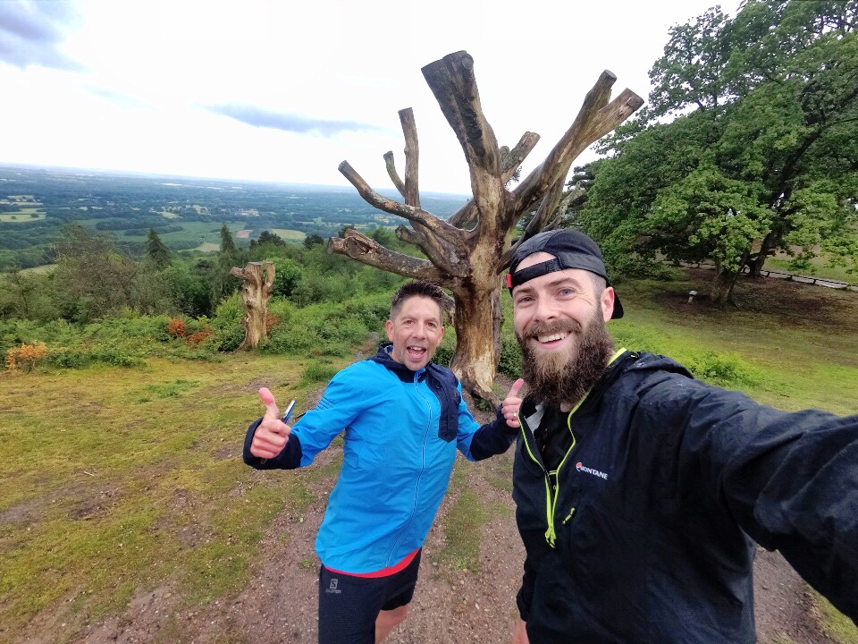
Cracking on, one of the milestones of the run would be the tower of Leith hill. It’s a hilly route and one I knew most of from other runs. We’d normally have immense views from here but it was a little subdued as the heavens opened just as we arrived (but not before me and Tom grabbed a picture at ‘Rachel’s’ Tree!). We were immediately soaked through, even in our waterproofs. We took another break as we waited for Toby to arrive and meet us once more. We were now 10 miles in and very wet and miserable. But that all changed when he arrived. Wow, what a spread he’d bought for us. A legend of the supermarket aisles, he’d catered for all our needs and began taking special requests for the next stop. Sadly Steak didn’t make the cut but Pork pies did!
With the rain and clouds covering the sky we began moving again before we got too cold. Once we were running we’d soon warm up again. We continued in the rain for several miles as we hit Pitch Hill and Holmwood Hill before the rain finally ceased. Along the way we encountered some wicked ‘trail art’ someone had created with Bark. It was later on as we neared about 20 miles that the implications of diversity of abilities in the group became really apparent. We started to spread out more and more and the front would have to wait longer for the tail to catch up. We really did have runners of all abilities – From dragons back finishers and top 40 finishers at MDS (I believe this deems you ‘elite’!) and sub 2:40 marathoners to first time trail runners and those who’d never been above 50km before. The gulf was huge and has got me thinking about the implications of this (more on that another time). I’d spent most of the time running with Carl. A long distance walker more accustomed to going at his “own pace”. He got stronger as we went further though and it was clear that his mental strength was next level. It was never a doubt that he’d finish, only a case of when. A real positive attitude and one you see a lot of on the trails.


One dude unfortunately dropped out shortly after the 20 miles. We still had maybe 3 miles left to the next checkpoint but he was in pain and couldn’t manage more than an uncomfortable walk. His groin was aggravated and he was affected. We agreed that he’d have to stop and we called for a pickup. I stayed with him until it arrived. After which I sped on after the group. Like a hunter chasing its prey. I knew the trail. I knew what was ahead (including one of my favourite signs/views at Blatchford Down). It was a moment to myself. A peaceful one of just me and my thoughts. I’d been consumed all day by a bad pain in my left foot. My arch felt bruised and I’d been alternating all manner of running styles throughout to try and run more comfortably. I probably shouldn’t have continued myself but I had a job to do. It wasn’t affecting my ability to support the group there and then but I knew I’d be in agony the next day (and for over a week afterwards it turned out!). Now with some time to myself I ran on. I ran free. Was it painful? Yes. But I was smiling too. I passed several more groups of DofE and walkers and smiled and cheered as I zipped through, splashing in the mud as I went (I’d been enjoying the cold wet puddles and found them soothing on the ankle and foot!).

It was raining again but still nice and warm as I broke trough the trail paths into an open space and found the rest of the group just starting off from the final checkpoint. Mark stuck around and waited as I stuffed more kitkats and pork pies into my gob and we were off. Less than 4 miles to go. Time to “bring it home”.
The exhaustion in the group was obvious now and as we ran down through Denbies wine estate one last time Tom had a surprise left for everyone – the route wouldn’t take us straight back to the festival village but first up, over and around box hill. We were going home alright, just the long way! A few groans came but really they were more flippant than anything. This group had started as strangers and now bonded over 9 hours of wet hilly trails. We cracked on, first tackling the Infamous steps of Boxhill before a quick photo stop at Salomon’s Memorial, which provided a brief rest-bite after the climb.

Just before the festival we regrouped for the last time and ran into the village together. We were Welcomed back by a few volunteers and other runners and then we were then greeted to the rapturous cheers from Maggie, Rachel and Hannah. They were loud. They were excitable. They were the support we needed. I started to feel my face ache I was smiling so much from their energy. Quite possibly the best finish to a run I’ve ever had!
After a quick ‘wet wipe shower’ in the car park we grabbed some coffee/beer and pizza. We sat in the dimming sun and enjoyed the Salomon films on the big screen before deciding it was time to leave.
Whilst we didn’t personally experience that much of the festival village, it was an incredible day. A well run event that was very popular and catered for all. From 5km to ultra distances. There were also Workshops for trail techniques, guided and times runs and yoga and talks. A great day out for those used to trails and also those new to trails. Get involved next year is my advice. I’ll be back for sure!
A huge huge huge thank you to all those involved in organising the event and making it happen. To Tom and Mark for leading a fantastic run and all those I met throughout the day. A special thanks to Maggie, Matt and all the team at Salomon Running for getting me involved. A great experience!
It’s been an unusual week. Unusual in the sense that it’s included a lot of familiarity with both familiar and unfamiliar situations and people. I say week, I mean two instances, just that they happened to be in the same week. First, I went to the Like the Wind Magazine birthday bash. Secondly I went to the Maverick Hampshire race.
At both events I’ve been surrounded by a ridiculous amount of runners and adventure seekers. All with their own passions and stories and experiences. Its been overwhelmingly inspiring.
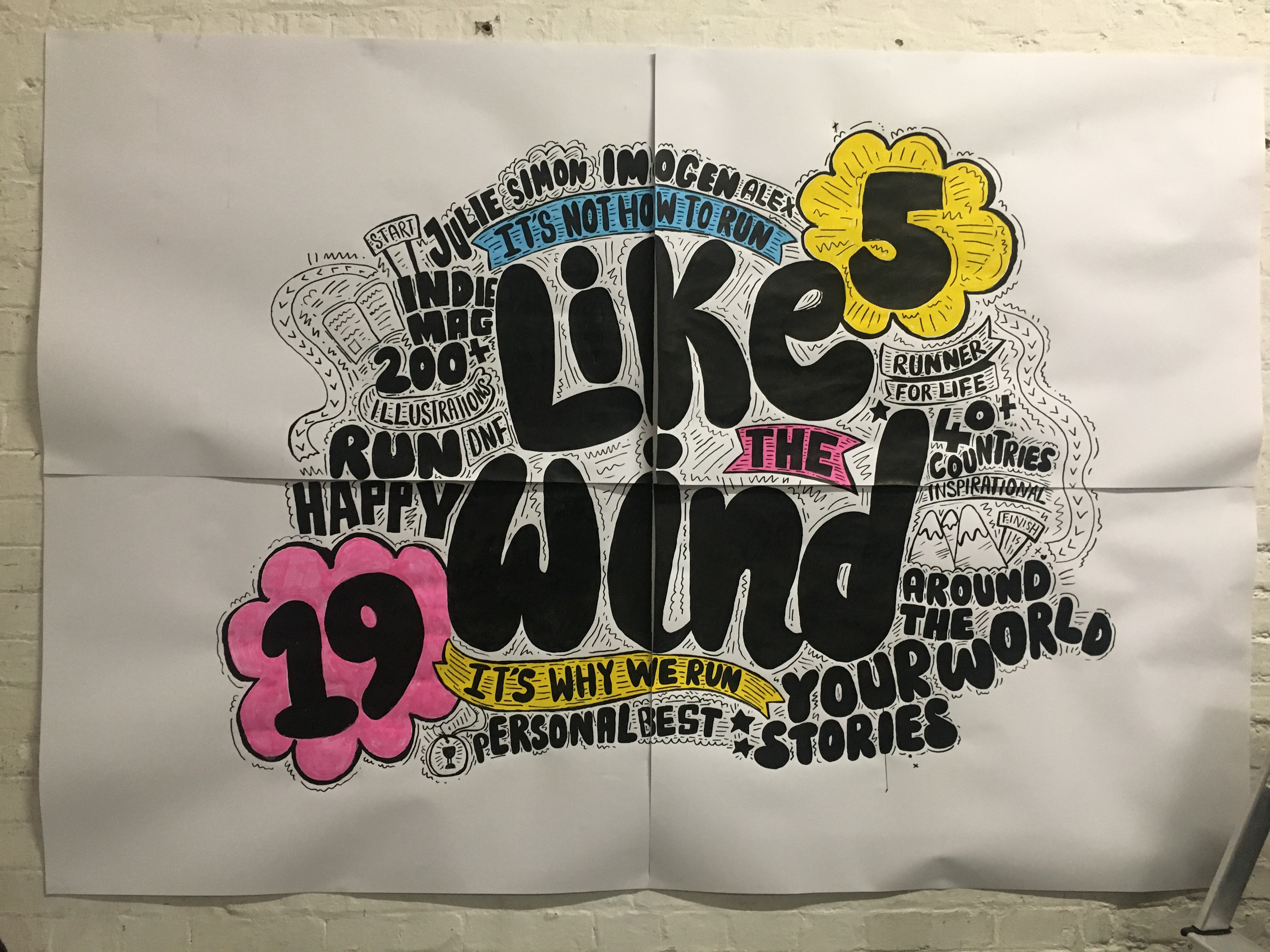
Before I’d even arrived at The Stance shop where the Like the Wind magazine was being hosted I’d exchange knowing smiles and head nods with other runners. We’d recognised each other but had not met in person until this point. This continued inside and throughout the night at Stance (where I spent a discounted fortune on socks!!) and I made many new connections that night. It was quite surreal with so many people congratulating me and asking me about the Trans Gran Canaria trip.
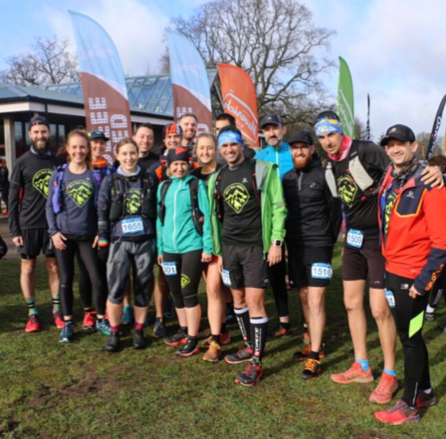
Two days later and I was on my way to Hampshire with the Wild Trail Runners. They’d swapped out their monthly trail run for an entry at the Maverick Trail Division event. I’d never been to one of the Maverick events before. I’d heard, and seen many, good things about these events and knew a lot of other people heading there too.

And so the theme from Thursday night continued. After registering and collecting my bib I dashed about to exchange some quick hellos and hugs with various others I’d spotted. Friends I knew and those I was meeting in person for the first time. Whilst I’d expected and was seeking out these meetings, one in particular stood out. In the crowd someone came towards me, Perkins! Sarah was there way back when in 2015 I ran my second marathon in Kilimanjaro. We travelled and climbed Kili together and I think I’d seen her just once since. That was most unexpected.
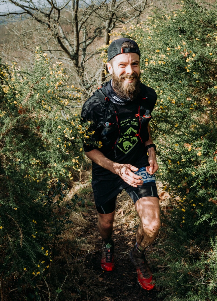
Time had gone by, group photos had been posed for and taken. It was time to run. There were three distances (short, medium and long). Most of the group were bashing out the half marathon ‘long’ distance. We set off. Immediately it became clear, it was muddy. Very muddy. I realised I hadn’t brought spare socks. I don’t know why, I wasn’t expecting mud. No explanation or excuse. I just hadn’t thought about it. I had prepared though. I turned up with my usual garb and was, spare socks aside, prepped for an ultra. It’s the norm now. I’m used to carrying all the gear I might need.
Initially the course was inevitably packed with runners. There were those I knew from Wild TR and NSL all around me. Out on the right Adam (Wild Tr coach) was snapping pictures. By this point my feet were already soaked and muddy. Runners ran to the sides of the bogs. Probably because it was easier than running trough the mud but also probably to avoid getting muddy. Like many others I ploughed straight through. There were hours of this ahead. It wouldn’t make a difference now.


I could feel my ankle. The pain I experienced over Christmas came back after Trans Gran Canaria. I’ve run once in the two weeks since. Recovery has been great apart from this niggle. Today was a test. And it was uncomfortable just a few miles in. Probably a warning sign and a fail of the test but I kept it in mind but also out of my mind at the same time, I wouldn’t dwell on it. It wasn’t bad enough to stop running. And that became my mantra for the run. Don’t stop running. I’d heard we had about 500m of elevation to cover. That’s nothing. A few little lumps is all. So I told myself I’d run the whole thing. Don’t stop. I’m so accustomed to walking hills now that today I decided to challenge that approach. Show myself I can and I will. I wouldn’t run particularly fast. Just what was comfortable. Making sure I wasn’t gasping for breath or heavy breathing at any point. Just don’t stop.
The course split for the short course to peel off and loop back to their finish. We continued on through the mud. There were lots of little dips where you’d run down and immediately back up a muddy incline. often over little wooden planks covered in mud. I struggled for grip at times. I didn’t see anyone else stack it though so was confident watching the runners ahead that the ground was stable enough.
I think we were about 6 miles in when I looked at my watch for the one and only time. My ankle was dominating my thoughts so I wanted to see how far in we were. Half way. if nothing else I could count down the distance from here. Up ahead in a field I could see the black kit of a runner, I couldn’t be sure but I thought it was Paul from the Wild TR crew. Out of the field we hit a small road section and a slight incline up a tarmac path between some farmer’s fields. On the left, as I got closer to Paul, some sheep were going wild, running and jumping back and forth closer to the runners. They were excited about all the activity going on around them?!

A little while later we hit a downhill section that was pure mud. Behind me a carnicross runner was chomping at my heels, I let them pass as the dog had so much enthusiasm. I think it was dragging its owner through! After this the route was flat and hard in comparison. My feet started to dry out nicely and then the route split again. We were on the last section of the long course now. A mental milestone where you can start to visualise how much is left. The Volunteer directed us left and up hill we would go. It was short but steep. Groans were coming from the many runners ahead of me. I joked as I blitzed past. I enjoyed this. I felt so speedy as I tip-toed up the incline whilst others bent forwards and pressed on the quads to power up. I kept thinking to myself this is nothing compared to inclines of two weeks ago. It filled me with confidence.
What goes up must come down right?! Soon we were bumbling back down a muddy hill. At the bottom A volunteer cheered me safely across a road and I ran past the aid station. I had everything I needed. I heard them say 6 kms to the finish. I didn’t need to stop for that. I did have a sense of familiarity with the volunteer at the road crossing though. I couldn’t place her. She was on my mind.
The course was quite spread out now. As I trudged through the mud I moved to one side to let a guy passed me. Shortly after this I saw him stop up ahead. I urged him onward as I’m sure that’s where I saw another runner in the distance go. He stopped and pointed to the left and we both saw some blue tap on a tree. It must have been left then. I questioned if I saw a runner go straight on, he wasn’t sure. We went left. It felt wrong. After a short while we turned back, at the turning about 10 other runners carried on straight. Great.
It wasn’t long before we caught them up and there was another hill. I zoomed off, They all let me passed again as I bounded up the incline as they walked. A short stint through some brambles lay in weight before more mud. Lots of mud, probably the muddiest part! I caught up with a female runner and we laughed as we both slid and got caught up to knee deep in parts. We were all smiles though. I said my goodbyes and carried on, seeing another group of runners in the distance. I vaguely recognised Paul, one of the Maverick Ambassadors, from behind and gradually caught up with him just after the course rejoined with the Medium course route. There were a lot more runners now. I briefly chatted to Paul who was feeling a little unwell before leaving him on the last climb. Again I tip-toed and weaved my way up and through all the runners. I stopped running momentarily as I reached the summit as I was slipping and sliding. We couldn’t be far now. Less than a km for sure. I started up again.

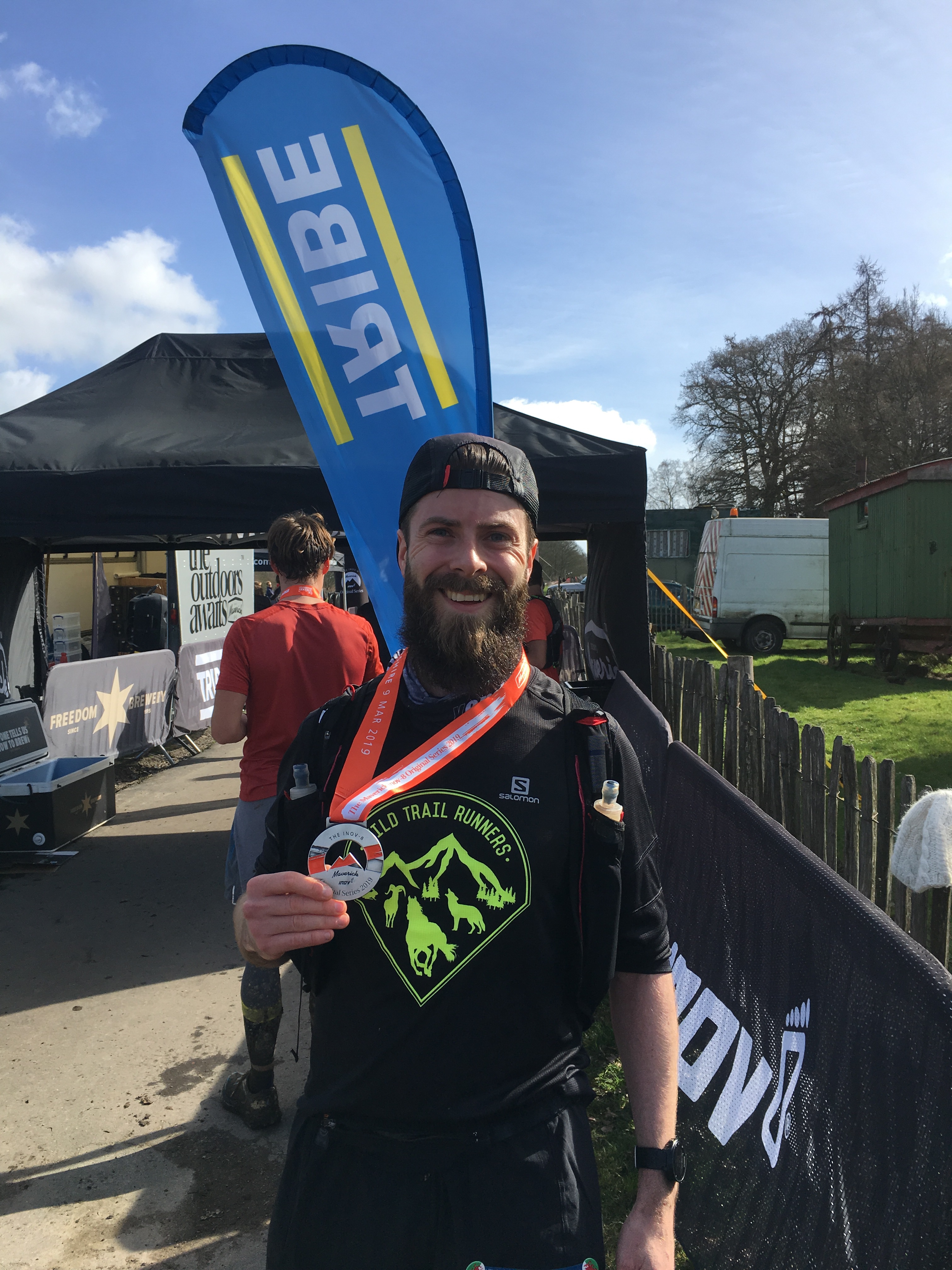
I could see the finish line up in the distance, we just had to cross the field in which we started. I don’t know why, but I undid my bag straps at this point. It made no sense at the time and it makes no sense now. I’m not sure what crossed my mind. I jogged it in to the finish and was greeted by the giant that is Spencer. I gave him a big sweaty hug in exchange for a medal and a beer. We’d met out in Chamonix after the TDS (him) and CCC (me) and hadn’t seen each other since. After a brief catch up I grabbed a Tribe bad and an Ice coffee and went and joined with those already finished. I also found a tap and was able to clean my shoes and socks.
Chatting away at the finish line the familiar unfamiliarities continued as I met more people whom I vaguely knew. Gif appeared with a box of beer – she’d won the female short course race (she joked all the others had gotten lost and she hadn’t), good on her, she loves her beer! Afterwards the Wild TR group headed to the pub and we all shared our stories.
Travelling home I reminisced to myself. Firstly, seeing the Instagram stories and posts answered the question I had mid race – Sarah. Sarah was the cheering volunteer at the bottom of the hill whom I hadn’t recognised. Probably good for her, she would have had a very sweaty hug if I did!
Then onto my feelings during the race. I tried to recall and recount how I felt. Yes, my ankle hurt. It didn’t hurt in a way that worried me though. I felt good to some degree. I recalled enjoyment and having fun. I didn’t push it and I felt comfortable. Yet I was running faster than I am used too. Probably, as a race, the fastest I’d run since Berlin over six months ago! I started slow and definitely got stronger as the race progressed (probably as my body is now used to longer distances where the race doesn’t begin until tens of kms in?). I questioned my prep again. Why I turned up packed for an ultra. Spare kit. Emergency supplies. Medical kits and the like. What was I thinking? I’m too used to days out I think. This was a half marathon. A supported half marathon at that. I enjoyed the mud. Besides the fact that it felt like I was running on highway of mattresses, the mud was ice cold. It was soothing on my ankle and probable helped a little with the pain management.
My takeaways were that it was an incredibly fun day. Very social with lots of great friends to interact and share the day with. I enjoyed the run (recognising parts of the Serpent Trail from a race last year) and felt there’s still a bit of speed in these ultra legs!
Ok, so here it is Saturday 29th December – a Trail run around Three Bridges. Who wants to join?


This time last year I met a bunch of trail runners. A collective of like minded individuals who share a passion for running, trails and enjoying nature. They welcomed me into their open group and took me on many adventures over the year. I want you to experience this too. So, come and join the Cool Cats (check them out on Facebook and the ‘gram!) as we head to Three Bridges to get one last muddy trail run in before the New Year comes…
Details are below, but get in touch with me directly and I’ll make sure you are added to the group and kept up to date with the plans. Expect cold and wet weather with mud and plenty of great company. We run together, to enjoy each other’s company and share the trails (there will be plenty of opportunity to take pictures along the way). We’ll probably be floating around the 7.30min/km (just under 12min/mile) pace on average.
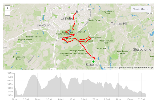
The route
The route will be a ~37km loop from Three Bridges, Starting and ending in Three Bridges Station. We will initially run down towards Balcombe station where you can opt to join the group there and do a shorter route (approximately 20km) as we head back up to Three Bridges. The longer route will have a few hills and a total elevation gain of about 500m.
Both routes are available on my Strava page (links below) where you can download the GPX/TCX files if you want to.
Both routes are mainly trail but will involve a few road sections.
The Long Route (36km)

https://www.strava.com/routes/16464579
The shorter Route (~20km (to the pub!))
https://www.strava.com/routes/16314420
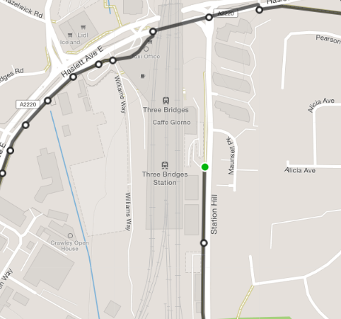
The Where –


The When
Saturday 29th December.
How to Get there
From Central London:
From anywhere else:
The Pub:
Your responsibilities
So if you are interested in joining, get in touch here or via Instagram to let me know (If I don’t know you are coming, I can’t plan for you!)
A sneak peak of what is in store for you…


Thanks
Dai
Back in January I opened an email that told me I’d secured a ballot place in The CCC – A mountain race that is part of the Ultra Trail World Tour (UTWT). I shit myself. I was scared. Why? because this is a race that spans 3 countries over 100km, >6,000m of elevation gain and has a strict 26 hour time limit to complete it. That, is The CCC!. Luckily by this point I’d met some amazing trail runners who were there to support me. Jana, who will also be doing the race this year after having to defer entry from last year, and Yvette, who soon volunteered to crew me. I’ve also received much support from Jack and Maggie who have both also completed this gruelling challenge.
After much persuasion, Yvette convinced me to get out to the Alps and experience the course. I’m going to write separately about some learnings from the ‘recce’, but for now I shall recap the weekend. A weekend I’d planned around covering as much of the course as possible, whilst not taking any time off work. I’m wise like that.
The plan seemed straightforward enough – Fly to Chamonix (France) after work on Friday, stay overnight before getting a bus to Courmayeur (Italy), running approximately 40km to La Fouly (Switzerland), staying overnight before running another 40km to Vallorcine (France) in time to get the last train back to Chamonix. I’d then fly back to London first thing on Monday to go straight to work. Simple.
The plan made sense to me. Yvette did all the hard work in arranging the accommodation and logistics. I set my mind to breaking down the run based on the actual route of The CCC, checking the regulations and timings of the different checkpoints I’ll experience on race day. This is when I first saw the flaws in my plan. It was going to be very tight! The weekend was about the experience and that also means enjoyment. I was now introducing an element of pressure by setting time targets we simply had to meet, (If we didn’t make it to La Fouly in time, we wouldn’t get to sleep, if we didn’t make it to Vallorcine in time, we’d be stranded and face an expensive taxi back!), these targets were based on the cut-off times to be allowed to leave the checkpoints and continue the race. I was confident it would be OK, Yvette was a little concerned, and rightly so – I’d been training for this. She hadn’t. Regardless, it was the only plan we had.

So here is how the plan unfolded and the adventure that we went on, one experience, from two different perspectives….
We were supposed to get to Chamonix well before midnight. Rest up ready to tackle the run. Severe weather in Geneva though meant our flight was delayed by over two hours. There was one final transport bus from Geneva to Chamonix departing at 23:59. As we disembarked the plane at 23:45 we were already deflated and acceptance of the almighty taxi expense we were facing. Dammit. This wasn’t on my expected list of issues we’d possibly encounter. Having been to Chamonix numerous times before, Yvette rushed me to where the bus normally departs. It was 00:06. Remarkably it was still there. Our deflated emotions picked up as Yvette caught the attention of the driver as he was climbing into the cabin. Some pointless and aggressive gesturing later, he let us on to the bus. Crisis averted. Yvette to the Rescue.
Nearing 02:00 we arrived in Chamonix and made our way to the lodge, let ourselves in per the instructions left and proceeded to arrange our bags and get ready to depart. With an 08:30 bus to catch we’d be up at 07:00. Geez, we were going to be shattered. Before we knew it, the alarms were buzzing, we were bumping into each other trying to turn them off. Quick breakfast of champions (two twinkie type cakes and a coffee) and we were off. We left out bags in the storage (we’d stop here again on Sunday night also) and took with us everything we’d need to be autonomous for 2 days of running (with the expectation of a meal in Switzerland later that night!).
Yvette: Successfully passing through security with our poles packed in the hand luggage, we faced a 2-hour delay. This meant missing our 10:30pm EasyBus pick up and potentially missing the very last bus of the day heading into Chamonix. Not a great start to our trip. Once we made it through Geneva passport control, it was already after midnight, but we tried our chances and rushed to the bus station hoping to see the tacky orange rundown looking EasyBus. Wahoo…it was still there. Relief! Finally arriving at Chamonix at 1:45am, feeling very sleepy walked to Chamonix Lodge, darkness everywhere apart from the odd streetlight. Pretty certain Dai asked what that dark thing in the distance was…err it’s the silhouette of a mountain. Not sure if he was messing with me or if he was genuinely clueless and baffled (Dai: Just ignorantly naïve!). We prepared our gear and went to bed at 3am.
Our bags were heavy and stuffed full. Yvette’s more than mine as she’d borrowed a bigger bag from Jon. We arrived in Courmayuer and set about finding some bread for the journey. There was only one thing we could do to carry it – flatten it and stick it in an elastic side pocket on my Montane Jaws race pack. This was going to get sweaty! A quick pause to take in the village, a picture taken by a local and we started ‘running’. I say ‘running’, it wouldn’t be for another 5 hours that we’d do any actual running!

On leaving Courmayeur, the first 10km is all up hill, or up mountain rather! Starting at about 1200m, you run along the steady inclines as the roads wind up until Ermitage (1500m) before the trails begin. From here the path takes us into a forest trail and the climb continues until it opens onto the bare mountain at Suche Damon (about 5km in and 1800m up). We’d been following the GPX on the Sunnto watches, and so far, so good. Carrying on around the path though we were soon deviating from the route. Tracking back and searching around the building revealed no other routes. I was confused. Back and forth we went before eventually a local runner came down from the path. Yvette knew enough Italian to have a conversation and he led us back to the building and directed us through the outhouses to a path. How confusing! This worried me a little, the ease at which we were lost.
Yvette: First 20min of the CCC route takes you along the residential streets before you hit the forest. I don’t think there was one point where we ran this; it was a long uphill road. Then as you enter the forest you realise how steep it quickly gets. Despite having the GPX route on our watches it was still confusing knowing which way to go, and immediately we couldn’t make out whether we had go through someone’s back garden or continue along this trail path which did not look right according to our watches. I took the opportunity to ask a runner coming towards us and in my broken Spanish/Italian managed to figure out that we did have to go behind the house.
Onward we continued, and the path required us to climb down and cross several glacier streams. I’ve never seen anything like this before. The Ice carved into the mountain, frozen solid but leaking water underneath. I soon slipped on my arse. Luckily no damage was done but a wakeup call served!
Yvette: We reached a section where you cross over rocks with water flowing through it. Not sure how, but Dai slipped and fell on his arse, not quite so gracefully, but had to laugh.

As the climb continued, the path again opened, and we were presented with some incredible views. There was also this wooden structure from times gone by. It was a great photo opportunity, but I genuinely do not know what it is (any ideas?). Continuing on, we misread some signs and ran the wrong way. Only we hadn’t realised for quite some time and, once again, some other runners and Yvette’ Italian came to our rescue and took us back to the signs. We struggled to keep up with them running back down but did have time for a quick chat. One of them revealed he has entered The CCC 5 times and failed to complete it 5 times! He claimed it was the mental challenge the beats him. Again, worried? Yeah, a bit! Anyway, with an extra little climb added to our trek, we continued, being sure to keep to the left path and the next intersection as advised.

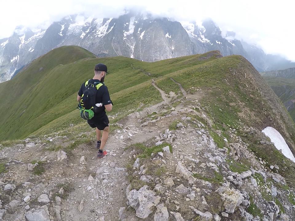
We were now facing a climb of about 600m over 2km. It was steep! It was vast and open with a dirt trail littered with rocks and boulders, winding its way up the side of the mountain. I powered on ahead of Yvette and had my mind focused on the summit. I reached it. It wasn’t the summit. Damn. I’d actually reached Col Sapin at 2435m. This was an intersection of many paths and mine would continue up further to 2571m and Tete de la tronche. Oh well. As I continued I past several other hikers doing the TMB (Tour du Mont Blanc – an 11-day trek of the region) and I chatted with an American Mum and daughter. Whilst I waited at the top for Yvette I messed around with some Instagram stories, my own sort of video journal of the trip. It mostly involved swearing. I’d just climbed over 1200m across a 10km.
The views at the top were breath-taking. I could see down into the distance and the path we’d take. A nice steady downhill all the way to the Refuge where the first checkpoint would be. The weather was suddenly questionable, but the waterproofs stayed in the bag. Finally, after 4 hours we could run.
Yvette: On track, we then came to the first beastly climb, Tete de la Tronche (2584m), winding up, a slow hike to the top, with my head down and not focusing on where Dai was (he was like a little tiny black dot in the distance getting further away from me, damn him!) finally made it. As the saying goes, ‘the best view comes after the hardest climbs’ and it certainly didn’t disappoint. A few videos and selfies (including a peeing with a view pic in the middle of the mountains, standard) we could see the weather starting to change, spitting rain it was time to move and head to Bertone. What was really cool was seeing where the trail path continued from Tete de la Tronche. You could trace it with your finger right across the mountain until it disappeared.
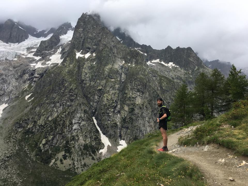
We hit the Refuge Bertone (1970m) shortly after and it was full of people on their TMB treks. We refuelled on the soggy (sweaty!) bread (on which I nearly choked inhaling it!) and set off again. On to the second Refuge on our path. We left after nearly 5 hours which was pretty much bang on my target for this weekend. Not bad considering we’d stopped a few times and been lost twice! As we ran we soon started passing people we’d spoken too at Bertone. There was some cool stone structure someone had built, and we passed the mum and daughter again coming back from another path that they would have taken at Col Sapin.


To our left were more incredible scenes of the mountains and the valley as we ran along the path Strada Del Villair. Eventually a short uphill climb took us to what I called “The Pub” – Refuge Bonatti (2025m). More refuelling and a moment to compose ourselves. We filled our water from the water fountain. It was so cold and refreshing. It was and is the best water I’ve ever had. I can’t wait to have more of this when I go back. Next on our list was Arounouz (Arnuova di Mezzo, 26km done and 2000m). Along the way we passed several derelict buildings and many river streams to cross. A few were fortunate to have wooden bridges over the. The route was still fairly flat but single track and we encountered a lot of people we needed to pass. Of all the people though, we weren’t expecting to see 3 young boys. They asked us the time (it was nearing 6pm) and we were a little concerned that they were heading in the opposite direction to us and were dressed in nothing but shorts and cotton shirts.


Arnuova Di Mezzo wasn’t open. We sensed now would be a good time to put some layers on. It was getting very windy and overcast. Out came my bum and willy on the mountain as I squeezed into my Skins leggings. Just as we were layering it started raining, Phew. Well played. I was pleased with myself. As we were doing so, the 3 young boys reappeared, again asking the time. We questioned them. They were local. We followed them down the path, winding down to Arnuova Desot (1780m) which is where the 3rd checkpoint will be on the CCC. At the bottom there was a party. Two drunk men had starting the climb looking for the kids. We assured them they were just behind us and they were grateful. The locals sure are relaxed about the mountain! With the Rock tunes blasting, Yvette did a little trail dance and we charged our watches. Next up was the climb to Grand Col Ferret (2537m) and the crossing to Switzerland!

Yvette: The route between CP1 – CP3 is so runnable you can make up for lost time. The weather changed quickly, temperature dropped and started to rain. Dai with his weatherman predictions was right to make the call on chucking some extra layers on and wearing waterproofs. Out of the blue we came across 3 kids, they weren’t wearing any sort of hiking gear and what was stranger, they were alone. No sign of parents or some older, responsible looking adult. They were dressed up in smart shirts and fashion trainers. As we made our way down, we could hear music, then 2 men appeared on the trails, dressed in suits, both quite drunk and smoking cigars. It was obvious they were looking for the 3 boys. There was some kind of big party, sounded like they were playing Queen’s Greatest Hits album. Had a bit of a dance as we walked by, banging out some air guitar moves, Dai looking at me like I’m crazy.
The beginning of the climb was another open and steep trek. The sound of cow bells rang strong and we saw a field(?) full of cows and bulls which we’d have to walk through. There was a farmer at the top sitting chatting on his phone. As we walked and joked about the smell of shit, we saw a pool of manure, and as we passed it stared to gush with fresh shit from the buildings. lovely. The smell really was horrific. Around the building we went and to a steeper climb that was very exposed. Then we stopped to layer again as it was starting to rain. Carrying on up we took the decision to stop again and put every layer that we could, up ahead there were dark clouds forming and within seconds we could see nothing. very limited visibility to just metres ahead of us. We powered on. Yvette was focusing on the ‘plinth’ she’d read about at the summit. I arrived first. It was very cold and very windy up top. We stayed a very short time, long enough for a few photos and then we were on the move.
Yvette: Our next big bastard of a climb lay ahead of us, 754m climb with 2537m total elevation and approx. 32km into the CCC route. This would also be the point in which we’d cross the border onto the Swiss side. Clouds were rolling in fast and visibility pretty much zero, Dai who was always ahead of me by about 5 minutes or so disappeared into the mist. It was kind of spooky. All I could see was the path in front of me for a few meters, with no idea where it was leading to and how much further I had to climb until I reached the summit of Grande Col Ferret or where he had wondered off to. I just kept thinking, surely that bloody signpost on a rock that I’d seen on Google images and blogs is around here somewhere. There it is, made it!! Damn I wanted to hug that rock. I bowed to it and rested on it. It felt great knowing we smashed the 2 biggest climbs in 1 day. Hugging and smiling, and a quick selfie to remember the moment we didn’t delay and carried on. Shame about the clouds as we missed out on the panoramic views from the top.


We knew it was downhill from here for about 10k towards La Fouly. The freedom to run was immense. Our bags were so light at this point as we were wearing everything. It was a great feeling. We were full of energy as we’d not run much yet and had great fun running the trails. We were the only people on this section. It was liberating. All around us the views were amazing as the mountains were scattered with white snow and glaciers punctuating the green slopes. As we got lower we winded down and through some fields and saw some villages in the distance with street lights flickering through the trees. We felt close. Maybe 15-20 mins away. It was starting to rain and we were thinking of food and sleep. Then we hit our first real obstacle. A cow in the path. We tried unsuccessfully to move them along. Nothing happened. A slow walk. More cows. Then a bull step forward. Fuck. 38km in and still 2000m, up we didn’t know what to do. It was as if the cow had told the bull we’d done something. The evil stare was very intimidating. He wouldn’t move. Yvette wasn’t comfortable. We checked the map. The path would continue and then U-turn around the cows and the buildings. So, we took the dodgy decision to leave the path and cut the corner. Downhill through vegetation. It was very risky, but slowly we successfully descended and re-joined the path.

Yvette: Trying to pick up some pace on the downhill, we had 3miles to go, when we come to a sudden halt and saw a cow on the trail path. A big cow! Literally blocking it. Munching away on grass, it turned its head to look at us and then continued munching away totally ignoring us. We were shooing it, waving arms around to move it on and I was clapping. Nothing. What a stubborn cow. I kept telling Dai not to go too close, he was as stubborn as the cow not listening to me. You just don’t know how these animals would react. For some reason I was a little scared, so I was looking around to find another way to cut across. Thankfully the cow slowly plodded down the path, and as it moved off the path we then noticed this black bull further down blocking it. Fs!!! It had sharp horns and just stared at us. Dai was determined to walk towards it but I wasn’t chancing it. Plus, I realised I had a bright red Salomon vest pack on. Bulls charge when they see red right!!? I mean I was a target to them. Just like the running of the bulls/bullfighting, they see bright red/pink moving around and they practically blow smoke out of their nostrils ready to charge. I did not fancy being chased by a bull, not that I would have had anywhere to run to but uphill on dead legs. Dai said that was a myth and that it wouldn’t happen. Whatever! We couldn’t stay there all day, we were wasting time, and so I made the call to cut through an overgrown grassy section going down a steep hill. I think, this the only point in our trip where we had a disagreement as he warned me not to go down there, it was too risky. I didn’t listen (ok, we’re both stubborn) and with my poles, poked the ground to see where it was stable and made my way down. The path was looping around to the right anyway, so it I would reach the same path eventually. I left Dai behind me, and he would either follow me or somehow negotiate with the bull and get through. He decided to follow me. Ha-ha.
Down into a forest we ran, our energy levels drained. We were soaked through from the vegetation and continuous rain. Darkness was setting in. We thought we were close so didn’t get our torches out. It took longer than expected though for us to reach La Fouly. As we continued further we went off the path and emerged onto the main road. Checking where we were looking for the accommodation. It must be close. Sign spotted. It was done. Nearly 10pm and very dark. We walked up the hill (dammit) and found the hotel. It was all closed. A message to Yvette to “let ourselves in”. A room with no key. Shared showers. No towels. Fuck that’s annoying, a shower was second on our “most wanted” list after food.

We headed straight out for food. Everywhere was closed (it was 22:30 in a very small village after all). The one open bar agreed to sort us out with something. They offered us some cold cuts. I was very happy with that. We ordered one each along with a pint of coke. When it turned up, it was massive! The most packed cold cut plate ever with fruit, nuts and cheese. It was epic! Yvette was struggling to eat but I couldn’t stop. We stumbled back to the hotel, had a shower (and a pat dry!) and went to bed. It was gone midnight, we’d be starting it all again in the morning. We wanted to leave by 8am….
Yvette: Out of the mountains and onto the road we reached Maja Joie hotel at 10pm, pretty dark. They had left a sign on the door we managed to figure out that we could go straight to our room, there was no key. Weird. Dumped our vest packs, didn’t bother to shower and went straight out to find anything that was open. We followed the sounds of people laughing and music playing. A place called Auberge des Glaciers. Everyone was getting on it, and we turned up looking sweaty, tired, dirty, smelly, and dazed. Annoyingly the kitchen had shut, and despite begging he said there was nothing he could do. Our eyes moved towards the crisps and nuts hanging behind the bar, if there was nothing else available, we had a backup plan at least. I would just opt for every crisp flavour and a pint of coke for dinner. He mentioned another place further up the road, somehow my legs moved quicker than my brain and I sprinted to this other restaurant. Ergh damn, kitchen closed. Rushed back to Auberge des Glaciers, ready to buy every crisp packet they owned, the man could see how hungry and desperate we were to eat. Knowing we had run 41km from Courmayeur, he felt sorry for us and said he could serve us cold meats and bread. Perfect!!! How many platters he asked….’we’ll take two’!!!
That pint of coke tasted so fucking good! I’ve been hearing how coke is the way forward for post long runs, or even flat coke in the last stages of an ultra-race. Something about the sugar, caffeine and carbs that reenergises your body with a boost and settles the stomach. I don’t drink fizzy drinks at all but if this is part of recovery and feeling human again, I’ll try it. The platters came out; yep it was obviously a sharing dish looking at the size of it. I took one bite of bread and I swear it took me 5-10min to chew on it before I could swallow. I had no saliva to break it down, I felt slightly nauseous. I was hungry, my body was screaming for food, but I just couldn’t eat it. I was watching Dai and he was demolishing that platter. He’d finished it while I was still on the same piece of bread!
07:00, the alarms are ringing. It’s time to get up and go. First stop, the breakfast bar. We head down stairs to the packed dining area where there is a table laid out with Yvette’s name. We chat to the Hotel staff and sort all the admin before tucking into another breakfast of champions. We have bread. Dry bread. Toasted bread. Just bread. But lots of coffee too. As all the other hikers gear up and head out we are lagging behind, it’s 08:30 before we make our escape. Ahead of the plan, behind the intention. But we are out.


The first 10km of the day is a nice and steady run. After leaving the road in La Fouly we hit a path along river that was rocky, but downhill. It was a busy section as we caught up with all the morning hikers setting off on their journeys. On Occasion we needed to pass several large groups, everyone was in good spirit though. We were fresh and smiley, the rest had worked wonders and the crisp morning air was a delight to breathe. I was conscious of the terrain. Whilst flat and downhill, the rocky paths were a slight concern, it could well be that I might be running this section in the dark next time. That could be hazardous. I was recalculating my ability to get this section covered before the sun goes down next time!
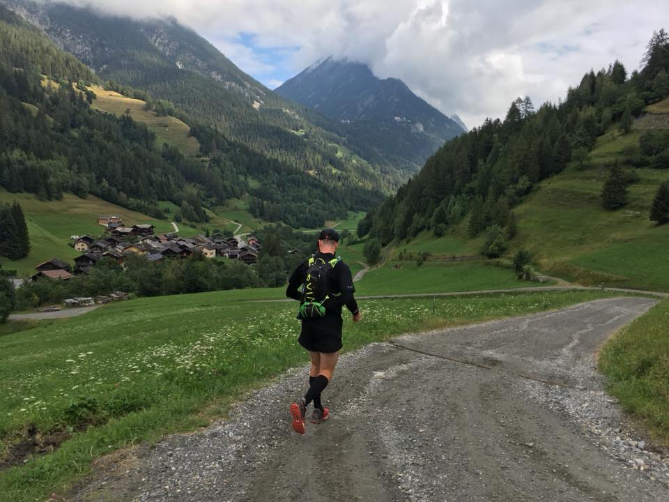
About 7km into the run the path took a sharp turn and opened into a beautiful elevated path lined with trees either side. It was like a tunnel of nature. It felt endless as we ran through, the morning light piercing through the gaps in the leaves. As we came out the other side we ran through the Swiss villages of Praz De Fort, Los Araches and Issert. These villages were quaint with wooden cabins, lush gardens and quirky decorations (Gnome village!). After running through nature for so long it was a weird sensation to be on the road and weaving through picturesque man-made structures. The villages were small and soon came to an end, as did the running. It was time to begin the first of 3 climbs this day, we were re-entering the Forrest and the Sentier Des Champignons (~1480m) that would lead to Champex-Lac.
The trail is littered with wooden carvings, some representing creatures of the forest, some were mythical. All were unique and special. The path was undulating and occasionally we could run, skipping and jumping the tree roots as we went. We interchanged with a group of other runners, joking occasionally as we passed. Laughing as the group stopped one of their runners from eating a bunch of berries she’d picked from a tree!
Yvette: 9am start and 14km to the next destination, CP5 Champex-Lac. Perfect flat trails to start off with, easy on the legs, beautiful section through the woods, took us through a quiet village in Praz De Fort, charming wooden cabins. Then as you arrive to Issert, the 3rd out the 6 climbs begins. The route takes you through a steep forest path; this is when you see wooden carved sculptures every few meters, quite amusing. I think I stopped paying attention to it while Dai made the effort to take photos. I just wanted to reach the top. I think by this point, I was getting frustrated with the running vest pack. It was weighing me down (I may have carried more than I needed to) and starting to rub my skin. No matter how much I tightened the straps it would become lose and bounce too much. My mood started to drop a bit.
We briefly met the runners again as we arrived at the bottom of Champex-Lac and said our goodbyes. As we entered the town, we saw the lake – Lac De Champex – we’d heard so much about. It was beautiful. We stopped briefly to admire the scene and soon pushed on after I challenged our timings. We had a long day ahead and a tight time frame to make the bus! It is true that I was pushing Yvette. She hadn’t enjoyed the climb and I was conscious it would be difficult if the negative thoughts consumed her focus so early on. She’s so strong and led us off again, around the lake and through the town, where a local event/festival was taking place. There was music and food and all sorts of entertainment. We were offered what looked like Vodka shots which we were happy to decline!
Yvette: We reached Champex-Lac (first of the assisted checkpoints) and I remember from a blog I read that you would run beside this beautiful lake. That it was. Stopped for a moment, refuelled beside some Harley Davidson bikers. The town was buzzing, some festival event with market stalls and such a nice vibe I could have chilled here for a bit. Dai would always check up on me, and I guess he was also aware that I had never run this far before and I think he noticed in my eyes and the expression on my face that I was slightly off. It wasn’t so much my feet or legs, thankfully. Dai would reassure me, would offer to swap vests, hug me and give me a bit of encouragement. He didn’t have to tell me, but I knew what he was thinking and trying to say. “Snap out of it, we need to stick to the plan and keep going. There is no way out now. We have a train to catch so work those little legs”. He was pushing but I needed that push.
We were presented with a short downhill along some wide trails for a brief rest before the start of the second climb. The ground was again rocky, and we took a moment to stop and refuel (I was expecting the climb imminently, but we still had some way to go). And then it begun. in the peak of midday, the sun shining high, the heavy sweats of the power hike would take over as we made our way up to Refuge Bovine at 1987m…


The climb started off on a wide paved road and we passed many hikers in both directions. Then the incline started. Some incredible views climbing a gravel path. We passed a lot of people. Behind us the views were vast, mountains and glaciers as far as we could see. As the path turned and the incline increased we paused to absorb the views. Then, far away in the distance we saw hikers climbing. They were a looooong way up. It looked like it would take an age to reach where they were. We continued with our power hike, crossing several streams flowing down the mountain side (at one point a wide section of the path was submerged) and were momentarily disheartened as a runner ran past (fair play, he was nailing this!). We continued climbing, stopping every few turns to catch our breath and swear. Eventually we reached that point where we were the ‘people high in the distance’, which surprisingly didn’t take us as long as I thought it would.

The path opened into more, lush green vegetation and fields as we continued upward. The sound of cowbells ringing in the distance grew ever so slightly louder, until we passed a small wooden cow shack. Then you could really hear the cow bells. After last night’s encounter I was slightly worried and also for Yvette, she was a little way behind me. As I reached the top I could see a larger building, packed with hikers, a restaurant. Besides the hikers, were bulls. tens of them, everywhere, amongst the people. This was daunting. I slowly walked passed as they eyed me up. They were very tame though, most just sitting there, enjoying the sun. I went and sat down in the tabled area to await Yvette (whom I almost missed as she appeared so quickly!). We spent a good 15 minutes eating, drinking (more fresh, cold water!) and admiring the bulls. We then set off again, threading between the bulls and climbing what remained of the path to the top, where the next downhill section would begin. We were ready to run again!
Yvette: There was refuge called Alpage de Bovine, surrounded by cows. These ones had a ginger mullet, I stood next to one and only then realised the size of these bells hanging from their necks!! They were like 5kg kettlebells. As we took a break, this cow walks over towards me, gets a little too close to the fence, curious, almost touching me. I jumped up to move away and said to Dai “Seeeee it’s the red vest’”. He rolled his eyes at me.


The run down was very technical. There were a load of people on the path and large rocks and routes to navigate. It was an instant quad burner and the legs were on fire, but as with the previous day and morning, the freedom to run after the power hiking was a much-welcomed relief. By now I was appreciating the need to run when the opportunity presented itself. If I’m to make the cut-offs during the CCC I’ll need to make the time up on the downhills and flats!
I waited at the bottom, we were just outside of Trient (1285m). The walking signs indicated 30mins, so it shouldn’t take us long. We used the moment here where we had phone signal to make some arrangements and estimates for our evening arrival, and for me to film and load more stories to the ‘Gram! Before long we arrived at a campsite and took the opportunity to again refuel, drink the always present cold water and use the facilities on site. There was one mountain left to climb (and about 10km to go). It looked the steepest of them all, a right fucking bitch to overcome…


The climb certainly felt like the steepest climb. We only saw one person all the way to the top (He powered past, coming out of nowhere with an epic power hike!). Initially I thought the route was taking us straight up the mountain. Maybe I was delusional and imagining the paths ahead, but thankfully there were switch backs leading up and up. There was this a amazing tree which caught my attention, initially I noticed the criss-cross texture before realising there were no branches. It was solid and tall and stood out amongst the others. Looking back, it formed an exception view with the mountains in the backdrop. I waited for Yvette, making sure she saw this tree!
Up I continued. It wasn’t walking or hiking really. It was more an endless session of deep lunging. This was definitely the steepest of the climbs. I was ready for the summit before we’d barely begun. Up ahead, straining my neck I saw some mountain bikers. They were heading down. I understood the word “cinq”, the lead biker was indicating there were 5 more to come. Ok Ok, I understood his hand gesture, not the language.
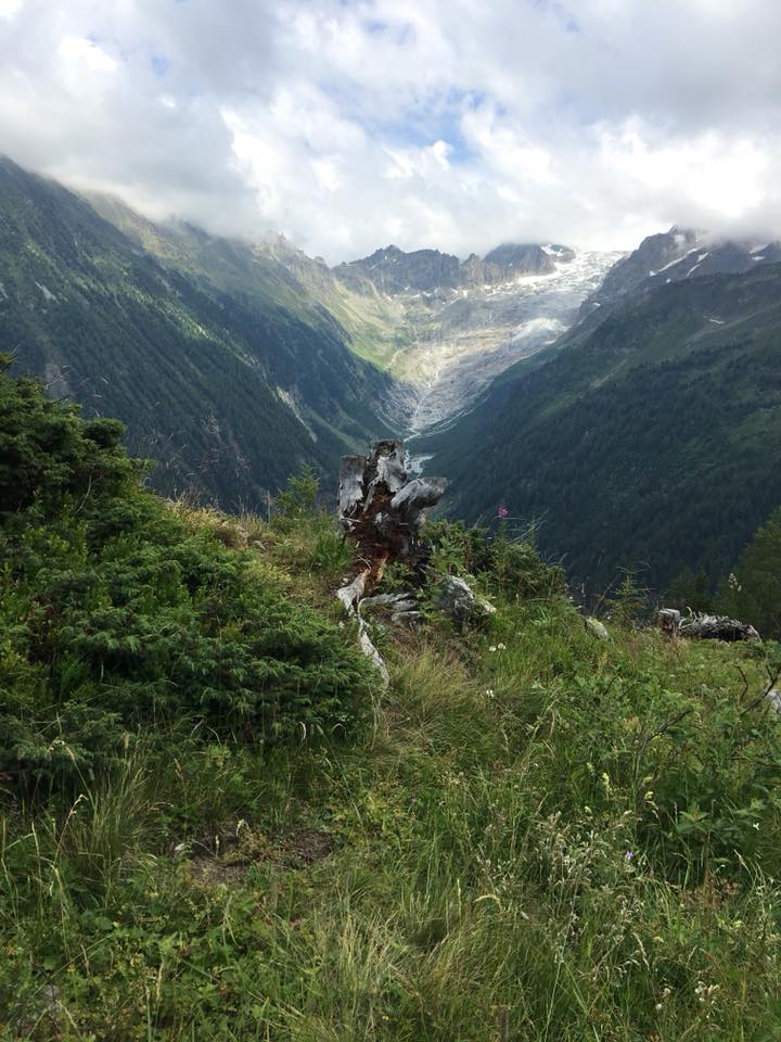
The summit (Catogne, 2050m) never felt like appearing. Eventually though the path flattened and to my right were sensational views. I carried on a little and tested the path, it was beginning to descend. So I tracked back and intended to enjoy the views and recharge my watch and wait for Yvette. I’d barely sat down before she arrived. She was emotional, we rested and absorbed everything our eyes could see (including Barage d’Emosson in the distance which was a real confusion for the eyes, to see a dam so high and so far away). The joy of knowing we were one downhill and less than 10km from the end was sensational. So onward we went, one more time, all downhill.


Yvette: This was our final climb of the recce route; I can’t actually tell you if this was harder than the other climbs. I lost sight of Dai…again. I kept looking up wondering if I was close to the top, nope…stop looking up…keep going. This was the pattern throughout the route; now and again you would be teased into thinking that the highest point was so close but then it would continue winding further up. Legs were dangling a bit! I’m sure at one point I hallucinated, but I looked up and saw a dark shadow of a person for a few seconds and then suddenly disappeared. I’m sure it was Dai having one final look down to see if I was close.
I then found Dai perched on the edge of a rock. That was actually quite a memorable moment to capture. Your eyes are usually fixed to the ground as you run, rarely getting a moment to look up and admire your surroundings. That was one thing we took the time to do, we made sure to stop and take photos and just embrace the unbelievable views. It’s the only chance Dai had to appreciate the route he’ll be racing. Plus from La Fouly to Chamonix he will be running this section in the dark and by the time he gets to Chamonix it’ll be sunrise. We had 10min to sit together and look around us. I think I had another cry in front of him. With 6km to go until we arrived at Vallorcine, it was all downhill to the end.
Momentarily I had a mild (internal) panic as I saw a path going up. It suddenly felt like we hadn’t submitted, but thankfully as we neared a sign we were directed away from the peak, we had indeed reached the highest point (circa 2070m) on this section and would be continuing down. Ahead of us, all around we could see beautiful paths weaved into the mountains. We were energised, light footed and excited. We bounded down and before long hit a section of wider gravel switchbacks. They weren’t too rocky, but they sure were hard underfoot!
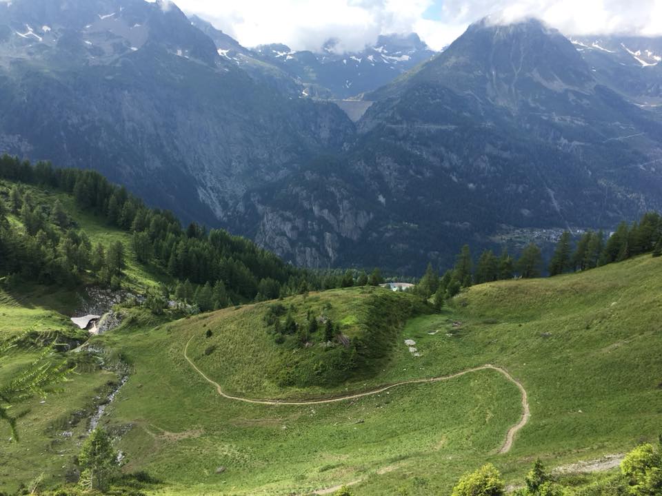
Another sign saw us eventually take a step off the path, we were entering Then a turn into the green forest – Foret Verte. The ground was softer here. But no easier to run as it was so uneven. Then, out of nowhere a sense was triggered, one that felt forgotten on this run, one that had become a repetition of wind, cowbells and the thumping of our feet hitting the ground, we heard a sound. A hoot hoot. A train. A fucking Train. Yes. We were close. Very close. We were so far ahead of schedule, we’d be home before we knew it now.
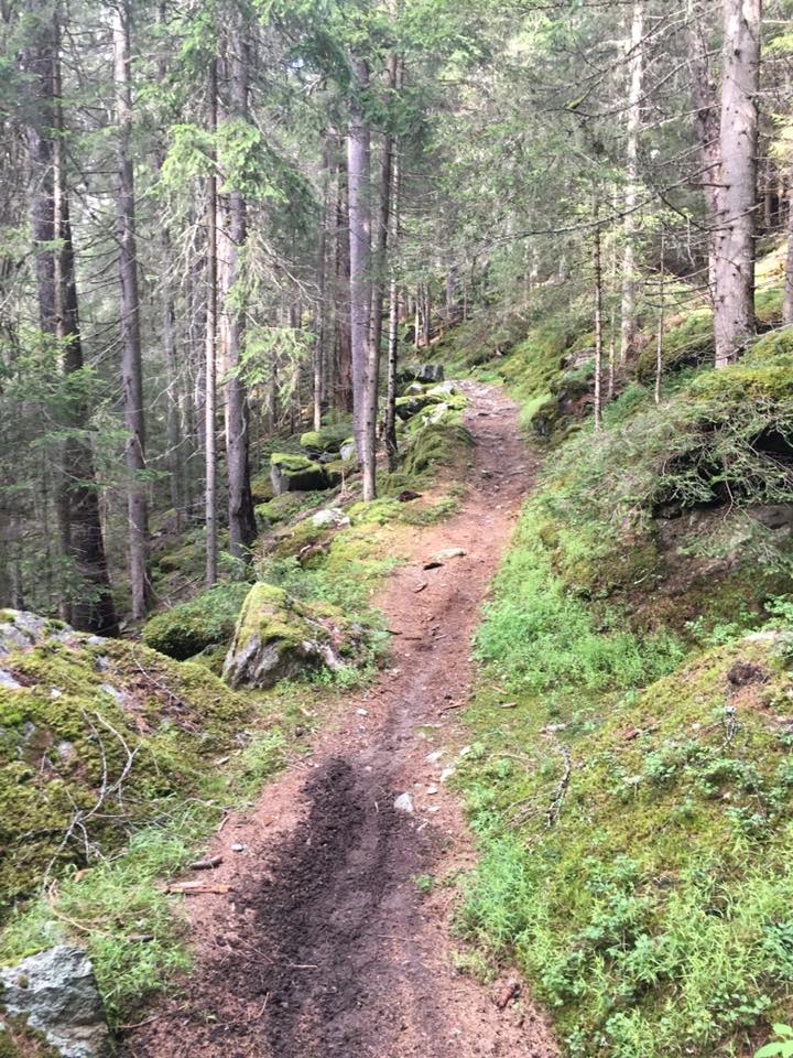
We came to the end of our journey soon after, a bridge symbolised our finish as we’d walk from here across the road and to the station. Time for a hug, hi-five and a quick trail dance. We were done. We were well ahead of last train but unsure as to how frequent they might be. We had just mussed on of course. it was 17:59 as we reached the station and Yvette saw the lights go out inside the ticket room. She kept knocking the window until answered. The kind lady advised the next train was due in any minute and we could buy tickets onboard. Result. We walked around to the platform and like perfect harmony the train arrived. We were so happy.
Yvette: We did it! Dai did his celebratory trail dance. We completed 83km of the CCC route just before 6pm, and we were ahead of schedule by approx. 1hr 30, according to the last train. Day 1 – 41.5km, took us 12hrs and Day 2 – 41.5km, took us 9.5hrs. Vallorcine is the final assisted checkpoint and with 19km remaining, we’d be reunited again at Chamonix where he’ll cross that finish line. There was a train arriving as soon as we got to the station, perfect timing! Back to Chamonix.
It was now back to Chamonix, time to check in, collect our bags again, go out get some food and meet with Jana, Maggie and Ali who’d been out running some of the GTR route. As we reached the hotel, we were super excited to find our room had a bath. So of course, a bath was had!
Within the hour we were clean and heading back out. First stop, food (we went to a Pizza restaurant and saw Max, another friend of Yvette’s) and then a stop at “the Pub” to collect a present for Jana. Finally, half an hour later than we agreed, we arrived at the hotel to meet the others. We shared stories of our journeys. Received advice from Maggie and feminised about her race last year before accepting it was time to leave. It was nearly midnight and we had a wakeup call for 03:30 to make the flight back to London.
6 Hours later and I’m at my desk in work, many of my colleagues still not in. But I’m smiling, exhausted, but smiling. Acknowledging to myself that this is just the beginning of an epic story!
I can’t thank Yvette enough for this trip. Coaxing me out to the Alps and making me realise I needed this, the arrangements, the positivity and fearlessness of attempting such an adventure and not least the support. Ever since I found out I’m running the CCC she has had my back. I know I’m in safe hands for next month!
(Main) Kit I used:
It’s 5am on a Saturday. For fuck sake. Why. A world record attempt, that’s why. I go through the usual pre-morning run routine. I snooze. I shuffle to the kitchen. I get the porridge on the go and neck some coffee back. Half an hour later I’m on my way. It’s the burger run today and we’ve coincided it with running a leg of the The I Move London Relay – which is an Official Guinness World Record attempt for the longest not-stop running relay. Run in 10K and 5K loops, in central London, repeated for 30 days and 30 nights and covering 4,000 miles by 2,500 runners. 1 Baton to rule them all.

At London Bridge I meet a few of the other pacers and we make our way to Potters Field and the relay base camp. We check in, drop our bags, don our I Move Relay t shirts and the masses start to appear. We have about 30 runners today. Awesome. The plan is to pop the 10km leg of the relay before continuing as per usual burger run style, this time to honest burger in Greenwich. As we are joking and waiting, the relay runner from the preceding leg rocks up with Rod (the baton). It’s an awful reception he’s 20mins ahead of schedule, we aren’t all here yet. We barely notice him arrive. I feel bad. Oh well. Sorry stranger!


Dana warms us up, Tommy gives us a prep talk, it’s time to go! We’ve discussed running as a group. It’s unusual for us as we accommodate several pace groups. But this is different. It’s a social relay party! Immediately this goes to shit as the faster runners leg it into the morning. It’s so hard to control and contain a wide varying set of abilities. That said, the 10k route (from potters field to Westminster along the South Bank before taking the North Bank back to tower bridge) is a hoot. Loads of pictures and videos and posing with the baton (don’t drop it!) and we do manage to regroup occasionally. Tomorrow is the Ride London event and many roads are already closed as part of the weekend’s activities. This is a London Runner’s dream. It’s surreal to pound the streets freely and safely and without all the pollution!


The 90s tunes have been pumping and, as we come off tower bridge for the final straight back to base camp, we sing and dance to Europe’s Final Count Down. We done it (We did it?) Collectively we’ve brought Rod home and each and every runner. After handing the baton to the stage 623 runners We are treated to some Trek bars and some Fitwater (which is very funky and not particularly nice!).


It’s time to prep for the next 10km. A few more runners have joined us for the next 10km (and a few more had to leave us). As the burger run grows in strength we’ve gone down the T-shirt route. Pacers now have t shirts and runners can buy some too. We kit up. Pose for more photos and head off.


I’m taking the 9:30-10min mile group today. We loop back over London Bridge and along the Thames path on the north bank. It’s a scenic route of part of London I always find is less frequented (by me at least) with some great views across the river. The finale of the route sees us cross from the Isle of Dogs to Greenwich using the Victoria foot tunnel. This is always good fun.


Emerging the other side we reform with the earlier pace group and head to the burger joint. It’s earlier than usual but burgers and meat are had. A group of us stuck around for a beverage in Greenwich where the smutty laughter continued.
If you’d like to know more about the London burger run, what we do, where and when and if you’d like to join then get in touch with me or @ldnburgerrun on Instagram. It’s an open group for any and everyone of all abilities. We just want to have fun and company and it’s a great way to take your mind off running on longer runs!

I’d been a long time follower of Run Talk Run. Instagram brought the group, and Jessica (the founder) to my attention. I love the simplicity of their message and intention. It’s not a running group. More like a support group. Like minded people being there for one another. Running is just the vessel they’ve chosen to deliver their message and actions.
They usually run in London on Thursday evenings (now also Tuesdays) which hasn’t been convenient for me. So when they announced a weekend run I was straight in there.
Sunday morning would be a visit to Epping Forest. A place I only recently experienced and am glad to go back to. Even if it does mean two trains to get to the start of the tube, sitting on it from end to end and then another train the other side! The scenery in the forest is spectacular. So many shades of green line the paths, its hard not to have jaw drop whilst running amongst the freshness and colours.


I arrived super early which gave me a chance for a little wander and to see a section of Epping Forest. Upon returning to the station Jess, who organises RTR arrived. Whilst chatting about the running community and how small it is two connections became apparent. Firstly Derrick who I know from the Burger Runs (and whom I saw yesterday!) was coming and had planned the route for the run and secondly Cat (a RTR regular) who also came along was also at the NSL trail run in Hampstead Heath a few weeks back. I keep saying it, it is such a small community. Its Awesome!
We set off running and chatting and were immediately welcomed by the wonderful wildlife of Epping. Firstly horses and then tiny (baby?) frogs which were littered all over the path. The route we took was largely familiar to me from the run I did here a few weeks back.
The run itself was very pleasant. It was such a great vibe as we ran and talked. No pressures. No expectations. No barriers. Just company and people to share motivations with. I liked it. The concept works so well in practice.


It was clear to me that everyone who’d come along was similar. Determined with a strong sense of self-awareness of what works for them and what doesn’t. Over a coffee/juice/hot chocolate we shared stories from running and aspirations, not necessarily about running. World put to right we headed back to the station, energised from a morning of smiles.


This weekend saw the excitement of two group-based trail runs, first up a trip to West Sussex with the Never Stop London crew and then on Sunday popping the Epping Forest Cherry with a few of the Cool Cats runners.
Every month the North Face community (Never Stop London) lead a free (yep!) trail run. Tickets sell out pretty damn quick and I usually miss out because I’m either too slow or not about on that weekend. This month though I managed to get a place…
We met at 9am outside the store in Regents Street where a bus was waiting and we were greeted by free coffee provided by the Workshop Coffee. Plug – it was bloody good 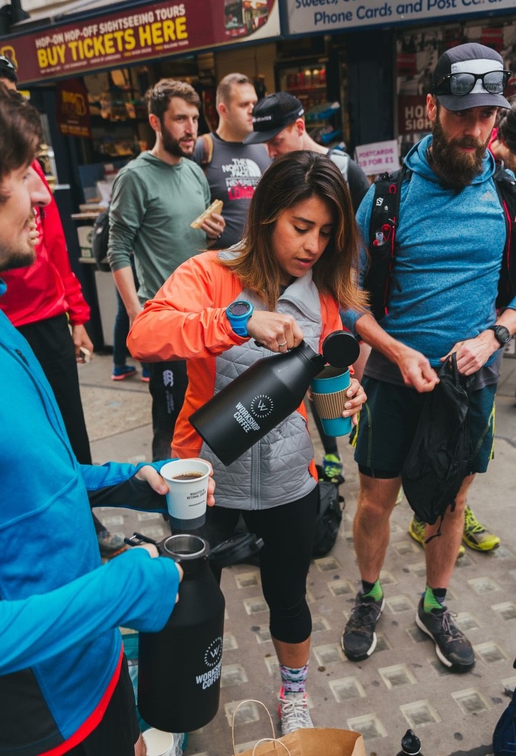 caffeine. Jack, the community manager, gives the first of many prep talks and we board the bus heading towards West Sussex. There must have been about 30+ of us. The drive was a bore. Slow and painfully escaping London (and passing back near the area where I live on the way!) we arrived in Fulking around 11ish and assembled in the car park of the Shadow and Dog pub. Prep talk number 2, an intro to the team (Jack, Mark, Mathilde and Yvette) and an explanation of the route planned by Jana who’s leaving the team to start new adventures in Chamonix later this month.

Group photo taken and off we go, starting with a climb of approximately 400ft where we were presented with some glorious views and plenty of happy cows and hikers.


About 3 miles in, after some undulations and more breath taking views of the South Downs we were upon Devils Dyke, a spectacular v-shaped dry valley. Time to run down, wooooooooo. Jack as always was behind the camera, dashing ahead to capture the emotions and joy of each of us running.


Earlier in the week I’d agreed to meet up with a friend Jon and some others he knows through Instagram, I got my dates wrong however and had to bail for the NSL run as I’d already committed too. They were also out on the South Downs doing a 30km Trail, and then we met. Amazing that in such a vast space you can cross paths with so many familiar faces. A quick detour and I went and said hello, introduced myself to those I recognise from social media but hadn’t yet met. And then a dash back to rejoin the group.
A few more pleasurable and breath-taking (literally) climbs and there were more views to savour. I chatted a bit with Mark, who is a very experienced runner, about the different techniques for hill running. Now I just need to put them to good use!


Along the course we were constantly greeted by the wildlife. So many young calves and lambs out on the Downs, cautiously saying hello and minding their own business.
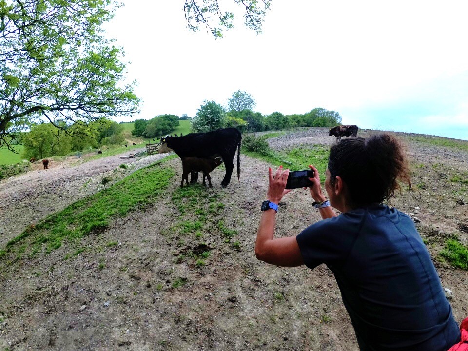
As we started to near the end of the 10 mile route we hit some mud (yay!) and it started to rain. Only ever so slightly did it dampen (get it?!) the spirits. But by now everyone was already thinking about the food in the pub.
Miles done and t was food time. We’d ordered ahead and the shadows and Dog were pretty good (I thought) with the group and the food was excellent. Now it was time to board the bus again and be lethargic. All in all a great day with plenty of laughs and memories and fun on the trail!!

The shortest version of this story is that I took the responsibility to arrange this cool cats adventure. A group chat identified that Jorge and I had never been to Epping Forest. I put out the Facebook post and the Vesseys, Yvette and Verity put their hands up. Nick was going to come but on the day bailed. I didn’t have time in the week to look at routes so I begged Jana for some from her collection. What came next was the result of the group.
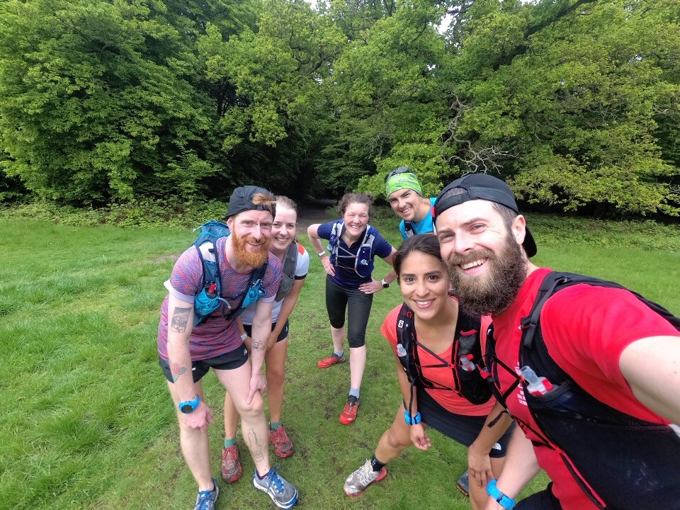
I opted for the shorter of the routes Jana provided, a 15km route. I had the NSL run the day before and the Helsinki marathon the following weekend so a shorter run was preferable to me. I’m also concious I’ve still some unexplained pain in my foot. There was some noise from the group as we were all travelling longer that what 15km would take, but we were easy. We could continue on the day if we felt like it.
On the day though we were all in favour of the 15km as a few of us were carrying injuries and niggles. So off we went from Loughton…
It was a greyish morning and we could feel the chill as we stood around setting our watches and bags. A quick mile or so up the road and we hit the ‘forest’ and you could immediately feel the humidity. We had the choice of a clockwise or anti clockwise loop as we’d be finishing in the same place. We went left and for the clockwise option.
 Soon we hit the lake and had some great views and crossed some wooden bridged-path before rejoining the trails. We were all smiling and glad of the flat but spongy gravel track and talked a lot about our injuries, inability to heed our own advice and the technicalities of different running shoes (always fascinating with Dan’s insight as he works for Runnersneed!)
To our surprise the trail took a little hilly turn. We had some up and downs to contend with. As relaxing as they were, I wasn’t expecting them! This is pretty much how the rest of the run went. It was very relaxed and we were all smiling and together for the 9 miles or so and only took a wrong turn a few times!
It amazed me that I wasn’t alone in never having previously ventured to Epping Forest. I’ve intended too many times before, just never made it happen. I was blown away by the scenery and in particular the “greenness” (if that’s a word?!) of the place. so many shades and variations of the green, it really is a gem of a place, and despite the time, so easily accessible from London with the Tube!
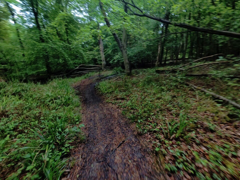
Food. Was on our minds and we finished up and went in search of a pub. None were open yet so we opted for Cafe Rouge. I’ve no idea why I felt the need to devour a whole sharing platter. Oh yeah I do, because it had baked Camembert on it. Result. It was time to traverse back across London and Home!


This weekend I got to enjoy the pleasurable company of the Wild Trail Runners. A collective of likeminded runners formed by Maggie and some others. Saturday was running. Sunday was not running. They say when you don’t run you cheer. And Sunday was the London marathon, so cheer is exactly what we did!!
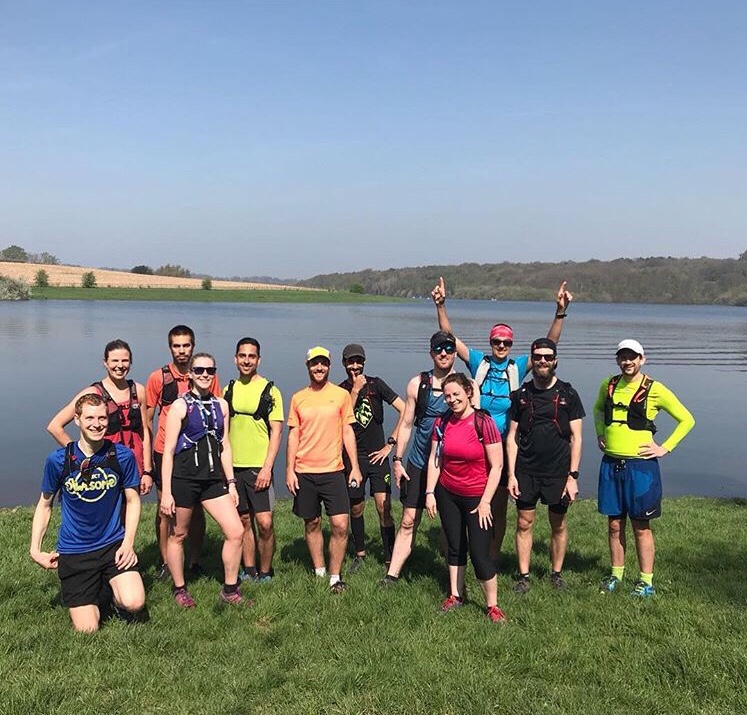
The Run
One of the group leaders, Weronica, had recce’d a run down in Tunbridge Wells area. So we met up early in London Bridge and headed down to Wadhurst where we’d run a 25km around Bewl Water Lake. The 7:40am meet was a struggle. We’d had a company event at work the night before and it was also my last day in the job. It’s fair to say I woke up with little sleep and a stonker of a hangover. But I made it. Intros done, train ridden we walked 2km to the start and met those already waiting. Bags checked and off we went.
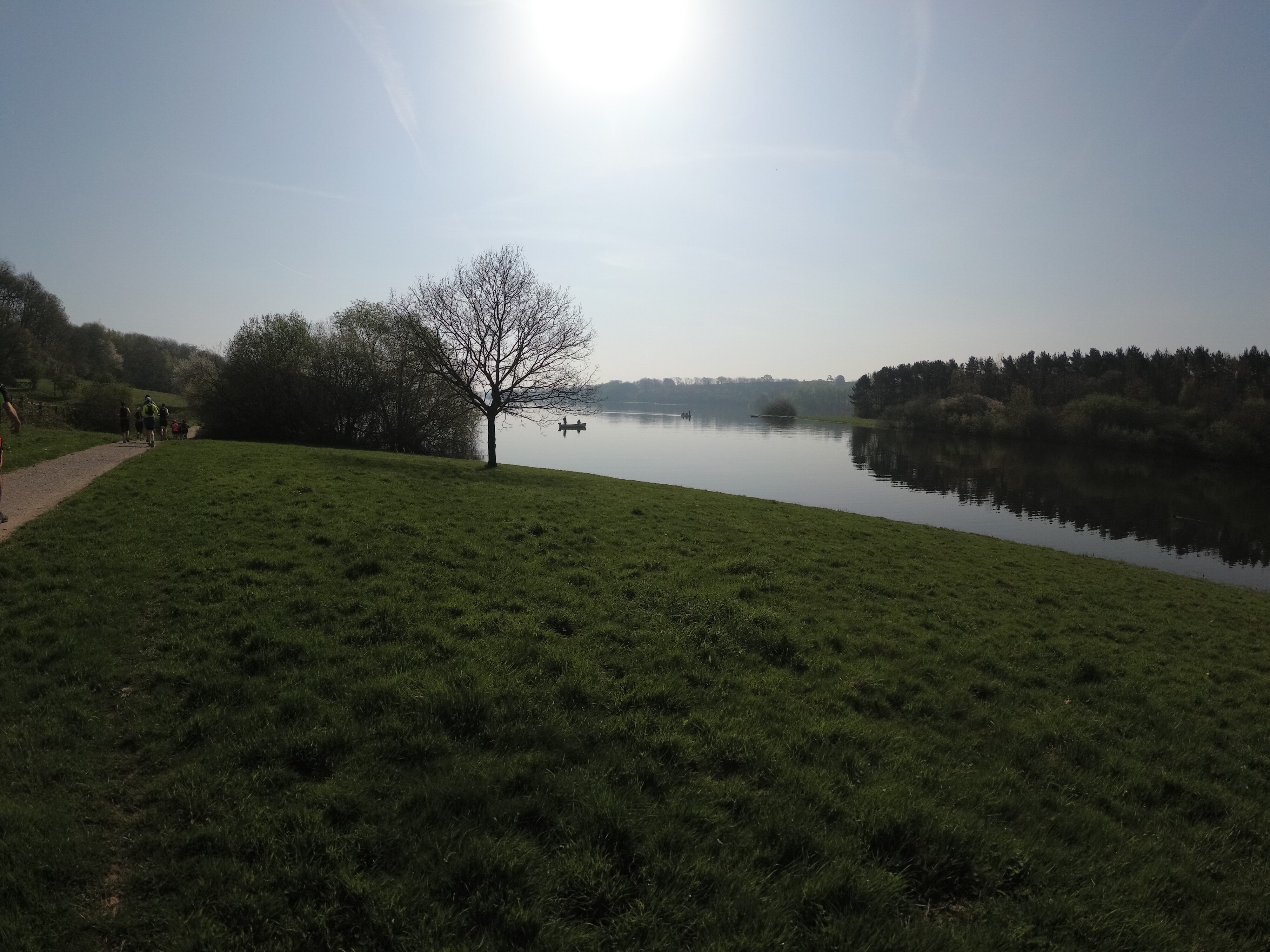
The run was beautiful. Bewl Water is the largest lake in the East of England (apparently) and we stuck to it pretty much exactly. It was a glorious hot day and the ground was hard not muddy. We all felt the heat immediately.

The first third of the route saw us run trough some fields, past the boat house and across a man made bridge/path built through the lake. We were largely close by as a group and enjoying chatting away. As always it’s so great to share and swap stories of adventures and plans with other passionate runners.
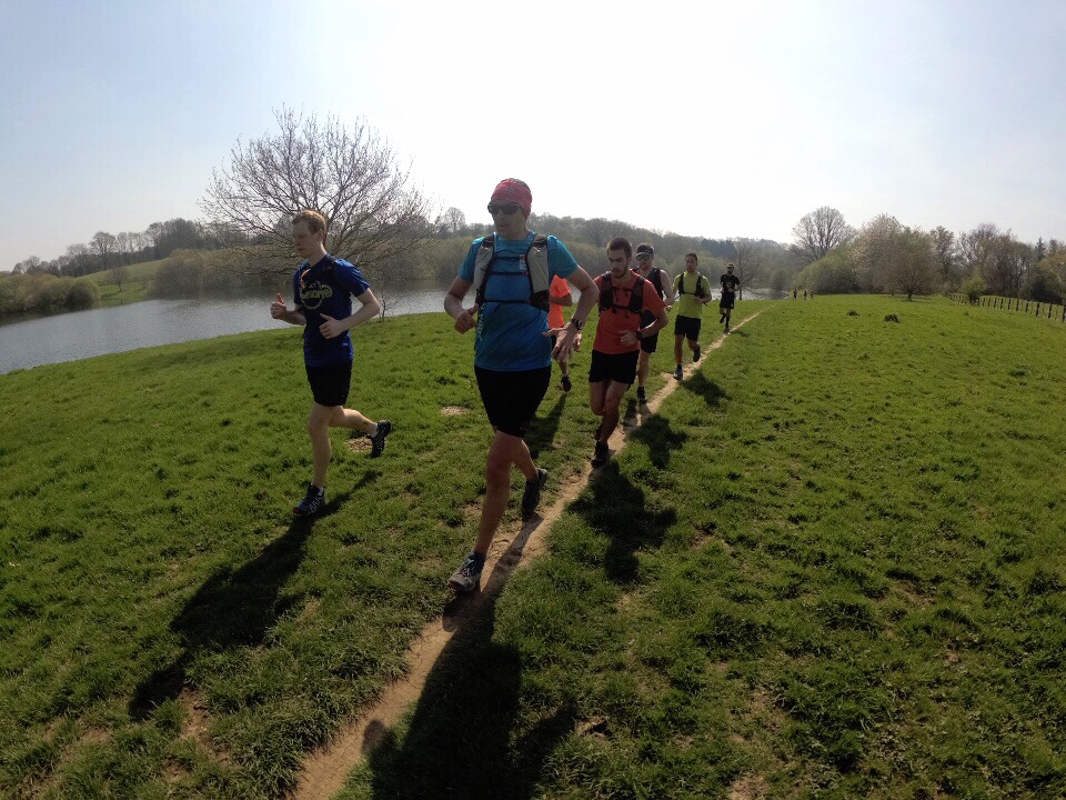
The second third of the course so us alternate between lake side paths and some roads. The heat was starting to take effect now and as a group we were starting to tire and spread out. We stopped frequently to regroup and ensure we were all adequately hydrated! The common theme was how sorry we all felt for the marathoners who’d be going through this tomorrow!!
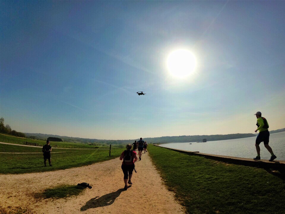

As we hit the last third of the route a few decided to take a shorter journey back to the meeting point (a pub of course). The rest of us carried on to what was a fairly hilly end to the route. Fair to say we were all glad to reach the end and head to the pub!


The Supporting
I made it my aim earlier in the year to spend more time supporting other runners. London marathon is such a fun event to support at. Cool Cats and Wild Trails has arranged to meet in limehouse near mile 21. I wanted to make a sign and I had the perfect inspiration from a child at Brighton. He held a sign saying “tap here for animal noises” and he delivered. So I stole his idea and made this sign up.
We arrived early and set up a space. Flagged and stickered so people knew who we were. We wanted to see the elites and had a roar when Mo ran passed looking strong and determined.

There were so many people I knew running whom I wanted to see but can be difficult in London as it’s so busy, but we had to see Daryl. He’d had a tough couple of months and probably shouldn’t have been running today. But he was determined to do it. So we thought through the crowds and made our way down to mile 14 where we saw him round the corner. Cheered and spent a moment chatting. He took a doughnut and some nuts and he was off again.

Back to mile 21 to cheer with the crowd.
Sometime later Daryl went passed again. Literally. We almost missed him and he had to weave his way back to us!
It was great to see all the runners the group knew coming by for hugs and cheers also!
Highlights have to be the various animal noises we shouted (and amazing ourselves at how few animals we could name!!) and seeing the response from the crowd.
About 6 hours later we were knackered. My throat was hurting and we decided to call an end to it. I woke the next morning with one hell of a sore throat.
What a great weekend of run related fun!

