When recapping my last race I mentioned how, during the Eiger Ultra Trail E101, I fell over for the first time in a race. We’ll I think it was a floodgate moment. In my next race I must have fallen about 50 times, no exaggeration, I spent a lot of time on my backside in Norway…
The Stranda Fjord Trail Race in Norway had been on the cards for a long time. Originally I signed up to the race back in 2019 and hoped to do the inaugural 100km run in 2020. But we all know what happened that year and the same cause meant 2021 also wasn’t possible for us. Oscar, the Race Director, was incredibly supportive in deferring entries until we could travel to Norway and race. So in 2022, a slightly smaller than planned group of us headed out to finally run in the fjells of Norway.
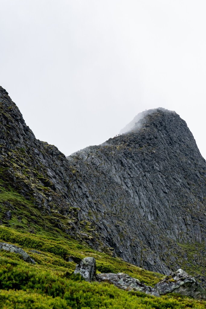
In the days leading up to the weekend it became increasingly clear that the weather was going to be less than ideal for the race. Clouds and rain meant a weather warning and amendments to the 100km route were activated for safety. At this point I was kind of ok with it. We can’t control or change the weather, and I was expecting the route to be very difficult. So removing some of the most difficult sections would be in my favour I thought. A small benefit to missing out on the legendary panoramic views from Slogen.
Nick and Natalia woke at 1am to escort me down to the town of Stranda for the start. An unnecessary and kind gesture from them both given they would need to wake up in a few hours to prepare for their 48km race. After collecting my GPS tracker I sat inside the building (where we collected our race numbers) with the other runners, waiting until it was almost 02:00 and time to run. We first lined up under the finishers arch before being led around the corner to the real start line. Here I fell for the first time, stepping in a hole in the concrete pavement, before the race had even begun!
Section 1: Start –Duklidalen
The course starts on the town square in Stranda. From Stranda you will first be running a few km on a asphalt road until you hit the trailhead on Framhus. From Framhus you will be running on a nice trail up to Dregetua (693) and then off trail over to Vardnakken (878masl) and further to Blåhornsvatnet on trail. From Blåhornsvatnet you will be running on a nice trail down to Vasset. From Vasset you will be running a few km on a gravel road until you hit the trailhead for the trail towards Lievarden (799masl) and Duklidalen (820masl). In Duklidalen you will find an aid station.
Excerpt from the Race Manual
Moments later and we were off, running the tarmac road switch backs for the first few kms. I was pleasantly surprised at this point that we stuck together mostly as one big group of runners and that I hadn’t been left behind completely.
The roads soon gave way to the forest and we began running in single file in the darkness. And it was very dark, something about it felt darker than the usual nights I’ve experienced. Though the trails were clearly lit by the dozens of head torches bobbing about.
Mostly it was silent now other than the sloshing sounds as we ran through puddles and muddy trails. I felt that most runners were, like me, trying to avoid getting their feet wet. I accepted that it would be wet but didn’t plan on being waterlogged for the whole race so was happy to skip around the trails when I could. I should have known better that weeks of rain in this area would have meant the ground conditions would be far worse than I imagined! It was soon clear that the trails would consistently be this way at the best of times.
Through the forests two things stood out in my memory. Almost getting lost – the spacing between runners was now increasing and a few of us lost sight of the runners ahead of us and this section was not course marked. A quick stop and check of the GPS and we were back on track before the damage was done! And a point where there was a delightful bunch of supporters with coloured lights and music who cheered us through one small section of the track. It created a good atmosphere and led to a few of us to start talking. Whilst talking to a few climbers who were doing the race it made me realise that most of the runners around me were head to toe in waterproofs (or wearing hiking trousers!) and there were very few like me in shorts and tshirts without a waterproof on. Even though it was drizzling with rain, I knew though that I’d overheat on the early climbs so was waiting until the climbs were exposed before I’d layer up.
After a little section on some wider gravel roads, the forests returned and became a little steeper and very, very muddy. Every now and then a series of wooden walkways assisted in avoiding much of the mud. The forest soon gave way and the mountain opened up into a vast exposed climb. The single tracks we followed, still trying to skip around the mud and bogs. So far so good although it was now very windy and cold (the drizzle of fine rain had become more constant now) so I took a moment to layer up with my waterproof jacket.
We continued climbing before reaching the first of the smaller summits (which must have been Dregetua) marked by a stone trig pillar. We then began descending and running again. I set off and was enjoying seeing the head torches of other runners way off in the distance. Here though it was becoming increasingly difficult to avoid the mud as the narrow tracks left little room to manoeuvre as the ground was so uneven. It wasn’t long before I was soaked to my shins and covered in mud. At one point my left shoe came off, stuck and wedged in the mud completely. I had to bend down and pull with both hands to get out back out. I took the moment to tighten both my laces! We then climbed a little more in similar lumpy conditions which was quite tiring on the terrain and in the cold of night. The heat from the first bit of climbing meant my t shirt was soaked with sweat so I couldn’t really avoid getting cold even with the jacket on!
From the next trig point (Vardnakken) we began descending. Down we went through a long series of lumpy bogs. The undulating terrain meant it was quite difficult to get a good rhythm when running. One foot would descend then next foot would ascend a lump. I felt like I was jarring up and down and running very inefficiently. There were rocks hidden in the darkness too.
Once more my shoe got sucked off (the right one this time) and after retrieving it I tightened my laces even more. They were so tight now that they weren’t particularly comfortable. But thankfully they never came off again!!

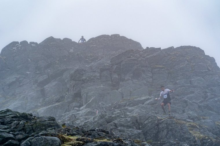
The descend was consistent until we reached Blåhornsvatnet. From here the descent became steeper and significantly harder. We we going down muddy and rocky switch backs, sometimes off trail, sometimes through streams and always having to look and see which way was the most obvious. It wasn’t long before I was on my arse and covered in mud. Within a few minutes I had fallen multiple times. The mud was so thick that there was no way to grip it properly. Whilst my Inov8 Trailrocs aren’t ideal for muddy runs, I also couldn’t imagine many trainers being much use here! I wasn’t alone. I could hear the gasps and groans of other runners in the night too and could see runners in front of me falling over.
I was already thinking to myself that this was the least fun I’ve ever had in a descent. It was relentless and torturous and I just had to accept it. Accept that it would be uncomfortable and that I’d keep falling. So I just kept moving, letting gravity pull me down, hoping it would be done quicker that way. There were a few points where I just ploughed straight through bogs above my knees and had to drag myself out with my poles. There would be no warning as the ground just sucked you in. Mostly though it was just about shin high. I remember thinking to myself that this was suppose to be the easiest section of the race! The alarm bells were ringing. I then took an almighty slip, skidding a little bit on my heels before twisting and going down on my left side. I know I swore loudly (not for the first time) and I heard a sound from my pole which I landed on top of. It sounded like a crack but I hoped it was just the sound of it hitting the the ground and my weight on top. Once again I picked myself up and carried on, thankfully the trails finally came to an end and we had a section of gravel track to run on. It felt quite long but soon enough we were climbing again (which I believe meant we were now connected to where the 48km runners would start). The gravel was a welcome change and I took the opportunity to remove my jacket again. I was also surprised how quickly my feet and shoes seemed to dry out. It was around 04:30, the morning was breaking and the sun starting to rise, giving a glimpse of the amazing views of Stranda and the Fjord below us.
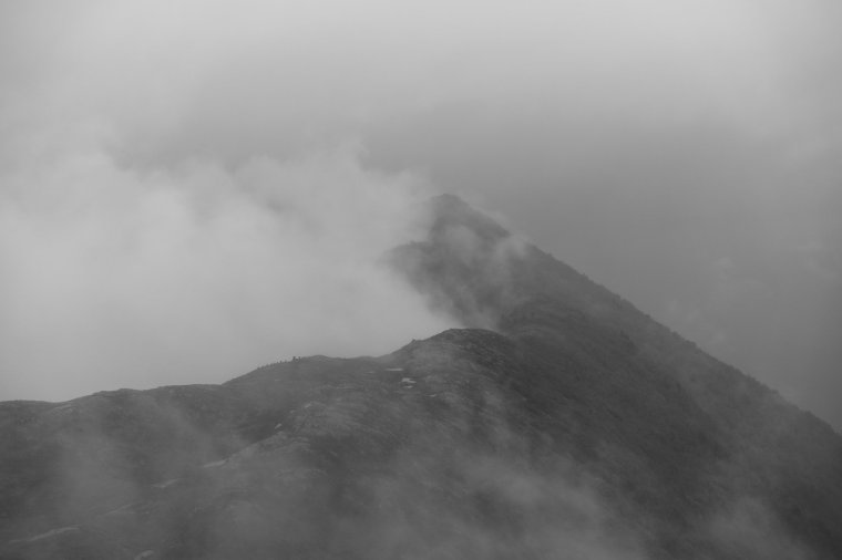
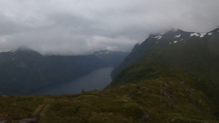
Inevitably the gravel road became a forest track and the climb became harder as the wet ground and mud returned. Over the course of a few 100m of climbing the tracks became off/track as the mountain opened up to us. The tracks returned and brought with them incredible views off to our left of the Fjord and over to Liabygda. I stopped for a few minutes to layer up again as the exposed mountain meant more rain and the temperature had dropped as the wind picked up. It did give me an opportunity to absorb the views all around me in the early morning mist.
From the climb we descended again, the tracks weren’t too steep but they were very wet and we ran on waterlogged tracks and bogs from the many streams. Up ahead a tent could be seen alone in the wild. The first aid station at Duklidalen and the first opportunity to eat something!
I checked my watch and timings and I had covered the 20km or so in pretty much the time I estimated I would. Not a bad start considering the state of the trails!
Section 2: Duklidalen – Fjørstad
From Duklidalen you will be running on and off trail up the Mønet. There are sections here that´s up to 45 degrees steep, you will have to use your hands at times on this section. Mønet is a cliff with a several hundreds meter drop on the fjord side, be careful and stay on the trail. Further on you will be on and off trail in scree up to Fremste Blåhornet (1478masl). From Blåhornet you will be running off trail along the ridge high above the fjord over Rjupskartind and towards Åknesnibba (1296masl). This section is very technical as the ridge is narrow with drops on boths sides. We recommend you to be catious here. There are parts where light scrambling is involved on this section. Before Åknesnibba the course will take a hard right turn down into the valley with a steep technical descent down, this is also a good place to be xtra catious. Then along Rjupeskarvatnet, and further out Fjørstaddalen past Heimfjørstadsætra and down to Fjørstad on a nice trail. On Fjørstad you will find an aid station.
Excerpt from the Race Manual
Immediately from the aid station we began making our way to the ‘wall’. I believe it was the cliff called Monet. But to me it was a wall on the edge of the world. I couldn’t see where we were heading. Making my way towards it I was texting Natalia ahead of her race and slipped and fell again. This one was my fault for not paying attention. The ground was soaking wet and cold where I fell.

As I reached the ‘wall’ it became clear we were climbing up it. I could see runners scaling it and became apprehensive. It was steep. I held my poles in one hand and used the other to pull myself up with each step. I dared not look down but accepted that it wasn’t as bad as it initially looked and I was at the top maybe 15 minutes later. Up top the grassy cliff turned to rock almost instantly. The climb however continued.
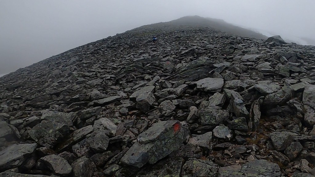
Looming in front of me was a giant of a mountain. Grey in every way. Grey rocks. Grey clouds. Just grey. I assumed this was the first change in the route and this is where we wouldn’t climb. I was wrong though. People ahead of me kept going further up and disappearing into the grey clouds. I put on my gloves as it became colder the higher I went. I then put away my poles and began climbing on all fours. It was quicker that way. I briefly started talking to Kristofer who’d done the 48km last year, who explained this was just the climb to Fremste Blåhornet (I believe he called it ‘Front Bluehorn’) and that the removed part of the course was further up still. He powered on passed me. Eventually I made it to the summit and the timing mat and turned around. Now we were on the diversion route which meant going back the way we came then across and down a valley.. There were a few runners ahead of me but they soon disappeared into the distance as I move so slowly over technical descents like this. I kept watching and making mental notes of where they were and went so I didn’t get lost. I felt alone now, for the first time in the race. I soon couldn’t see runners ahead nor behind me.
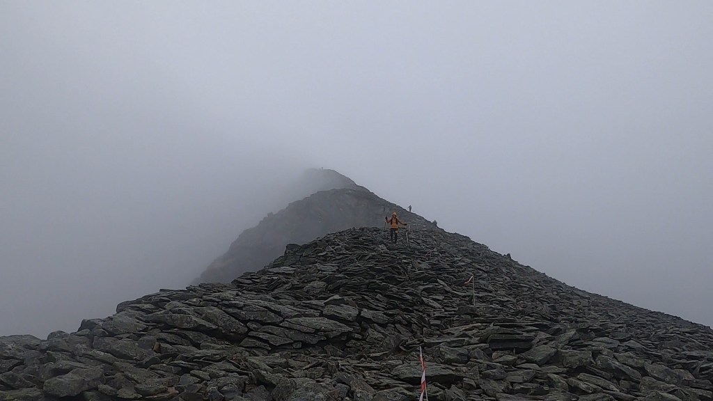
After completing the rocky downhill the diversion route took us left and away from the next climb. There was no path though and it was an off track descent from here to the next aid station Fjorstad. I was beginning to see the pattern now and off track terrain meant crossing lots of streams, slipping loads in the mud and bouncing up and down with the lumpy ground. Every now and then I’d get a glimpse of a single runner ahead and another behind me. This was another down hill I did not enjoy. I was initially glad when the route entered a forest area but that happiness soon gave way to frustration as the mud returned with a vengeance. Once again I was constantly on my bum. I started saying “fuck you” loudly. Like a chant. Every time I stubbed my toe on a rock “fuck you”. Slipped on my arse “fuck you”. Stepped in a bog or stream “fuck you”. It became my mantra as I continued tumbling down.

Finally the forest let me free and I ran the small down hill to the aid station, slipping and falling for the supporters and volunteers to enjoy! We all smiled and laughed knowing I wasn’t the first and wouldn’t be the last to provide the entertainment.
The aid station was a good one. Kristofer was there and changing into spare clothes. On this race you could have a drop bag at each station. I’d opted just for one at the 63km point. I regretted it slightly seeing Kristofer change into dry clothes as I was soaked through. It was warm inside the building so I packed the waterproof away again and noshed down on plenty of watermelon, crisps and cinnamon buns.
Section 3: Fjørstad – Habostadsætra
From Fjørstad you will be running the asphalt road down the Strandavalley for 4km and then into Moldskreddalen on a gravel road for 3km to Mesætra. By Mesætra you will hit the trailhead to Storhornet and cross the river on a bridge, and start the climb up to Storhornet (1309masl) on and off trail. Parts of this trail is technical. After summiting Storhornet you will turn around and follow the course back down for 1km, and then turn right and hit the trail down to Habostadsætra. Ths downhill section is very steep but the trail is very nice. On Habostadsætra you will find an aid station.
Excerpt from the Race Manual
Before long I was back out running with Kristofer on a long road section. It felt good to run. I’ve never wanted to run along a main road with cars driving passed me (very safely and courteously I should add!) so much in my life. It felt like it was the first time I could actually run. It was also a strangely therapeutic few kms knowing I could see this road from our incredible mountain accommodation.
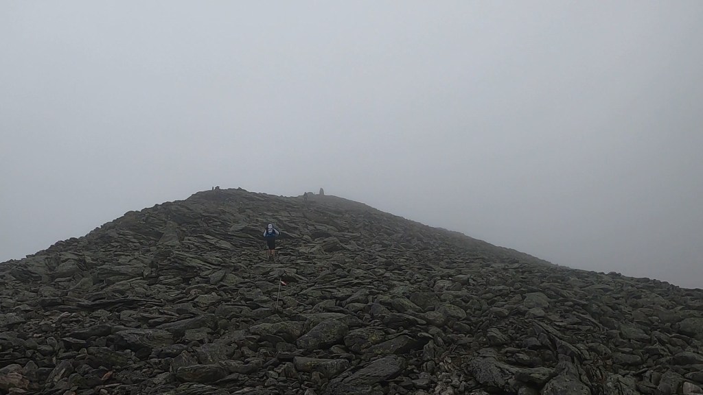
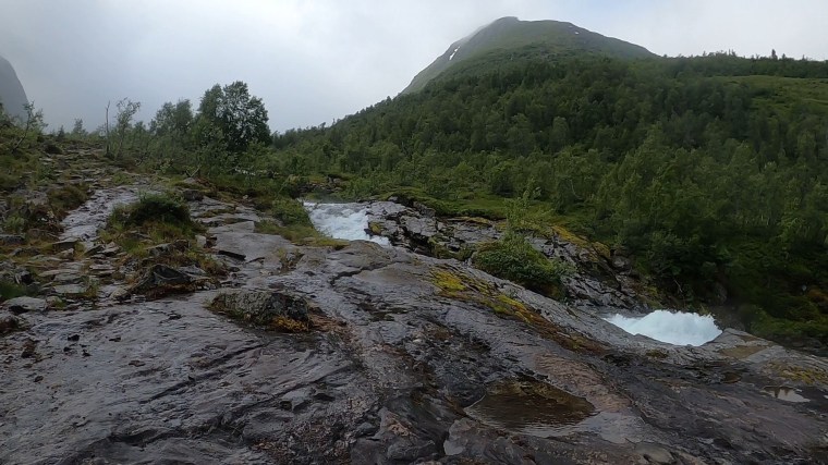
From the road we were once more on a gravel track uphill before, yep, you guessed it, we were back in the wet and slippery forest hiking off track up a steep climb. Kristofer started getting further and further away as I huffed my way up. Once out of sight I had to concentrate more looking for the red trail markers painted on trees or rocks. This climb felt like it took so much longer than it probably did. After the forests it was wild and rugged terrain. Up and down lumps whilst still generally getting higher. There was a person out here all alone. It took me a while to realise he was a photographer. It took a while longer for me to get to him, he waited patiently and snapped me as I said hello and made some bad jokes. I asked if it was Ian, and it was. A world reknown adventurer and photographer. I’d read his blog from the 2021 event and we had a brief chat comparing the contrasting weather conditions. He kindly shared some advice on the climb and temperatures awaiting me and wished me well on the journey.

From here things got a little harder. The climb went off for an out and back section to the next summit of Storhornet. It went ‘up’ pretty steeply and the trail was more prominent and clear for a short while as the the mud and wild terrain tagged out and the went rocky tracks tagged back in. There were many runners coming back and I’d let them glide effortlessly passed me. I had no idea how far I had to run to get back to this point. But up I went. There was another photographer filming runners coming down and he had to film me slowly walking up. I made it clear I wouldn’t be running down like they all were!
Like the Blåhornet summit, this one became very rocky very quickly. It was now just like before as I was stumbling from rock to rock heading into the mist in the direction shadows were coming from. Here I had one moment that ‘threw’ my mind a little off. A lady was coming down and started speaking to me, I assumed in Norwegian, and I explained I only spoke English. She then told me that it was very cold further on and asked if I have any more clothes to put on. I was caught off guard. Whilst her intentions were no doubt full of kindness and support of other runners, I didn’t quite understand the comment. There was mandatory kit and I was clearly in the race with a full bag on my back I also had on my waterproof coat and gloves on, so I don’t think I looked under-prepared compared to anyone else. I assume she was concerned because I was just in shorts. But I reassured her I was fine and carried on. Soon Kristofer ran back passed me and sometime later I looped around the summit and too was heading back down. On this section many runners overtook me as I once again descended so slowly.
Eventually I completed the out and back and was then going down a steep hill in another wet and slippery forest section. I was all over the place. Sliding and slipping everywhere going down the switchbacks. A lady behind was asking if I was ok as I was swearing constantly. Then it was her turn as she slipped and did a pencil roll down one bend/turn. I can’t quite describe how fantastically she rolled and ended up down ahead of me and back on her feet laughing at her ‘shortcut’. She then sped off descending rapidly with ease. She called back to check on me a few mins later when I let out a rather loud expletive laden cry. I was ok. I’d fallen again (Fuck you!). This one was worse though. Whilst I was fine, in the process I’d snapped my fucking pole again (I snapped one in the VDA last year). I was really pissed off. It snapped right at the handle where it slides in and the locking button is. It was fucked and useless now and I’d only covered around 40km of the race. In a mood I carried on into the aid station that wasn’t far away.
A few runners looked at my pole and the volunteer was a superstar, running around looking for things to fix it (his plan was to tape a small rod to the handle to strengthen it). I knew it was a lost cause though but I appreciated their efforts. I filled my sorrow with meat soup (which was frikken ace) and Coke. The aid stations were pretty great for variety in my eyes! I checked my timings and, once again, felt I was pretty spot on to plan as it was about 30 mins before the first cut off. And so, having experienced running with one pole before, I knew I could overcome it, I packed it away and carried on with the single pole.
Section 4: Habostadsætra – Myrsætra
From Habostadsætra you will be running on the marked DNT hiking trail trough a lush birch forrest to Nysetvatnet with a great view towards Brekketind and the Brekketind glacier and then further to Patcellhytta where the climb to the iconic mt. Slogen (1564masl) starts. You will be running on the marked DNT hiking trail up to Slogen. The last part up to Slogen is very steep and involves scrambling, be catious on the way up and down. From Slogen you have a majestic view over Hjørundfjorden. The summit is very narrow, so one have to be carefull on the top. Here you will turn around and go back the way you came up for 1,5km. But instead of going back down to Patchellhytta, you will turn left and continue towards Isavatnet and further down Langseterdalen past Storevatnet on a nice trail. At the parking lot at Myrsætra you will find an aid station.
Excerpt from the Race Manual
The next section began with us walking up a stream. Really?! Fuck this trail I thought. I was waiting for the pain of constantly wet feet to kick in. Like the rest of the route, there was nothing to do about it except power through. It was kind of up hill, but very gentle and certainly not runnable (for me) as it was mostly rocky. My power hike was in full flow though and I was enjoying the intimating views of the mountains surrounding us on all sides and thunderous roar of the river besides me. Off in the distance I could see the lady along with another runner. I kept thinking I was gaining on them but I really wasn’t. The section was another that felt like it went on for a while, but I was content knowing we were at least climbing gradually higher. And so my mind wandered a little. I got thinking back to that last aid station and my timings and realised that all wasn’t quite what it seemed. Whilst I was ‘on time’ and within the cut off. We hadn’t done the climb from Blåhornet nor the ridge or its ‘more’ technical descent. That was the very technical section and no doubt a harder descent for me. So I highly doubt it would have completed that longer section of the route in my spare 30 minutes. I realised I would have been timed out at the first cut off (which was 13:00 at the last aid station) if the route hadn’t been changed due to the weather. I clang onto the hope that if the weather was better then the terrain would be less muddy and I might have moved a little quicker!
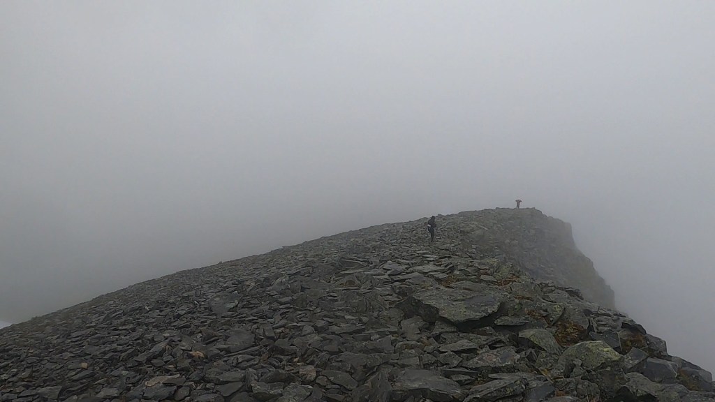
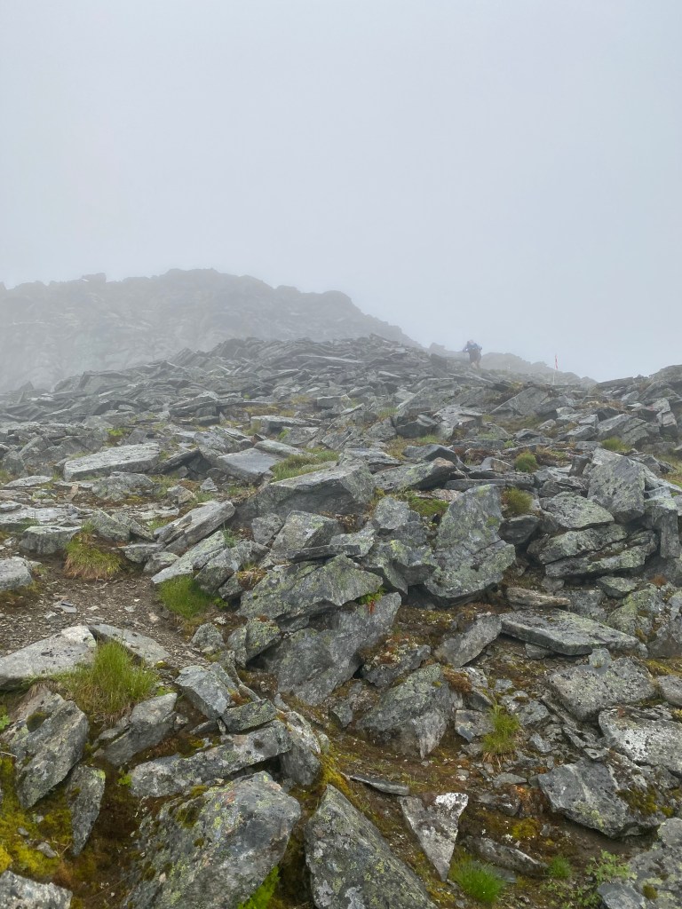
In the distance there was a little mountain hut of some sort and a guy out sweeping the decking area in the rain. It amused me. As I walked passed a volunteer called to me and waved me up to him. I checked my watch, yes, I was mindlessly following the two in front. I called after them and they walked back to join me on the climb. Each climb in this race seemed to find a way to be more challenging than the one before. This one was just a pain to start with as the terrain fluctuated between single track and off track frequently and we traversed so many streams and flows of water down off the mountain. It was just miserably wet. Like the number of times I fell, I wish I’d counted the number of streams we’d crossed on this course, I’m certain it would be hundreds. The mountains were leaking water everywhere due to the recent weather. It only stopped the higher we got. And it only stopped because the terrain became rocky. Once more we were playing dot-to-dot connecting the red trail marks and traversing the huge boulder fields.
There was a giant sleeping here. To my left I could sense and enormous presence and was admiring the mountain in the clouds. It was Slogen. The original route included an out and back to summit of Slogen for ‘panoramic views’. But we wouldn’t be doing that today. I was glad. This was also one of the hardest parts in the race so I was relieved to be skipping! Instead we carried on straight passed it. Straight into and across the snow fields. These were fairly short but difficult with one pole and not so aggressive soles on me shoes.

After some time we began our descent towards Myrsætra. This is where my drop bag would be. So I was in good spirits anticipating it. But the descent was tough. It was, you guessed it, rocky. So the the three of us moved slowly. I don’t remember much more than passing down alongside some lakes and rivers. I do remember we were in a valley and it reminded me a little of a section the TDS route in how it looked (but harder!).

There was plenty more falling over here too and I was losing track of my orientation and where we were going. The lady reminded me that soon we’d have the out and back to the aid station to the left and then we’d go back to the right to climb out of the valley. It made sense when she explained it.
Oddly, here I also realised my eyesight was a little hazy. I could see ok, but it wasn’t crystal clear. Almost as if I had clingfilm on my eyes. There wasn’t anything I could do and I assumed it was a combination of tiredness, constant concentration, the wind and the rain and perhaps the white glare from the snow. Anyway, I wasn’t worried, but I was conscious of it and to keep an eye on it (Whey hey!)
We reached the out and back section and now, like before, saw runners and familiar faces going in the opposite direction. There were a lot less of them this time though! I didn’t know how long it would be to the aid station but I was aware of how wet and muddy the track was again. I immediately decided that I would not be changing my shoes or socks. My socks would be soaked as soon as I changed them so I thought it wasn’t worth the effort. As I rounded the last corner into the aid station I had one of my best falls yet. I slipped in some mud and both feet went up in the air, above my waist, as my hands and head threw up behind me with the motion. I landed on my bum and back straight into a boggy patch. I was covered in mud. The volunteers laughed as I arrived (they heard the ‘fuck you’ scream) and I apologised as I sat straight in one of their chairs and covered it in the fresh mud. I ordered more soup, ate more cinnamon buns and finally changed into a dry tshirt after 14 hours.
Not long after the three of us reached the aid station, we were shortly followed by a fourth runner a Polish man I’d been near throughout the day. We sat and ate and drank and joked with the volunteers. We had our own little party before cheering ourselves back out knowing we had five hours to cover the 10km to the next (and final) cut off. Easy we thought… Wrong…
Section 5: Myrsætra – Brunstad
At Myrsætra you will run back up the same trail you came down up to Langsætra where you will follow the DNT marked trail up to Gullmordalsvatnet passing by the Gullmorglacier along the trail (you will not be running on the glacier). This section is very technical and you will be running parts of it on scree. After passing Gullmordalsvatnet you will be on the top of the Gullmorbrekka (979masl) pass, from here you will be running technical downhill to Velleseterhytta and further on gravel road down to Brunstad where you will find an aid station. This is also the location for the the cut off time at 21.00.
Excerpt from the Race Manual
The first section was ok. It was a repeat of the out and back. After which we we were constantly looking for the trail. This section wasn’t marked by the race and no red trail markers could be seen anywhere. We followed our GPS and would be on what seemed to be a trail, then all of a sudden the GPS would say the trail is off to our side by 50-100 m. This meant we were zig zagging up the climb. Crossing all sorts of wild terrain to ensure we kept heading in the right direction. Every now and then the Polish guy would appear from nowhere. He was having the same navigation issues. After an ‘age’, the lumpy foliage turned to rock. But that didn’t make it any easier and the same thing would happen as we’d turn at right angles to try and maintain the correct direction. We at least could now occasionally see some red trail markings on rocks though.
At this point we were sticking together as a foursome as we crossed many more snow fields and rocky sections climbing and traversing our way out of the valley. The lady, who was from Argentina, lady kept kindly offering me her poles as I was really struggling on all the snow crossings. So mostly I was behind them all and would time to time shout out when I thought we were ‘off route’ again. To me it felt like it was night time. We were deep in the clouds and the grey-ness of the mountains. The only light was coming from the snowy floor we trudged over. It was surreal and disorientating at the same time, yet it was only about 17:00.
We were trudging across another snow section when I noticed we we starting to get further from the trail, which was going off on a sort of angle above us. We stopped and debated for some time where to go and eventually agreed we shouldn’t continue on the snow. For one thing, we couldn’t see any recent signs of activity on them! The issue however was that the snow was sloping and above it was a wall of rock. It didn’t look feasible that the route could be up there. But that’s what the GPS was saying (and scrolling out we could see that the route would turn further that way after about a km further along). If we carried on the snow instead we’d soon be far off course and could see nothing ahead to make us want to continue (into the unknown).


So we back tracked and headed for the rocks. It took me a long time with one pole to get up to the rock and my troubles didn’t stop there, the climb facing us was a beast. It was essentially bouldering and rock climbing. I was trying to use strength from my arms which I just do not have to haul myself up onto rocks. And it was all loose. Admittedly I was scared. Actually, very scared. A fall here would be bad. A certainty of a serious injury and likely a very long wait to be rescued. I was glad I wasn’t alone and Argentinian Lady was very supportive and looked after me with constant reassurance. I knew we had to keep going though and that we should even get a little higher to be safer and further from the steep drop.
The climb, even just covering a few meters, was very slow. We were barely moving and the loose rock was causing us difficulties. Several times we knocked rocks back on each other, one time I released a sizeable one that went tumbling down. My warnings weren’t enough for the Polish guy to get out of the way in time and all he could do was raise his arm to protect his head as the rock fell straight into him. I felt so bad, but he reassured me that he was ok, just annoyed by the situation. It only added to our frustrations and concerns of safety.
We were at least now tracking in the right direction according to the GPS and the rocky climb eventually gave way to firmer ground, albeit more snow capped fields. I thought it couldn’t get worse than that section, but I was wrong (again). We were now faced with another directional dilemma. The route indicated we needed to leave the snow and descent a very narrow, very steep rock face. I looked over the edge and it felt like an abyss, the end of the world. Meters below us all I could see was a dark grey mist cloud wrapping the mountain. I couldn’t see a trail or path. It is fair to say I was not keen and I didn’t want to go that way. The alternative though was to remain higher up and walk along the snow covered mountain. I’d had enough of them though and we couldn’t see far enough ahead to determine where we would go or how we could re-join the path if we did continue that way. It felt like ‘down’ was actually the better option. Two of us started to descend…

I was still on top of the snow when, in the distance, a lonely figure, in a bright blue coat, emerged through the clouds with his hand in the air waving. I didn’t know what to think. He was clearly gesturing to us so we called back to let the others know someone was coming. We walked on and met him. He explained he was a volunteer from the race and he’d show us the way. He confirmed we could go either way, but the snow might be the easier route for us. So we followed him.
He was moving so effortlessly I struggled to keep up. He pointed down a steep snow slope and said we can go down here. And off he went, sliding, skiing (without skies) down hill. The French guy went next and pretty much made it the whole way standing up too. I followed and immediately landed on my arse. I sped down like I was on some sort of toboggan, bouncing up and down with the lumps. In no time at all my arse was so cold and starting to hurt with the freeze and friction. The whole thing lasted a matter of seconds. Looking back, my Strava indicates we went down a slope of approximately -50 deg and covered around 70m in descent. My apparent pace was 1:32 km per minute. What a ride!

One by one we all made it and we were at least treated to an incredible view of the Gullmordalsvatnet lake and valley surrounding it. The downside, I could still see no clear trail or path. We were told that we needed to traverse along to the right of the lake. I couldn’t believe it. What?! It was just the slope/side of the mountain with alternating layers of snow and rock. How? He reassured us that as we got closer we would see some race markings to indicate the way we should go. He told us that we would need to climb and descend on the rock and avoid the snow slopes at all times. I could see why, if you slipped on those, nothing would stop you sliding all the way into the freezing lake. Game over. There was another catch though, first we would need to ascend on the initial snow slope, but not to worry, there is a rope. Fuck sake…
One by one we ascended the rope climb. This was awful for me. I had no energy or strength to pull myself up and no grip in the snow to provide any traction. It was yet another very slow ascent. I relied on a tactic of pulling myself up and looping the rope around one hand with each pull to get more leverage. I thought my shoulders would pop out here. Thankfully I soon reached the sanctuary of the rocks. Ha! Now I was thinking that the rocks were my friends!
The volunteer left us here and went back to look for the remaining runners behind us in the pass somewhere. We thanked him but I never got his name. His final words were “it is 2 hours to the next checkpoint”. I looked at my watch. We had 2 hours and 10 minutes until the cut off. Shit. I thought we wouldn’t make it, that we would be timed out. If he was saying 2 hours, it would probably take us longer. I hung on to the glimmer of hope that there might be some sections we could run and that he was talking about walking time.
We still had to travers the lake first though. Painstakingly, we looped up and down each rock section, maybe up to a 20m climb and descent each way. Looking and following the trail flags which we could finally see. Each loop required a small traverse either along the top of the snow slope or along the bottom, right next to the water. I could feel the chill coming off it. At one point I sent another rock tumbling. Down the snow it rolled and then bounced off the bottom of the slope, launching into the air and over the water onto a floating patch of ice with a ‘boom’. The lake didn’t flinch and I didn’t want to follow the rock!
As we finally reached the end of the lake, the paths did become a little easier. They were far from runnable though. Just easier than what the last few kms entailed. It was still a horrid down hill though. In maybe 3km we descended over 500m. It was very rocky and very slippery as we navigated through tens and tens of waterlogged paths and streams. There was plenty of falling over and slipping here too. We mostly descended in silence. I’m not sure what the others were thinking, but all I could think about was the cut off and whether we would make it or not. I wanted too, but I was also wondering how I’d feel if the decision to continue was taken away from me. I genuinely believed that, after this cut off, we would have plenty of time to finish (there was 13 hours for the last 20km or so). So I wondered if we were close to the cut off if I would be of mind to try and negotiate my continue. It was all theoretical, but it kept me focused. Going further down, fast hiking, moving with purpose. It as all I could do.

We then came upon a forest section which was far less steep than before. The trails became a little drier and other than a few big leaps across streams (with broken planks that were intended to be crossed) the next few hundred meters of descent were a little more forgiving. We still weren’t running, but were able to pick up the pace at least. We were racing the clock though as time was against us and I kept looking at my watch and doing the calculations. 50 minutes to go, 40 minutes to go, 30 minutes to go… With every step I adjusted our progression, but it didn’t really make much difference. It was going to be tight if we couldn’t run. And then luck was finally on our side…
From the forests we came across a house with a lady gardening and a man tending to the path. We ran down, said hello and left through their gate. He wished us well and said he hoped we were enjoying ourselves. I think I just laughed. But, from the gate, there was a gravel road. It was steep, but it was dry and even terrain. Gravity did its ‘thing’ and we ran. We were a little spaced out as we all descended at slightly different speeds. But we were all running. After maybe 1.5km, there were people further along. It was the aid station at Brunstad. I looked at my watch. We had 20 minutes to spare. We’d made it. This 10km section of the race had taken us 4.5 hours to complete!
I ran into the aid station with belief. I believed now I would finish. I believed in me. The decision to continue was in my hands, and I know there is only one answer to that question, pulling out is never a consideration, never an option. I would continue and I would finish. We sat and set about refuelling. Eating more soup, more cinnamon rolls, more chocolate sweets and crisps. At the aid station, the Argentinian lady’s family were waiting. It dawned on me that her and her husband, along with their dog, had been sitting opposite me in the reception at the start line some 18 hours earlier. With the positivity we were feeling, the Polish guy said what I’d been thinking “we all stick together now right, and finish?”. There was no hesitation from me. Absolutely, yes I said. The French guy agreed also. I’m not sure if I missed it somewhere but the lady had decided that this was where her adventure would end. She simply had no more desire to continue. I only realised when she was offering me her poles to continue on with as ‘she didn’t need them anymore’. Even now, after bowing out she was still supporting and looking after me. I felt sad and emotional that she wouldn’t be seeing it through with us. I declined the offer of the poles though. I made it this far and was confident I’d be ok.
As we set back out we were a little deflated that we still had over 20km to go. The amended route GPX had indicated we would be doing around 88km in total, but we were already around 77km at this point. It made sense though, the final two sections were unchanged and we still had to complete them. We left just before 9pm (and then stopped straight away as I had forgotten to get my head torch out ready for the darkness).
Section 6: Brunstad – Svartevatnet
From Brunstad you will run to Brunstadsætra through lush birchforrest and crossing the river right before Brunstadsætra. On Brunstadsætra you will get on the nice and very steep trail up to Storevatnet. From Storevatnet you will be climbing off trail up to 1100m and traverse over to Vassdalen (The course is not going to the peak of Ystevasshornet) where you will be running downhill on technical trail down Svartevatnet. At the parking lot by Svartevatnet you will find a aid station.
Excerpt from the Race Manual
Initially we had a gravel road ascent similar to what we had just descended. This was good for easing back into the task ahead. We took this opportunity to chat and for the first time exchanged names. It felt silly that we’d been through so much together without knowing who we were. This was where I learned that the Polish guy was Kamil and the French man was Matt. From the results table I now know that the lovely Argentina was Margarita. These were my companions, my saviours.
A few kms later the gravel changed to forest. The gradual climb, with no warning then became very steep switch backs as we climbed for another 500m in the slippery dense forest. I had to stop a few times to catch my breathe and refocus. It was tough going, but I was happier with this type of climb than the many we’d done before.
After leaving the forest it was more off-track plodding in the open mountainside as we continue to about 850masl where the ground flattened out. Here we could see up ahead a semi-circle of mountains surrounding us. Once again I had no idea where we were going and how we would ‘escape’ from here and descend back down. We continued walking towards it as the day light diminished and darkness began to set in.

We reached a lake where our head torches started to pick up the feint shimmer of the reflective tape for the race markings. One or two at a time. They gave an indication of where to go, but not too much insight as to where we were actually heading. Slowly it became clear that we were just going ‘straight up’ to get out of the plateau. Seriously? Fuck you. In the darkness we began to climb the rocks again. I was struggling with the climb. Matt and Kamil were getting progressively further away. I set myself a target to rest and breathe at each flag marker, only meters away from one another, but I was stopping multiple times between each one. We climbed for maybe another 200-300 meters, up and across scree slopes, the rocks loose under foot and when I grabbed at them with my hands for support. As I reached the top we were now in complete darkness. Besides the reflective trail markers I could now also navigate by following the head torches of the others in the distance.
We began the descent which wasn’t any easier. Loose and sharp rocks, winding switch backs and wet streams to cross. We stopped at one stream and filled our bottles with ice cold water. It was delightful. I gulped back two bottles straight away. Like many before this one, the streams we needed to cross were often bursting at the seams and the ‘path across’ was submerged under rampant and powerful flowing water. They were difficult to cross and even more so in the night. It was a case of steadying ourselves and hoping for the best, accepting that we would be wet to our shins. The aim was to get to the other side and not to get sucked in or fall over. The roar of water in the night was quite something. It was the only thing we could hear out here in the wild.
After a while the rocks gave way to forests and you already know that these were steep, muddy and slippery. As we progressed, a huge lake started to come into focus below us. Way off ahead, on top of a mountain silhouette in the darkness I could see two head torches way up in the sky. I knew where we were heading now. We would descend to a road crossing (Svartevatnet) before the final climb on the other side. I remember looking at this section when we drove along the road into Stranda when we first arrived.
I was glad to get off the forest track as we bottomed out at the lake. Here there was a slightly flat gravel section towards the road. At this point Kamil, who was in front on the descent was now behind me. Matt was up ahead on the road and I shouted at him when I saw the markers on the other side. We started to cross. Then loads of volunteers came into sight further up the road at a lay-by. They gestured us towards them. It was another aid station that I had complete forgotten about.
Here I was ready to leave quite quickly and just get on with it. I was sick of soup now so ate some crisps and cookies. Matt had some soup and a French man came to say hello to him. He was in the area, saw about the race and heard there was a French person running, so he stayed out to say hello and cheer him on. How lovely that was. Kamil sat in a chair and told us to go on without him, that he was going to have some sleep as he was struggling with fatigue. He wrapped up and tried to get comfortable. I let Matt know. Whilst we were there I had a half cup of coffee to try to fight off my own tiredness before we set back out. For now, we were down to two. I was sure Kamil would catch up with us at some point on the climb in the night.
Section 7: Svartevatnet – Stranda
By Svartevatnet you will cross the road and get on the trail to Langevatnet and further to Roaldshornet (1230masl). From the summit of Roaldshornet you can enjoy the epic view over Storfjorden and down to Stranda. You will continue to Blåfjellet and downhill Trollvaregga with technical running down to Skuravatnet. (The course is not going up to Skurahornet, it goes straight to Stranda from Skuravatnet) .From Skuravatnet you will be running on a nice trail all the way down to the outskirts of Stranda, and then on gravel and asphalt roads down to the finish line at the town square in Stranda.
Excerpt from the Race Manual
And so, at 01:00 in the morning we began our final section. From the aid station we crossed the road and began heading into the darkness of the forests once more. The trees lasted only a short while and the climb began. Initially I had flash backs of the first climb of the race when we left the forest and the mountain opened up. The terrain felt very similar. It was a series of gently inclining winding big paths littered with bogs and waterlogged foliage. Compared to the other climbs of the race I was very happy at that moment in time. This felt very manageable.
As we had previously, we navigated by reflection of the race markings. Each one opening another insight into where we were heading. The large silhouette of the mountain standing tall in front of us and getting closer with each step. As we neared it, the climb took us to the mountain face and the rocky ascent began, but, it was no where near as bad as the ones before. I felt this was the easiest climb of the night and possibly of the whole race. I was thankful.
Before we reached the summit, my watch died. I hate this watch. I accept it is now a good few years old (it is a Suunto 9 Baro) but the battery just does not last what it indicates it will. Barely 24 hours with some of that on the Ultraks mode. Useless. I couldn’t care less about charging it now. I just wanted to finish the race and rest.
The climb wasn’t too bad either and we emerged onto the roof of the mountain. It was, of course, rocky but for the most part we were now traversing the top along to the next point at Roaldshornet. It was very cold and windy on top and we stopped to layer up ready for the final climb to the summit. As we hiked along to the summit, with a gentle undulation, the sun started to rise to the East. It was going to be spectacular. We’d miss the full sunrise and views from the summit, but we had a glimpse of the orange glow breaking up the darkness. We kept moving and covered the final little dip and climb back up to Roaldshornet where we could start to see the landscape ahead of us for our descent back to Stranda. From here it was all ‘downhill’ (of course every trail downhill has some sneaky ‘uphills’ included!).

The descent was going to be long though and it was still very technical. Once again lumbering over a boulder field of rocks. For many parts I had to sit and lower myself down and we were trying to find the best and most accessible route between markers, sometimes straying from the more obvious path due to slippery rocks or muddy sections that we were still slipping and falling on. Eventually, further down, we could see a short ridgeline way below leading to what looked like dry dirt trails. We were heading for it and we’d then loop down into the forests back towards Stranda. We had a visual aim, although it still felt like a very long time until we reached the ridge.
We continued the descent from the ridge which was a lot harder than I expected. It was a complete mess from the rain and the mud and bogs were everywhere. Where possible we avoided the trail, running over the lumpy ground along the sides instead. In some places, wooden structures were there to go over the marsh land, but they weren’t really helpful to us. With so many runners having been through the day before, the land was completely churned up and the walkways covered in mud and equally as slippery and dangerous. I think I fell more along this section than anywhere else on the course! Matt must have been sick of hearing me swearing and groaning. I did one spectacular fall where I slipped and skidded downhill, completing a 180 spin and falling flat on my front, face first, into a bog. The mud muffled my scream. It was slower progress than I expected at this point and it certainly wasn’t the dry dirt trails I’d been imagining from the view at the top. From time to time we looked back, expecting to see Kamil come bounding passed us. At one point I swore I saw a head torch on the summit at Roaldshornet.

The mountain side started to give way to forest tracks, which weren’t all that better. They felt steeper and, whilst drier for the most part, still had many wet and muddy sections. The benefit now was that the trees could be used to steady ourselves and break our falls. As we ran down, we were getting hotter and hotter. The layers from the mountain were definitely no longer needed now, but the inclination to stop and delay the finish further was low. We wanted it to be over as soon as possible.

A few kilometres later we left the forest and hit some road. We crossed some fields and were then back on the road in a section we both recognised from visiting the town. It wouldn’t be long now until we were on the main road into Stranda and down to the finish line. We were running. Probably very slowly but we were running for the first time for many, many hours. It was painful and slow but we were inching towards the finish as we ran down the deserted and quiet road. It was some time after 06:00 in the morning.
We rounded the final turn and climbed the steps into and through the hotel before the finish line (it was strange passing straight through a building to get to the finish!) and emerged into the final stretch to a lone clap from a volunteer at the finish line. We walked over the line. The final finishers. We hi fived and smiled. We’d done it.
I thought the volunteer was Oscar (the Race Director) but it was Martin. He told us he was at the last aid station with Kamil when he dropped out. It took us a moment for the realisation to set in, Kamil hadn’t continued on after his attempt to sleep. I felt bad for abandoning him and wondered if he would have been ok if he kept going? Martin gave us our medals, congratulated us and went and fetched us pizza. Then Matt’s wife, Natalia, Nick, Arlene and Gif all arrived and congratulated us, taking us back to the safety of a shower and bed! We had done it.


Final Thoughts
I knew this race was going to be difficult and would include terrain that I’m not always comfortable with. However, it was worse and harder than I imagined. The weather for the race was actually ok, but the terrain had suffered from weeks of rain and that made it far more difficult that it could have been. I reckon I must have fallen 30-50 times. I wouldn’t be surprised if we crossed 100s of rivers and streams throughout the 100km. I’m actually surprised my feet weren’t in a worse state when I finished (they were pretty mangled though!). Oscar acknowledged the conditions in has post race breifing:
SFTR 2022 was just as hard and muddy as it can be! We got a bit of everything with some glimpses of sun, rain, snow, wind. The feedback from the elite field in Golden Trail World Series was that this was the most technical race they ever participated in. So all of you who joined the race should be proud of your effort! The good news is that we ordered sun for SFTR 2023, the bad news is that we ordered sun for 2022 too 😉
Oscar, RD
It is without doubt the toughest 100km I have done (and we didn’t quite get to the 100km mark!) It took around 5-8 hours longer than my typical time for a mountainous 100km. That is quite a significant time difference. Despite the course and the conditions, the local Scandinavians ran incredible times. I’m amazed at how effortlessly they cover this sort of terrain, they are phenomenal athletes.

Reflecting back on the progress, I actually would have been timed out at the first cut off (around 40km / 11hrs) if the route hadn’t been amended. I see no way I could have completed the original route in the time I had remaining at the cut off. The gods were on my side on this occasion!
I also think we would have been timed out at the second cut off (Brunstad) if it weren’t for (1) the volunteer who found us in the Gullmorbrekka pass at showed us the way (thank you so much!) (2) the short road section down to the aid station at Brunstad which meant we could run! without those, I’m sure we wouldn’t have made it in time.
I came away from this race with my ankles pretty beaten up, loads of cuts and bruises, one broken pole, a ripped pair of gloves and a shoes shredded on all sides. Yet, I saw it through, I persevered and once more can say I’m a finisher and have re-evaluated my own limitations and strengths. I love this sport!
As with every race I met some incredible people. People who show all kinds of determination, strength and will power who go above and beyond to help and support you. Thank you Margarita, Kamil and Matt. And of course, thank you to Oscar and his team and thank you Norway!
For an expert view on the race (all distances) take a read of Ian’s race report – Strand Fjord Trail Race 2022.
Some of the professional race photos: