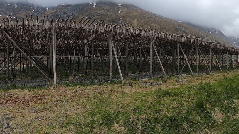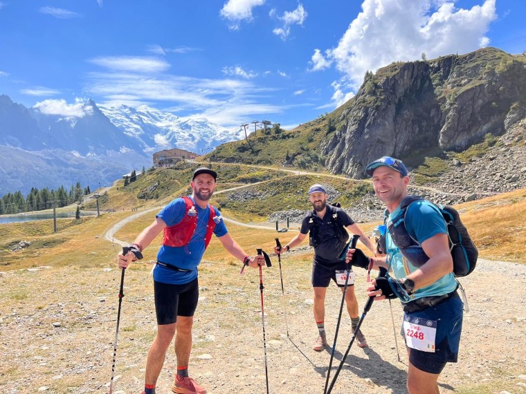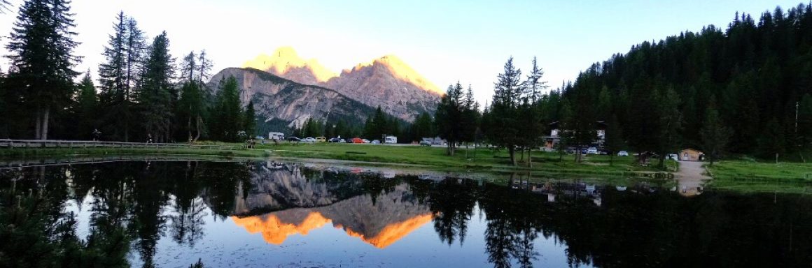
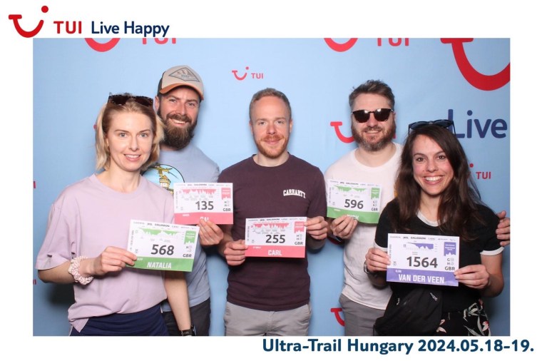
The Salomon Ultra Trail Hungary has numerous different race distances from a V500 up to a the 111km ultra. It is set in the town of Szentendre, a short drive outside of the capital Budapest, situated on the banks of the Danube. On this occasion myself, Natalia, Nick, Elise and Carl headed out there with me and Carl doing the 111km, Natalia and Nick on the 50km and Elise doing her second trail race on the 22km ‘Twin Peaks’.
Natalia, Carl and myself flew out on Friday and spent the night in Budapest before joining up with Nick and Elise who flew on the Saturday. The weekend began with some humorous errors. Carl booking the wrong hotel in Budapest (thankfully he was booked in the accommodation next door and not further away!) and then we found out that somehow we’d all missed that Elise’ race was on the Saturday, just a few hours after she landed, not on the Sunday as we thought. Thankfully, when checking in to the hotel in Budapest, we got talking to Erika, the receptionist, who was running the race herself on Saturday and volunteering on the Sunday. So we were able to get a message to Elise and prepare her ready for the surprise! That day in Budapest a thunder and lightening storm hit the city. It was torrential. We spent maybe 20-30 mins at one point waiting under a bridge as the rain was so heavy and the ground instantly flooding. We hoped that the trails would dry up on Saturday (Saturday was predicted to be mid 20 degrees, but more rain forecast for Sunday morning).
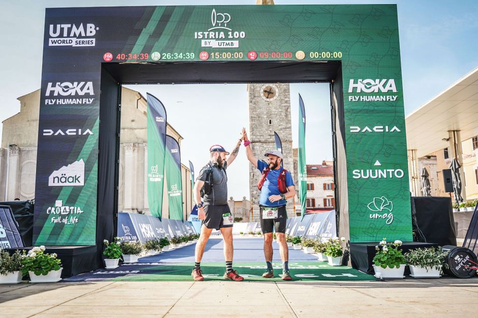
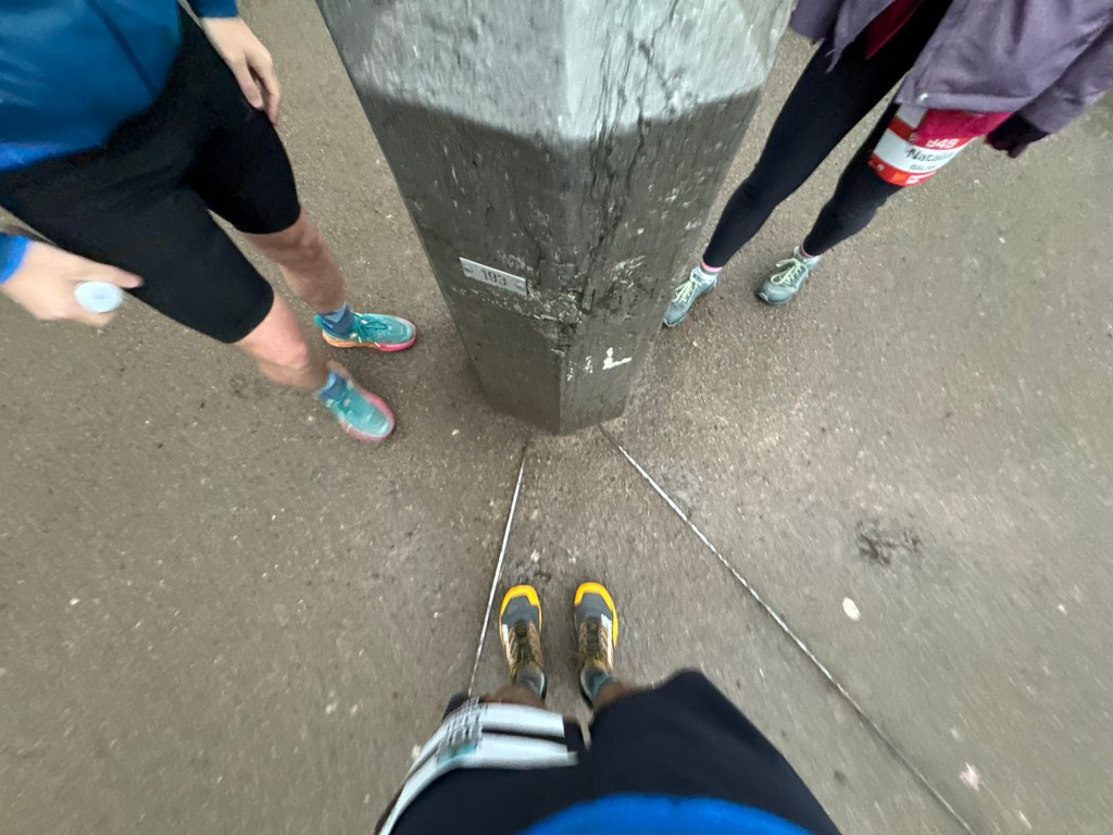
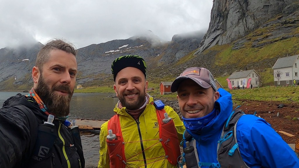
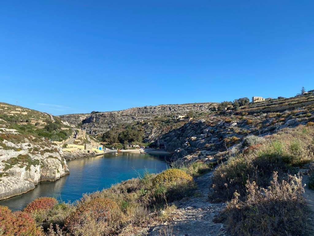
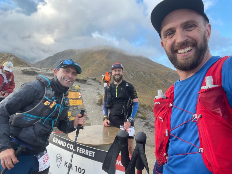
The next day we travelled to Szentendre and met up with Nick and Elise in the town centre before checking into our AirBnB around 2pm. We all went to the race centre for registration, where I had the comedy moment of seeing a picture of myself and Paul from the Letecka ultra on a tv screen at a stand for the Slovak Ultra Trail. I also happened to be wearing the race tshirt as was the person at the stand. So we had a quick chat about that and the Big Bear Ultra which is another Slovakian race I’ve got my eye on. After the Expo we saw Elise off to the bus for her start and went about preparing for our races. Carl and I would be starting from the town at midnight whilst Nick and Natalia had a more respectable 9am start on Sunday.
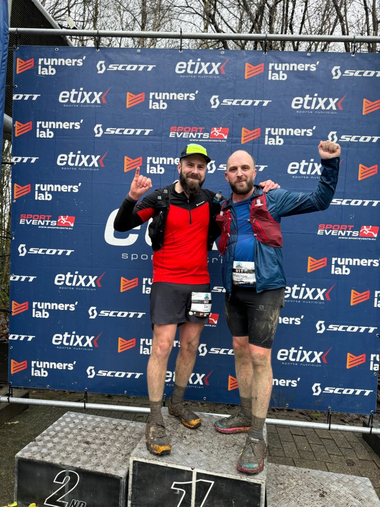
Around 8pm we made our way into the town centre to cheer Elise over the finish line. Whilst there was a prominent race finish area, and plenty of crowds, the atmosphere was completely flat. Hardly anyone was cheering or clapping runners in. We took turns ‘enthusiastically’ cheering in the runners whilst awaiting Elise’s finish. She soon came bounding round the corner with a huge smile on her face (and mud on her legs from a slight fall). We brought the noise chanting “Van, Van, Van Der Veen” much to the delight of the elderly lady next to us. It worked out nicely, for us all to be able to support Elise as we expected we’d all be out running when she would finish. Afterwards we made our way back to the accommodation and an early night (or attempt to rest our feet for a few hours for me and Carl!).
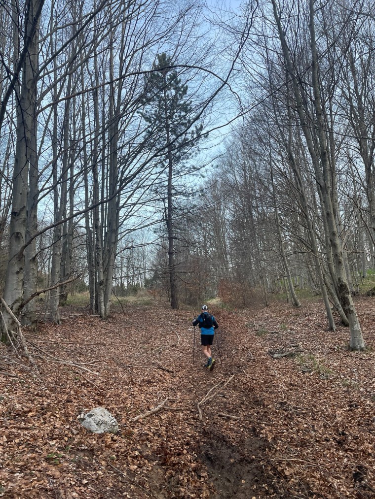
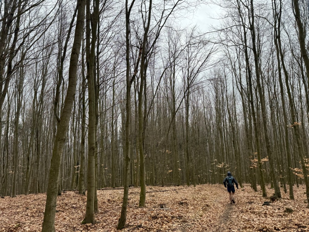
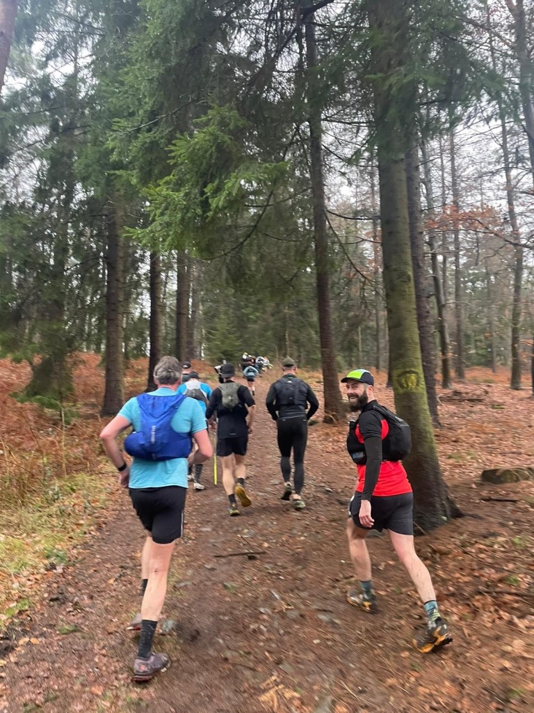
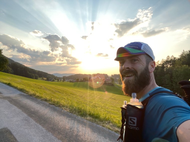
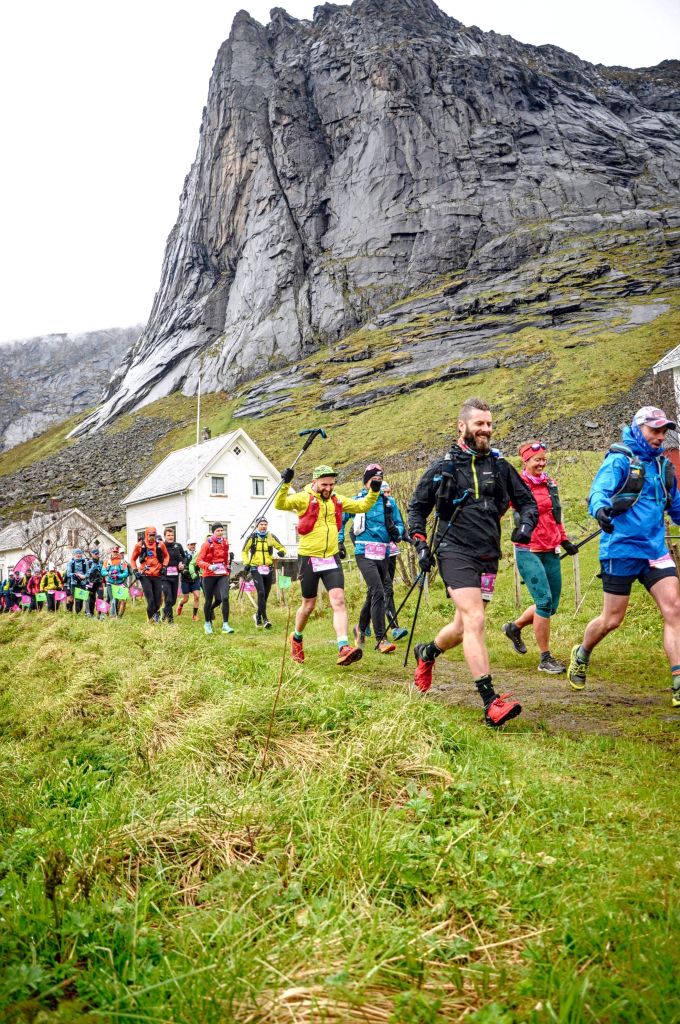
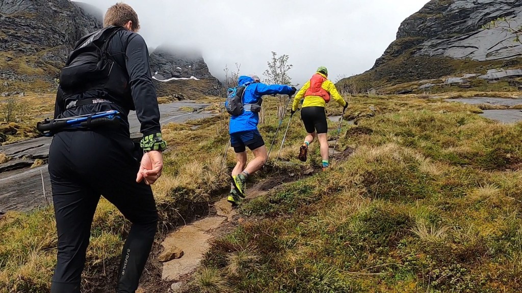
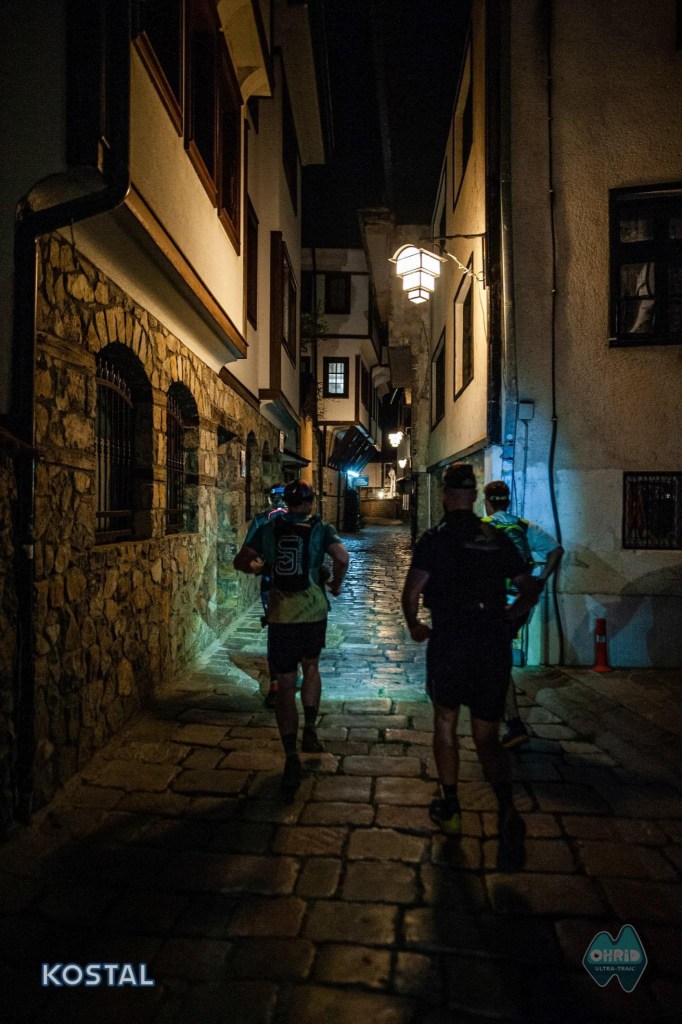
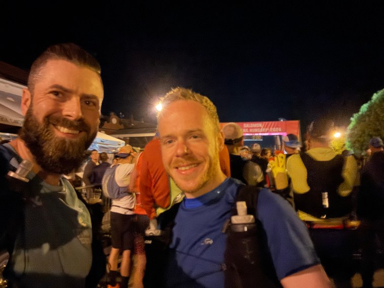
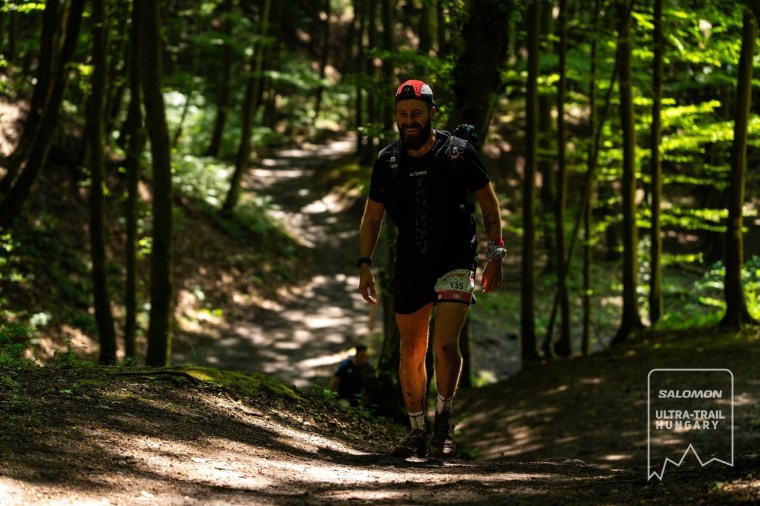
At Midnight we entered the start line. A full kit checked was performed on every runner entering the start pen and information about the route and weather was relayed to the runners. From the start we weaved through the old town, along the cobble streets and towards the river. We had a few kms along the footpaths before leaving the town behind and entering some fields and forest trails. The ground was compact but soft and the rocks slightly slippery. The first climb came and went and soon enough we were on single track forest trails on a speedy downhill. We were chatting away non-stop and commented that it was incredibly peaceful. There wasn’t a sound in the forest and no other runners were chatting or speaking. It was very relaxing, but it was also very humid. The lingering storms made the night stuffy and warm. I was already soaked through and felt like I’d been swimming in a river with my shorts dripping wet and clinging to me.
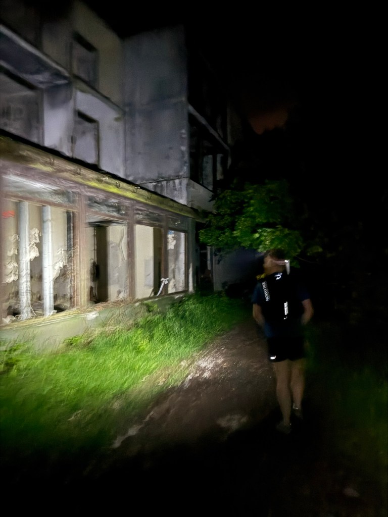
Next up there was a long, slower climb where the ground was covered in a thin layer of slippery mud. It made the climb tougher than it should have been, but the sweeping downhills made up for it and we skipped on at speed. After one climb, seemingly out of nowhere a huge derelict building appeared next to us. It was eerie in the darkness of the night. Right after this we found ourselves in some sort of campsite / out door active area and the first aid station (Dobogoko). We were 20km in so took some time to eat and drink before carrying on.

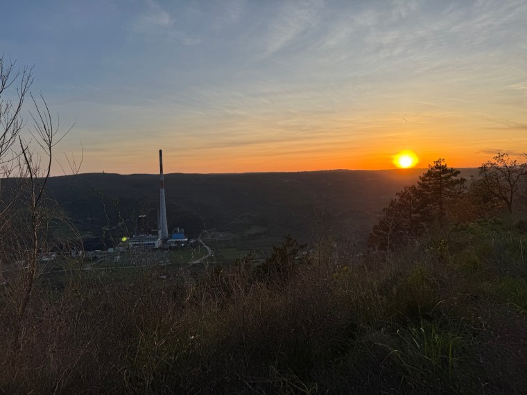
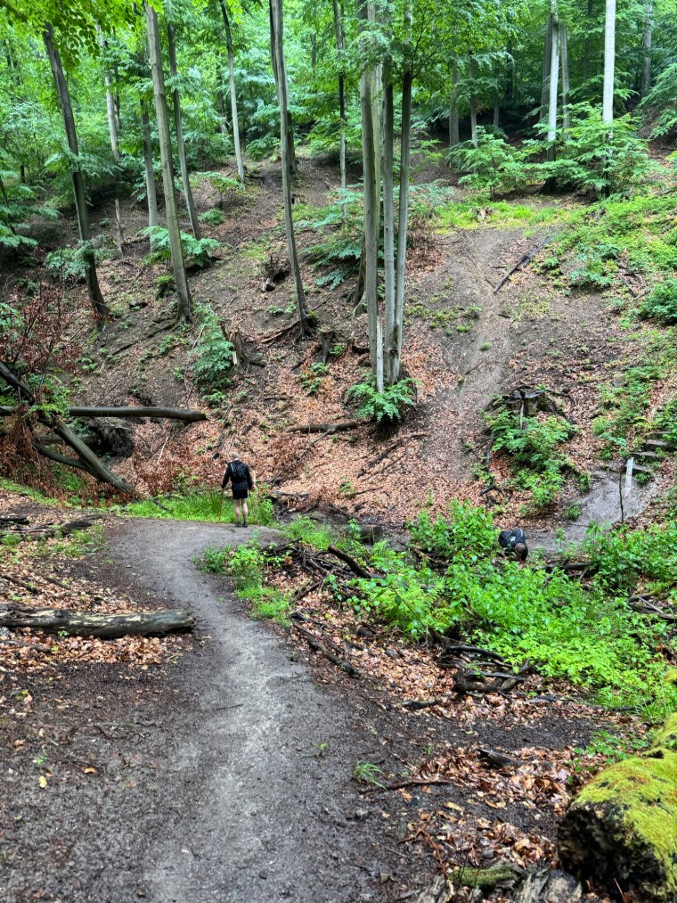
We started descending from the aid station straight away on beautiful forest trails. I made a note to message Natalia and Nick with some insight on the trails. It was very much like the sort of trails you’d find on the North Downs Way or in the Hurtwood forest. Very runnable and mostly wider, well defined trails and paths. We continued to enjoy the sanctuary of the quiet forest before a short section higher up where the wind was howling and the temperature dropped. After descending though we soon warmed up again. The next climb was a little more troublesome as the sludgy wet mud had returned with a vengeance. The trails were drenched from the recent downpours and our shoes were now clogged with mud. We struggled to get any grip and made slow progress up the climb. Thankfully the descent was much better and very gentle. The morning was starting to break and for the first time we could get a sense of the scale of the forest. It was dense and the silhouettes were vast and majestic as the darkness started to ease. We were over 30km in now and already confusing ourselves. Somehow we thought we had another climb and descent to go, but then arrived at the next aid station (Pilisszentlelek). We were happy about that, a pleasant surprise! Whilst this was just a water stop (there was an option to have a bag drop here which we didn’t use), we sat down and rested for a good 20 mins. Carl was starting to feel fatigued and was having issues with his hamstrings and his glutes. We did acknowledge that we had probably been running the downhills too quickly.
The next section was fairly straight forward. After the two longest sections, and 5 chunky climbs done, we now only had 9km to cover with a small climb and longer descent. The forests woke up and were filled with the sound of birds going about their morning routines. It sounded like there was a party high up in the trees. After a short out-and-back section we were at the aid station of Pilismarot. We sat down and enjoyed some warm vegetable soup. It was so salty, exactly what we needed. It was starting to become clear that we were spending more time at aid stations than most runners. We weren’t concerned just yet, but were very aware that the cut offs for this race were quite tight and we probably didn’t have time for all these long breaks. We went back out on the course, into the forests and began one of the longer climbs of the day.
I was needing a comfort break so told Carl to carry on and I’d try and catch him up. As I tried to catch him I upped my marching pace and started over taking runners as I set my sight on Carl way off further up the climb. As I got near to him, the runner in front turned and started coming back. Shit, I thought, had we missed a turn? I checked the route on my watch and we had indeed missed a turn a few hundred metres back. As we made our way back we wondered how we’d managed this as the route had been exceptionally well marked throughout. As we found the flags it only made it more confusing – there were about 4 flags, clearly marking the turn and all 3 of us had completely missed them. We must have been tired!
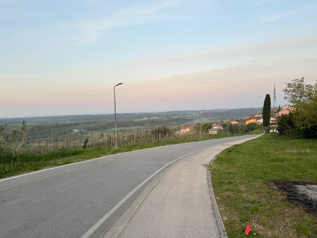
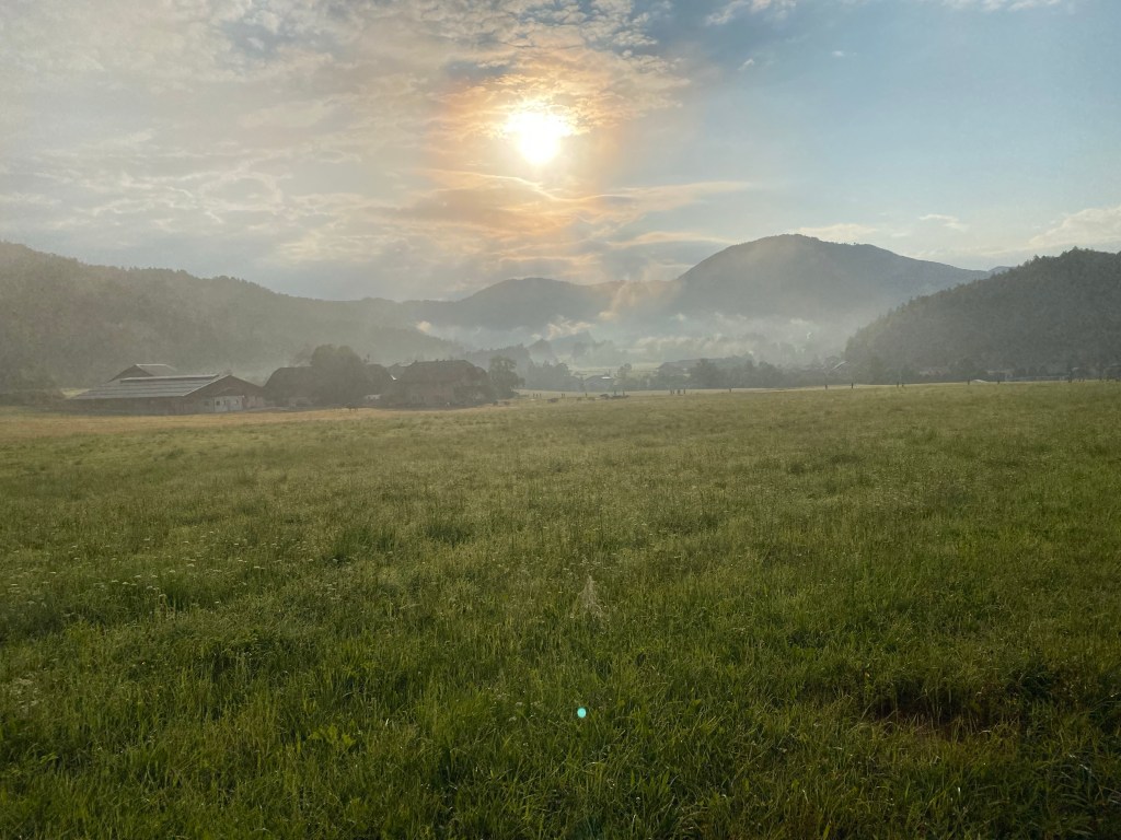
As we re-joined the correct route the heavens opened. it was probably 7/8am now and it was pissing down. I was hopeful the dense forest would shelter us, but we suddenly seemed to be in the least sheltered part of the route so far! We made the decision to stop and take our jackets out before we got too wet. We were then amused as my shoes started foaming with soap suds, clearly I hadn’t rinsed them well enough after I last cleaned them! The rain made the rest of this section tedious as we continued climbing in the now wet and muddy forest. We were however greeted with the start of some excellent views as the sun continued to rise before descending on the what was starting to become a mud slide. We were all over the place trying to stay up straight and move forward rather than sideways. Thankfully after the downhill we had the next stop at Domos, which on the way to we passed a gathering for mass at the site of some old ruins. Once we reached Domos, which was another water station, the rain eased up and we packed away our jackets, tried to knock the mud off our shoes and refilled our water.


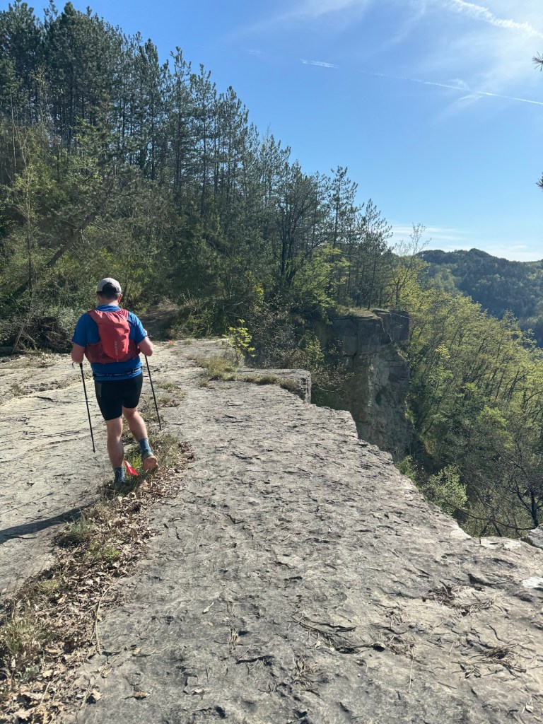
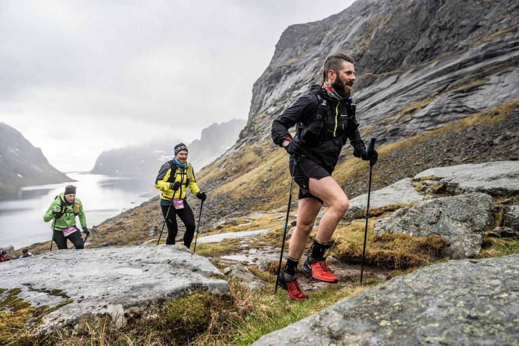
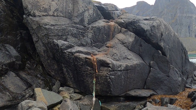
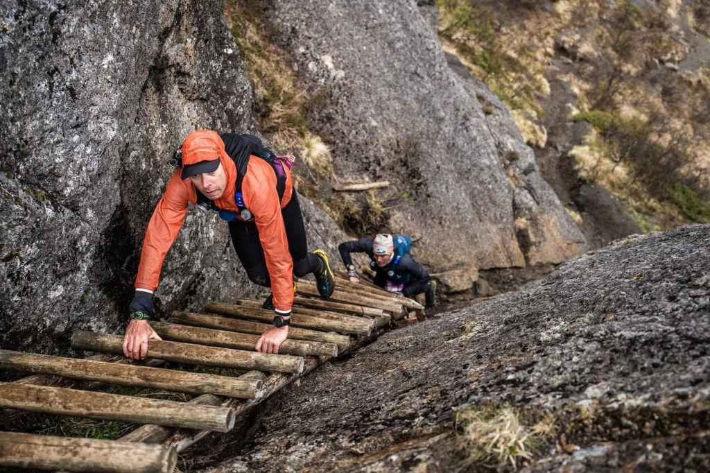
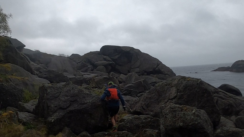
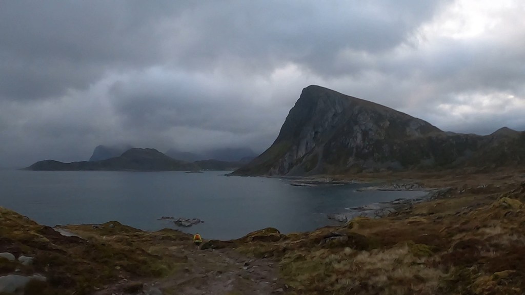
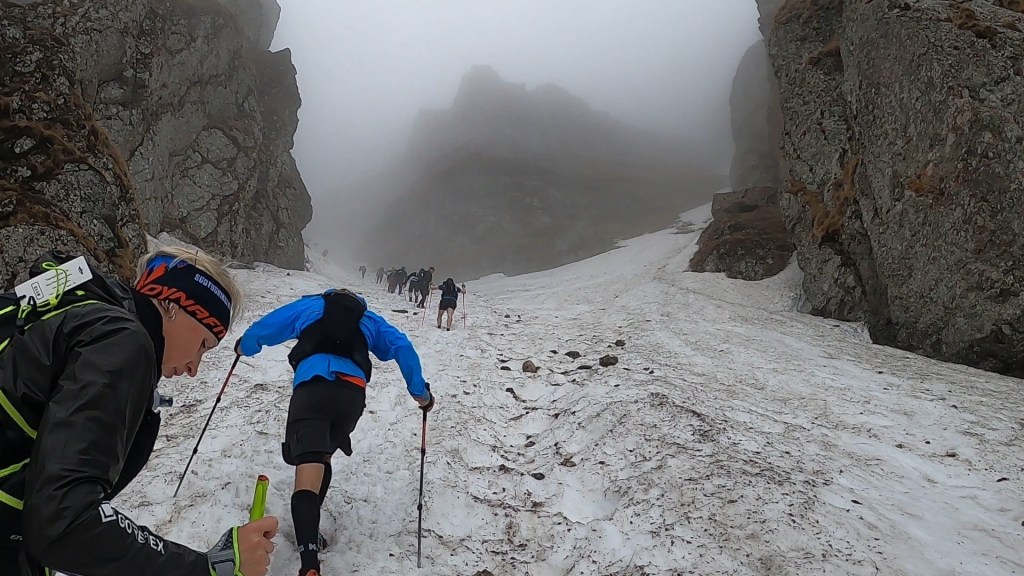
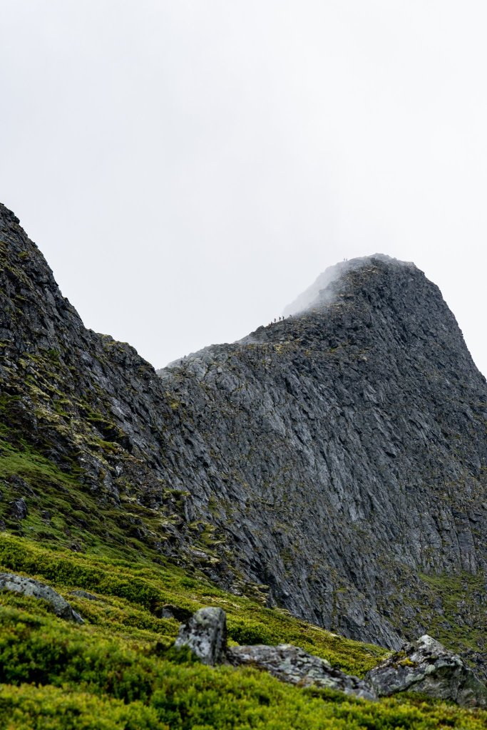
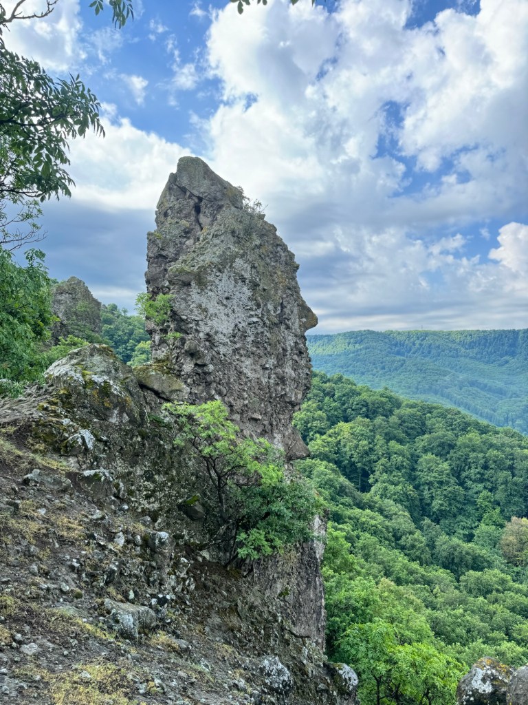
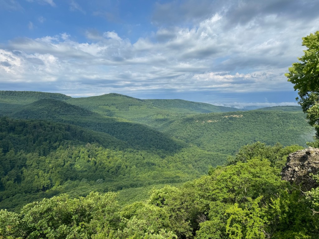
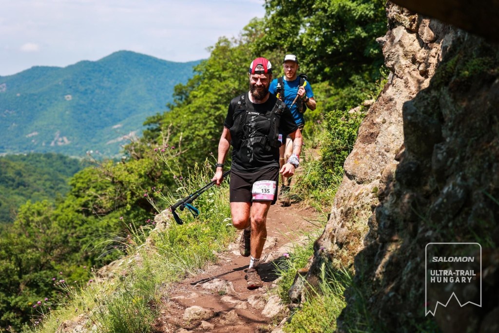
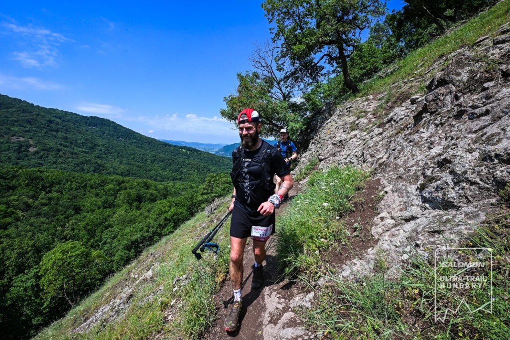
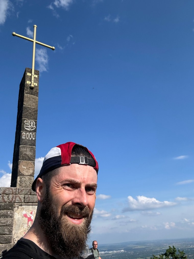
Now we began the biggest climb on the route. It started off weirdly technical as we clambered up some rocks, but it soon eased up. It wasn’t long though before it became particularly technical again. Firstly there was a long steep forest climb, trying to follow the flag markers where an obvious path didn’t exist. Then it became a narrow, single track path. I found some rocks and sat and waited for Carl to catch up. The views here were spectacular. For the first time we could see the landscape in which we’d been playing. All around us were layers of mountains, dark green forests covering the land for miles and miles. It put everything into perspective of just how dense the forests were. We continued climbing as the views became more and more impressive. There was one rock we though looked like a head staring at the mountains opposite. Slowly the forest gave way and the rocky ground started to dominate. We had a light scramble for a short while, where a photographer capture the runners and the landscape in the perfect location. Then, thankfully it was back into the forest for the remainder of the climb.

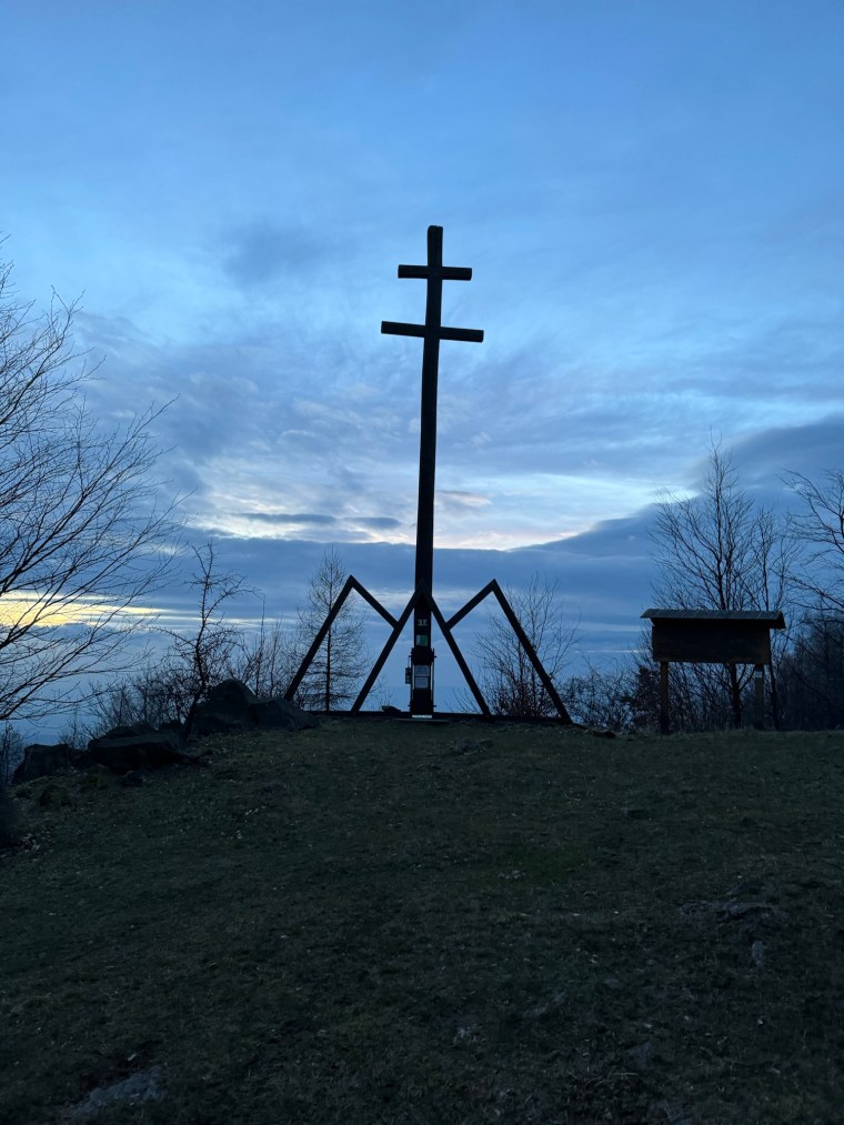
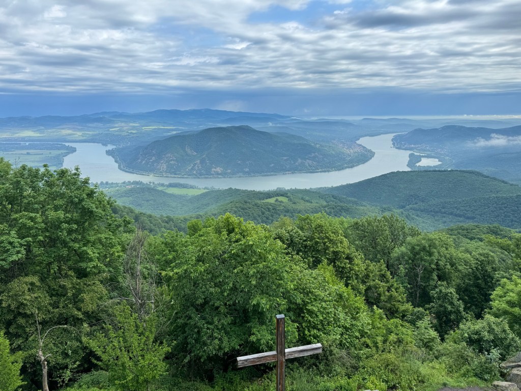
We were nearing 60km into the race now and the fatigue was having a greater impact on Carl. He was open and honest as he started verbalising it and so we agreed to take the climb a little slower before finding a place to rest. At first a log seemed an ideal spot before a race volunteer near a look out tower with benches appeared and seemed more optimal. We ‘checked in’ and Carl sat on a bench. I asked the volunteer if I could climb the look out tower and he replied “yes, if time is no worry for you?!”, so I did. Round and round, up and up I went. From the look out tower I had an incredible view over the Danube (and Carl below). It was just a shame I had to share it with some hikers smoking some weed. As Carl waited, he talked to the volunteer who told him all about the ‘famous Hungarian trail’ we’d soon be running on (and to look out for the green trail markers that indicate the route).


Our focus now was on re-energising Carl. We had a few kms downhill to the next aid station (Lepence) where we’d have access to our drop bag. A change of clothing and a longer rest was hopefully going to work wonders. We plodded on, and gently covered the downhill at a more conservative pace. We then arrived into the aid station with some odd confusion. The trail left the forest with a short, steep and incredibly muddy descent to an access road. There were volunteers there and a lady started waving and directing us to our right, where there was another trail leading off back into a forest. There was a language barrier and we resorted to pointing to the trail leading off to the side, to which we interpreted her response as that being the way we needed to go. We couldn’t understand why as the aid station was right there. As we ran off they started shouting and calling us back. It seems they were simply trying to direct us away from the mud to an easier descent. We didn’t care and risked the mud, tentatively sliding our way down. Thankfully we didn’t have to suffer the embarrassment of falling over in front of everyone!
We changed tee shirts and socks (our feet were soaked) and took some time to rest. Carl wasn’t improving though and the tight cut offs were now a stark reality for us. We were right against it and only had 35 mins at this aid station until it was to close and 2 hours to make it to the next one. So at a tad over 60km in Carl was starting to accept his fate and that he might need to make a decision to not continue. Carl is incredibly self-aware, modest and considerate. He was phrasing the logic around me, would I be able to make the cut offs if he wasn’t slowing us down, could I go on to finish the race, would I be annoyed if he dropped out. The answers for me were simple. I wanted him to run and to finish. I wanted to do it with him and of course I wouldn’t be annoyed in anyway. I also had complete faith in myself that if he did drop out, I could claw back the time and make the cut offs and finish. The difficulty was though that we would have to move much quicker than we had been and we’d have to stop for less time at each aid station. We decided to continue and make the decision at the next aid station (which would also have more hot food at it). So with slightly drier feet we set back out.
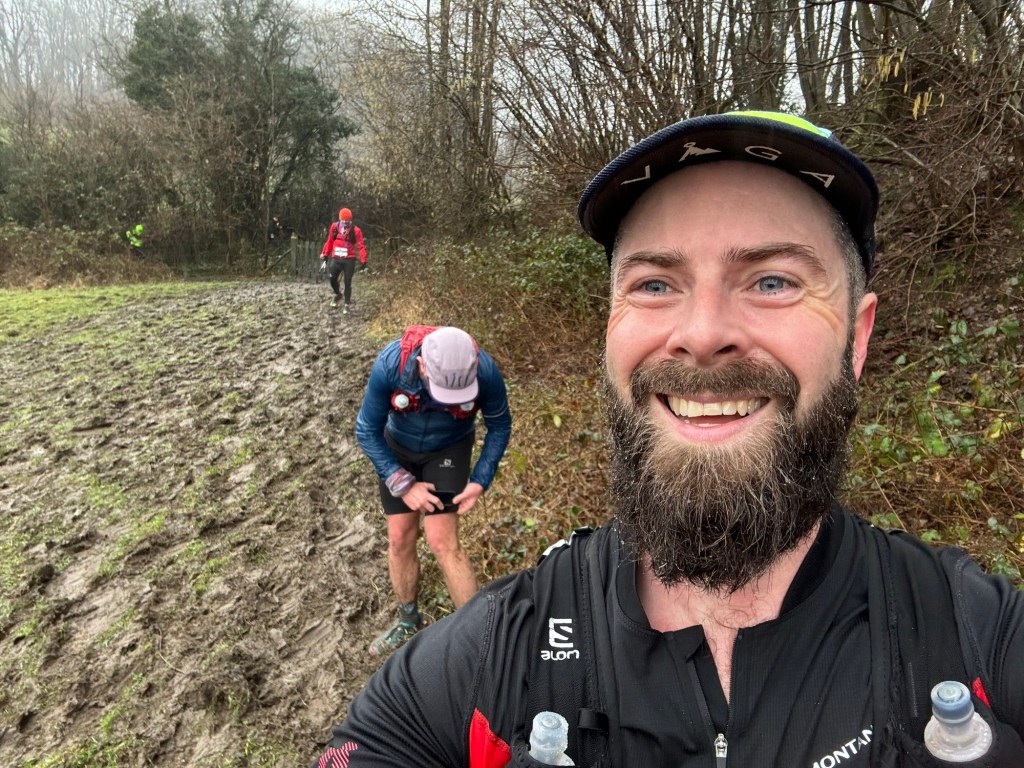
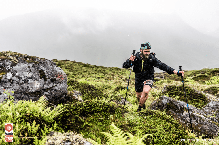
The next section was one of the slightly longer ones at about 12km, but ‘on paper’ looked fairly straight forward. There was one climb and then a long section of undulating trails. As we set out, the trails made it clear to us that we’d have to work for it… The first few kms were a very gentle downhill, almost flat, but alongside a road. The trail was elevated a little up on a sort of embankment with a steep drop on one side and overgrown foliage and felled trees on the other. The path was covered in the same wet, slippery surface mud that had been plaguing us for hours. The path was also right on the edge of the slope. So we had to move carefully as the risk of falling seemed high. As we moved the trails gave us everything, mud, rocks, overgrown parts, felled trees to climb over, stingy nettles. We moved quickly, but it was tiring. Towards the end of the path, after seeing a snake (slow worm?) we ran along side the road before continuing into the forest again. Here the mud was worse than we’d experienced so far. We had a tiny climb and descent of about 70m but it felt like it took a lifetime, every step forward we climbed we slipped backwards. When it came to the descent, well, we just had everything crossed. Our feet didn’t leave the ground, we were just ‘skiing’ down hoping not to loose control. I was lucky to stay on my feet (despite sliding straight into a stick front on into my shin), Carl wasn’t so lucky and at one point I turned around to find him on his back horizontal across the trail. I thought he was about to roll down the slope!

Back on his feet, we found ourselves re-joining a more respectable path and one which the 50km route had now joined up too. I wondered where Natalia and Nick were and if we would see them (I suspected we’d be way too far behind them now as their cut offs were an hour earlier than ours). We plodded up a long uphill as the day started to get quite warm (I think it was now around midday). Every opportunity we got, I started to run and set the pace. I felt bad, but I knew I had to push Carl. He had to ‘taste’ the pace which we needed to maintain to make the cut offs. It was hard work for me and I’m sure it was hard for him too in his condition. As we reached the top of the climb we came across a picnic area full of people. I noticed the green trail markings on the trees. We were on the popular hiking route now. If the markings weren’t obvious, the volume of people were. It was busy, very busy. The trails were dry and narrow and there were a lot of people to pass for the next few kilometres. Thankfully everyone was very kind and supportive and ever single person we came across stepped aside and gave us priority. I’ve never experienced such common generosity on a race before. Something else I noticed was people’s attire and footwear. No one was dressed for mud! So I was optimistic that this section would be far kinder on us. And it was. We covered the trails at speed, passing other runners too. I hoped it was good encouragement for Carl (except the bit where were once again missed a turn and had to back track!). After a short and steep climb we were out of the forests again and in open fields and a small town. We had arrived at Pilisszentlaszlo, the next aid station.
On arriving at the aid station two volunteers offered us water to wash our hands and our faces. Clearly they recognised the muddy yet warm conditions and it was nice to have some small sense of hygiene before entering! They also told us we were the first British people on the 100km and I joked back that I just had to beat Carl to the finish. Little did they know that Carl was about to make his intentions to quit known. We entered and a lovely lady started tending to my needs, she took my poles and replaced them with homemade tomato soup and offered to fill my water. I told her that Carl needed more help than I did and I went off to eat. As I was enjoying a second helping of soup Carl came and joined me. He hadn’t dropped out just yet. They’d indicated that the next section was 8km pretty much all downhill and we had time. His mind was back in the game. So we sorted our hunger, quenched our first and set back out together. Carl was clear and understood the mission now, he’d tasted the required pace and told me he’d let me know if I was to go on without him. So we started running again…
After leaving the road and entering the forest again, the descent started. I naturally picked up the pace felt Carl dropping a little further back. I shouted back to see if he was ok. “Yes, No” came the response. I turned back and waited as he clarified. He wasn’t going to be able to maintain the pace. He told me to go on without him, that he’d make it to the next aid station in his own time. That was it, the moment the race changed. I accepted his decision and didn’t push him to reconsider. There was probably about 35km still to go and now it was just me against the clock. We said our good byes and I embraced the downhill. I ran, I didn’t think about anything else other than running. I knew I now had to run every section of the course that wasn’t ‘uphill’ and when it came to the hills, I had to push hard. The next cut off was at 14:40 and I had maybe an hour and 20 mins until it closed. I was hustling as the trails passed by some built up tourist centre with a load of busses and people. I dodged and weaved my way through as I made my way to the river.
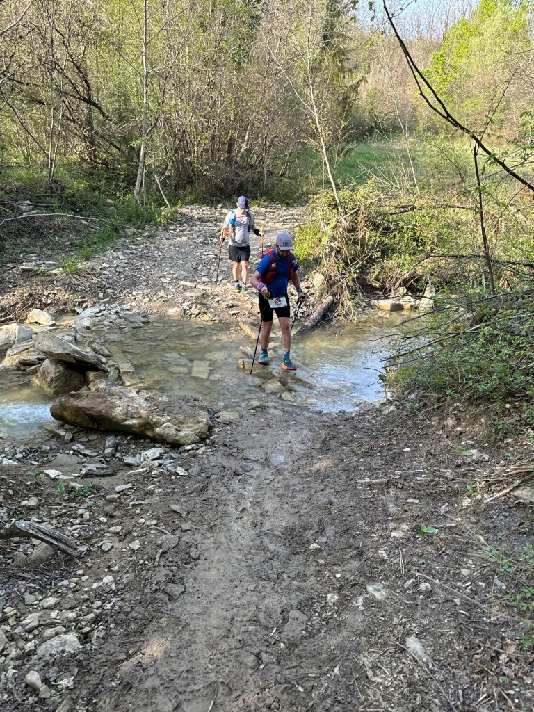
Here the trails followed the river downhill as we crossed it 12 times (so the volunteers told us we would earlier in the race). I tried to count but couldn’t even keep count to 10 as my concentration was on the trail and the quickest route for each crossing, finding those stones and logs that looked most stable and wouldn’t see me end up with wet feet. I started catching and passing runners, I enjoyed this section. We left the trails onto a road and passed another popular area where people were fishing and watching the wildlife (I think there was something special going on with lots of birds making noise in the pond areas?!). I passed by another runner looking lost as I called and directed him back to the trail. At this point I had the route on my watch. I wasn’t going to risk any more navigational errors! After a short climb we descended on a concrete slab driveway and down into a small town, Visegard, the next water station. It was 14:20. I had 20 minutes spare and I needed it. I was hot and tired from running. My left heel was sore. I thought I’d developed a blister (I’d been gradually loosening my left shoe all day as it was putting pressure on my foot, I suspected the looseness now meant there was rubbing on the heel!) so I had to do something as I’d soon be in agony for the next 30km otherwise. I also planned to fill a third bottle for the next section as there was a big climb to come and it was bloody hot now! As I had to take off my bag to get the bottle I also fished out some spare KT tape to give a bit more protection to my heel. Thankfully it was just a hot spot and a blister hadn’t yet formed so I set about drying the area with my buff to try to get the tape to stick a little bit. Then a lovely lady came over with a box of medical supplies and offered help. They had zinc tape so I cut a few extra strips of the tape to put over the area and make it more secure. This was perfect. On the way out I was also given water to wet my head, hat and buff to keep me cool. I left without eating and began the journey to Pap-Ret. I was fired up and focused.
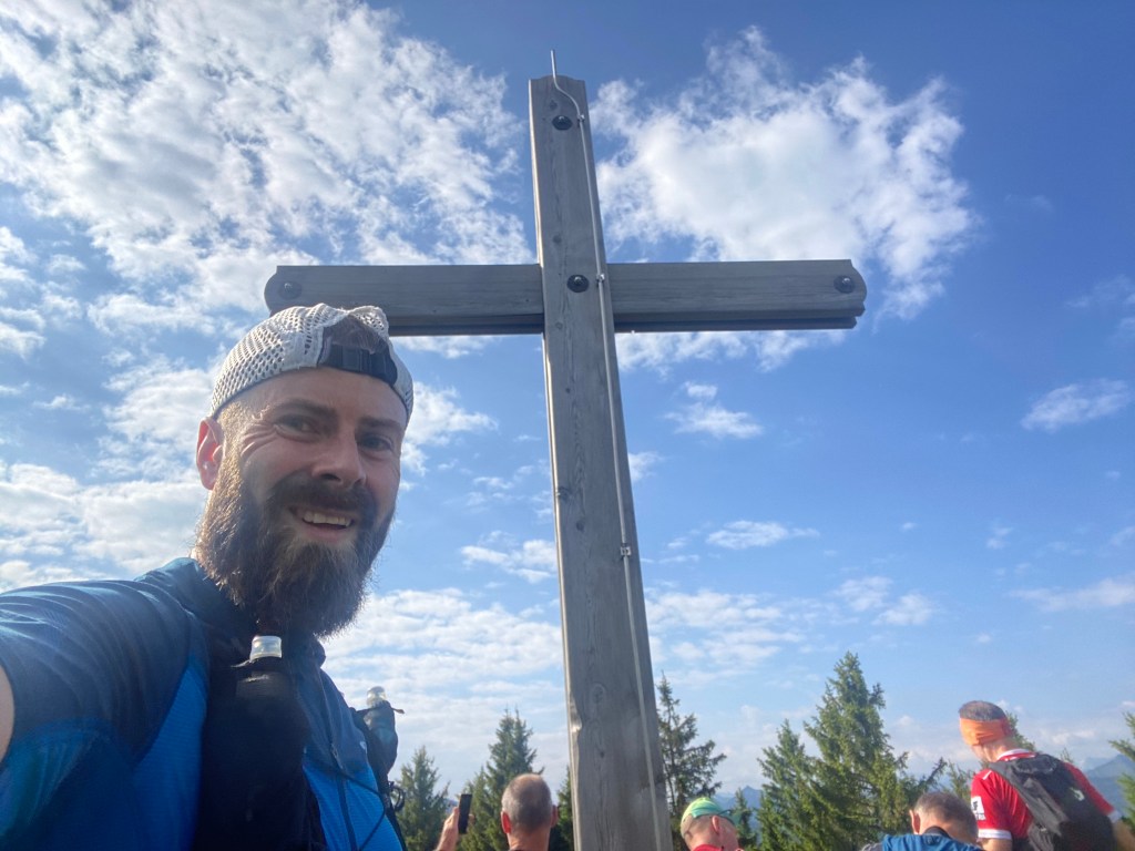
I left the town and began the climb. It was one of the longer climbs on the race profile but one that looked broken up into two, maybe three, smaller climbs. It was now back into the forest and a slow slog on the forest trails. The mud wasn’t as bad as earlier parts, but still added an extra level of difficulty to the climb. I remember there were lots of amazing views of the surrounding area, but no time to take them in. Only at the top did I stop to take a picture and absorb the moment. I then started running again. There were about 5 km of undulating trails that I just kept focused on. Small little inclines that I used to try not to break my momentum. Through the forests I went, picking off runner after runner. I was moving far faster than those I was passing. At no point though did I have to call out / request to pass. Everyone in the race was so aware and always stepped aside well in advance and cheered me through. Occasionally there were runners moving at a decent pace, and this only encouraged me more, I sped up as not to pick up any runners, I didn’t want any pressure of people running behind me. I was hydrating well and glad of the third bottle. I knew I wasn’t far from the aid station now and then came across the volunteer directing people the correct way along a crossing in the trail. I remembered it from the route, there was an out and back to the aid station. I kept running. It was longer than I realised though and I covered almost a km before I reached it. Along the way I recognised many runners from earlier in the day going in the opposite direction. There were people that passed us on the climb back around the 55 km mark. I made it my goal to see them again…
At the aid station I looked for Erika as this is where she said she’d be volunteering, but I couldn’t see her and I needed to get a move on. I had just ten mins until the aid station closed. I told the volunteers I would leave in time. A girl then helped me fill my bottles and then a few minutes later I was gone. I had about 2.5 hours until the next cut off and 13km and 500m of elevation to go. I was confident. I’d done the last section in just under 2 hours and it was slightly shorter with similar elevation. I just hoped the trails were not covered in mud all churned up from all the other runners that had passed before me…
I ran back through the fields and forests, there was then a small, gentle climb that I quickly walked before the forests presented a series of glorious sweeping switchbacks for me to descend on. It was the first time in the race that the trail had been switchbacks. The terrain was good, the scenery was awesome and I felt good to push, so I did. I ran and ran, passing many more runners. I knew at some point there was a steep climb to come. Elise had told us the day before about a steep climb where runners were using their hands to climb up on the tree routes. As I approached a ‘wall’ in the forest, there was a volunteer who asked if I had enough water and directed me to a stream where I could refill. I had 3 bottles again so I was fine, but I took the opportunity to wet my hat and buff again, putting water on my neck and arms too. Then I started the climb. It was as Elise had described, it was steep and there were loads of runners ahead of me, all clambering up on all fours. I was catching them as I powered up. Each one became a target.
At the top I was relieved, I was glad it was over. But I couldn’t rest up. My mind was also calculating, wondering if that was the climb Elise was describing. I thought I had another climb to go, and she’d said it was the second of her two climbs. I wondered if her route hadn’t come this way, surely she wasn’t describing a climb that was harder than what we’d just done? After more lovely switch back descents I found my self hiking uphill again. I was full of anticipation, waiting for the route to turn and become steep, but, it never happened, I was descending again. I was checking the profile on my bib number, surely I was on the way to the final aid station now. I was. I left the forest onto a road and saw the flags in the distance. I was there, Skanzen, the final aid station. It was about 18:30, I was will inside the 19:00 cut off now.
I was buzzing though, full of competitive energy knowing I’d finish in time and getting high off the endorphins of passing other runners. So I quickly refilled my bottles and confirmed there were a little over 6 kms to go. I knew this was mostly road and down hill to re-join the paths along the river we’d used to leave Szentendre all those hours earlier. I grabbed 3 gummy bears and ran on. I intended to run all the way to the end. I messaged Natalia and Nick to tell them I was on my way and moving well.
The last section took us along the main road before we continued into fields then out and onto a beautiful residential street that was so wide and full of massive houses. I wanted to live there. All the way I was watching over my shoulder for other runners. I felt pressured but engaged, I wanted to catch runners but I also didn’t want anyone to catch me. I knew that with the pace I was going, if I maintained it, then I’d be just fine. From the residential street we joined a main road. It was busy and loud. Thankfully though there was an elevated pavement away from the road. One by one I passed a few more runners. A police man then held the traffic and waved me across the road and I followed a trail back across a bridge to the riverside path. This was it. I knew I wasn’t far from town now. It was still about 2.5 km, which was further than I’d like, but I promised myself not to stop. Every now and then I’d see runners in the distance and set them as the next targets. With about half a kilometre to go I passed one more runner and headed into the old town.
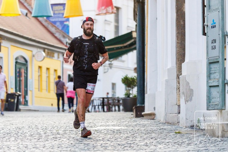
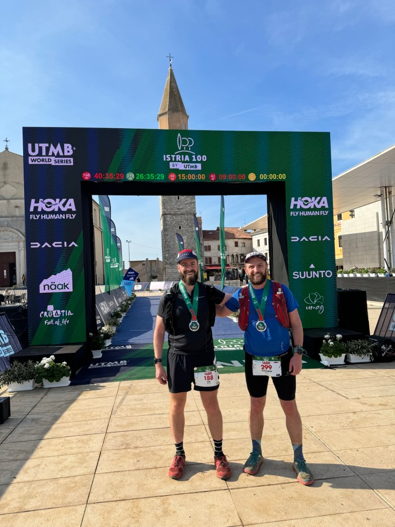
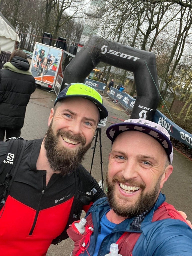
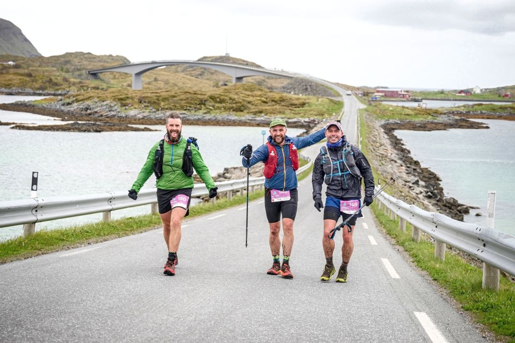
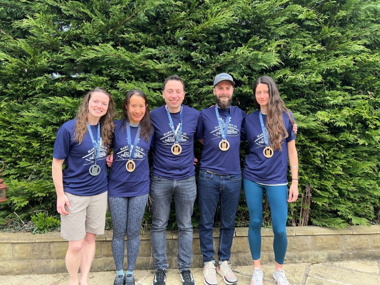
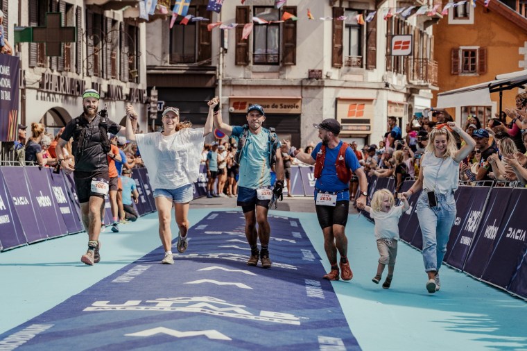
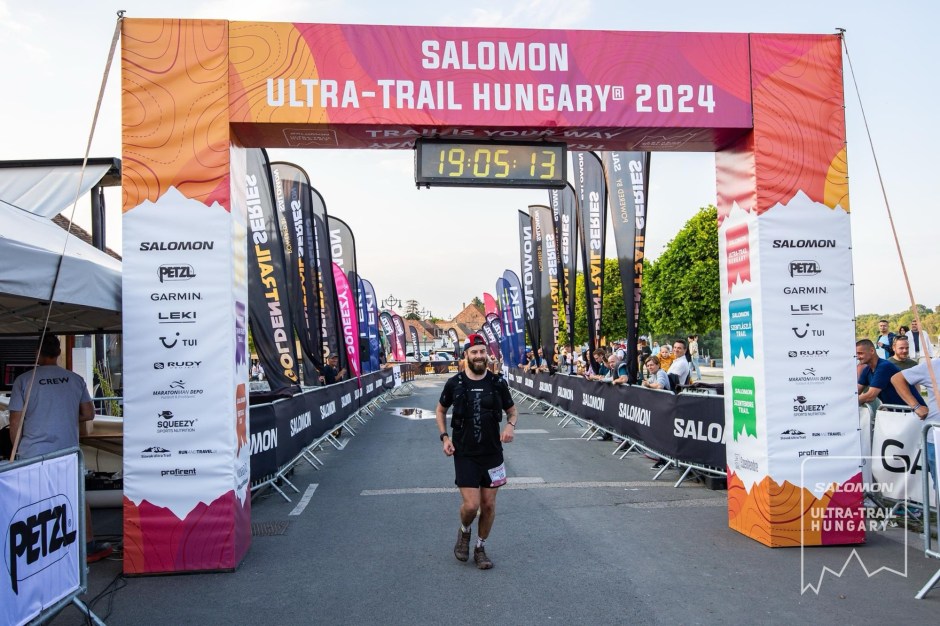
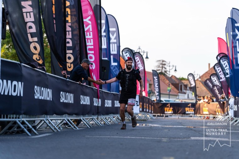
Running down the cobble streets my legs were flying and it felt like my stride was lengthening. I smiled at, and thanked, the many volunteers cheering me in as I ran round the corner into the finish line cordon. I saw Natalia, Nick, Elise and Carl. The joy of seeing them was mixed with the raw emotion of Carl being on the other side of the fence. I ran to them and stopped. I hugged and kissed Natalia. I was so proud of her for completing her 50km race. I hugged Carl (no kiss for him!) and thanked him. I wouldn’t have been at that finish line if it wasn’t for his company for 70+ kilometres and his thoughtful, considerate decision to tell me to leave him and chase the finish line. I tried to get him to come walk the finish line with me, but he humbly refused and agreed to walk along his side of the fence. I slowly jogged to the finish as the announcer said something like “come on, get a move on and finish”. A stranger reached out for a high five and I duly complied. I clenched my fist for the photographer and took a very welcomed wet towel over my shoulders and a medal round my neck.
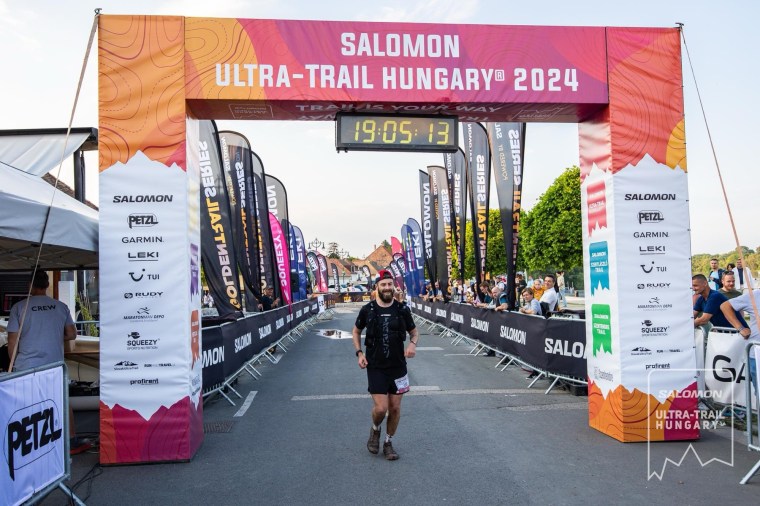


I was full of emotions at the finish line and glad to have my friends share the moment with me. We sat for a bit as I waited for my body to go into shock and crumble (I expected it but thankfully it didn’t happen!). On the way back to the race centre (to collect my drop bag and grab some post race food) we ordered pizzas for collection. As I waited I saw many of the runners I’d run passed finish, I clapped and cheered them in too. I’m sure they were filled with similar relief and emotions to finish too.
I knew the race would be fast and hard, 20 hours for a hilly 100km is a tough target for me. We didn’t manage time well and got complacent early on, spending too much time at the aid stations, particularly those that were just water stations. We lost a lot of time doing that.
I’m amazed at how fresh I felt and able to push hard for the last 35km or so. I don’t think I’ve ever run at that sort of effort so late in a race before. I was also amazed at how I ran without eating much, pretty much since the tomato soup at the 74km mark I’d eaten nothing. Normally I’m empty inside and running on fumes on the later sections of races. The soups really were great and must have given me the energy I needed.
Everyone was so generous, the volunteers where so incredibly friendly and helpful, and the awareness of other runners to let me pass them on the route was so very thoughtful. Like wise for the many people we passed who were just out enjoying their Sunday.
Its a great race and a beautiful area and one I’d highly recommend.