This is the second event by Big Feat Events that I’ve done. I did their Big Pilgrimage back in 2024 which was quite unique and I really enjoyed. With it almost Christmas, I had a little itch for one more ‘big’ run before the end of the year. The timing worked out so I signed up.
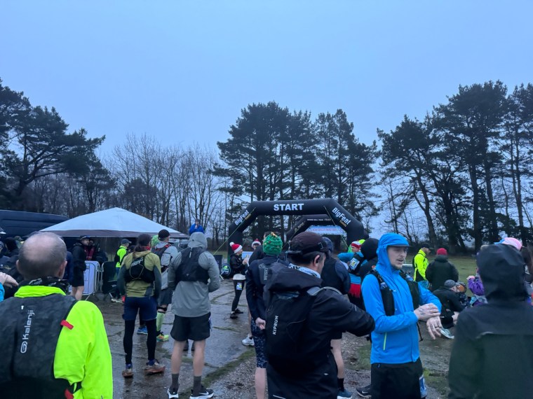
The next week it was an early start to drive to the New Forest in the pissing rain on Sunday morning for an 8am start. Arriving at the Holmsey Campsite I was already pretty wet after walking from the car park to the registration tent. Thankfully the rain stopped just in time for the start of the race.
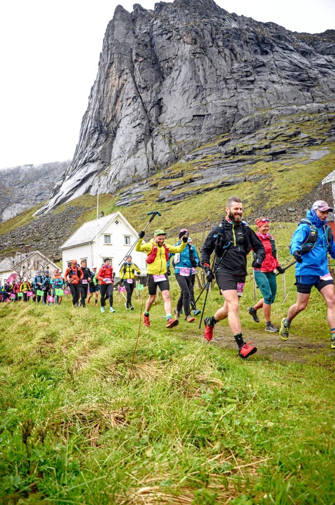
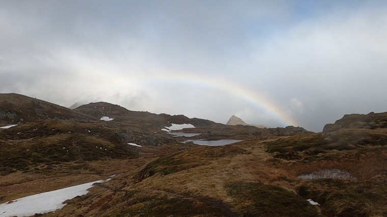
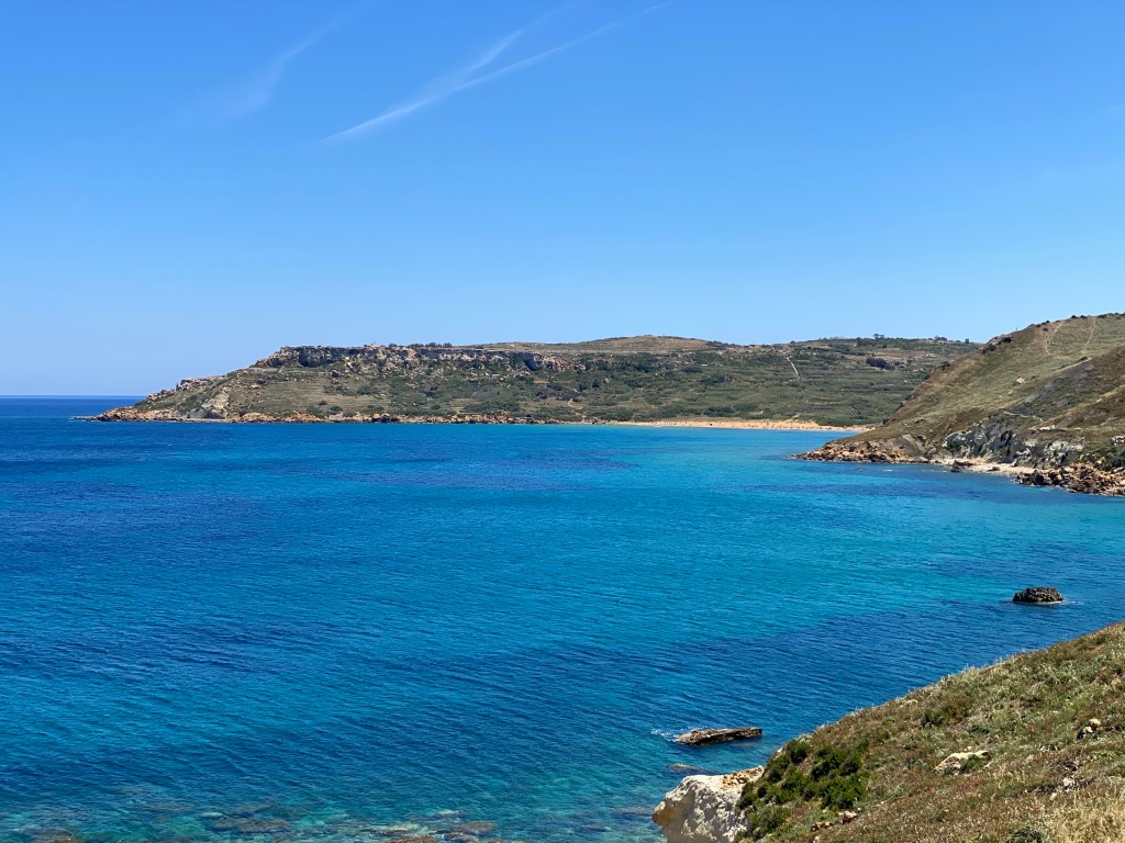
The rain briefly stopped as the race started
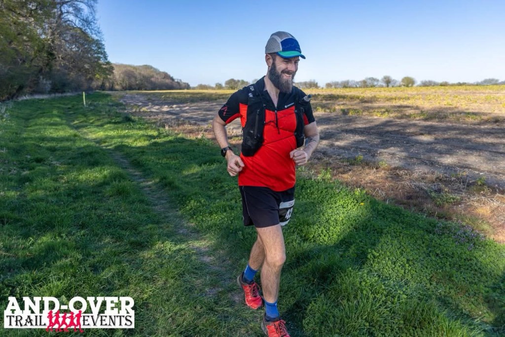
The route promised lovely crisp and glistening frosty winter trails. From the off though it delivered wet and soggy muddy winter trails instead. The muddy patch at the start line held runners up before a brisk run on tarmac. Although it was covered in surface water. This was to set the tone for the day. With wet feat from the start though, it made for great fun not giving two hoots as to where I placed my feet and trying to avoid the mud or wet. It was amazing though how many people were actively trying to avoid both the mud and puddles at the start!
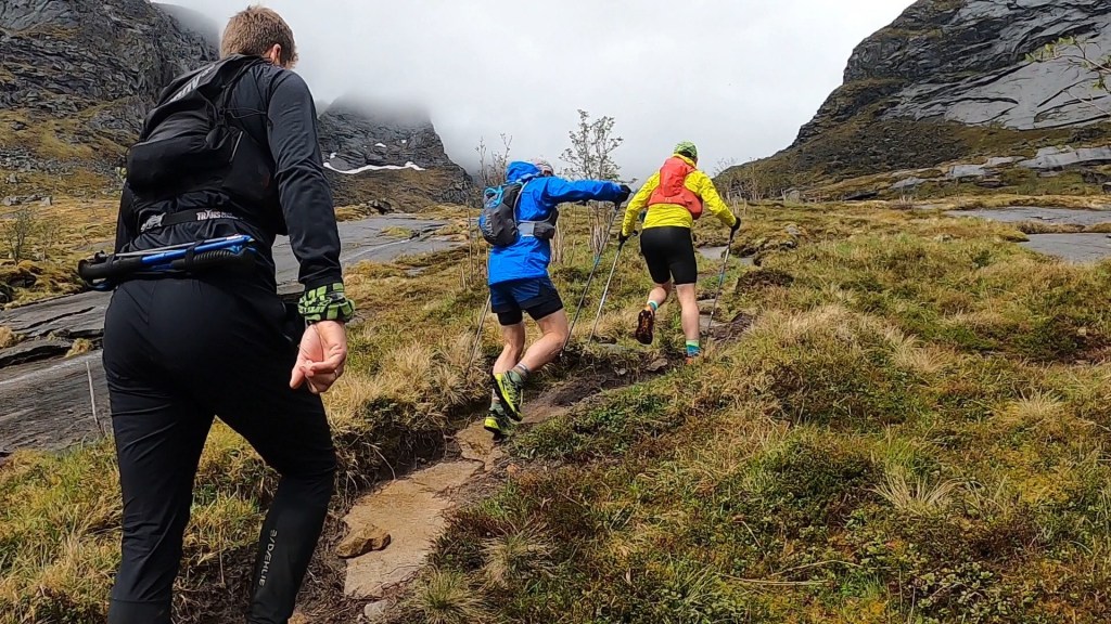
I’ve been to the New Forest twice before but never have I covered this sort of distance there. The trails were mostly on marked footpaths that were wide and forgiving. They were however either water logged or caked in mud throughout. Whilst I had good grip on my shoes, it did make it a little tougher on the legs constantly trying to stay up right and push off the softer ground.
I set off running and maintained the run pretty much the whole day. I walked briefly on the longer of the hills and after aid stations when I was still stuffing my face. Given it was wet I tried not to hang around at the aid stations for too long as it was clear I’d get pretty cold rather quickly. About midway through the run the heavens opened and it pissed down. I couldn’t get any wetter so it wasn’t too much bother.
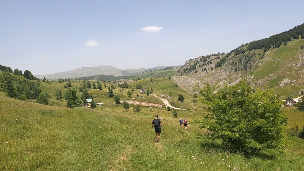
Enjoying the wild horse roaming free
As beautiful as the route was, my mind was very distracted. The day before I had the amazing fortune to b drawn on the waitlist for the Western States Endurance Run in America. As great as this is (the chances are so slim and I’ve been applying for 7 years now!), the frustration is that I am number 49 on the waitlist (out of 75). The reality is that I’m more ‘out’ than ‘in’ and only a few times before has the person in 49th got an entry to the race (and each time that was all in the last few days before the race!). So my mind was crunching the options and scenarios all day long! It made the time fly by!
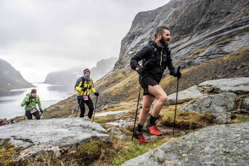
Wet Trails and Wet beard
waterlogged throughout
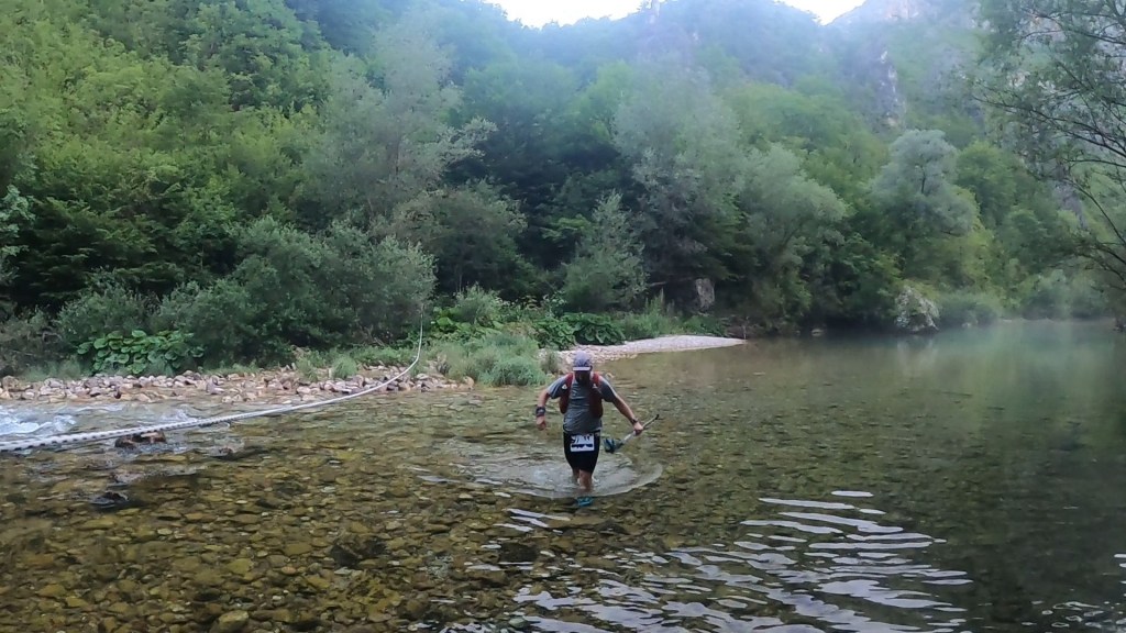
Towards the end of the route we had to cross a ford. We’d been warned in advance about this crossing and it was funny listening to people moan about as we approached like we weren’t already soaked from head to toe! Given the weather it was fuller than expected – they’d suggest ankle deep but it was more like thigh high. It was icy cold, but refreshing. As I crossed a shorter lady behind me needed assistance from another runner as there was quite an under current.
Towards the end of the route the different courses all came together and I found myself running near more and more people. I was still moving strongly until the last 5 km when stomach cramps hit me out of nowhere. I tried to ignore them but the last 1km they won the fight, grounding me to a halt a few times and playing on my mind. I was so close to the end. As I crossed the finish line I grabbed my medal and kept running straight to the facilities!
Despite the weather (I probably haven’t run in that sort of weather since I did Lakes in a Day!), it was a really fun day and I made my way around far quicker than expected which was good as I could get home earlier! I was planning on getting as close to 6 hours as I could but end up coming away with a 5 hr 20 finish. A lovely end to wrap up another year of running.
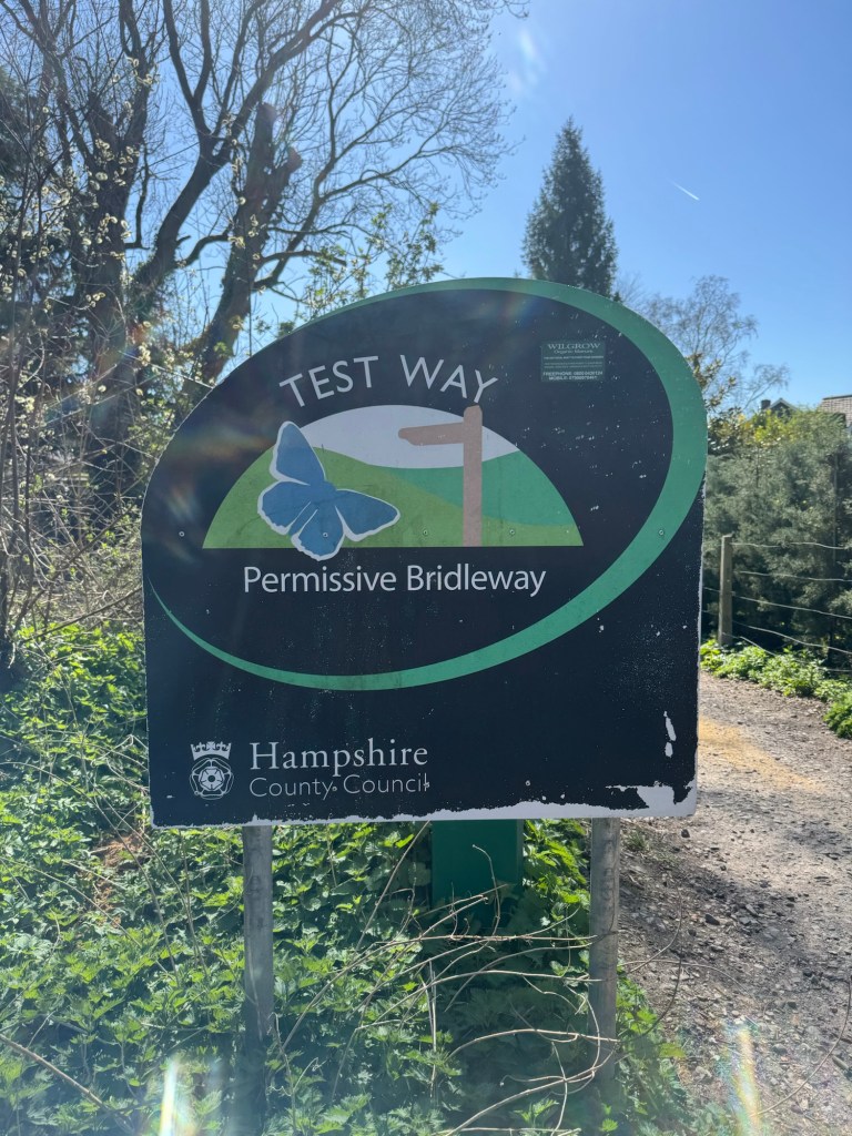
When I ran the Hangman ultra, the course followed a section of the Testway walking route. I liked it so I looked it up after the race. It runs from Linkenholt down to Totton (just outside Southampton). Soon after I came across the Testway Ultra by Andover Trail Events and added it to the list of things to do.
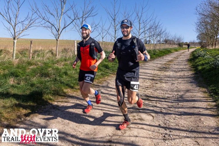
Darryl signed up to the race with me and we decided to park a car at the the finish so we could make our own way back to the start rather than faff with timings of the shuttle bus service offered. We stayed overnight in Andover (proper shit hole) where we saw things we’d never seen before. A very odd place. On the morning of the race we drove over to the Linkenholt Activity Centre for about 7:30. After a straightforward registration we sat in the car to keep and waited until everyone started lining up just before 8 before joining them. The morning had a bitterly cold chill to it with a crisp wind blowing hard.
Colder than it looked
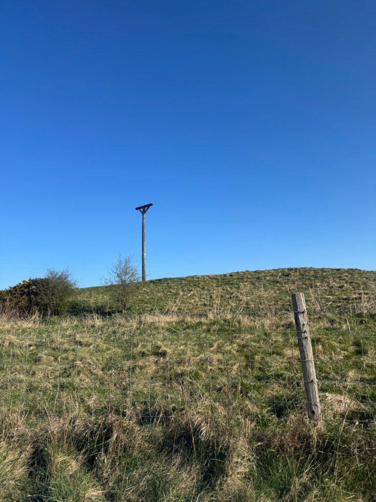
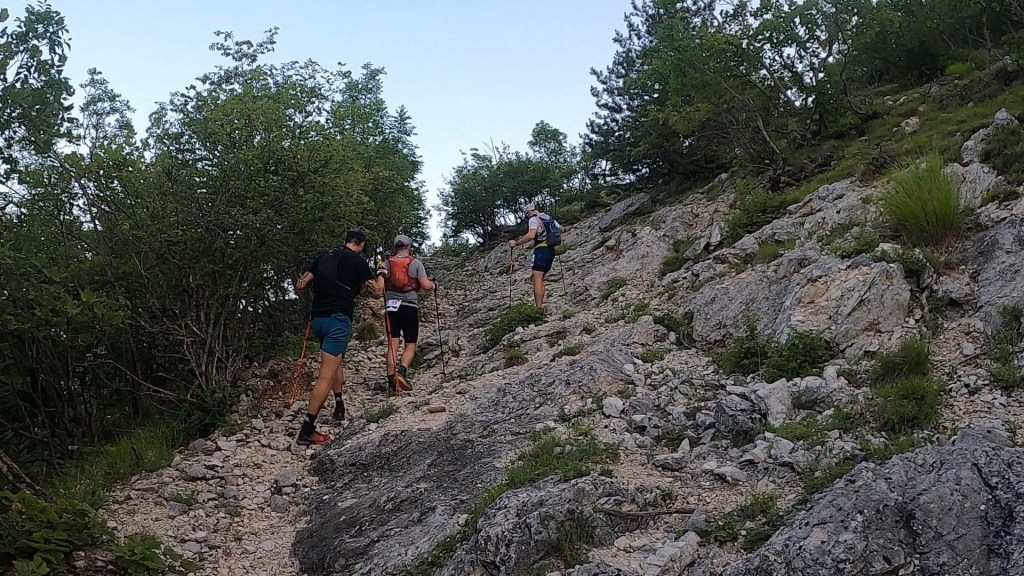
The first 10miles of the route was a loop out of the Activity Centre and up over to Combe Hill where the Combe gibbet is. I remembered this well from the Hangman Ultra where the gibbet was the ‘turnaround’ point. There were a few small hills on this loop and we quickly racked up pretty much all of the elevation of the course before the first aid station when we arrived back at the Activity Centre.
Combe Gibbet
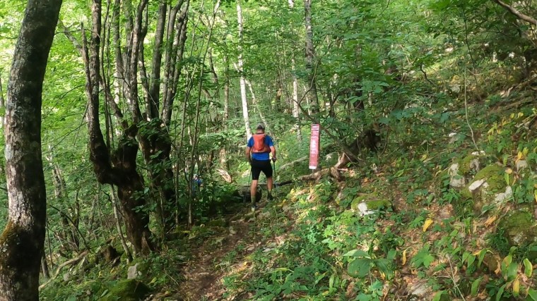
We stopped briefly to eat some cocktail sausage and empty a few small stones from my shoe. On leaving the aid station we re-joined the Test Way and followed it south to Longparish. I knew this whole section from the Hangman Ultra too. We’d pass through little villages, farms, up a few little climbs and follow single track footpaths along the top of the hills.
There was another aidstation after about 10 more miles where we ate more cocktail sausages (if you’re not a meat eater, the aid stations on this event aren’t designed for you!) and carried on to Longparish. I kept recognising points of interest that triggered memories and recalled the section arriving into Longparish. We carried on through and upon leaving the village we got chatting to two guys who’d arranged an ‘unofficial, bonus’ aid station outside their house. They had all sorts including pizza. This was by far the best of all the aid stations. We stocked up when they told us it was still about 5 miles to the next official aid station. So this section was the longest of them all. We needed the bonus stop as it was now very hot, almost 20 degrees and we were starting to drink a lot more fluid that need been used to in the colder weeks preceding the race.
scenic
Leaving Longparish we had a few miles of very scenic trails with more beautiful villages, countryside trails and open commons. Eventually we came to the next aid station, joked with the volunteers for a few minutes and fuelled up for the ‘second half’ of the race. The 30 miles we had so far covered had been varying in terms of terrain and undulating throughout. The next 20 miles would be pretty much dead flat the whole way to the finish line.
After a few kilometres we came into Stockbridge and joined a straight gravel track running parallel to the main road and river. It was hard going. We covered about 12 miles on this path breaking it up into a run walk strategy. Our legs ached and our muscles were tightening with the lack of variation and general fatigue setting in.
Test way!Painfully flat
For hours we had been entertaining ourselves with a guessing game. One of us would think of an actor and the other had to guess using nothing but clues based on films they had been in and characters they had portrayed. By now we were both struggling and finding it hard to think of actors or mixing up clues and characters. It passed the time for many hours and kept us going though!
All smiles
Thankfully we did leave the gravel track and spent a short while running on softer ground through grassy fields before reaching another aid station. Here I managed to knock a whole box of brownies and flapjacks onto the floor. I felt so bad. We didn’t hang around long after that! Whilst at the aid station a load of runners came in shortly behind us. It messed with my mind a bit. I felt like we’d had a strong section and hadn’t seen many other runners. Whilst on the gravel trail, then all of a sudden loads passed us and I felt a bit deflated. Darryl was right though, it made no difference to us nor our adventure. For a while we followed two other runners, One in red and one in purple. We enjoyed Their little battle and followed closely as they kept leapfrogging each other for a few miles. We were all shuffling and walking now. There wasn’t any speed involved!
Thankfully the trails were much nicer once we’d left that dreaded gravel path behind. We followed single track trails through fields, woodlands and alongside the rivers all the way down to Romsey and the M27. Here we had a final aid station which we knew was only a few miles to the finish. It was a good boost. We were exhausted now, sun kissed from the exceptionally warm weekend and drained from the flat terrain. We plodded on.
the boardwalk at the Lower Test Nature Reserve
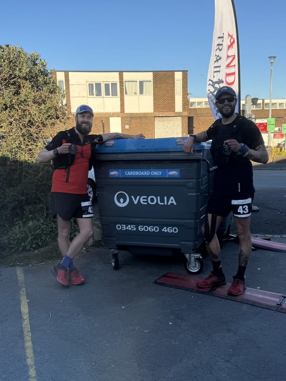
After red top guy missed a turn we found ourselves in-between him and the purple top guy. There were some overgrown bramble covered trails as we made our way onto the Lower Test nature reserve and ran over the boardwalk and into Totton. Once we got through Testvale park we were clapped into the finish line as we ran around the library and into the finish at Empire Hall. We took a picture by the bins before heading back to the car, getting changed and driving all the way back to the start to collect the other car.
Finishing by the bins
It was an enjoyable day on the Test Way and great as always to catch up with Darryl, push the body on a 50mile run and enjoy and experience somewhere new. The organisation was good and the course exceptionally well marked.
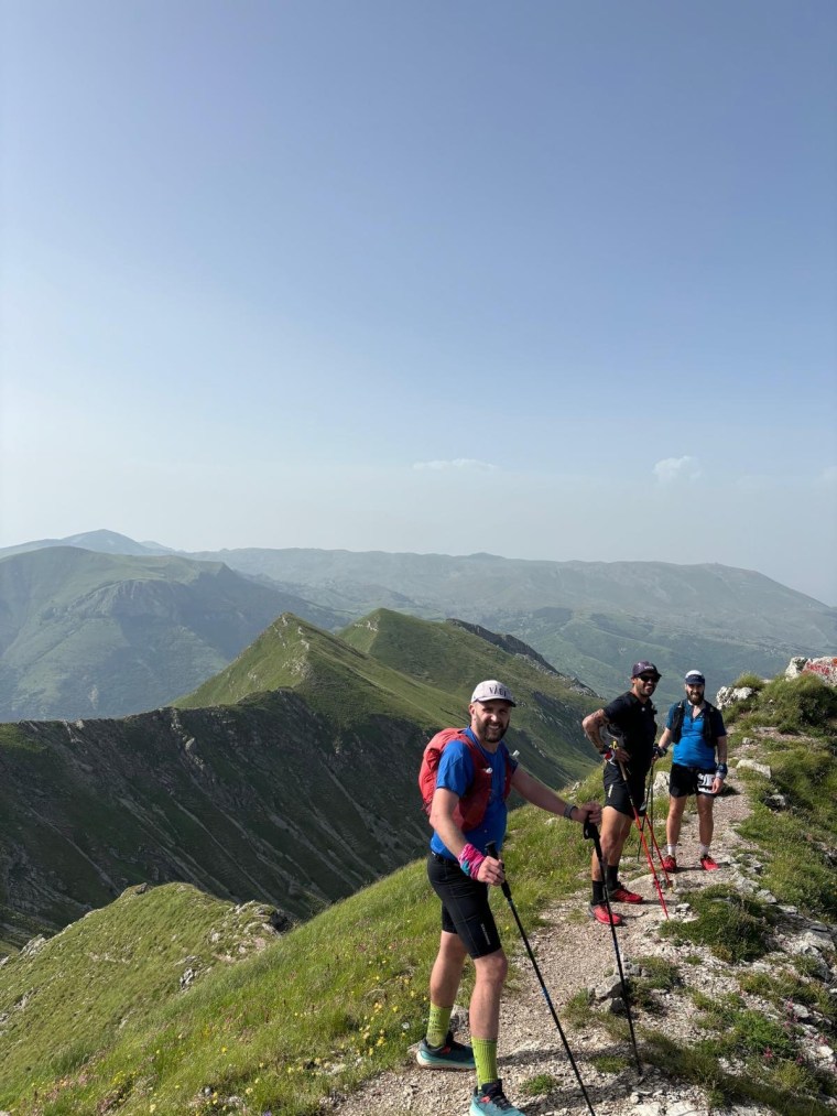
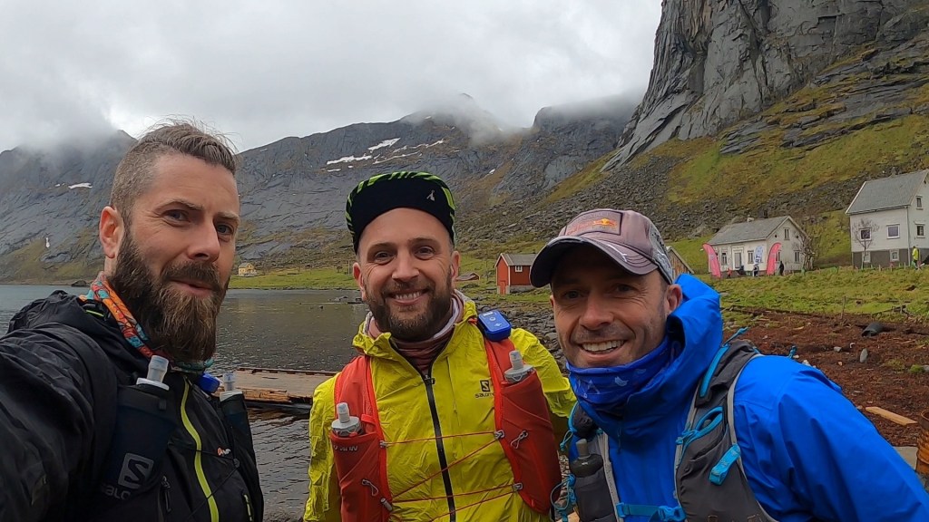
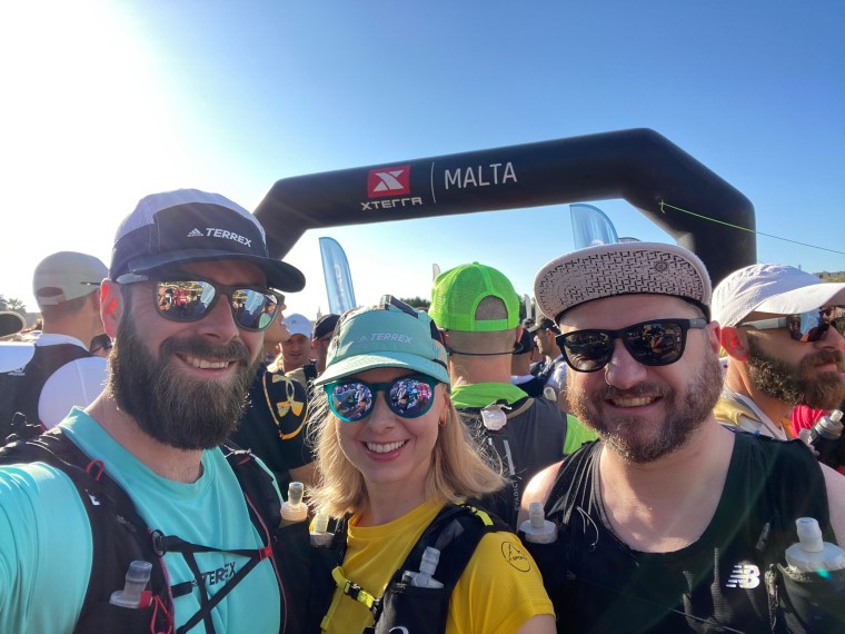
Oh how we’d been looking forward to this one. Many, many years ago I had a short trip in Bosnia when I was travelling around the Balkans with friends. We took a few days to travel to Bosnia and visited Mostar. It was stunning and I’ve been wanting to go back and visit Sarajevo ever since. When I came across a 105km ultra trail race near Sarajevo, I knew I’d sign up and that Paul, Darryl and Matt would come too.
After a few logistical mishaps leading up to the summer we flew in to Sarajevo the day before the race. On Friday we made the short journey into ‘town’ from where we were staying and did a bit of sightseeing. As we made our way back to the accommodation chaos descended on the town when a major power cut (affecting much of the Balkan region!) hit. We spent the next few hours in the increasingly hot accommodation, preparing for the race that would start at 10pm whilst wondering if it would go ahead – with no power surely the event was a safety risk. Alas, a few hours later power was restored and we were on our way.
On the way to Javorov do, Bjelašnica, where the race would start and finish, we stopped off for food at a lovely restaurant Lisa had found. They weren’t too impressed when we turned up in full running kit but reluctantly let us in. With full bellies we then continued to the start line to register. Bjelašnica might be familiar to some as this is where some of the events of the winter Olympics of 1986 were held. Now the surrounding area has many new and modern ski resorts set up.
The Vucko ‘Black’ trail starts high up in in the mountain resort Jorovano Do which is about 1,250m up in the mountains. The Black trail starts at 10pm and we arrived just before 9pm to register, have our kit checked and attend the technical race briefing. The race briefing was very thorough and detailed as every section of the race was talked-through. We chuckled when we were told to watch out for bears, snakes and other animals. After the race briefing we made our way outside to the start line along with 40 something other runners. We had our full mandatory kit checked and soaked up the atmosphere where many supporters lined the starting arch to send us off.
10pm start line at Javorov do
It was an excellent start line and we ran off onto the trail, quickly hitting a climb in the forest. The trail gradually became steeper as the single track led us away from the start line. The soft soil led us up and we crossed a road where loads of people cheered from their cars as they waited for us to pass across the road where we went straight back onto the forest trails. The smells were fresh. The ever so familiar feeling of calm washed over me. I love this feeling at the start of a race for the first few kms where all my anxiety and stresses flow out of me and the excitement of what is to come replaces them. My kind of freedom!
The clarity of the full moon at night
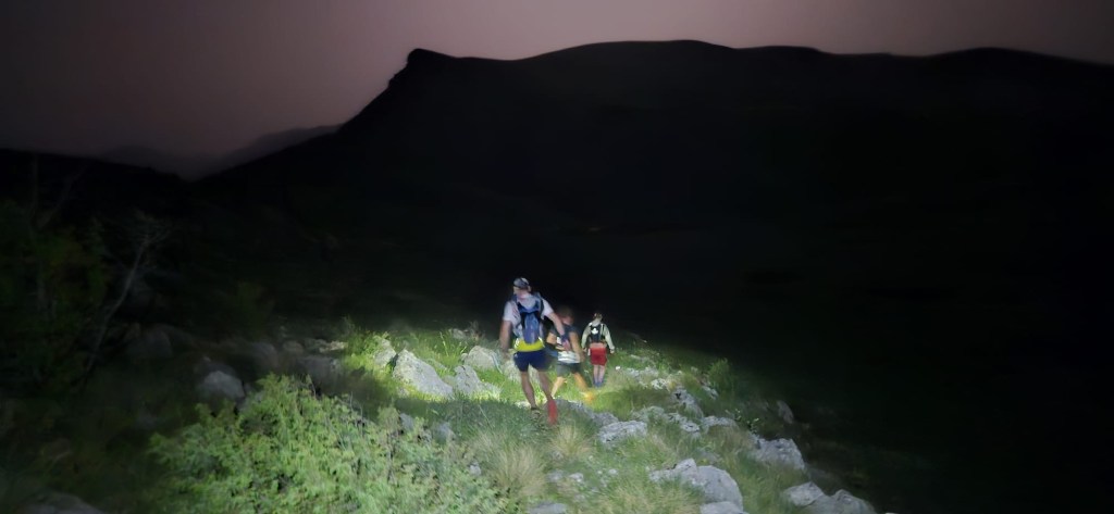
The night was warm. Very warm. Sarajevo was experiencing higher than normal temperatures and there were reports of high 30s being reached during the day. We weren’t going to be cold, that we knew for sure. Even as we climbed higher the temperature was warm and the air was still. The path led higher and we emerged from the forest onto trails that skirted along the side of the mountains. They were rocky underfoot and had a slight camber. Above us, dominating the night sky, was a full moon glowing orange. The night was hazy and light and I imagined having no head torch that I’d still be able to see enough. The night sky made beautiful silhouettes of the surrounding mountains which were visible. The mountain trails took us off the path, descending and ascending the undulating trails in a most direct fashion. Beneath us the gravel tracks gave way to lumpy grass and big rocks to skip along.
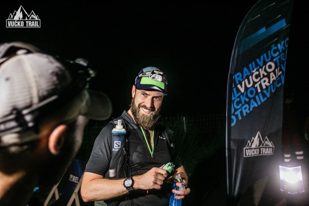
We passed through the first two aid stations, in what felt like no time. The first was a simple tent in the middle of nowhere after a steep and slightly technical descent. From which the mountain paths continued as we reached the second aid station which was at Lukomir, Bosnia and Herzegovina’s highest populated village at almost 1,500m. As villages go it is very small, just a tiny settlement of old stone houses and I believe a small number of families living there. At the aid station we talked and joked with the volunteers and tried all the food combinations they offered which it seems other runners weren’t interested in (Chocolate spread on bananas was a firm favourite for the boys). We then set off with strong vibes and encouragement to ‘enjoy Herzegovina’. That I was sure we would do!
Ready for the refreshments at Lukomirsome how looking demented just 20km in
The trails into Herzegovina where rocky and undulating. More skirting around the side of steep mountains and the vast emptiness as we traversed along the top of them. With the warmness and stillness of the night, we were sweating a lot and my shorts were soaked through. By now we were mostly alone though. At some point Darryl had quite an ingenious idea to combat the wet clammy buttocks that we were experiencing – just pull your pants down. So we did. For short bursts we ran with our ass cheeks out, bare to the world. Now it was a night of many full moons! Wow it was refreshing though. I’m not sure how in all the running I’ve done I haven’t thought to do this sooner. The dry air evaporated the sweat and our bums felt free and liberated. It may not have been pretty but it sure was effective. This was going to combat any chaffing for sure. Thankfully no one came running up behind us in the night!
Out in the wildness of the mountains we found ourselves on a slightly more rocky section here as we descended then climbed again. After which we found ourselves near Ivana, A runner from Croatia we’d shared some kms with earlier in the night. She was nuts, in a good way. She was so full of good energy and vibes, happy to talk and laugh her way along the course with complete freedom. We stuck around her for as long as we could keep pace through the night. At one point her scream of “Fuck you Paul Martin!” had us laughing as something was misinterpreted.
Daybreak over Dubočani
Somewhere on a decent, the calm night gave way to the freshness of morning and darkness started to recede. We arrived at a small aid station on the side of the road that was Dubočani. We tucked into some warm some soup for breakfast. We needed it. At 05:00 the sun was already breaking through. We could have stayed here a while if only it wasn’t for the amount of flies buzzing around. Little did we know they’d soon become the most irritating thing about this race. We swatted them away whilst we devoured the soup and then finished the descent down towards the river crossing where we would make our way to the other side of the Rakitnica River.
We were excited for this. From what we’d heard, and from the pictures we’d seen, it seemed like quite a wide crossing. Last year, with high levels of water, the crossing was relocated. This year we were fine though. We were ready to wash off and cool down. When we did reach the river it was surreal. So beautiful with a morning mist layer covering the crystal clear water. It was however absolutely freezing. We were contemplating a full on bath, but just after 05:00 it was just a little too cold for us to commit. So instead we went up to our thighs and washed our faces, hair, arms and legs and decided against that sit down wash! A scream from above drew our attention as we looked up to see Ivana high up on the climb out of Dubočani, we waved at her and enjoyed a few more minutes before making our way across and starting the big ascent of the route. We had about 900m to climb in one go and then another 300m or so further on.
Rakitnica RiverCrossing the River
The climb started off wet and muddy, steeply climbing through the forest before we broke free onto some dirt tracks leading to a small village. Sheep dogs were barking, protecting their herds as we neared the farms. We then zig-zagged our way up as the terrain became steeper and more rocky. It was a slow climb, which was annoying as the flies were loving us. They were so irritating. Many of them bashing into our heads, flying into our ears and in Matt’s case tens of them enjoying a free ride on his head/hat. We tried to mask our sweaty smells with sun cream, which worked if only for a short while. Despite this, the climb and early morning gave us the first real glimpse of the incredible environment we were in. The silhouetted mountains now showing in all their glory. Layer after layer for as far as the eye could see. It was quite a sight! We even saw a snake!
Rocky ClimbMorning ViewsSnake!
Eventually the climb levelled out a bit and we found ourselves on a long dirt track with a very gradual climb, the start of the 300m section. We had no interest in running this, as runnable as it was. We knew that we were close to the next aid station now – Grušča polje – and here we’d have our transition bags.
At just short of halfway, here we were greeted by the aid station in a small building. We were so glad to be able to go inside and escape from the heat (yes at 7am!) and the flies. We sat down and loads of friendly volunteers started helping us as we ate and changed our clothes. We talked with them about the route and experience so far and showed the picture of the snake we saw. Consensus seemed to be a viper (can’t recall what they said) but not one of the venomous ones or something to be concerned about. A viper though, that’s exciting! We were served big pasta dishes with lumps of tender meat and noodle soups. There was so much food and drink. Darryl even had some medical support for his feet. I dried mine off, re-taped them and applied fresh socks and dry shoes. It was bliss after the soaking at the river crossing, so glad I had a spare pair of shoes.
We spent a long time here and many runners came and went. We weren’t bothered though. We were so far ahead of the schedule we expected. Eventually we did leave though and began a long walk as we re-joined the dirt track with its gentle climb through the villages. Now we had about 15km to go to reach Puzimsko groblje.
The gravel tracks soon disappeared as we reached the highest point on this section and we went off track again. It was grassy, it was open. We passed through a section with stone circles where we took a rest and saw a hiking group in the distance. We were weaving around the high mountains, along the basins and up through a saddle. We started descending again and it was a little tricky underfoot as there were more rocks and we weaved our way down and into the valley below. Much of this section followed the same – off track, lumpy grassland scattered with rocks. Weaving around and through mountain passes. It was beautiful but tough. This was the longest section and there was little variation and no shelter from the increasingly brighter sun. Our focus was to just get through it as we’d then be around 60k in, a decent milestone.
There was a small road crossing and a very twisty section where I powered ahead. Every time we thought it would be nearing an end we’d see flags/markers way off in the distance. We’d reform together and crack on then over time spread out a little. We’d been moving for over 12 hours now and we were feeling it.
We skirted a rocky section around a mountain that had plenty of loose scree underfoot and we could then see the aid station up in a verge/layby in the distance. When we eventually reached it we all collapsed into the seats and started stuffing our faces with watermelon. The watermelon out here was so fresh and juicy! We felt that. That section, being the longest, with naff all shade and increasingly warmer temperatures of the morning drained us and we all looked exhausted. Copious amounts of Coke and watermelon were consumed. We needed the break but probably spent too long here. Loads of runners came through and they all hardly stopped and left quickly. We were the only ones that hung around. Not that it bothered us, we were enjoying it.
After sitting down and leaving the aid station I decided to check my phone signal and my emails and messages. I’m in the process of trying to sell and buy a house and over the course of the morning I had received an offer through that met my expectations. My brain snapped into focus. The run became my second priority and as we left the aid station I was head down in my phone pinging off emails to different estate agents and telling them “I’m up a mountain in Bosnia!!”. It was stressful but I was buzzing. A wake up call that gave me energy.
Once I was done I put the phone away and chased after the others whom I’d told I’d catch up. It was surprisingly muddy and there were lots of little trip hazards as we ran through a forest section. No wonder I was all over the place when I wasn’t looking at anything other than my phone. I caught them up just as we came across a weird little climb that diverted us around a fence to re-join the path through a long grass area. We’d seen pictures of this as the organisers had ‘cut’ a path out through the grass. We tried to move with more pace but it was so damn hot now that our pace and effort didn’t make a damn bit of difference.
This was a slightly shorter section but it still took us ages. Almost 3 hours to cover less than 8km. I can’t remember much else as my mind was distracted. But here Matt started to really feel the heat. There were some smallish climbs in the forest and they just zapped his energy making it very slow going. Darryl was sticking alongside with him and managing regular rest breaks, Paul was pulling us up, setting the pace. Team work. The goal now was the aid station at Bobovica. Get to this aid station and rest again before tackling the big section with the ridge lines. Matt was a little worried about the next section due to the heat but stuck with it. Into the aid station we went. Darryl and Paul had a little lay down. Me and Matt tried to eat and drink as much as we could as we talked with the volunteers and got more info about what lay ahead. It was going to be long. Another runner on our race arrived into the aid station after completing this section (it’s a loop back to here via a different path). He said it took him 4-5 hours. So it was going to take us a lot longer. Matt was rejuvenated though knowing the total elevation was broken up slightly and that there was now an extra water stop before the descent – about 6.5k in.
managing the climbs
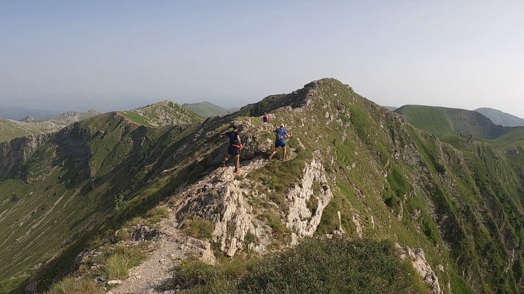
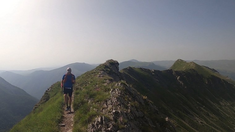
As we set out and started the climb there were two other runners from the red course (66k) who set out just before us. We followed them slowly as the climb led us into the shade of the forest. We played leap frog with them for the whole climb. They were up against a different time limit on their race and knew they wouldn’t make it, but were going to finish the section anyway. We were just exhausted. We all took breaks fairly regularly, to stop and manage the heat the best we could as we climbed through the forest which was steep and hot with more flies. Eurgh. We made slow but steady progress as it wasn’t too bad in the shelter of the forest but that wouldn’t last. We left the trees behind and continued up on the increasingly steeper and rockier paths. There was a short sharp climb that opened onto the side of the ridge line. We sat and enjoyed the spectacular views. I was with Matt and he desperately needed some shade. But there wasn’t any. We carried on up where we found Paul and Darryl spread out on the summit. What a place to lay down and relax. It was just missing the shade. The view showed us everything that lay ahead. A horseshoe of ridgelines with maybe 4 or 5 summits we’d navigate along the way around too the other side of the valley. Somewhere over there we’d descend. Somewhere…
Ridge!Incredible views
We carried on with trepidation. Up close though the footpaths were clear and solid. Nothing to worry about here. Despite the heat it wasn’t so bad either as there was a glorious wind to keep us cool. For the next hour or so we traced forward, following the dots in the distance that were the other two runners. After the biggest climb on the ridge we all got momentarily angry. We thought the water would be here. We’d been climbing for about 2 hours and drinking like there was no tomorrow. We were worried the water station had left without us. Surely not. Thankfully it was just our minds and fears. In the distance, at the end of the horseshoe we could see the structure of a bivouac shelter and people. This drove us forward as we enjoyed a nice descent on the mountain side down to where the water actually was. Somehow this whole section was only 6.5 km but had taken us over 3 hours.
With the ridge attacked, overcome and the spectacular views enjoyed, we stopped here too for a little while with Matt resting in the shade of the shelter. We refilled our water and talked and joked with the other runners and volunteers. We could have stayed here happily for hours. The view really was really something special. Alas, we clambered to our feet and all set off together, there was a long way to go back to the aid station to finish the loop.
As we set off it was mostly downhill, we had climbed a long way after all. We had about 900m to descend in total and the route set off steeply. It went straight down the side of the mountain then onto some switchbacks as we headed for a lush green ‘lump’ on the mountain side. Over it we went and further down as we started weaving towards the forest. It was here that I started to fade. I had to call a time out and sit in the shade because I was so hungry. I’d not eaten for the whole section, probably for over 4 hours by now, and hadn’t been managing my fuelling at all. I think I was fine but just hadn’t fully considered how long the ridge would take. I devoured a chocolate/nut bar and we set off again before all the flies swarming us bit us to pieces.
The forests here were incredibly dense and the smells sensational. All sorts of fauna combining to give the forest its scent. It was a completely new experience on this run with much of the route being exposed to suddenly be in what looked like a tropical rainforest. We enjoyed it. After some time, with lots of little climbs and further descents in between, we clambered across a boulder field. I hated that stuff. My feet were aching now and every boulder caused my feet to move in awkward positions and rub more and more. I was glad to traverse it and get to the other side!
Dense forests
Even after the boulder field the route seemed to continue on more and more. We were still weaving and winding around the mountain we’d descended for so long. After what felt an age we did eventually get back to the aid station almost 6.5 hrs after our first visit. That was a long section. We took soup and prepared our head torches for the next part as it would now be dark. Paul did his duty and gave Matt a good talking to, ensuring his mind was set for what was to come. He was ready. We estimated another 6 hours before we’d finish, a long way to go but gladly broken up into 3 sections. We said good bye to the other two runners and set off.
We now had 3 sections all about 7km or so in length, so a little more than half marathon remaining and the bulk of the elevation was done now. We’d always said we would get to the 70km mark and know when we’d finish. That momentarily lifted our spirits. The first section was mostly down hill and rocky. It was tough on my now very sore feet as we left the aid station off track down some steep and uneven paths to the river. The darkness set in very, very quickly as we bushwhacked our way along the path, following the sound of the water. After a short while we had the suspension bridge crossing which was… interesting. To get on it we had to climb some largely spaced ladder rungs and then make our way across some wobbly planks which weren’t connected to the guide ropes we held on to. It made for a mini test and adventure for our tired legs!
The trails were largely off track on this section. A few climbs and descents later we emerged from the darkness above a village with street lights glowing in the darkness. It was very loud here and we assumed we were at the aid station. Only it wasn’t and instead there were a group of guys partying loudly at 1:30. Music pumping and screaming and shouting. Darryl was adopted by them and almost lost to their party. I think they even offered him a lift home if he stayed and drank with them. We climbed up a road, leaving the village, and almost Darryl, behind. Then we saw the aid station.
Another aid station stop and another round of soup for everyone. Despite being the last runners, they were keen to put the kettle to use and get us warm drinks! The night was cooler than the night before and we took the moment to layer up as we left. This ‘second’ section felt long and hard. It started with a descent and climb in the darkness. Then our tired minds played tricks with us using the squished route profile on our bib numbers. We’d interpreted the section appeared to be flatter than it was. Only all around us were mountains. We were very close to where we’d run some 90 km and over 24 hours earlier – in the valleys, off track running along lumpy grassy areas. The terrain felt all to familiar but there didn’t feel like there was anyway out with out climbing! The feint glimmer of reflective trail markings confirmed this as they seemingly lead us upwards, climbing to the heavens. We had no choice but to follow. We did however have a choice to vocalise our dissatisfaction and confusion and we chose to moan like hell. Thankfully by now Matt was seemingly well recovered from the heat exhaustion of the day. The cooler night had certainly made things easier. But we were all tired, all so very tired. More times than I can remember we curled up on the floor and turned our head torches off to try and sleep. Sometimes we did, mostly we didn’t, every time we complained about the flies! It was very stop start as we slowly navigated to that last aid station.
From here we knew we just had 7km left to go. We were glad it was one of the shorter sections and not a race with a large section at the end. I was struggling though. The tiredness had gripped me hard. We continued what remained of a short climb before descending. Each step causing me to curse with the pressure on my sore feet. After the descent we found ourselves crossing the open mountain side, a gentle camber underfoot, Even in the darkness it was breath-taking. Looking down it only got darker and darker like an abyss. I remember thinking about the grass beneath our feet was that was wet with dew. It felt so different to the previous night.
After sometime, lights up ahead caught our attention, and then the sound of people. We were at a road crossing and volunteers cheered us in. 3km to go they told us (it felt like it should be more and it was indeed slightly more). From the road we descended sharply in the forests. The guys were spurred on, but I couldn’t keep up. The steepness and loose soil aggravating my feet. I called after them to slow down. It felt like the same forest paths we ran through as soon as we started way back on Friday night. It was close but, not the exact same paths. We had multiple conversations about the paths and debated whether we were retracing our steps.
After the descent we broke out onto a gravel track road. We had to climb again. Not far or high, and at a very respectable gradient, but our pace slowed. It felt like an eternity as we trudged onwards. I was hallucinating now. I remember asking Darryl if he “wants lemon with that” (seems that I was dreaming that I was working in a bar) and telling Matt to “Put the kettle on”. Darryl stayed with me, trying to keep me talking and awake as we plodded on. I probably spent more time walking side to side than walking forward!
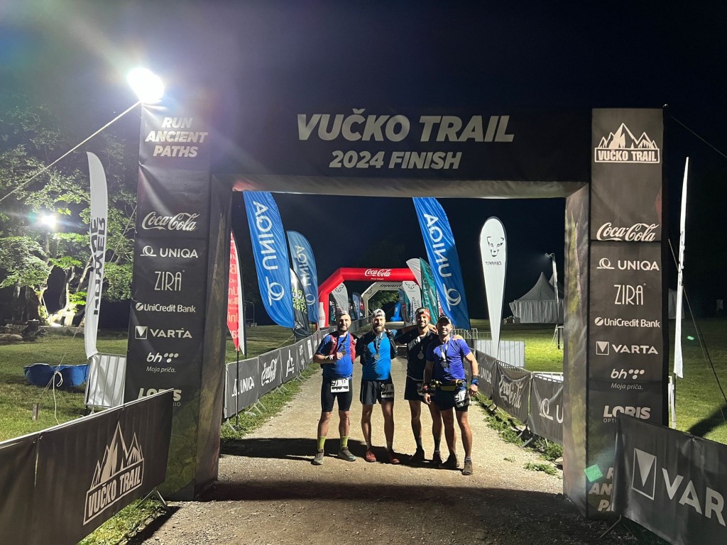
Finally after the road and a further km or 2 through the forests we saw the lights of the finish line. The guys huddled up and we crossed that line together to the raucous cheers of a few volunteers who remained and clapped us in, telling us they’d been waiting for us and that we’d missed the party! We were indeed the final finishers. Lisa was there too, to look after us and drive us home. We sat for 10 mins and chatted with the organisers. 10 minutes later I was fast asleep in the back of the car. In 3 hours time we’d be awake and heading to the airport to go home.
We thoroughly enjoyed this event. It was tough, probably more so than we expected given the heat, but beautiful. The mountains and the route are incredible and the organisation of the event was spot on. Highly recommend this is added to your ultra trail bucket list!
For the last few years a couple of us have always met up on the second weekend in March to go running in Snowdonia. It’s become a bit of a tradition. This our plans complicated it and only Paul and I were able to do the weekend. I also wanted to go somewhere new, as much as I love Snowdonia and have so much more to explore there, I crave travel and adventure in places I haven’t been too. When looking at races for the year I came across this event in Slovakia that offered just the 100km distance and coincidently landed on the second weekend in March. From the pictures it looked like a tough winter event with plenty of snow covered mountains to enjoy. It didn’t take much to persuade Paul to sign up (side note, the race is limited to approximately 200 people and sold out within the first day!). Slovakia here we came…
The race started and finished in a town called Trencin. It seemed like a peaceful little town, located about an 95km outside of Bratislava. It was very quiet and is not a tourist destination. Shortly after arriving, we sat in a restaurant with one other table even though Google indicated this place was “as busy as it gets”. It made us chuckle and set the scene for the weekend – a nice lowkey event with just over 200 participants. I believe there were just 6 runners who were not Slovak or Czech.
A few hours later we experienced the most efficient and straight forward of race check in / registration at the sports hall near the stadium. It was pleasing to see the mandatory kit being checked, in full, for all runners. A refreshing change from the more mainstream events where kit checks now seem to take place less and less often. Armed with a sturdy race bib and multiple free drinks we headed back to the hotel to sleep ahead of our Slovakian adventure.
The start of the race with Trencin Castle in the background (Official photographer: Peter Sobek)
At 6am we were back at the sports hall and ready to start. After not paying attention we found ourselves standing at the front of the race as the countdown began and the sun started to rise. We quickly shuffled to the back where we belonged. The start of the race featured a Long 18km flat (marginally downhill even!) section as we ran along the Váh, passed the local airport and towards the town of Beckov. It didn’t take long for the field to spread out into a few bigger groups based on pace. As nice as it was to see and run alongside the river, it quickly became tedious. The path started as a pathed cycle path and then become narrower trail tracks and an embankment which were solid under foot, far better than the conditions the week before when they were soaked following rain. The weather was fantastic and couldn’t be any different from the snowy winter weather we expected to encounter. These were great conditions to run, but that’s not something you get used to in these sort of ultras and we didn’t want to ruin ourselves completely early on. We were able to keep a decent pace and tick off all the distance in a good time of approximately 2 hours. As we reached Beckov we had the first aid station on the side of the track. It had a good view of Beckov Castle standing prominently on the hill which we’d seen on the drive in the day before.
Running alongside the Váh as we approach Beckov
We ran through the small town and then had the first variation of terrain as we left Beckov with a short climb through some fields and woodlands. There was a photographer cheering us on with a photo opportunity of the castle in the distance. We popped down the other side of the hill and had a short road section before arriving at the second checkpoint in a community hall. The atmosphere here was bouncing as volunteers and supporters cheered us in. We took a few minutes to fuel and compose ourselves, satisfied that just under a quarter of the race was already run. We were feeling good but knew from here the elevation would start to come. We were in good condition though and ready for what came next.
Beckov Castle below in the distance
From the aid station we now had just over 20 kms to go before our next stop. It pretty much started with a 600m climb. The climb started through a mountain bike park before continuing further up into the mountains. On the climb we could see many hills in the distance and one with a tower which we believed we’d reach at some point in the race (I believe this was Inovec). It was like a game as we kept guessing ‘are we going over there’ (we were wrong each time). It was a very gentle incline and weaved up through long woodland trails. The forests were special. The Trees were leafless, the floors covered in a blanket of golden brown leaves which our poles collected like litter pickers. The sun was shining through creating beautiful light patterns on the leafy floor. It didn’t take long before the climb was levelling out. There was no ‘summit’ on this climb but rather the route took us skirting the sides of mountains as we continued in the forest. As we reached the highest point the route was undulating for a few kms before we began descending. Again it was a very gentle and runnable descent and we made great progress on the initial descent before another few kms of undulating woodlands.
We arrived at the 3rd aid station in the Sport Chata mountain chalet at about 43km in. This was a small aid station that was a little cramped inside with runners taking a break. It was obvious why people were hanging around – there was a fire burning and pizzas had been delivered. Lots and lots of pizza! It was midday and the perfect lunch in a party atmosphere. We had a few slices and rested as we prepared for the next section which was also around 20ish km.
Mouth full of pizza at Sport Chata
This one included more undulating trails before a smallish climb of about 300m and subsequent descent. I remember there were parts here that were slightly muddier and the ground wetter as we crossed more fields and weaved through more forests. We also got chatting with a local runner who shared information with us on the trail running community in Slovakia and the other races they have (I’ve read about one further north called the Big Bear which intrigues me). She told us how the race organisers (who form the Slovak Ultra Trail) all help and support each other which I think is a fantastic thing. I also remember running through a long field where there was a guy on a scrabble bike doing loops in the field. The noisy bike momentarily broke the peaceful atmosphere of the race. After leaving the forests we had a short road section (that felt like a very long road section!) on a gentle decline as we approached the 4th aid station where we’d have access to our drop bags.
We’d now covered around 3/5 of the course and were glad to have a rest. As we set about rummaging through our drop bags the volunteers brought us warm dumpling soup (yeah ok I thought it was cheese soup at first!). It was delicious. We were so very well looked after here, and everywhere else on the course – the volunteers were so helpful and friendly. The aid station had so much on offer. There was a huge range of drinks (this aid station had Coke, Pepsi, water, isotonic, bottled fruit juices/squash, magnesium/vitamin water, energy drinks, beer, non alcoholic beer, Radler…) and loads of food options. The warm soup was perfect and we washed it down with a Radler as I talked with another local runner enjoying a beer. We put on some warmer clothes for the next 40 odd kms. It was a very cold day, despite being dry, and we figured it would only be about 2 hours before it started getting dark. After about 40 minutes we went back out and began the long , fairly flat pathed section before we tackling the next climb.
We were now faced with the biggest/longest climb on the course as we’d head up towards Inovec. It was another 600m climb but this time we’d reach and altitude of just over 1,000m. Similar in height to Yr Wyddfa, but very, very different trails. Like before, this was a climb we found fairly easy going as it was another gentle ascent (admittedly we didn’t find it as easy going as some runners around us who ran off up the climb!). For us, we were pleased, there was no ‘huffing and puffing’ or elevated heart rate. It was a nice change to be able to enjoy the inclines and maintain a steady climbing pace. We were also back climbing through the forests and leave covered woodland paths.
As we climbed we completely switched off by reminiscing about movies from the 80s and 90s. All the good ol’ fashioned action movies. Paul was making a mental list of films to watch again. As the climb started to level out there was a short section where we ran back along the course we covered earlier in the day (if we weren’t paying attention here we could have carried on and probably followed the course markings from 50km earlier! I think if you did you would have ended up back at the Sport Chata we passed around 40km in!). This time though we’d turn off in a different direction and towards a ‘ridge’ that everyone kept mentioning.
Approaching Inovec Lookout Tower
We weren’t quite at the highest point yet and had around 10km of undulating trails as we climbed further up. This section seemed to drag a little. Every climb felt like it should be the last one. The daylight was starting to fade and the wind was picking up as the evening began to get colder and colder. As we reached Inovec it was just about light enough to see the Inovec lookout tower. After this it went dark pretty quickly. We were tiring a bit now (fair seeing as we had covered over 80 km) and the terrain became ever so slightly rockier compared to the previous sections. This coupled with the very cold wind made it harder going. I was aware of how cold I was getting now as I trudged through the thinnest layer of snow on the ground. Most of the day I’d had my gloves on but had resisted a windproof jacket up until we reached Inovec. Now I wanted my thicker jacket and warmer gloves! Thankfully the descent finally came and we made our way into the next aid station. Again another mountain hut with fires burning inside. It was warm. It was welcomed. I stuffed my face with apples, crisp, salami and chocolate before warming up and layering up with a beanie hat, my warmer gloves and thermal jacket. We shivered as we left.
Somewhere up high after Inovec
Leaving the aid station we continued on some more road before completing the rest of the descent, probably about 400m downhill in the dark forests. We were toasty and warm again now. After this came a short climb of about 300m. Thankfully this one wasn’t undulating and we started descending pretty much straight away. This final section was nicely split up by one last aid station. We were glad it wasn’t another 20km section straight to the finish. The aid station was another chalet and was lit up with lights and reflective signs. We made a quick stop as it was set up outside (probably a good thing to keep us moving!). Paul knocked back a coffee and we set off before we started shivering again. Stupidly we walked the wrong way for about 50m. It was stupid as we’d even talked about this section and it was incredibly well marked as we approached the aid station. It was clear we were tired, cold and distracted. Back on the right track we finished the descent and got excited as the kms started to tick down.
We’d mentally accepted that it was pretty flat to the finish now, but despite the simple appearance of route profiles, it was broadly uphill, albeit at gentle undulations. The deception of our thoughts messed with our heads a little, but it wasn’t far to go and the climbs were no worse than walking around the hillier parts of London! So really it was mostly runnable and we made good progress. We were impressed by our undertrained body’s ability to keep running during this race. Before we knew it we were arriving back in Trencin, just below the castle. As we approached I remembered some massive luxury houses and how one resembled a yacht. We then made the final descent, down the cobbled path through into the church courtyard, then down into town and along the pedestrianised streets, through the subway and back to start, the way we’d walked to the registration the evening before. Arriving back at the sports hall we had a great reception from the volunteers and race director.
Trencin at night from the church
After finishing I spent a little time chatting with the race director who was so friendly and accommodating. The organisation really was excellent, we were well looked after, supported by loads of friendly volunteers, had ridiculous amounts of high quality foods and drinks and enjoyed a great atmosphere and vibe from the Slovak trail community. I couldn’t recommend this race enough and really want to try some more of the Slovak Ultra Trail events now!
On a personal note this race was a real confidence booster after recent injuries and lack of consistent running. I was expecting a slog (I’m sure it would have been in worse weather!) but seemed to get through with no issues or problems. Even afterwards my body felt ok and didn’t ache too much. Overall we were happy. Undertrained but over performed. With a 17.5 hr finish we were well under the cut off of 25 hours and the WSER qualifier time of 22 hours. Now I can look forward to what is to come next, roll on Istria100 in April…
It has taken far too long, but finally I got around to visiting Matt out in the Netherlands for a run on trails more local to him. Over the weekend Matt and Lara treated us like royalty, putting us up for the night, feeding us, driving us to the race and putting up with our tourist commentary.
The race was the 50km Drielandenpunt Trail in Vaals, in the southern part of the Netherlands, in a park area known as Drielandenpunt, which is the three country point. This is where the three borders of the Netherlands, Belgium and Germany meet. The race is mostly in the Netherlands but the course twists and weaves its way into Belgium at several points and also tracks along the border with Germany.
The night before we stayed nearby and had the shittest risotto known to man. It was a real talking point that someone is capable of making such a bad risotto. Alas, being the non confrontational type we ate it and kept our mouths shut. After all it did serve the purpose of a meal and it’s not like we need high quality food before running an ultra. In the morning we made the short drive up the ‘hill’ to Vaalserbeg which is the highest point in the Netherlands at about 322m, near the three country point. Here is where the race would start and finish. I suppose not many running races will both start and finish at the highest point in a country! We registered and messed around taking pictures on the tri-point where the borders of the three countries meet, crossing between the countries and back in a matter of seconds. We then said goodbye to Natalia who’d start her 30km race an hour later. After the quickest starting line up ever, Matt and I set off.
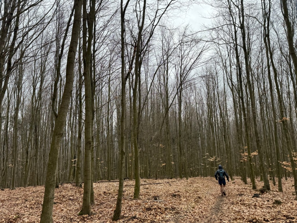
Within minutes of starting the run I was overheating. It was a wet day with a constant drizzle of rain, but, with just the wind jacket on I was too hot, so opted to continue the run in just the t-shirt and sleeves (I probably gave myself a cold as a result, but it was very stuffy in the forests). It was instantly noticeable how, muddy the trails were, how narrow the forest paths were and how surprisingly hilly it was. With a total elevation of 1400m elevation across the course, it was very much a series of short steep climbs and descents with very few flat bits in between. The course, mud aside, is rather runnable although my fitness levels meant I didn’t run a single one of the hills! The first part of the course was a 14km loop to the south. We had some great views of some very grey, overcast skies (‘m sure on a better day there are views to be enjoyed) and made the first of numerous dips into Belgium. This was my first time visiting Belgium. I think it counts as a visit!
Towards the end of the loop we left the forest and ran (trudged!) through some very muddy fields. I laughed as the person ahead kept falling over whilst my Inov8 X-Talons were excellent for ensuring I stayed on two feet, I was so glad with my choice of shoe! We then had a one of the bigger climbs (at just shy of 100m) back up to Vaalserbeg and the start line which would now serve as our first aid station.
From here it was more of the same with forest trails undulating as we ran alongside Germany. Drielandenpunt is a beautiful area with many, many intersecting trails for hiking and biking. It reminded me of the Surrey Hills area with endless twists, turns, short sharp descents and muddy climbs. Overtime the trails all blurred into one and it wasn’t long before I was completely disorientated and had no idea where we’d come from or which direction we were heading in.
After another 13km or so we arrived at the second check point where we were spoilt with ham and/or cheese sandwiches. These went down a treat and we both stuffed our faces and enjoyed a few moments of rest (although standing around we got very cold very quickly). By now we had been passed by a lot of runners. It felt like nearly the whole field had passed us as well as many of the 3okm runners. We were enjoying the day though, chatting our way round the whole course and catching up (some how it had already had been 8 months since our last run together in Lofoten).
Throughout the day Matt was sharing all his knowledge and facts, particularly at key points on the course like when we ran through the vineyards and he gave me a crash course in the history of Dutch wine production. It was a welcome distraction from the muddy trails! Throughout the run I recall the course being fantastically marked and sign posted, the aid stations being well stocked and the ground being a slushy mud fest – there were several more fields that were really muddy and a few little picturesque towns that we weaved through connecting the trails together. After another 15km or so we’d made our way back to the second aid station location for our final stop. With a quick top up and refuel we set back out.
King of Facts
We were on the home stretch now and had finally stopped being overtaken by runners. We commented that we didn’t think that we overtook a single person in the race. Towards the end of the course that changed with a steep muddy descent causing a few other runners to have trouble descending. We sped and slid our way down and claimed about 4 places in one short movement. From here it was a gentle jog into the finish line where we passed with an American we’d shared a few moments with earlier in the day. The ‘international finish’ as the MC dubbed it as an Aussie, American and Welshman crossed the line together.
We opted to skip the ‘city wash’ showers and just throw on dry clothes to start the long journey back to Amsterdam as quickly as possible. This was hindered a little bit by the inaccessible finance system in the Netherlands where many stores don’t accept Visa or credit cards as a payment method. To buy a portion of chips we needed to call Matt and have him come pay for us!
Overall a thoroughly enjoyable weekend in the Netherlands and a great adventure in the forests. Drielandenpunt is worth a visit! Personally, after a few months of inactivity it was good to finally be back out and running long distances. Now I just need to find the fitness before the bigger events that are fast approaching….
It had been a while since I’d toed the line at a Maverick race. Here, on an overcast summers morning I found myself at the Grasmere Showground pinning on a bib for the X-series Lake District…
Image by Jake BaggaleyImages by Jake Baggaley
After the usual detailed race intro from Ben, we set off out of the showground, turned off the main road, through Grasmere village and started making our way towards the first climb of the course up to Easdale Tarn… The road soon became trail and the fresh damp summer smells filled the air. We settled into a rhythm and a stream of runners on both the long and ultra distances. Already with the heat and humidity I was soaked through with sweat as we ambled round countryside tracks and began climbing. The first climb was slow and gradual. Up into the Misty mountains approximately 300 m high. As we approached Easdale Tarn we crossed a small river and had the Tarn to our right. The pool of water blended effortlessly into the misty grey skyline. It looked like an impressive infinity pool where there was no distinction between the water and the sky. Almost Eerie in the spectacular early morning. Jake was on hand to snap our photos as we gawped at the scenery.
Jake capturing the epic views behind us at Easdale Tarn
From here the climb increased as the soft ground gave way to rocky paths and then steeper on slight scrambles over the barren mountain face. We huffed and puffed our way up further into the clouds as we climbed to the equally impressive Stickle Tarn (Overlooking Harrison stickle, which we couldn’t see). Up top we levelled out and began our descent. Now the trail was feint and the blue course marker flags were hidden in the clouds. We followed shadows, glimpse of flags and wet footprints to find our way down. It was a nice gentle descent from the summit that later became steeper with wet rocky steps on a defined path. Tanya captured more pictures on the descent before we came out at the bottom at the trail head and the first aid station
Tanya capturing the rocky descent from Sickle Tarn
Refuelled, we had a fairly flat and slightly undulating section through lanes and alongside stone walls. Epic views of stone quarries and riverside tracks entertained us as we made our way towards Great Langdale and on to the next aid station. Here familiar faces volunteering and supporting us could be found. Fiona marshalled us back along the river, her husband Graham and Leo at the next aid station cheering us in just before Skelwith Bridge where we’d turn and head towards Loughrigg Tarn.
From here we’d run through ancient forests with a short climb and descent before crossing to the other side of Grasmere and Rydal Waters. We’d now began making our way to Rydal Hall. There were plenty of views as we ran alongside the rivers through country parks with loads of walkers now out and enjoying the morning. We crossed the road and joined a trail path (the Coffin Trail) back on the mountain base where the course split from the medium route. Already I’d been passed by speedy front runners on the medium route who now headed back to the start and the finish line. We on the other hand turned the opposite way and continued off to Rydal Hall. It was A shortish section from here and one I was already overly familiar with. I was staying at the Rydal Hall so had walked 3 km along the race route to the start earlier in the day. Now I found myself back on the ‘Coffin Trail’ navigating back to Rydal Hall.
From the Coffin Trail (later in the Evening)
Arriving at the Hall the aid station was a welcomed sight, although one like a scene from a war movie with runners sitting and laying all around it. I joked with Steph who was volunteering what had happened. Everyone was feeling the heat and humidity.
We were approximately halfway through now with a loop up the Fairfield Horseshoe to go. I knew the second half of the course was the tougher part and we had longer between aid stations and bigger climbs to overcome. So I filled and extra bottle of water to help keep hydrated. With potatoes in my hand I set back out and soon found myself walking and talking with Matt who was on his first ultra. We’d end up running the next 20km or so together.
After a little climb and descent (with no views over Ambleside sadly) we then began the climb to Kirkstone Pass. It was gentle and easy going through fields, trail paths and the latter few hundred m on the windy, steep road. As we reached Kirkstone pass the clouds cleared and the sun came out. Stopping at the aid station Leo and Justin were on hand to support us and provide the entertainment and laughs. I took a can of Tenzing and applied some sun cream. Maybe too much as they joked I looked like I was covered in mayonnaise. Once we’d rested a little we set back out and to climb too Red Screes.
The climb was steep and slow going. Me and Matt plodded on gently consistently moving onwards and upwards thanking the marshal as we went. We were passing runners who were struggling in the heat, although thankfully the cloud cover prevented the sun penetrating us and the mountain wind provide a beautiful cooling sensation. Up top we descended. It was long and steep but far nicer than the earlier descent from Stickle Tarn. It wasn’t too long either as we had another little climb followed by some undulating trails and false summits before we reached Fairfield (Turning off just before the summit). Along the way Jake popped up once more, this time at least the clouds started to clear a little.
Heading up to Fairfield by Jake
Her it was all, mostly, downhill. With less than 10k to go I left Matt and powered on. I had plenty of energy and felt strong. I passed more runners moaning about the false summits and the heat. I wished them well and continued. The descent I enjoyed up until we left the mountain and started traversing the side of it near Stone Arthur. Here the trails narrowed and became a little more rocky underfoot. I bounced on and soon found myself cramping badly. It was strange, it came out of nowhere and hit me in both legs simultaneously in the calves and inner quads. I ground to a halt and tried to stretch. There wasn’t much I could do and found the rocky steps of the trail triggered y cramps as I hopped down. I felt well hydrated and thought I’d been taking on enough salts but clearly not. Thankfully I passed some more Marshall’s just before the narrow descent and were informed that there was an extra water station at the bottom. So I welcomed this news.
I arrived at the the extra water stop and found Fiona once more supporting us with water and Tenzing. I took the opportunity to take two cans hoping it would combat the energy drain/cramping. I necked one and put the other in my bag ready to use if needed. From here we had just 4 km to go. To the shock of some runners we had another 200-300 m climb to go up to Alcock Tarn. I’m not sure why this shocked people as the route and profile was well advertised. It was a fairly straightforward climb for me and I eased passed more people in the way to the summit and passed the Tarn. From here we had clear views over Grasmere and a clear sight of the finish line
I trotted on as the downhill took us from the mountain, through the forests and back out at the end of the Coffin Trail. Now it was a short job along the road and back into the Showground. I ran across the finish line with a big smile having enjoyed possibly my favourite Maverick of them all. It was a great course and challenging in the temperature humidity of the late summer.
X-Series Lakes, Done
I grabbed some food (sadly no pizza left but I did have the best white chocolate rocky road) and stuck around to cheer some runners I passed and ran with and I also got to see Matt enter the showground as I was leaving. All was left for me was to once more walk the length of the coffin trail for the third time that day as I made my way back to the Rydal Hall.
This race for me epitomised Maverick race and the inclusivity of their events for all. I shared some 20km with Matt who was doing his first ultra (what a way to start!). Here he was running his first ultra whilst I was running the distance for the 77th time!. Two complete ends of the spectrum. But very littler differentiated us. You wouldn’t know. He led the way and ran and covered the course strongly. He enjoyed the experience in the same way I did. The only difference was my greater experience for noticing when there were gates we could open rather than stiles to climb, which of course I waited until he’d climbed before I went through the gate. Other than that, my legs were probably a bit more accustomed to the fatigue at the end of a race and how I was able to descend quicker than him. Great going on your first ultra Matt!!!
As always the Maverick team were brilliant. I heard so many positives from runners about the routes, the organisation and the brilliantly stocked aid stations. These guys nail it every single time!
I had the urge. The itch. I needed a little day out, something to feed the adventure beasts inside and keep them happy…
I saw an advert for the Hangman Ultra when I was looking into the Test Way trail. It looked perfect – the date worked and logistically it was feasible and at 50km it could be done in a day without too much disruption. I signed up.
It’s a small little event from the folk behind Ultra Magazine, capped at 100 runners, although there were only 26 sign ups this year (the event was returning after a two year hiatus for various reasons). I liked the smallness of the event. It felt personal and friendly. It is so low-key that they don’t even bother with race bibs or timing. You get an allocated a number and call it out when you pass through a checkpoint/the finish. Nice and simple.
Race briefing
Arriving at the village hall for registration, the runners formed up. It was a real smorgasbord of runner clichés. Within the small group there was someone I knew, someone I knew of, UTMB tee shirts, Centurion tee shirts, and many friends meeting again. I overheard a runner talking about their Marathon Des Sables experience and a reply from someone else saying they had another race the next day. It wasn’t surprising when Andy (the Race Director) asked during the briefing if this was anyone’s first ultra and not a single hand went up. There was some collective experience in the room for sure! Throughout the day the conversations would typically cover up and coming races, training plans and previous triumphs. Trail runners are a little predictable, we do like to talk about running!
With Jamie at the start
The route was a simple out and back route along the northernmost section of the Test Way trail. We had a checkpoint approximately halfway to the turnaround point where there was another. So three stops in total. After the race briefing we walked round the side of the village hall to the start arch. Andy wished us well and sent us off. The pack barely moved and it was a very conservative start which led to jokes about finishing together as a big group and jokes about winning. Momentarily I believed that I too could myself win the race and started to overtake runners as we plodded along the single track. Barely minutes later, when I couldn’t catch the front runners, I snapped back into reality of where I belong!!
The lead runners early on in the race
The first section was undulating with two little climbs. We tracked through farms, side roads and dirt tracks. There was a little farm we passed through with goats, piggies and chickens which amused me before a lovely section of redwood forest followed by a sharp descent down into the town of Hurstbourne Tarrant and the first aid station (at the George and Dragon). I took delight and enjoyment in devouring a Tunnocks caramel, a classic bit of confectionary, before continuing along the road and back onto the trails. Up until now I’d mostly been running with a guy called Matt as we were in 5th and 6th place.
Oink Oink
After the aid station I was slightly ahead of him now and then took a small wrong turn at the next farm before getting quickly finding my way back on track. There was a long slow walk uphill before some quicker downhill sections on gravel tracks before another slow road climb. The descent from here was very over grown and the nettles attacked our legs from all sides. It wasn’t a fun descent and I wasn’t looking forward to the return climb here! After more ups and downs and a good bit of consistent running I then caught up with the next runner ahead of me.
Combe Gibbet
We chatted for a bit about running and races as we climbed the biggest of the ‘hills’ on the route together out of Combe Wood before he then left me for dust on the climb up towards Combe Gibbet (A historic structure used for the ‘gibbeting’ of murderers back in the 1600s. It stands on the Berkshire-Hampshire border). I walked most of this track through the farms and fields. As I rounded the bend I could see the Gibbet off in the distance and 3 runners already looping around it and heading back. I cracked on knowing the aid station was in reach. A few minutes later, when they passed me, I still had about a km to go to reach the Gibbet and back to this point. I guessed they were maybe 10-15 mins ahead of me.
Reaching the next aid station we ran passed, reached the Gibbet, ran around it and then went to the aid station. I took a few mins here to eat some food (loved a bit of pineapple!) and refreshed on coke. I was glad to be turning around and heading back now. The good news was that the course overall was slightly more down hill on the way back to Longparish and we’d experienced the route so knew what to expect for the next 27kms.
I left Matt at the aid station and started heading back. Shortly after reaching the fields a little further on I saw Jamie, then, not far behind him I started passing other runners. Everyone was so friendly and cheered each other on.
Heading back to the first checkpoint (or now checkpoint 3) the hills we climbed were far more enjoyable to run down in this direction. I found this section went by quite quickly (except the climb back through overgrown nettles!) as I walked the hills and ran the downs and flat. I even made sure I didn’t take a wrong turn again towards the end of the section. I was hot now and drinking more so was very pleased to reach the checkpoint. I had it all to myself. I had a good chat with the volunteers, took on more Coke and pineapple then left. 14km to go. The race felt like it was passing quickly which I was glad of, despite enjoying it.
I walked from the aid station knowing that after a little road section we’d climb through the fields and the forest again. I couldn’t be bothered to run the road so just walked. The forest was just as delightful even climbing through it rather than running down it. The dense forest also provide shelter from the midday sun and a cooling breeze. I did start cramping in my calf though, no idea why. I thought I was well hydrated and had the usual amount of salty foods etc. Either way, I kept moving and before I knew it I had less than 10km to go.
some field somewhere
I think I did find the run started to get harder here. Fatigue was setting in and it felt more hilly then I remembered during the first section. There was lots of walking, lots of long gradual climbs. So the run/walk strategy was in full swing. For some reason I was feeling the pressure and kept looking over my shoulder to see if I was going to be passed. Silly really as I say I don’t care about times and position. Something competitive was twitching in my head though and I didn’t want to drop the 5th place spot. So I ran when I could and felt confident that as long as I kept running in parts that wouldn’t be caught and I assumed everyone else would walk these hills too.
The tiredness and ‘looking over my shoulder’ continued as I counted down the kms. Soon it was 5km, then 3km, then 2km. The knowledge of the impending finish was a great feeling. Soon I was on the single tracks again and less than 1km remaining. One last turn, back into the field and the finishers arch came into sight. The 4th runner was there and helped cheer me home. Medal in hand I posed for a photo and then headed off to the village hall for some refreshing soup and planned my journey back home.
finish!
I’ve been talking with mates about our love of the smaller events. The desire and attraction to the ‘big boys’ events is starting to fade. Like everything, commercialisation takes the spirit away. Whilst this is far smaller than what we have talked about, it was exactly what I needed. The organisation was spot on. From the pre event details, informative race briefing, relaxed vibes, awesome volunteers and a meaningful welcome at the finish and chats afterwards. If you want to experience a great friendly ultra atmosphere then go give the Hangman a try!
This feels like a diary now, writing about races so frequently in a short time. It’s almost as exhausting as the runs themselves!
Last time I wrote about how my feet had recovered in rapid time between Transylvania and Lofoten. Well miracles don’t happen twice. After Lofoten it was a slow recovery. I’d done nothing except sit at my work desk and move from there to the sofa. Despite the little bit of rest, flying out to Salzburg for the Mozart 100 I had three health issues on my mind. My feet – delayered and with fresh, raw baby-like pink skin on the pads and around my heels on both feet. My right knee after the twisting pain from Lofoten. And my left big toe/metatarsal – I hadn’t been able to bend the big toe for two weeks. These weren’t going to stop me though. Mozart 100 has been one of my bucket list events for a while and I wanted it. I was out here with Natalia and she was running the Mozart marathon which was the last 40km of the route I’d be doing (a sort of figure of 8 route from Salzburg through St Gilgen and back).
Just like Lofoten I prepared the feet before the race with a combination of Duo Derm (hydrocolloid dressings) and KT tape I. The hope of substituting for the missing skin layers. The knee and toe would just have to be dealt with mentally if they caused me issues. I was quite casual in the morning and had less than 5 mins to the start of the race after I dropped off the drop bag for St Gilgen. By the time I walked back to the start line, I found myself right at the back. I couldn’t even fit in the starting pen!
Arriving with minutes to spare
The plus side was that, within minutes of arriving, the race had started and I was running under the start arch. I made a decision to try and gain some places whilst I could and whilst it was flat. This was a good, but questionable decision. It turns out that the first 7km of the race was flat road and gravel tracks. The route took us through the old town, out and along the river. I kept running. Speeding passed people until I was only keeping pace with those around me. I was gassed. I wasn’t expecting to be running so fast for so long. Thankfully though, 8km in we hit the single track climb into the forest and the pack of runners came to a complete stand still at the bottleneck. People were moaning and trying to push passed around the sides. I was glad though. I needed the breather!
After a few short minutes we were on the move with gentle trails in the forest and smooth roads taking us up little climbs on switch backs. In no time at all we arrived into the first aid station. From here we’d head to the town of Hof. We’d visit Hof later in the day on our way back to Salzburg too.
This section was more of the same really with the route following smooth roads and wide gravel tracks. The small climbs were gentle switch backs and the downhill sections were sweeping tracks at a pleasing gradient that was pleasant to run. I was feeling good. My feet stung a little bit from all the pounding on hard ground when running the downhills. But I couldn’t feel any knee issues and my toe was only mildly uncomfortable when running downhill. This was good.
We crossed little villages and a few streams over small wooden bridges. We ran Into forests that had that fresh damp smell (there were thunder storms the day before) and it smelt divine. After a few small climbs and descents with plenty more running, I arrived at the aid station in Hof. It felt quick and my average pace over this first 22km was close to 7mins per km. Plenty fast for a 100km ultra! I hadn’t really eaten much and wasn’t endeared by the offerings at the aid stations, so I took a Naak energy bar. It was quite nice. Different to what I’m used to eating.
Leaving Hof I recalled two ‘lumps’ in the course. The first on road up through a little village and down as we left it. Then the second taking us back up this time through grass and fields behind houses and we passed a little farm and across a main road. I remember a volunteer / marshal sitting outside a house directing us. An old man with a big smile on his face.
From here the climbing began… the first of three chunky ascents in the first half of the race was upon us. It was a steep climb. It seemed to go Just straight up. No switch backs or winding trails to ease us up. Just a straight line through the forest packed with runners. It was fairly Technical in the sense that it was was very rooty. I thought to myself that this could make my tender feet very sore so tried to be consistent with my foot placement to minimise any rolling movements. I was glad we were ascending and not descending on this trail. Every now and then the trees would open up and present amazing views of the surrounding mountains and towns.
Once we reached the top it was rocky. We had a short traverse before beginning our descent. It was similar in that we pretty much ran straight down with few twists in the trail. It was steep and rocky at first before becoming more steady underfoot with smaller loose rocks and then gravel tracks. It was a long descent and I could feel my quads starting to burn. My legs were understandably tired after recent adventures and I was feeling it in my body now. We bottomed out and arrived at the next aid station. I treated myself to some Coke (Red Bull cola) as I felt I’d been running well up to now. Just under 4:45hours and 32km distance covered.
Cows enjoying the views
From here we climbed again. The course was very similar now and followed the pattern of long sweeping roads and wide dirt tracks on gentle climbs. This one we covered about 600m over about 5km. It was tiring but not too taxing. Up top was another aid station and a chance to take on more water. There were plenty of cows chilling at the aid station and a café with hikers sitting outside it. I wet my hat in a mountain trough and made the short, single track descent before the next climb where we’d continue up to Zwölferhorn. This was another big climb to Zwölferhorn . It started the same manner as the others – on roads and gravel tracks. Then became steeper as we hiked up in the forest. Once more the tree line breaking to provide amazing views of the lakes way down below on either side.
Eventually up top we broke out of the forest to a peak with a cross marking its summit. Loads of hikers were sitting enjoying the views. I started taking pictures then realised the real summit was further along passed the next aid station, the flags flapping in the distance. I carried on and ran over into the aid station. I made a short stop to refill water knowing that St Gilgen and my drop bag awaited after the descent the other side. The descent to St Gilgen was the longest and steepest yet. We ran along a mixture of rocks and rooty forest paths. Some very steep as we traced a path down under the cable cars. The views during the descent were beautiful with constant panoramas of the lakeside town. My quads were on fire now from all the steep down hills but I kept on running until we stopped descending. A young boy was cheering runners with a loud cowbell. He then ran passed me with his mother and the cowbell cheering her all the way into the aid station.
Beginning the descent to St Gilgen
The aid station was a bit chaotic. It served both the 100km and the 80km races and also acted as an aid station at two different points on the course (we’d now run a loop out of St Gilgen and then back). So there were a lot of runners coming and going. The benefit was we could access our drop bag twice. First here around 50km and then again around 67km. My plan was for a quick stop now and a longer stop on the way back. I grabbed a can of Coke and my drop bag and sat down. I gave myself 10 minutes to refill my tailwind. Eat some of my bars and drink the Coke. I also rubbed some cold gel on my quads and calves. As I left I saw some noodle soup and wished I’d seen it on my way in!
Leaving St Gilgen we ran along the Lake Wolfgang (great name!). It was absolutely beautiful, if a little busy. Loads of tourists out walking but also runners running back against us towards their second pass at the aid station. It was a little demoralising seeing so many 100km runners that we 17km ahead of us.
The incredible Lake Wolfgang, looking back at St Gilgen
I started talking to Marie, a Swedish lady living in Cork I’d met earlier on. We were both enjoying the stunning views that the course had to offer. As we talked we began climbing. I remember thinking how good the trails were. Typical well maintained Western European trails. You know you’re on ‘princess trails’ when there are families with small kids and prams walking the same route!
The climb was broken with a short down hill. I was running again and passing some runners on the 80km route. This was a little buzz and mental pick me up. My toe started hurting from something underneath. It felt like a thorn or something. I was running awkwardly to avoid putting pressure on my toe. After a while I blocked it out. (The next day I found a sizeable splinter stuck deep in my toe through the tape!).
After the down hill we began the big climb. This 10km section (including the last climb and descent) had 1000m of elevation to climb. Most of it now lay ahead. It was a big and slow climb. It was just straight and rocky underfoot. I powered on and hiked steadily. Runners were stopping and resting. I challenged myself to not rest until the aid station at the top. It was very tiring and felt like it would go on for ages. I could here some runners were asking hikers ‘how long to the top’. They were clearly feeling it too. Nearer the top it was rocky and the tired legs had a bit more work to do. I was craving some more coke now and sugar (there wasn’t anything sweet besides chocolate at the aid stations). Every now and then I could hear a mechanical roar further up. Some sort of cable car I thought (it was a tourist train up the mountain). At the top my heart sank when I saw a building way off several hundred metres further up a peak way off in the distance. Thankfully though an aid station was hidden just around the corner and we were not heading all the way up there!
I was glad the climb didn’t continue up to the real summit!
Here the aid station was shit. Perhaps I’m being harsh (it’s 1300mup a mountain, although a very accessible one). But when we arrived it was decimated. There was no coke. Just water or isotonic. And very little food. Just gels and tomatoes left amongst the crumbs of other fruits and biscuits. It was shit. I needed something so took a gel. I then just left in frustration and planned a good raid and feed back at St Gilgen.
It was about 7km down hill back to St Gilgen. It was hard at first with the rocky terrain and gradient but soon the trails became less steep as we ran into the forests and on to switch backs. It was quite quick and I covered the descent and trail back around the lake from st gilgen in around 1 hour 15 mins. I was pleased with how I ran and kept running, passing many runners here.
Back into St Gilgen my frustrations continued. There was no coke here either. I couldn’t believe it. I was nowhere near the back of the pack. So many runners were being deprived of the expected levels of support with food and (non water) drink. I could hear everyone around me asking the same. I reluctantly took a red bull I was offered. I needed something sweet. I also went to get the noodle soup which I had to scrape the barrel for. Hardly any noodles, just the broth water.
I grabbed my drop bag, changed my t shirt, ate some food, refilled my Tailwind and got ready to leave. Maybe 20mins rested. I didn’t want to hang around now. I’d messaged Natalia and saw she’d completed her run in 6 hours! She was hoping for 7 so I was proud of how fast she’d run. It lifted me too at the thought that trails would be good – there were no more big climbs to go now. And I had 10 hours to the cut off. I was confident that 8 should be feasible. The cut off times seemed to be so skewed. I left with 45 mins to the cut off!!
I walked out from St Gilgen as the route took us through the town and up some back streets behind some impressively big houses. There was a steep up hill that was just a few hundred metres along a narrow dirt track skirting the side of a mountain. It led into some beautiful trails that were nice and wide and gently easing us down into some forests and along through beautiful little mountain villages. In no time at all I arrived at the next aid station and to my delight finally they had both coke and soup. I took a cup of both. It was real Coke out of small bottles. Not the sponsored red bull cola. Clearly they’d been out shopping! I was satisfied and energised now.
Leaving here a little more refreshed and buoyed on by the thought of maybe a little over 30km to go. I ran along some roads as the course took us towards the lake. Here scenic undulating gravel tracks took us for a few km around the beautiful lake with its clear water of different shades of blue and green. I wanted nothing more than to stop and dive in to cool off on the evening heat. This feeling intensified at the far end when we reached a popular café/swimming spot with loads of people in the water. Without tempting the dip it had been a consistent section of running and walking when it was slightly uphill.
Lake side trails
Evening was starting to set in and the sunlight was dipping as we reached a road crossing. Just after the crossing, a family were outside their house with a hose pipe filling up runners bottles. I took the extra water gladly as despite the evening drawing in it was still very hot. Shortly after we reached another road crossing and began a climb onto a grassy hill. I recalled it from the section maybe 60km earlier after Hof. Hof must be the next stop now! I Remembered the grassy incline, passing through the farm and forests. Then long roads through villages. The old man volunteering was still sitting in the same spot he was many, many hours earlier and still smiling away. I thanked him once more. Shortly afterwards I arrived back into Hof with the now familiar ‘sorry, no coke, just red bull’ response to my request for coke. I moaned silently into another cup of soup. Satisfied I was at least getting some warm food into me. I took my head torch out ready and carried on. 20km to go…
Amazing sunset!
What followed I had ran before. Much of it I don’t remember. Whatever I previously described as wide roads and gravel tracks through forests is probably about as descriptive as my mind would remember anyway! Somewhere in the forest we went differently though. I don’t remember the river crossing over a small grid platform balancing on a barrel from before. It was all very similar from here though with (yep, you guessed it) more forests and roads. We then started climbing again. My run had become a hike as we continued a long climb as darkness set in and the torch light came out.
Up on the hill a glow of an Aid station signalled the next break and the marker for the final 10km. Here at Koppl it was the same old story. The sugar I was craving wasn’t there. I did get a cup of alcohol free Steigel though. That was good enough for a bit of fizz and change in flavour. More soup too. I took ten minutes. The atmosphere was good and the soup piping hot! I steadied myself for the next section knowing there were a few sneaky climbs and descents still to go. I made sure to leave though before I got cold though as, all around me, runners were layering up. But I knew I’d be warm as soon as I started climbing again.
The 10km was split roughly into a 6k and a 4K section. It started with a 150m climb. It was fairly tough going. Single tracks and rocky in parts. We were climbing towards a tower on top of the mountain but wouldn’t get that high, peeling off around the side of the summit. We had incredible views of Salzburg bellow with the orange street lights shining brightly. I led another runner on and we chatted briefly before we started descending. It was steep in the forest and I used gravity to stumble forward slightly quicker than walking pace, excusing myself passed other runners. It was a long rooty down hill that was a little awkward and painful. I was feeling my toe/foot issue now with the constant pain ringing clear. The lower we got the harder it became as the trails became stairs. Steep steps made of wood at uneven angles. It was uncomfortable to traverse at pace. They kept going one after the other. Like death by a hundred steps. I hobbled on, out of the forest and over the train tracks. A small water station marked the end of the first 6km section. It was the home stretch now.
The Glow of Salzburg way down below
I knew what came next from both the route profile and Paul’s wisdom from his experience 4 years earlier. Now back in Salzburg, the route climbs another 200m up to a building on a hill. Then descends into the heart of town before we cross the river to the finish in old town. I had 30mins to cover the 4km to get a sub 19hour finish. I knew with the climb this wasn’t possible. But I was pleased to now be so close to the end.
I still couldn’t quite understand how/where a 200m hill existed in the city! It was very steep and mostly steps to climb. A right pain and torture after already covering 100km. It was frustrating more so because of the groups of teenagers hanging around up there and smoking. The fresh air smells polluted by the stench.
I reached the castle on the hill and began the slow descent. The trails of rocks and tree roots soon turned into stairs. Of course. The stairs became shallow angled steps closer to the old town and my foot placement became more pronounced. Reaching the bottom we came out onto a street of bars and pubs bustling with Saturday night vibes with loads of people out drinking and enjoying themselves. I walked around the corner and pressed the button to cross the main road onto the bridge and over the river. The green man signalling my safety. I walked the few hundred metres along the river promising myself I’d run what’s left through the old town. One more road crossing and I started jogging again. I was catching people with less than a few hundred metres to go. They were walking through the old town but then started running when I neared them. I’d either have to run faster or drop back to avoid finishing alongside or right behind them. I dropped back and got a clear pass at the finish line.
Printed finishers photo!
At the finish I got another alcohol free beer (no coke still) and was given a printed finish line photo. That was a nice touch. I was then directed back to the race office around the corner in the adjacent square to get my drop bag and finishers medal. Here I was also given a frame for the photo. That’s a new one for me! Never had a frame and a photo at a finish line before! I drank the beer then walked back to the hotel. Ready to wash and climb into bed…
I loved this event. Salzburg is a beautiful town and one I’ve wanted to visit for a while. The trails and scenery is beautiful. Overall the organisation was good but if you haven’t sensed it yet, there was a sour taste in my mouth from the aid stations. They were grossly under stocked. Only one aid station in the last 60km had coke and the food was scraps at many. And I was mid pack. With 5 different distances and thousands of runners, they really hadn’t enough food. Given the race is now under the UTMB banner, this isn’t good enough. For fully supported races, they have to provide enough food and water.
The Arctic Triple 100 mile ultra trail in Lofoten, Norway. An event I eagerly looked forward to but one for which my preparation was screwed before I even signed up. Back in 2022 I’d already signed up to Transylvania 100 and Mozart 100 for 2023. When Matt floated the idea for this race in Norway, and him and Paul signed up, I was torn. It ticked every box on our criteria for an adventure. Trouble was, it was a week after Transylvania (we’d actually start 4.5 days after the finish time of Transylvania!) and two weeks before Mozart. This was not an ideal time to squeeze a 100 mile event into my year. But I did, of course I did! I signed up. My plan was simply to survive and enjoy Transylvania without wrecking myself before Lofoten. That didn’t quite go to plan and the race in Romania was far harder and more damaging to my body than I’d hoped for. Come Monday, I could barely walk. Besides bruising to my right quad, my feet were in pieces. They were so sore and covered in blisters. It was 3 days of soaking them in salt water, applying creams and ointments and hoping for miracles.
By Thursday, miracles had happened. Somehow my feet had healed pretty well, well enough that I wasn’t in any discomfort, maybe still missing a few important layers of skin, but after a self inflicted stressful few days I was confident again. All that was left was the day-long journey to Svolvaer where the race headquarters and finish line was based. That night, I wrapped my feet as best I could in hypercolloid dressings and KT tape. I hoped this would buy me a bit more time during the race before further damage was suffered. I also opted to wear waterproof socks to start the race (which turned out to be the best decision I’d made that week!).
The next day the journey to the start line began, this was like an ultra in itself – it involved a 2 hour bus from Svolvaer to Reine and then a 30 minute boat ride to Kirkefjord. The bus journey to Reine was scenic and gave a good first insight into the stunning scenery and terrain of the peninsula. We drove around the islands and mountains making up the landscape and crossed bridges and went through tunnels that connected all the islands. The mountains were quite a sight and dominate the skyline.
Suited and booted for the boat ride
At Reine we left the bus to get a boat across the fjord to Kirkefjord where the race would start. Due to some logistical issues, the planned ferry boat wasn’t available, therefore smaller boats would complete the transfer. This worked out amazingly for us as we were stopped before boarding the boat that was waiting when our bus arrived as it was full. Instead we were directed to a smaller speed boat/dingy. This meant donning a life/body suit. I made sure we were first in line to get suited and booted. This boat looked so much fun! Straddling the seats we held on as the boat sped off. Wow. What a way to start a race and what an experience bouncing along the water, the wind and rain battering our faces. The attempts to disembark were then hilarious as we tried to climb up the jetty and needed pulling up from the marshals directing us in.
Best seats in the houseWhat an experience! Zipping along the Fjords
We had about 45 mins before the start and spent it sitting in a wood cabin on the ‘pier’ to take shelter from the rain and exploring a vacant building. At midday, as we made our way to the start line, we found ourselves at the front of the runners. This made us giggle as we did not belong there, but we embraced it as we set off, momentarily leading the other 70 or so runners into the adventure that awaited…
Waiting to start at KirkefjordThe subtle start line
The race starts with two steep climbs. The first about 100m and the second a bit more punchy at around 350m. Straight away I was huffing and puffing. The terrain was mountainous, rocky and wet with water streaming down the slopes. The incline was sharp and the gradient reached a good 30 degrees in places. Runners inevitably started passing us as we climbed. As we reached the top the of the first climb the fun began. Groups of runners started passing us at speed as we tried to navigate the slippery, rocky terrain. In some parts small remnants of snow made the rocks extra slippery. I wasn’t ready for more snow after last weeks fun in Romania. I was making my way tentatively.
Leading the way. Bunch of clowns
I cautiously crossed the trails connecting down to the second, steeper climb. I fell a few times along the way, slipping off the large boulders we had to traverse. As we began climbing again the story repeated itself. After reaching the top another tranche of runners went passed. We were now near the back of the field already. We’d barely been running an hour and already couldn’t keep pace with everyone!
Paul and Matt valiantly holding on to the lead in the first few 100 metersThe terrain of the first two climbs
The race description and briefing did indicate that the first 20km or so made up some of the harder sections of the race, so we weren’t disheartened just yet (even if we were only about 6km in!). Besides, from here we began the route towards the beach at Kvalvika as we descended again. We had a short road section and the first checkpoint with refreshments before we were heading off track again towards the beach with a short climb and descent along the way. Here we started to be caught by some of the relay runners who started after us. You can also cover the 100 miles in a team of up to ten people. In 2024 they are also offering the 100 mile event as a multi day adventure. The views, despite the wind and rain were incredibly pleasing on the eye. We knew about this beach after watching the short film ‘Nordfor Sola’. It’s about two young men who embark on an adventure and spend 9 months living on the remote beach, building a ‘cabin’ out of materials that wash up on the shore and that they salvage.
Matt excited for the beachMatt even more excited for the beachMatt excited ON the beach
The beach is split into two sandy bays. As we reached the first, the trails took us right to the coast. By now Matt had fallen numerous times, the last one spraining his wrist. He was in pain, but masked the pain with his excitement of reaching the beach. The descent to the beach itself was very challenging. We clambered over large boulders and loose rocks, lowered ourselves down cracks and used ropes and chains to reach the beach. It took a little navigating for us to find our way down and the rope descent was tough going, even if it wasn’t very high! We immediately then had to climb and clamber back up and over the wet rocks to work our way around the coast.
The ropes and boulders connecting the beaches made for slow going
Eventually we reached the second beach. The one made famous from the film. In the distance we thought we could see the the makeshift chimney from the cabin. A surfer was preparing himself for a dip in the vast Atlantic ocean as we began the long, wet climb away from the beach. Again, barely a 200m climb, but the incline was steep and the soggy wet ground made for slow going. This would be the theme for the climbs in the course. None were particularly long or high. But they were steep and always sapped the energy and reduced us to a snails pace. At the top a Photographer waited patiently and snapped the runners as we made our way onto the boardwalk planks installed over the boggy ground. They kept our wet feet from getting even wetter. The solid ground was greatly appreciated. The descend took us back along some gravel tracks and boggy downhills towards the next checkpoint, 20km in at Fredvang. We stopped for a short rest here having some warm soup and plenty of the ‘Triple Buns’ (kind of like a fruit loaf bun) which were excellent. We studied the route for the next section and made some mental notes of the runners around us. We were conscious that there was a new cut off (noted during the race briefing) at the 56km mark at Napp. We had 14 hours to get there but had already taken 5 hours to cover the 20km to this point. It didn’t make for good thinking, but we held on to the belief that the trails would soon get ‘easier’ and we’d reclaim a little time.
Boardwalks after climbing away from the Kvalvika beachBoardwalk
Leaving the Check point we carried on for a few kms along the road, crossing two bridges connecting the islands. There would be plenty of bridges along the course and these first two gave the initial impression, with steep inclines and descents either side (the steep shape allows for the passage of boats underneath!).
In high spirits leaving FrevdangPromise we did run some of the roads!
The roads then gave way to gravel tracks and, as we neared the southern edge of the island, we were back into the boggy marshland and forests near the coast. The wind and rain was continually battering us and we found this section particularly cold with the head-on wind. The coastal section was tough going and we were all over the place trying to follow other runners and navigate our own way through the bogs, sometimes slipping knee deep in the stinky mud. I was so thankful for the waterproof socks at this stage!
Professional photographer’s image of some of the wetter terrain and bogs
We were very wet now with the heavy rain pelting us from all angles and the ground soaking us from below with every step along the spongy ground. It took us about an hour and a half to cover the 7 or so kms here and emerge back onto some beautiful coastal roads making our way to the next checkpoint at the picturesque fishing village of Nusfjord. We rounded the buildings and into the shelter of the checkpoint.
Coastal trailsNusfjord fishing village
The checkpoint was outside but we made good use of the shelter with heaters and blankets. We could feel the icy wind blowing from the sea so tried not to spend too long tending to our needs. Somewhere in these opening kms I’d noticed my eyesight was a little bit hazy. I’d covered up my left eye and realised everything through my right eye was blurry. It occupied my mind for a while as I’d had something similar back in January when running the Tea Round in the lake district. By the end of the run I’d lost eyesight in my right eye. It came back when I woke the next day and I put it down to a bit of mild snow blindness after running for 13hrs in the snow. I’d made a note to myself to keep being aware of it as I’d a lot longer to run this time and it clearly wasn’t related to snow! We stocked up and refilled on more triple buns, emptied our shoes of excess sediment from the bogs and warmed our hands under the hot water tap. 8 hours and 40km covered, we’d reclaimed a little time and were confident of the impending cut off at Napp. Which was good, because the next section to Napp was said to be particularly challenging and we were warned by he Race Director during the race briefing not to be deceived by the relatively flat route profile for this section. We continued to hold on to that belief that, if we got through this next section, things would become little bit easier. We just set our sights on Napp 19km away and headed off towards our target…
One of the professional photographer’s captured this incredible view of Nusfjord fishing village
By now it was night time. Night time was a little different here as we were inside the Arctic Circle. During these months of the year, the area receives 24 hour daylight. Not having the changing atmosphere as darkness set in was certainly an unusual experience for us. Hopefully it would mean our tiredness would also be kept at bay and the daylight would help keep us awake – we were tired with the long day of travel, early start and effort of the first 40km. Anything that would keep us moving forward would be welcomed. The road out of Nusfjord continued for a few km, we passed some drying fish (we’d learnt about the fishing industry and exports of dried fish heads to countries like Nigeria from some local runners on the bus ride out) before we headed into the forests and started climbing.
Fishing villages were covered in these fish drying stands
It started with a slow and steady climb on loose scree. We jokingly (seriously) hoped this was the ‘technical’ element. Of course it wouldn’t be. We climbed further and the visibility got less and less as we entered the mist. We barely climbed 150m before we began descending on more of the same terrain with a well defined path and limited visibility. Inevitability more marsh and bogs lay in wait as we left the path and head off track with several more smaller climbs and descents to cover as we made our way back towards the coast.
Climbing into the mist just outside of Nusfjord
Once we reached the coastline it was a particularly treacherous coastal section. I just recall boulder after boulder putting further stress on our tiring legs. More ‘light’ scrambling and scaling waterfalls (frustratingly my GoPro battery was playing up here so I’ve no visual records of this whole section, the professional photographer photos however capture a little of this brutal terrain!). It was beautiful and surreal but arduous at the same time. I don’t think I’d imagined that I’d spend so much time on his race on all fours in the water trying to haul my ass upwards. It was very slow going. The weather didn’t relent and we were cold and frustrated. I had three pairs of gloves on and had started ripping the waterproof over-gloves from all the climbing on jagged rocks. After what felt like a lifetime of navigating the coast we found ourselves upon the ‘small’ ladder mentioned in the briefing (mentioned as a safety notice as the bottom was a little broken), but it wasn’t quite what I’d envisaged. It looked huge to me. Not long, just oversized. Like it was made for some Nordic God. Down we went, my hands barely able to wrap around the rungs of the ladder and hopping to safe ground near the bottom. From here the theme continued as we descended further, still battered by the wind and rain. We had now resorted to sitting on our bums to lowered ourselves through cracks and gullies. My waterproof over mittens were now ripped and a hole torn open. I questioned why I buy myself nice kit and then do these events and break everything!
Steep downhilsGnarly terrainthe Ladder
It probably wasn’t as bad as I remember, but it did take us a long time. Looking back it took us about 2 and a half hours to cover 10km along this coast. We had a few small navigation errors as we tried to keep the pink flag markers in sight. I can’t recall how, but it eventually came to an end. Somehow we came out into the village of Napp, ran along the road and found the school where the next checkpoint was. We were relieved, we’d been going for about 12 and a half hours now and were very much in need of a rest. Thankfully Napp was where our first drop bag could be retrieved and we had time. We took about an hour here sorting ourselves out. As we started changing our clothes a thoughtful volunteer started mopping up the water that we were leaking. It was everywhere. She also appeared with a bucket when Matt had a coughing fit. He had to reassure her he was ok. We’d planned this stop ahead and all had plenty of warm, and spare kit to change into. With warm kit on and more soup and triple buns consumed, I set about ‘preparing’ my feet for the next section. I was surprised that they had held up so well. Compared to the others, my feet looked great and in far better shape. The waterproof socks had worked wonders. I cleaned them up and dried them off, applied fresh compeed and taped over my soles, heels and little toes. A fresh pair of socks (more waterproof ones!) and dry shoes finished off the pitstop. I wasn’t making the same mistakes I’d made last week in Romania and was super confident that I was managing my body better.
Wet coastal TrailsRocky Coastal….trails?
After a good dry out and reorganisation we set off. We even had toasty fingers after warming our gloves a little on a radiator (spare dry gloves would be the one addition I would have made to my drop bags in hindsight!)! From Napp it was a short road section before a 2km stretch through an underground tunnel. By now it was about 2am (so confusing with the day light!) so there was minimal traffic in the tunnel. A lorry did pass us as we were ascending out of it and and the roar and echo was deafening. Being on flat ground, I ran this section with my Buff covering my right eye to try and ‘rest it’ a little bit and hopefully give the eyesight a chance to recover. I looked like a right Pratt.
TunnelPratt
Emerging from the tunnel we looped back on ourselves for a circumnavigation of a big ol’rock – the mountain Offersøykammen. It stood there prominently for the whole section as we ran around it. It started with gentle trails which soon became became wetter and rockier. Before we knew it we were back on boulders, scrambling along the coastline and deviating onto wetter sections where safer (we heard the following day that a runner fell and broke their ribs along this rocky section, we don’t know if that was substantiated or not though). There were a group of runners here. We talked a little bit acknowledging the difficulty of the course and conditions. As the race description says ‘this section is hardly any trail and more technical following the rocky coastline’. It was nothing but accurate! The trail looped us out onto the road which we’d now follow on a diverted course – due to local land restrictions this year, we’d avoid another coastal section to the north and instead loop south to Leknes and Brustranda before re-joining the original route further along the E10 road. We ran through Offersøy and continued on the road to Leknes.
Trails to OffersøykammenTrails to Offersøykammen
The group of us jogged on in our own paces. Interchanging leaders and varying progress along the road. We felt we put a pretty solid shift in and ran consistently here with short walking breaks as the road inclined. We were aware that these long road sections, as tiring as they were, would be our only chance to gain some ground in a race against the clock. We made good progress, although we could all feel that fatigue was beginning to set in. We’d been up most of the night and the benefits of constant daylight was starting to wane as it was now passed 04:30 in the morning. After hitting the cross roads at Leknes it was a straight line to the checkpoint at the hotel. We entered and the first thing that struck us was that it was so warm. It was great. The smell of warm food filled the room. We discussed having a power nap so found a table and put our heads straight to rest with a timer set for 10 minutes. We needed a recharge. As we woke we went in for the food. There was a sausage (single!) and some wraps that we shared. We tucked in and, at 30 mins, probably stayed a little longer than we should have but we were ready to go again and very much needed to close our eyes for a short while. Most of the same runners who’d arrived before or after us were still here too, so we weren’t overly concerned as we braved the cold once more.
I loved this view on a coastal road. It was a earlier in the race and a long time before we reached Leknes
The next section was about 17km and mostly road as we followed the diverted course to Brustranda. Almost immediately my feet started to hurt. I was a little frustrated as they’d felt so good up until now and we were only half way through the race. I’m not sure if it was the long road sections or something else (thicker socks in the shoes?) but I could feel the start of some feet troubles. There wasn’t anything I felt I needed to do immediately, but I couldn’t ignore it for too long! The road running continued with a long up hill hike and a gravity fuelled downhill trot. The rain was intermittent now and we were commenting about how frustrated we were of taking our hoods off and putting them back on again. The temptation to leave it off was high, but it was still very cold, even here inland further from the coast. From the down hill the road continued what felt endlessly. We weaved around the landscapes with more breath-taking views as we made our way back to the coast at Justad. Here we ran again with the ocean on one side and steep dominating mountains on the other. We’d pass through small settlements as we continue along the coastline. A photographer passed in his van, pulled over and snapped us before continuing on again. We sensed (prayed) that the section would soon end but the inlet where the ocean met land seemed so far away in the distance. Our run had become a jog and our jog had become a plod. My feet were on fire and I knew I couldn’t wait beyond the next checkpoint to address them. It took us about an hour and 40 minutes to cover the 10km before we came upon the campsite at Brustranda Fjordcamping and entered the warmth and sanctuary of indoors. We were loving these checkpoints. They were all well stocked, spacious and warm!
Roads out of Leknes
As Matt and Paul went about refuelling I went to work on the feet. Blisters had formed on the pads of my feet and on the heels and more hotspots were becoming apparent along the soles. I dried the feet, removed the tape, applied another four compeeds (supplementing those still in place from the last touch up!) and secured with fresh, dry tape and new socks again. It still hurt but I was hopeful it would minimise the damage that was now inevitable. I packed up and we left. No refuelling here for me. I’d have to make do with my own, ample supplies on the go. A slightly quicker pitstop at around 20 minutes this time. We’d covered about 95km by now in just over 20 hours. Despite the extra stops and rests this felt like a good time, even if all the other runners we’d been near had now left us behind and picked up the pace.
As we left we took note of the specifics of the next section. At 24km it was the longest of the route. It also had one of the biggest climbs (although still a mere baby at about 450m) of the route. We started the slow climb. Stopping shortly so Matt could quickly assess and fix his own feet after feeling some discomfort shortly after leaving Brustranda. With a long way to go it wasn’t wise to wait until we next stopped. This gave me the chance to take on some food. As we started off again the climb started to increase in steepness. We meandered through streams and muddy tracks before huffing and puffing our way up into the clouds. The climb was broken up slightly as we made our way towards Vårliheia and Tjønndalsheia. Up top, there was snow on the ground in places but otherwise vast hills of nothingness. The views were endless but the terrain barren and bare. It snowed a little and the wind really picked up so we tried to keep moving and get off the summit as quickly as we could. Mostly off track, we made our way down along soft (of course wet!) lumpy ground similar to somewhere like the Brecon Beacons (Matt and Paul often related the terrain to the Highlands, but I don’t have that experience for comparison).
Steep green climbs with some added snow
We lost track of the route a few times and I was slowing behind Matt and Paul on the long twisting downhills. I slipped at one point in comedy fashion. The wet flat grass beneath my feet caused me to slide and turn before I fell backwards on my bum and slid down on my back, coming to a gentle stop in the wet grass. I laughed it off but was a little annoyed at how wet my gloves now were (these were my dry gloves that had been kept dry when wearing the waterproof over-gloves in the rainy sections) and how cold my hands would now be. Still, nothing to do other than pick myself up and try and catch up with the others.
amazing views up high
Once regrouped we emerged off the mountain and back on to a road. Here we’d follow the road all the way around the lake Innerpollen. Whilst thankful to once more be on a dry and stable road, it was a good 17km that lay ahead of us. The view of the lake from the mountain put it into daunting perspective – it was a long way to run after more than 100km and almost 25 hours of running!
I find that in most long distance, endurance runs there is a section where the memory becomes a bit of a blank. This navigation around Innerpollen was it for me in Lofoten. For Matt and Paul too I suspect. I can recall the road, the views, how we were feeling and the distorted passage of time. What I can’t recall is how it took us as long as it actually did! Looking back at the GPS data, it took us about 3 hours and 20 minutes to cover about 14km after we got down and away from the mountain. Almost twice as long as the 10km section leading in to Brustranda when we were hurting and plodding around the coast. At the time it felt long, but it didn’t feel like it was that long! We were very tired now. The weather had dried up and it was warmer than at any point in the last 24 hours. The problem now was that all three of us were bonking at the same time. This is quite unusual that we all become so synchronised in our tough and difficult periods. Normally at least one person is in a position to take control and lead, dragging the others on with a bit of intention. Not this time. I think in our bonks we slipped into a state of limited consciousness. By that I mean we were moving forward, just with limited momentum and purpose. We were stumbling side to side, each of us closing our eyes and experiencing little day dreams (I kept jaunting awake when I repeatedly mistook the white lines on the roads as planks of wood at head height that I was about to walk in to!). Matt was doing his best to try and keep us focused, trying to engage us both in conversation. He did a great job, asking simple and specific questions to generate discussions and get us talking. Sadly I don’t think Paul and I were that responsive though. I also recall the endless amount of toilet stops I needed along this road. I don’t think I’ve ever been so hydrated in my life!
As our stumbling continued we focused on the next check point at Torvdalshalsen where we’d get our final drop bag. We’d already agreed that we needed another power nap once we reached the check Point. There would be a few mountain passes and ridges to overcome later in the course and we weren’t in any fit sate at that point to attempt them. As we neared the checkpoint we started to be passed by the leaders of the 50 mile and 50 mile relay races. This gave us a little focus as we clapped and cheered them passed.
In the distance the pink flag at the aid station could be seen. We made our way there, smiled and laughed with the race director and volunteers as we entered, retrieved our bags and went to sleep with our heads on the table once more. I requested 15 minutes on the timer this time and Matt obliged. As we woke we found another lady on the hundred mile race had caught up with us. I was happy for her as I remember her from the aid station at 20km and she was worried about making the 14 hour cut off at Napp. It also shocked us a little into action. She was once more worried about the next cut off, so Matt started crunching the numbers. She was right to be worried. The calculations weren’t good news! We had about 27km to go to the next cut off (around 144km in) but only 6 hours to make the cut off. Given progress throughout the last 28 hours, this was going to be tough. The profile of the next section just made it a struggle before we’d even begun. The next 15km had a lot of the ‘lumpier’ sections of the route with 2 climbs of about 350m each. Sandwiched between them were smaller climbs and descents. Once we climbed the second mountain and descended to the coast we then had a 12km road section to the check point with the cut off. It was going to be tight. We set ourselves a target of 4 hours for the first 15km in the mountains and then 2 hours to navigate the coastal road. It was ambitious but it was all we had. I patched my feet once more, fresh socks and fresh shoes and we headed back out.
Trying to keep pace with relay runnersMoving ‘quickly’ again after an Nap!
By now loads of 50 mile runners had passed us and we could see the route way off in the distance marked by dots of runners ahead of us. Refreshed and up against the clock we were moving with purpose again. The first climb was arguably forgiving in terms of terrain with a well defined single track leading the way. We passed some photographers we remembered from the boat ride the day before and they cheered us on. We were feeling it, the joy of the trails and the pressure of the chase. We were blocking out our pains now and power hiking up the hill and jogging where we could along the flatter parts and descents. In between the two big climbs the trail descents again gave way to the mud and we found our progress slowing. The flatter sections connecting the climbs were off track along more soft, marshy terrain with huge tufts of foliage to clamber over. I felt my right knee twist and twinge. The pain was instant, but I just added it to the list of things to ignore.
Focused and determined on the climb out of Torvdalshalsen
As we rounded corners and mini-summits, we followed the lines of runners. Then our Jaw dropped as we saw the ascent into the clouds ahead of us. Silhouettes of runners disappearing into the sky. Like all the climbs out here, the elevation gain was incredibly deceptive. I don’t think that 350m elevation gain is a big climb. The steepness and terrain however tells a different story. We sucked it up and slowly followed the runners into the clouds. The time pressure pushed us on and we summited with about 3 hours to go before the cut off. We were trying to estimate the distance remaining in this section and settled on about 6km or so. We thought a 1 hour downhill 6km was still achievable. Lofoten had different plans for us though. The descent began with a traverse along a ridge. The snow was falling and the wind had picked up again (it was late evening again now). In the race briefing this was one of two sections the organisers were monitoring and would divert us if the bad weather predicted took hold. The weather wasn’t as bad as expected so they deemed it safe for us to continue. Safe, but that doesn’t mean easy!
Making our way towards the ridgeTraversing the ridge on tired legs in limited visibility
The ridge was a little intimidating. I’ve been on worse, but probably not after 30 hours of running. I was thankful though that my eyesight had fully returned (it had at some point earlier in the day but I hadn’t acknowledged it!) and I began leading us on our descent. The benefit of the ridge was that we covered significant elevation drop very quickly once we were off the ridge. The downside was it slowed us significantly and we had a real battle on our hands now. I was clock watching constantly, watching the minutes disappear. We sensed we were nearing the coast and the next check point, but the path kept winding us away in all different directions. We were back in wet marsh land, meandering through mud and streams, slowly but surely heading to the coast.
Eventually we hit the road and saw the check point in the café. It was quarter passed 6 in the evening. We were behind our pressured schedule. We had to stop and grab water and refuel. It was chaos we were all over the place, spilling drinks and food and trying the patience of the ever so helpful volunteers. We turned it around in under 5 minutes and set off. We had a little less than 1 hour and 40 mins to cover 12 km on the coastal road.
We still believed, somewhat naively, that we could make it. In our favour was a burning desire not to give up, to keep on going, to not fail. We clang to the hope of ‘its a road section’. Against us were so many factors: 130 km and 30 hours of fatigue and pain in our bodies. Our performance – at the best of times it takes me 55 mins to an hour to complete a 10km road run, to expect near similar performance now was unrealistic. The road was also against as it had ever so slight undulations and climbs, changes in elevation between 5 and 10m were enough to derail our attempts at consistent running. We also knew we couldn’t sustain a running pace for an hour and a half. We’d have to break it up with some walking.
We were plodding along full of beans and belief, maybe less than a km after leaving the check point, when Paul was crunching the numbers and working out our pace. Whilst we felt satisfied with our sub 8 min/km pace, Paul put it into perspective that it still wasn’t good enough. At that pace it would still take us over an hour and a half to cover the remaining 11km. We ground to a halt and walked the long gradual incline we were on. So many thoughts going through our heads as we tried to work out different ways to approach and over come this section. We continued with the run walk strategy and ticked off km after km. Each one we ticked off made the picture ever more clear. We weren’t going to make it in time…
It wasn’t necessarily that we couldn’t make the cut off, we still believed we could. It was more what it meant to make the cut off ever so tightly. After the next check point we still had approximately 20km to cover with the larger climb of the route and a longer mountain ridge section to cover. Before we could attempt that we at least needed a few minutes to stop and refill our water. Getting in at the cut off wasn’t enough, we really needed to arrive at least 5 to 10 minutes under the cut off. We were in a unique juxtaposition now. The more we ran, the more we exhausted ourselves and the harder it came to continually push the pace. But the more likely we’d make the cut off, but also the more likely we’d then crash and burn.
The saga continued as we reached the crossing at Sundklakk. Way off in the distance we could see the Gimsøystraumen bridge which we’d cross before the checkpoint at Kleppstad, our target. I think it was here that reality started to set in and when we really started to accept our fate. We had little over 30minutes remaining. Some 50 mile runners and, to our surprise, two more ladies on the 100 mile race caught us. We really believed we were the back of the pack, well, we were now! The other runners seemed overly optimistic (good for them!) that they were going to make it. They kept telling us it was only a few kms to go. We thought differently, believing it was longer (and were right, it was still about 5 kms before we passed over the bridge and into the check point).
The final moment of acceptance as we approached the Gimsøystraumen bridge
These 5 kms were some of the longest I’ve ever run. Fighting the losing battle against time. Defying ourselves not to give up, but simultaneously accepting more and more with each step that we just wouldn’t make it. The inevitable happened and we gave in to the long walk to the checkpoint. No amount of pushing through the pain and running would change our destiny now. We walked more and ran less. Not long after our walk lost its purpose again and we talked and cheered each runner passing us that still held onto the dimming glow of hope. After a slow walk over the bridge, we arrived at Klepsatdd. It was like a ghost town. The Arctic Triple Trail flag being the only indication that this was the aid station. We tried the doors but couldn’t get in. It looked closed and locked off, chairs on top of tables and darkness inside. Eventually Matt found someone inside who directed us to the door. We still couldn’t get in. In our tired state we’d completely missed another side door that was the way in (in our defence it was clad the same as the building!). The lady greeted us with a very stern “You’re Late”. We asked if we could continue, she didn’t see the funny side and reiterated that we were late.
Part of us did want to continue, we’d come so far after all. But we accepted our fate was sealed. The final few kms of walking had meant we were now well passed the cut off and another one loomed in less than 4 hours after the next mountain ascent and pass. No way would we have made that, even if we had made this cut off in time!
Inside we saw most of the runners who’d passed us on the road. None of them had made it in time either. The volunteers were helpful and gave us warm food and drinks and information as to when a bus would be available to take us back to Svolvaer. There was one leaving soon which we might have been able to jump on but in our politeness we let someone else take the last spaces. We might not have been so polite if we’d realised we’d have to wait another hour for the next one!
Back in Svolvaer we had to walk to the finish line to return our trackers, collect our bags and ponder “what could have been” watching people finish the race. The consolation was a lovely fish burger available to runners which certainly warmed us up and filled our bellies a little. It was now nearing midnight and I was eager to wash the bogs off before getting some sleep and beginning the long journey home the next day…
Reflections
What an adventure! Lofoten is so wild and remote. The little villages we ran through were so isolated and peaceful. The back drop of towering mountains and the ocean is an incredible combination. It is such a beautiful place and one I’m glad to have explored a little.
Despite the result, we loved it. The race organisation and volunteers were fantastic (the race briefing was very informative!), the check points and support were brilliant and the location was just unreal!
The boat ride only made the whole experience even better!
The terrain out there is gnarly! I’ve done a lot of trail running around the world on some difficult terrain. This was something extra though. I described the mountains like someone had chopped the tops off them and just placed them close to the sea. At only 300m – 500m+ elevation it felt like you were over 2000m up. The mountains very quickly become steep, sharp rocks. The weather up high changes rapidly and varies significantly from that just a few hundred meters lower down. When not in the mountains, it is just wet. Consistently probably the longest I’ve spent in bogs. Far more so than runs in Snowdonia and the notoriously boggy Cheviots!
A phrase Paul used was “you’re not in Kansas any more Dorothy”. This was so true and to the point. A lot of the ‘big’ European races in the likes of France, Spain, Italy, UK, Austria, Switzerland etc., have exceptionally good trails. If you’re looking for well maintained single track trails, this part of Norway is not for you.
I thought the road sections would make it easier. I anticipated we’d have greater control over our pace and when we ran and when we walked. They didn’t, they just sapped our energy and enthusiasm. Our bodies had different plans for the roads. That said, the landscape was still incredibly beautiful, even when running along the roads.
My perception of time has been completely warped. I’d describe this as one of the harder races I’ve done. Although, making the vaguest attempts to compare races – we covered the 100km distance in about 6 hours less time than it took me to run Transylvania 100km the week before. Compared to the more forgiven Alpine and Pyrenees trails, we were on course for a far quicker 100 mile time than what we achieved at Val D’Aran or UTMB (broken ankle aside!). This felt longer and harder in parts than these races. The cut-offs are tighter that is for sure!
Let’s be straight, we failed. I hate all the self-motivating and congratulatory crap around ‘but I did not fail’ people use when referring to DNFs (Did Not Finish) classifications. We absolutely did fail. We set out to run 100 miles and knew the cut offs. We didn’t finish the course and we didn’t achieve what we set out to. Say what you want, this is a failure. It is black and white for me.
The failure doesn’t subtract from what we did achieve though. 90 miles and 32 hours – it was one hell of an adventure and exactly what we signed up for. Only 22 of the 47 starters went on and finished the 100mile event.
Looking back, how do I feel about not finishing? Surprisingly ok about it. Yes it hurt, yes it was frustrating, yes there was and is still disappointment. But I’m ok with it. There doesn’t feel like there is anything to ‘deal’ with. We had the adventure we set out for, we’ve memories that will last a life time. I think I’d feel differently if we were timed out earlier – image it happened at Napp after 56km, then it be pissed and annoyed and would definitely feel a need to try again. As it stands I am completely at peace with it. I don’t feel a desire to got do those last 10 miles.
Perhaps I’m ok with the DNF because we didn’t give up. Right up to those last few kms we were fighting. If it was an option, we definitely would have continued as well. I believe there is a big difference in not finishing because you are timed out or medically withdrawn and whether you make the decision yourself. Maybe I’m being arrogant, but the decision was made for us, that makes it easier to stomach.
Where did it go wrong? Immediately after, and for the next few days we couldn’t really figure out. We felt we were ok. Possibly we were just enjoying it too much and took our eyes off the cut offs a little too. Thinking back there are a few clear places. The stops – time at check points was very much needed, but a few 30 min stops plus the hour at Napp certainly affected our overall time. Mainly though, the road section around Innerpollen is where I believe we lost too much time. All three of us succumbing to fatigue and tiredness at the same time meant we just took too long on this section, far longer than it should have. Ultimately though, we just couldn’t cover the terrain quick enough. That is on us. And not something that I think has any real learnings associated to it. The route and course was just better than us and more than we were capable of.
Norway might be my running nemesis. Trails are a bit different there. Last year Stranda Fjord almost had the better of me (and I would have been timed out there too if it wasn’t for changes to the route due to the weather conditions!). Possibly the hardest race I’ve done. This year Lofoten finished me off. I’d quite like to live in Norway though!
Back in 2022 Nick and I were looking at races we fancied and Nick was eager to run in Malta after a recent holiday there. A quick search threw up the perfect event for us – The Xterra Malta 50km Gozo trail race – which is a route that takes you around the entire island of Gozo off Malta. We signed up and turned it into a little holiday with Natalia and Elise.
We woke on the morning of the race pretty relaxed and slowly made our way to the start line about 10 mins away from where we were staying in Ghajnsielem. It was great, we arrived about 10 mins before the start of the race and caught most of the race briefing (although couldn’t here anything). We liked the vibe, turn up and run, simple. Of course there was time for a ‘before’ photo at the start line.
Let’s Go!
After a very modest countdown the race began and we trotted over the start line. It was without doubt the most relaxed start to a race I’ve experienced. Although we were pretty near the back of the pack, no one was rushing or racing passed and the majority of the group just jogged on casually as the adventure began.
From the start we ran passed some tavernas with views over the port below and then turned up and along a main road where we crossed and joined up to the trails. Within minutes we had spectacular views as we ran on the coastline along winding paths weaving over the cliff edges. Runners were peeling away into the distance.
After a few km we dropped down to our first inlet of the day. The trails were more technical as we dropped the massive 20m descent and climbed back to 40masl after crossing the small beach and continued back along the cliffs. Way off in the distance we could see the curvature of the island and the majestic forts, churches and citadel inland on the island. The views were exceptional.
Shortly afterwards we had the first real climb of the day, as we climbed 100m and left the coast for a short while before going around a small seaside town (and the first water station) and finding our way back to the cliffs along the coastline for several kms before descending back to another cove. This would pretty much be the story of the day as the trails were undulating with short sharp ascents and descents as we hopped from cove to cove. Each one more beautiful than the last.
Around about 14km into the race we had a beautiful coastal stretch that passed through a little town of Xlendi and another 100m or so climb up some steep rocks (a little bit of simple scrambling was needed here). From here the trails took us high along the coast with more spectacular views of where we’d come from and where we were heading. Particularly in the distance seeing the ‘azure window’ view point where the next aid station was located. We stopped to refresh and reapply sun cream with the temperature now at its highest as it was around midday. It was very hot and humid and we were craving for every breeze of wind we’d occasionally encounter.
After the climb out of the aid station I think the trails started to become a little more technical. They were now rocky underfoot and overgrown with wild foliage evolved with spiky stems and leaves. Our legs were getting shredded and itching as we sweat in the heat.
The trails took us along many more coastal sections littered with salt pans where Maltese salt is collected. The formations in the landscape were a sight to behold. This was now by far the flattest section of the course and after about 30km we were ready for a little rest. Thankfully the penultimate aid station appeared and we could enjoy some fresh fruit and more water and isotonic drink (pretty much all the aid stations had). It was somewhere around here that the 21km race started and we wondered how Elise was getting on in what would be her first trail event.
From here we had several kms along the bushy cliff-side tracks descending to rocky coves and climbing back into the foliage. It was hard going with the uneven terrain and lack of any wind along this section so we hiked most of it. Way off in the distance we could see the red sand of the terracotta beach of Lr-Ramla. Eventually we reached it and had to cross the Sandy beach, passing all the pale, ghost-like sunbathers. We stopped immediately afterwards to empty or shoes which were full of sand. It was a steep ol’ climb as we as ascended back to the mammoth 100masl before back down to the coves at Dahlet Qorrot and the last aid station. The bulk of the race was done now and we had just 10km to go and one final climb.
lr-Ramla in the distance
We climbed out of the aid station and left the coastline for a few undulating kms inland along some ‘roads’ before returning just north east of the start/finish in Mgarr for the final 5km. It was probably the most technical part of the coast where we did a little more scrambling and bushwhacking for a few km and crossed the rocky Beach with the view of the ‘halfa rock’.
After getting off the rocky tracks, we had a very short ascent up the rusty metal ladder and then passed the water sports area of Hondoq-lr-Rummien and continued off trails towards the harbour at Mgarr. We ran passed the ferry terminals and sea front restaurants before climbing back to the finish line.
Over the last few km we’d steadily picked off runners and then held them off. As we rounded the final street we saw one final runner walking to the finish line. We agreed we could catch and pass them so ran on. As we ran passed we realised the runner was a double amputee and felt immediately bad for passing them so close to the finish line. What an achievement though, I can’t imagine how difficult it must be, but navigating those last few rocky kms must have been very challenging!
As we reached the finish line Elise was there to cheer us in with her own finishers medal proudly on display. Her first trail race completed! We took some photos and went in search of the the finishers food and refreshments.
Finishers
The race was very straight forward and highly enjoyable. The organisers, Xterra are simple and no fuss. Whilst the course was sporadically marked, the ‘red dot’ trail markings were, for the most part, easy to follow. The aid stations were simple and had very little, but it is probably quite a fast race and we were told this year was far hotter than previous versions. Despite all my races, this was the most I had continuously ran on the coast as the route circumnavigates the entire island. It was a joy to run with the crystal clear blue water of the Mediterranean sea at your side the whole way. It is a fantastic way to see the entire island. We made mental notes of some coves and beaches which we went off to enjoy the next day! Despite being a small island and only having about a 4 or 5 ‘climbs’ on the course the route does manage to cover 1300m of elevation, which shows that the trails really are undulating!
For me, this one was going to be a little bit special. Going in to the race I thought it would be the 100th time I’ve run either a marathon or longer. Turns out I missed the occasion and it was the 101st! (Trans Gran Canaria being the 100th) (for the geeks like me – it’s made up of 77 ultras and 34 marathons, with a mean distance of about 67km over those runs in 22 different countries!). Whilst not all races, each run has meant something to me and I guess shows that I really do like running long distances!!