This was my second time running the North Downs Way 100 by Centurion Running, 5 years after my last outing. I’m not in a story telling mood so won’t be recounting step by step this adventure. 100 miles is a long way and I’ve described the course and experience in detail already, but I have captured some thoughts:
NDW100 by Centurion Running
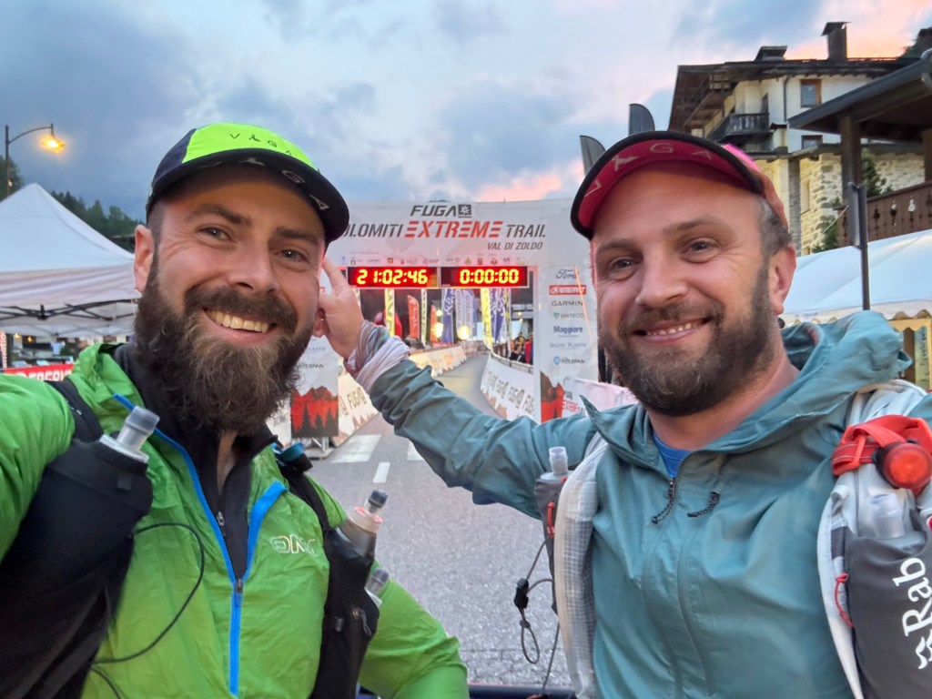
The why – Why did I sign up to do a 100 mile run I’ve already run? Why did I sign up when I swore I onl want to run 100 mile races that offer something truly different and special to me? Western States is why… As I mentioned in my last post about the Glossglockner Ultra Trail, I now needed to complete a qualifying event to be eligible to enter the lottery for the Western States Endurance Run. I toiled with many other qualifying races, but the logistics, costs and timings were all unfavourable. So it was really coming down to doing one of the Centurion Running 100 milers. I didn’t want to run the NDW, so it was a bad place to start in terms of not really being mentally invested, but the logistics were just by far the easiest to accommodate. Despite this, the desire to get that WSER qualifier was strong enough to ensure I would finish though.
The short notice planning – Signing up to a 100 mile race with just a weeks notice is weird. It did however remove a lot of anxiety involved with the lead up to big events. Whilst it was kind of silly, it also feels good to know that I can do that. Not just start. But finish strongly! In the week leading up to the race, I went back and compared my previous time with that of Paul and Maria. We were all similar (finished within 30 mins of each other’s times over different years) but had massive variations in our pace. Maria was consistent throughout. I blew up at 50k, but then covered the last 40k significantly quicker. Paul had a speedy mid section and then blew up at the end.
My 5,6,7,8 Plan – From this I made a plan. Finishing was the goal (that is enough for the WSER qualifier). Finishing quicker than my 2020 time would be nice. I figured if I could move more consistently it would be a good day. I broke the race into 4 x 40km and gave myself a really intelligent and thought out arbitrary timings for each. Do the first 40km in 5 hours. The second 40km in 6 hours. The third 40km in 7 hours and the last 40km in, yep you guessed it, 8hrs. That would give me a 26 hr finish. Nice. Now the more informed reader will be aware of a gapping flaw in that plan. The race is 103 miles. So not exactly 160 km as per my plan. It also didn’t accommodate for any ‘dwell time’, of which there would be plenty. But I didn’t care. That was enough of a plan for me to be satisfied.
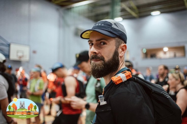
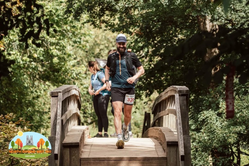
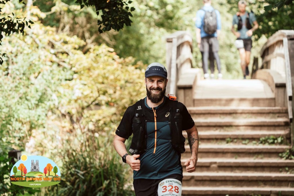
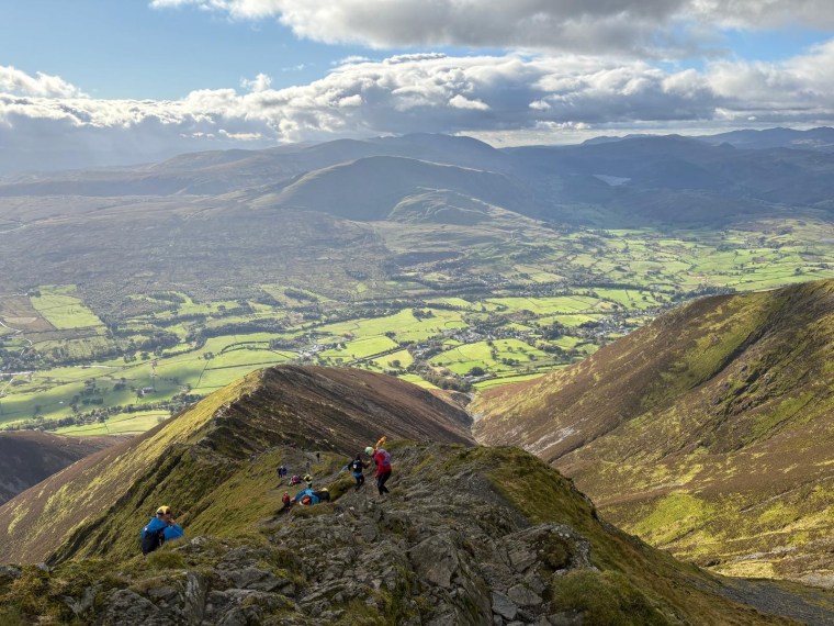
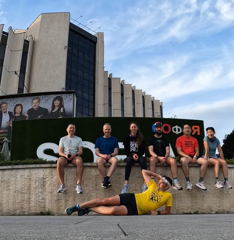
Official Photos thanks to Pierre
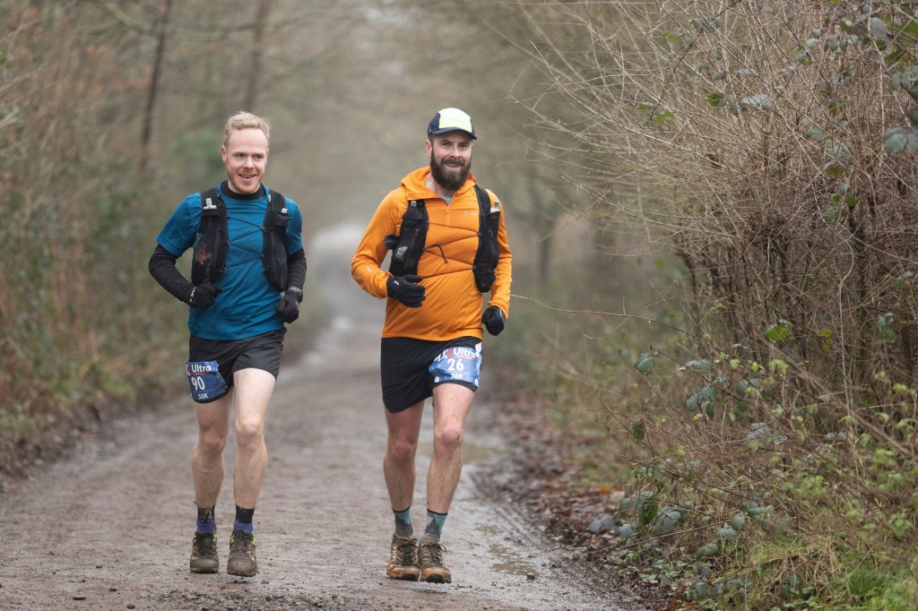
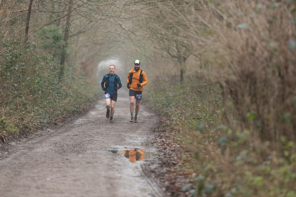
The friendly faces – There were many people I met at the start, during the race and at the finish. At registration I saw Pierre who was working as the Official Photographer for the event. Thanks so much for the pictures! Sarah who I met during registration and then ended up running the first section with. We had a good ‘ol natter and put the world to rights. Come the first aid station I couldn’t keep up though and she sped off. After box hill I never saw her again as she finished an impressive 3+ hours before me as fourth lady. Incredible performance. There was also Frank who was volunteering at Box hill. Thanks for the mood boost and filling me with food and water! Ian and Jamie were at the finish line and were out pacing other runners throughout the night. I always see them both at various races, Ian I shared many miles with on the North Downs Way back in 2020! Then there was Jamie (another) and Robin who I shared some miles with throughout the day. Always good to have company.
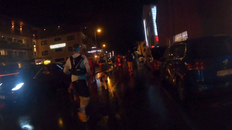
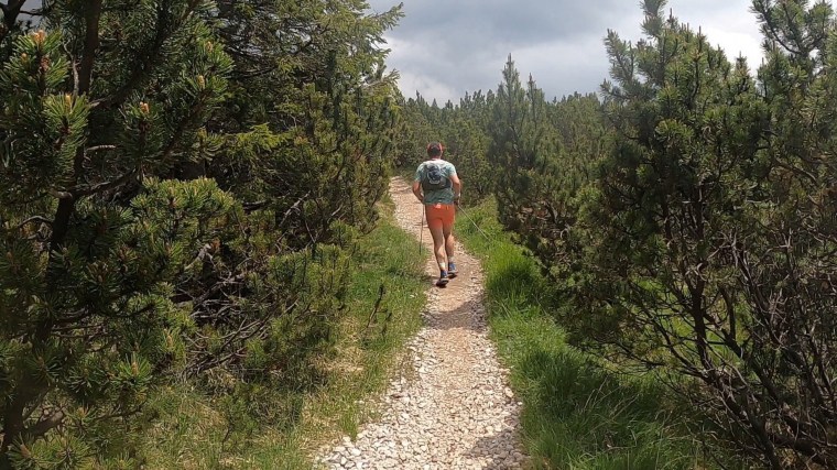
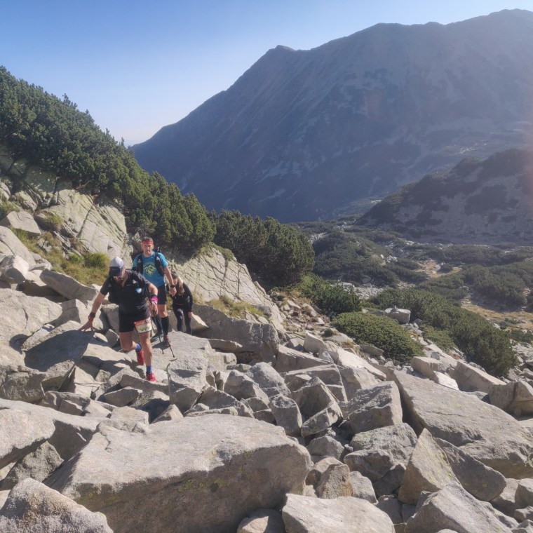
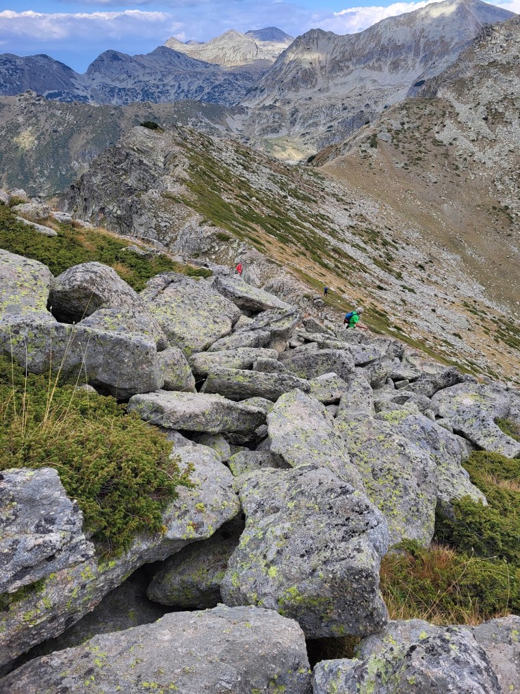
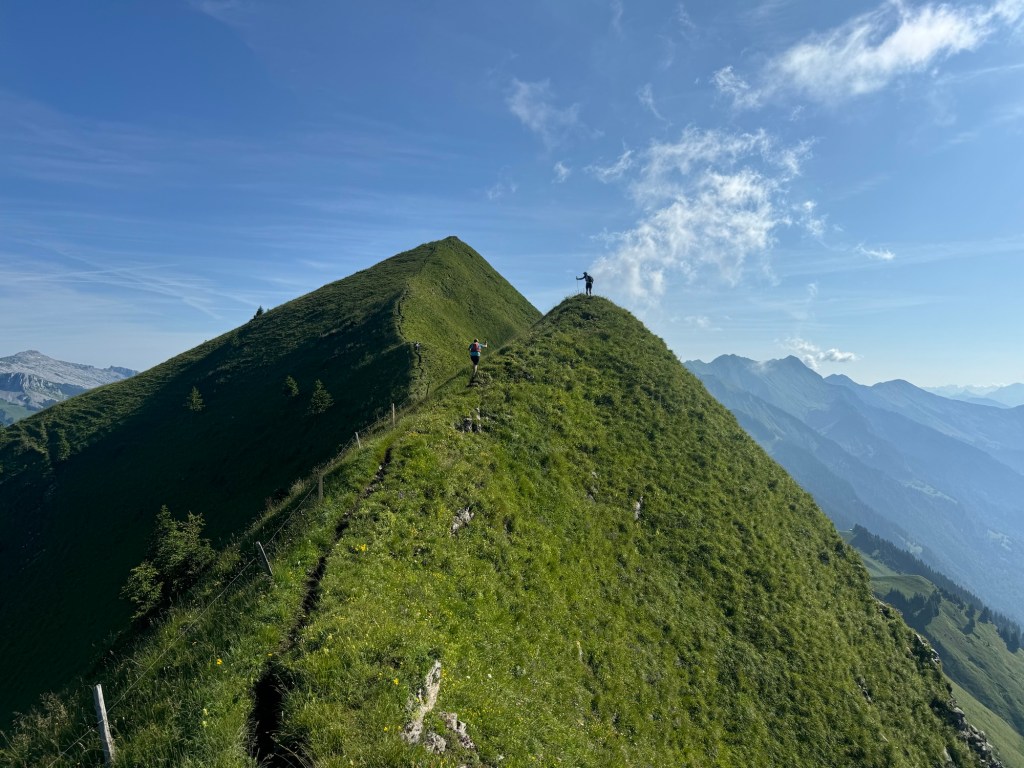
The first 40km – The start felt good. There are lots of flat sections and runnable trails from Farnham to Dorking. I ran pretty hard. Think I did it in about 4.5 hours which I was very happy with. The section after St Martha’s in particular I don’t enjoy (it’s so flat and repetitive) so I was glad to keep moving through these sections. At Box Hill it amused me how people have turned Box Hill into a mountain. The amount of huffing and puffing and sweating. The amount of runners using poles. It’s become this mystical beast. People walk up there in their Gucci trainers carrying buggies for fuck sake! It’s only about 100m of climbing!
The North Downs Kiss – I was running the section from Box Hill to Reigate with a guy I met called Jamie. Chatting away I must have completely switched off. I stubbed my toe and fell spectacularly. I let out a whelp and did a sort of shuffle stumble forward. Thankfully the shuffle gave me time to react and break the fall. Rather than go down like a sack of spuds I sort of skidded along the trail as I gave the North Downs way a kiss. Frustratingly it’s a Root-y, lumpy area and I did feel some impact. Grazed arms and knees mostly and I was covered in dirt which clung to my sweaty skin. I was shocked. It messed me up a bit. I was happy and moving well. Now my body was shaking and my mind wobbled. I couldn’t shake the thoughts about what damage I might have done. I told Jamie to run ahead as I walked and tried to compose myself. It took me a few km. I walked up Reigate hill and walked / shuffled to the aid station at Reigate cafe. I took ten mins here to sit down and breathe. I was ok. My hip hurt. But I was fine. The rest did wonders and I was able to shift the negative thoughts and get back out there. Turns out I didn’t break the fall entirely. A week later I still have a massive bruise on my hip which has gone through the whole spectrum of black, blue and then yellow!
North Downs Kiss – A week later the bruising was subsiding
Caterham – Running through Caterham was odd. 8 months ago I moved there. Now I was 38 miles into a 100 mile event running along trails I run every week. It was a mental thing running past knowing I could quit and be home within a few kms. It was never going to happen though. It also surprised me how hilly it is here. I run these trails without thinking every week, with 38 miles in the legs you feel every incline!! From Caterham to Otford it was hot. Not like in 2020. But it was the warmest part of the day on one of the most exposed parts of the trail, running through many open fields was tiring and energy sapping in the heat. I clocked the second 40km including an extended stop at Knockholt in about 6 and a half hours. Perfect. Right on time. Ready to go get Paul.
Secret Service – Leaving Knockholt a spectator made a weird joke about “look out for the secret services”. It went over my head. Down the country lane we came across some coppers. I thought nothing of it. Later on I found out that JD Vance was in town visiting the Foreign Minister who lives down that lane. So there was a high security presence. The joke made sense then all those hours later!
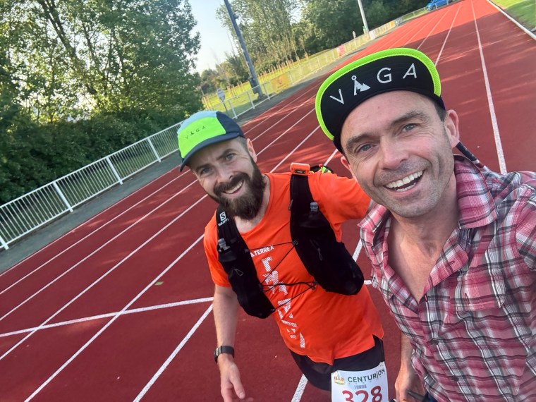
Meeting Paul at Otford – It was good to have a friendly face and someone to chat with. It had been a while since we’d seen each other, longer than usual! So it was good to catch up here over the next 14 hours or so. He’s such a top guy and happily volunteered to support me through the NDW to get the WSER qualifier.
Night time – I’d forgotten how many road sections there are in the race, even so in the second half of the race. There was a long flat section after Wrotham (about 60 miles in) that I couldn’t remember. And the roads to Blue Bell Hill and those at the end through Ashford were also longer than I remember. Conversely, there were a lot more hills in the last 30 miles than I recalled. A few of the obvious once I recalled but there were lots of undulations I’d completely forgotten about. Also at night the red moon at was epic. Here’s a picture from Pierre the photographer.
Bluebell Hill – Once upon a time there was an aid station here. There isn’t any more. It threw me. I thought I looked at the race instruction but clearly missed it. It was annoying as mentally I was looking forward to the stop and break. It made the section harder mentally as we carried on for a few more miles before reaching Detling. On the climb to Bluebell Hill I ticked over the 120km mark. That last 40km was a tad over 6 hours, far better than the 7 I’d planned for.
Pot Noodles – My drop bag for Detling (mile 82) was just 4 Pot Noodles. Nice and simple. Making sure me and Paul had something to fuel us for the last 20 miles. Paul wolfed them down. I spent 30 mins trying to get through them but only managed one and a dribble.
Sleepy Time – Arriving into Hollingbourne I was tired. Very tired. I’d shut down and was just trudging along. Not really talking. I was swaying aide to aide and my eyes were closing. I tried a 2 min trail nap but it wasn’t enough/ didn’t work. I told Paul I needed a 10 mins stop and wanted something I could sit on. Thankfully the ‘cyclist/ramblers rest’ spot on the Pilgrims Way had a lovely bench. We stopped and had a snooze. A little while later I was still sleepy. It was starting to get lighter but in the forests it was still pitch black. I found a stile and had another ten mins. I think I went to dream land on this one. Paul woke me up and I was fine afterwards. Daylight had arrived and the tiredness subdued.
The second sleep, the one that worked
The Pilgrims Way – This last section, the last 10 miles, was a constant plod and shuffle. Way better than 5 years earlier. The trails are now flatter with gentle undulations and mostly on gravel tracks until the last 3 miles of road to the finish line. We had a sit down and coffee at the aid station at Lennham and then breezed through Dunn Street into Ashford. It took about 8 hours to cover the last 40+kms.
No idea why I’m flipping the birdHeading to Ashford
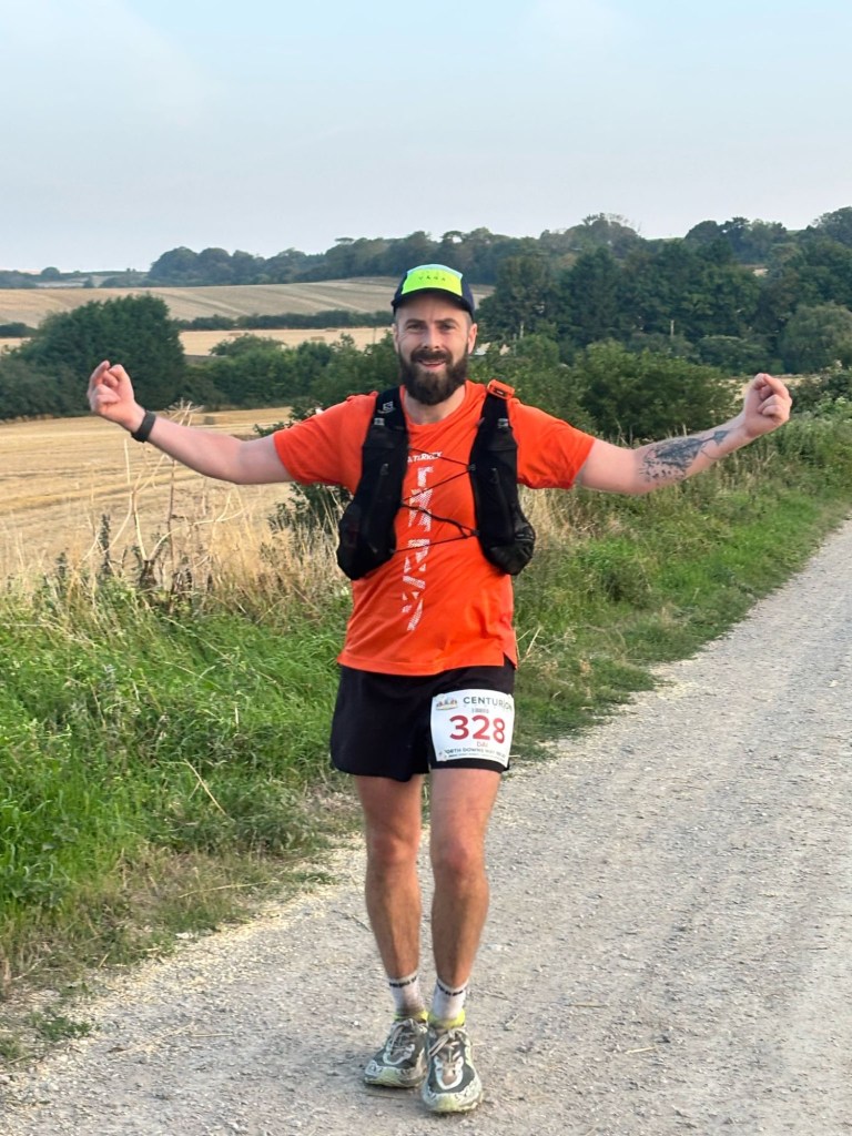
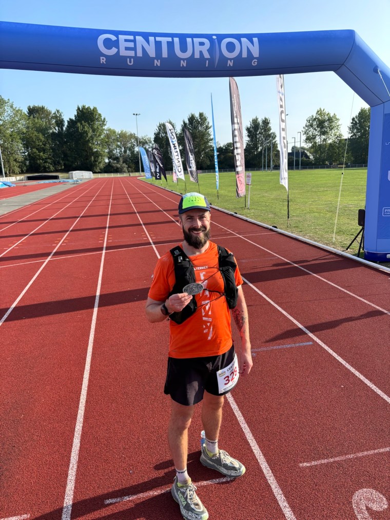
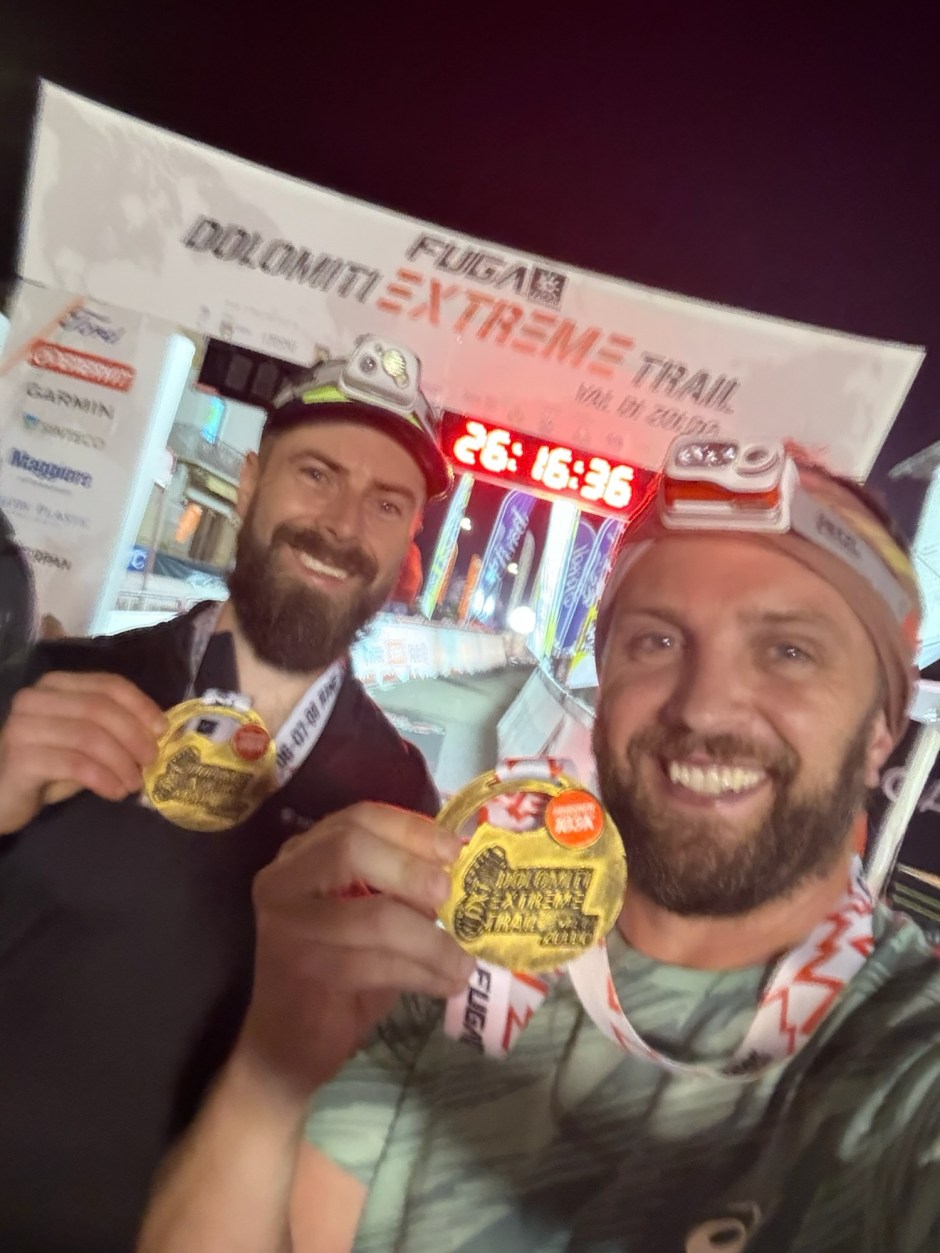
The Finish – I crossed the finish line in about 25 hours and 20 mins. Almost 2.5 hrs quicker than when I ran the route in 2025. Pretty much nailed my 5678 plan. I’m aware that a sub 24hour finish is possible. I don’t need to move faster. I just need to spend less time at aid stations – the tracker suggests it had almost 2 hours of dwell time. I looked up other runners finishing hours before and hours after me and many stop at aid stations for only a fraction of that time. Still, it works for me. I like to faff about.
Final Thoughts – As always all the centurion staff and volunteers were awesome. It is such a well planned and organised event, as are all the Centurion races. And so, the objective was achieved and the bonus secured. A Western States Qualifier for the year is obtained and the dream is kept alive…And of course the biggest thanks to Paul. Since I mentioned the Glossglockner cancellation he was in my corner supporting me. Helping look for alternatives. He made the logistics for the NDW much easier and cheaper too by letting me stay in Guildford the night before, driving me to the start. Insisted on keeping me company for almost half the run. Drove me home. Looked after me. Not many would do so much. Only a few weeks back he flew to the states to do the same for Matt at Hardrock100. He’s one hell of a good friend!
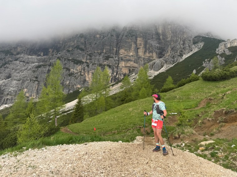
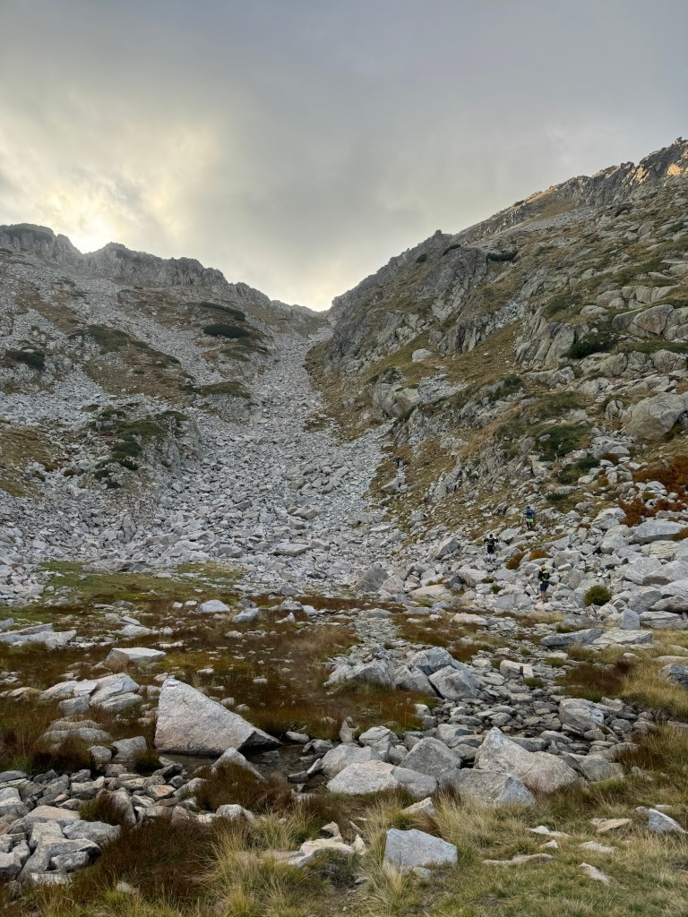
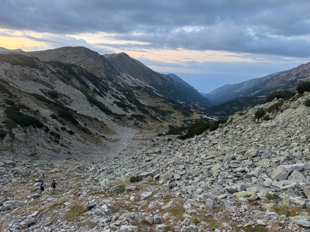
We arrived into Kaprun to be welcomed by the rain. Immediately on the drive in the mountains were spectacular, towering above us in all directions. We managed one dry little hike the day before the race. Other than that, it rained, sometimes torrentially, for the few days we were there before the race. We also took advantage of the physio taping available, each addressing our own little niggles. Mine, some weird heel issue that has come out of nowhere to cause me pain (so much so that I added Codeine to my medical kit incase I needed to ‘block it out’).
Whilst the rest of us enjoyed a lazy morning, Ale did the 37km race, where he ran along the first 30km of our route, only in the opposite direction back to where we would be starting later that night. At the finish, he was soaked, but happy. That afternoon, the safety briefing for our race was released. It was comprehensive and very detailed. As we suspected it might be, the course for the other races was changed. For the 110k there were two changes, both in the second half of the course, we’d lose elevation gain and instead be re-directed through the valleys rather than up and over the mountains. We were ok with this change, the other potential change (that we were aware of) that could have happened was a complete re-route of the first 30km where we’d follow a road around the mountain. We were glad we wouldn’t be doing this diversion. They also changed the cut-offs, reducing the overall cut off by 2 hours. I guess that suggested the course would be ‘easier’. It didn’t affect my plan though – I intended to finish within 28 hours as that was the time required to use the race as a qualification for the Western States (WSER) run which I keep trying to get into.
Me and ‘Zincke’ twinning at the start
At the start line it was raining hard. Jon and I kept dry as long as we could. Just before starting the rain eased up and the MC indicated that they didn’t think it would rain anymore. Knowing we would be climbing uphill for pretty much the first few hours (we’d cover just shy of 2,000m elevation gain in the first 20km), I removed my coat to avoid overheating. Naturally, as soon as we started running it began raining again…
Running through the streets
The route started in the main town square. Immediately we were walking as they funnelled the runners right after the start line for some reason. Then it was a free for all along the road. I ran with Jon to begin with. After a short while we left the road onto some wider gravel tracks and then about 2km later we hit a climb. The poles came out as we slowed to a walk up the switchback narrow tracks. But it didn’t last long and we flattened out pretty quickly and started running again. I kept moving with the crowd and lost Jon in the masses. After the climb we ran first through muddy fields and past a building site/quarry of some sort before we were back on the wide gravel tracks again. It was an ever so gradual incline as we ran passed the Sigmund Thun Klamm Wasserfall that was spectacularly lit up in different colours in the night.
A picture Jon captured of the waterfall. Far better than the one I attempted to capture!
It proceed to rain and piss down as we made our way uphill, the climb getting steeper and steeper. There was a combination of narrow tracks, switch backs and wide roads. Occasionally, heavy machinery passing us on the roads in the night. We made our way through numerous tunnels, some on the roads, and some on the trails. They added a bit of adventure to the course. So far, so good. The climb was long, but easy going. The terrain was varied and, early on, at its hardest it was because of the water and how muddy the trails were. We weaved around the mountain, crossing many streams through the early hours. I was soaked right through, head to toe, but mostly warm. I told myself I’d re-assess the clothing options at the first checkpoint once we got higher. The decision was almost made for me as we passed through the bigger of the tunnels, running inside a narrow footpath beside the road.
TunnelTunneltunnel
As we emerged back out to the footpath, there was a queue of runners and a marshal. We were going to navigate along the cliff edge. There was no path anymore, just slippery rocks and a sheer drop below us. There were metal rungs occasionally there to aid our step and a metal cable along side for support. It was slow going. The worst part, above us over the mountain, the water was gushing down and we were essentially crossing a waterfall. It was a cold, midnight shower. Suddenly I was drenched and freezing and knew I’d need to put on a warmer layer at the aid station. Thankfully it was just around the corner once we were back on solid ground.
We were 2,000m up now. It was much colder. There was a large gazebo on the side of the road. It was the first aid station, Mooserboden. Like me, other runners were changing tops/putting on jackets as a priority. I put my coat straight on. Whilst I was wet underneath, I knew keeping the cold, windy air off my body would be sufficient to keep me warm. The effort of the climbing would mean my body temperature wouldn’t drop. I quickly had some warm potato soup (amazing!), filled my bottles and set back off.
A picture Jon took somewhere along the first climb. That might be the first aid station shining bright in the distance
Now we had one of the more spectacular sections of the race, alongside the damns and reservoirs above Kaprun. Only it was about 1am, so there was nothing for me to see. The route here was fairly flat and a mixture of pathed roads running across the damns, then rocky trails along side the streams that fed the reservoirs. It was undulating with a few climbs and again very muddy on the trails. I wasn’t expecting this, but it made so much sense. Even in the darkness I could sense the presence of the mountains, they were huge and dominating. They create their own weather system in the area and the vastness of the water-cycle became obvious.
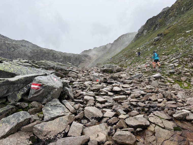
After 4 or 5 km of these trails we started climbing again. It was steeper than before. Again, initially muddy, then progressively steeper and rockier. The rocks became boulders and it was a slow slog. Occasionally a little scrambling was required. Watching videos of the course I was mentally prepared and had put my poles away along time ago. They wouldn’t help on the giant, slippery rocks and the freedom of my hands for scrambling was a definite winner. At the top, a narrow squeeze through the rocks took us over the summit. I took a mount to breathe, looked down and assess the descent.
It started with a slow scramble down, using my hands to lower myself between rocks. The rocky switch backs then dominated the track as we weaved down slowly. As the rocks became smaller, the trail became narrower and wetter once more. I was moving freely though. Behind me another runner stuck with my pace and we started talking. It was a guy called Jakob. Between us we struggled to navigate in the darkness. The mist and clag severely limited our vision and the head torches couldn’t pick up the reflection of the course markings. It was slow but steady progress together. Thankfully I remained upright throughout, despite the odd bog reaching above my shins. For parts the trails reminded me of the boggy trails I’d run in Norway.
After the descent the trails were similar to before – flooded, muddy and narrow. Once more we weaved across many mountain streams as we made our way to the next climb. This one was a little slower going. It felt steeper, the rocks felt bigger and my breathing felt heavier. We were open to the elements up high and the wind was howling. After about 300m or so we emerged at the next aid station Rudolfshutte. Jakob set about tending to his feet and I went and had a few vegetable soups. The warmth and saltiness of the soups were delicious. Best I’ve had on a race for a long time. I didn’t stop long and went straight back out.
In the darkness of the night I ran down the path out of the aid station, a straight, fairly steep downhill that woke the legs up. It wasn’t long, although with the mist I couldn’t tell. At the bottom I found myself running with a few others. It was stop start as we navigated the course with difficulty. After a while we completely lost track of all markings and found ourselves to be off course. We’d followed the more obvious path, but now needed to back track a few hundred meters. Back on course we were climbing again. Just like before, out in the open on the mountain, steep rocks leading us up. There were no switch backs here. Just head down and follow a straight line up to the summit of the climb. It was once again slow going but I kept moving. The higher we climbed the colder it got.
An Image Jon took showing the terrain on some of the climbs. I assume this was the last summit before the long descent giving the darkness had gone and he wasn’t far behind me.
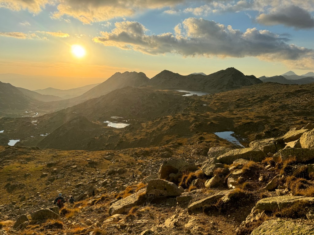
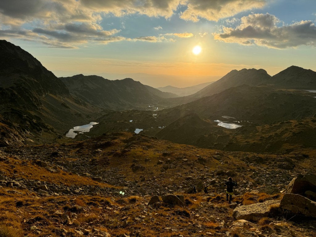
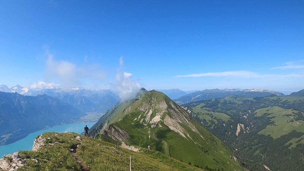
When I reached the summit, I felt on top of the world. Morning was slowly breaking and the darkness of night was becoming more grey in the rain. Visibility was improving as I headed straight back down. I knew now it was all down hill to the half-way mark. It was about 16-18km of downhill though! The initial descent was steep as we clambered over the boulders to lower ground. Then we followed narrow switchbacks on loose scree. The ankles were screaming, but the descent was quick. After descending a few hundred meters the incline decreased and the trails became less rocky.
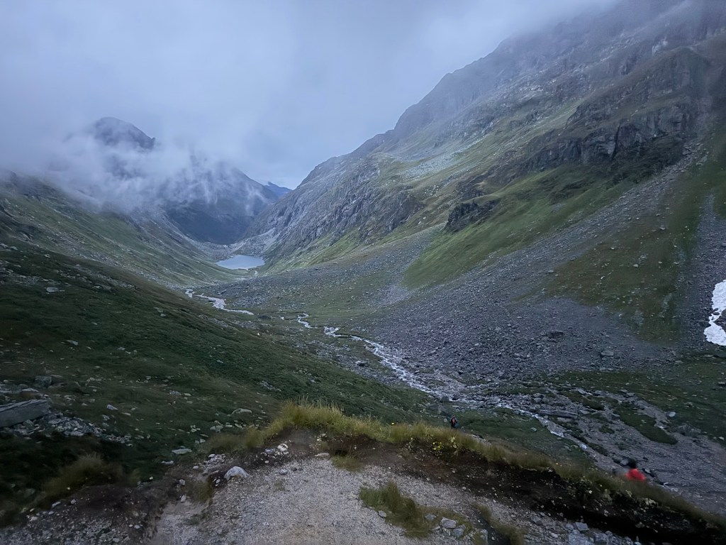
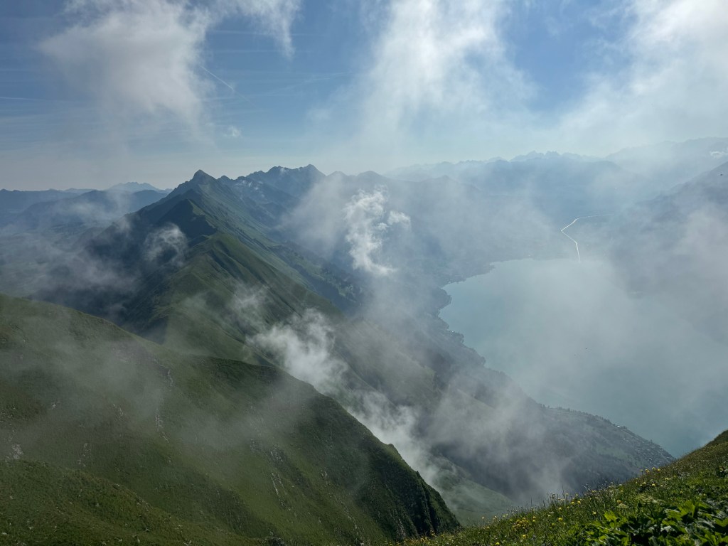
The morning was clearing up, the rain stopped and I finally had enough light to get a glimpse of the surroundings. Wow! We were in a vast valley. Surrounded by huge mountains. It reminder me of those in the French Alps. All around us were spectacular rock formations and huge waterfalls. I tried to take some pictures, but the lighting didn’t do it justice. Jakob went flying passed me as I continued to plod down. Way off in the distance was a lake where I could see runners heading too. From there who knows where the course would take me…
Looking back on the summit as the darkness gave way to lightIncredible valley.
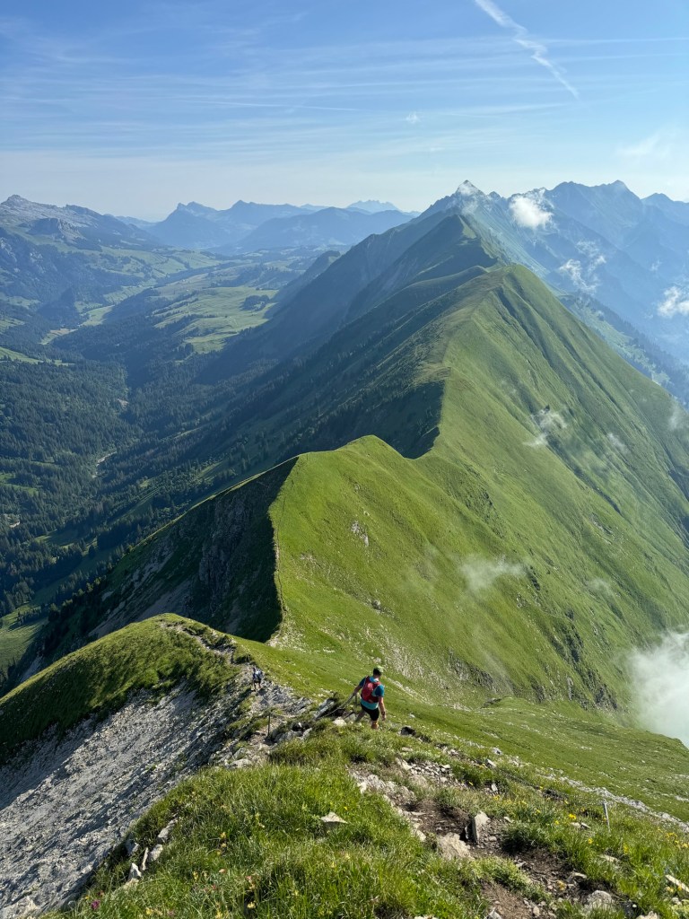
It felt like an eternity, trundling with wet, muddy trails and dry gravel tracks to make any progress. Occasional short inclines brought brief moments of rest. I was conscious that I was going to destroy my quads, but this was probably going to be the best trails and terrain I’d get for any consistent running, so kept moving. Partway down there was a water stop at a farm. Well, water and beer. I filled my bottles (with water!) and left, carrying on the consistent pace where possible. There was another runner here, Jan that I started chatting with and we ran pretty much all the way to the aid station together.
Closing in on the lakeDown we go
At one point on the descent, the trail took us through another tunnel. Jan was way ahead at this point as I entered and tried to film the tunnel. It was however longer than I expected and pitch black inside. As I ran I fumbled around to find my head torch. It was a huge tunnel. As I ran I could here a rumble. It was loud. Like the night before I assumed there were works and heavy machinery somewhere. It grew louder and louder and I couldn’t ascertain where it was coming from. Then I looked behind me and saw a faint glow of headlights. There was something very big coming behind me! I stepped up the pace. I was almost sprinting in the dark. There was no where to step aside in the tunnel. I could see the daylight ahead and ran as fast as my tired legs would take me. Outside Jan was waiting and moments after me a huge tractor and trailer emerged right behind me. I made it just in time! A race within a race.
The last few kms into the aid station were a walk run as we ran through the town and up to the aid station. As I arrived the 50km runners were lining up about to start. The MC called out “one minute to go”. I looked for my friends in the crowd but couldn’t see them. So I started screaming their names. The runners loved it. Many cheered back, many clapped me and there were a few hi-fives too as they set off running passed me in the opposite direction, to begin their own adventures.
Inside, I got my drop bag and did a full kit change, dried and cleaned my feet, reapplied some tape and had a nice warm pasta dish. I spent a little over 30mins preparing myself. I felt good. Very good. It had taken just over 10 hours to get through Kals, which was just shy of 50km. As tough mountain 50kms go, it was alright! For comparison it took over 13 hours to do a similar distance at the Dolomiti Extreme Trail recently and Stranda Fjord 3 years ago took me about 12 hours. I psyched myself up to head back out in the rain, optimistic I’d be finishing far quicker than I planned for.
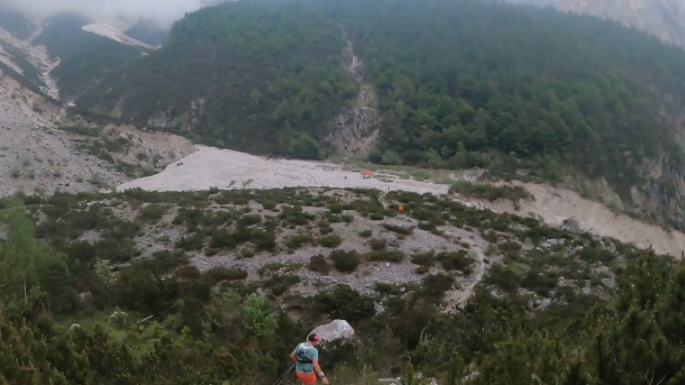
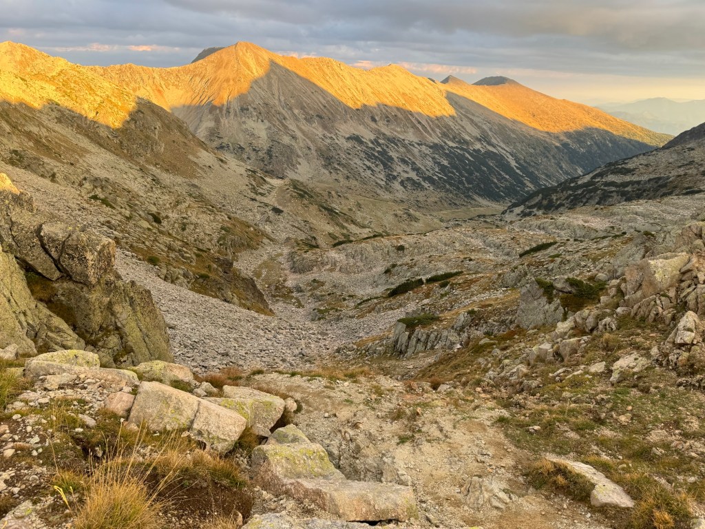
The long, diverted climb after Kals where my race ended
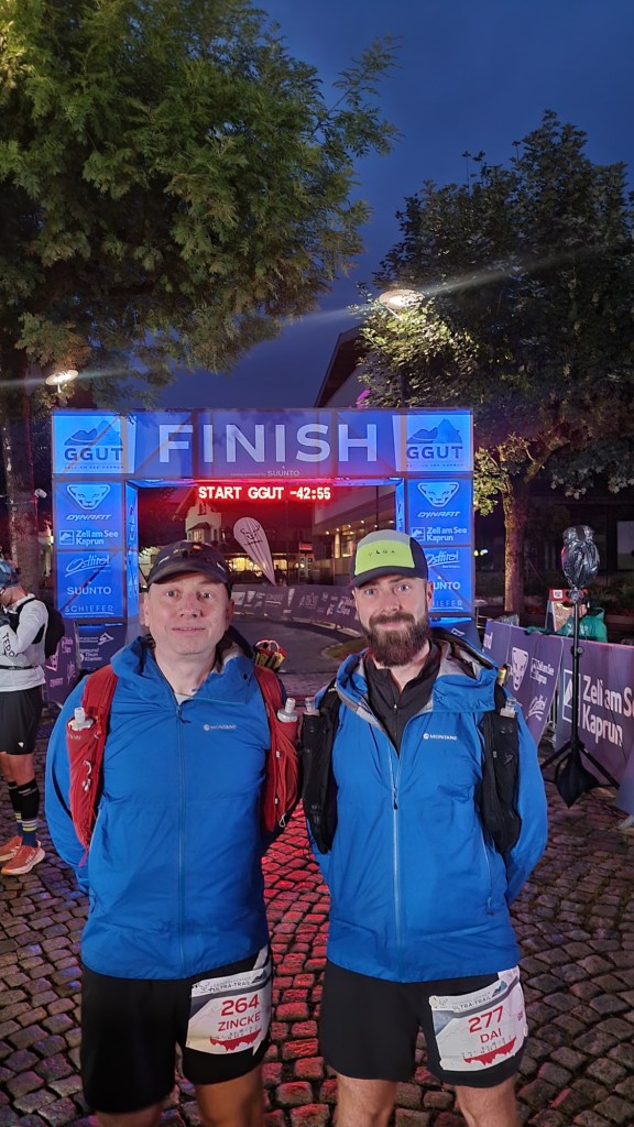
Only I didn’t realise just how quickly I’d be finishing… After leaving the aid station we were on wide un-pathed roads. Climbing almost immediately. Some parts were fairly steep but overall it was a manageable incline to hike steadily. I passed the turning where the original course would have take and probably got about 2-3km along, climbed maybe 300m before I saw a runner coming down hill. I assumed they were either not in the race or had decided to quit and return to Kals. Then they stopped me and explained the race had been stopped. Cancelled. It was over. Due to weather conditions near the GlocknerHause the organisers had decided to stop the races and runners were to return to the nearest Aid Station (either Kals I’d just left or to GloreHutte for those further along). I was in disbelief. I didn’t want to believe them I stayed there and waited as they headed back down. A few moments later more runners were coming. Acceptance set in. Once of the runners was Jan and he confirmed he’d spoken to his wife who’d said the same. Begrudgingly I turned around and began slowly heading back to Kals too. On the way down more and more runners passed me.
As I descended I got chatting to another, a French chap. We acknowledged it was disappointing but safety is always the right call. He said that the organisers were arranging for buses to transport runners back to Kaprun from the aid stations. At Kals, I looked for Jon and the others but couldn’t find them. Then a lady announced there were two buses. I made sure I was on one. An hour and a half later I was back in Kals where it all began. A whole day ahead of me with no idea how to use it!
As disappointing as it is, it’s always the right decision for an organiser to prioritise safety of runners above everything else. People will moan, but no organiser wants to cancel their race! I was glad to get on the first bus (good timing!) as some of the others waited hours for buses. The only thing I’d criticise is that since the race was cancelled, and still, there has been no communication from the organisers whatsoever to participants directly. An explanation of some sort would be appreciated. That said, I’d definitely go back to this race and finish the job! I was running well and on for a good time! I also feel bad for my friends on the 50km race that only managed a few kms before their race was cancelled less than an hour after they began!
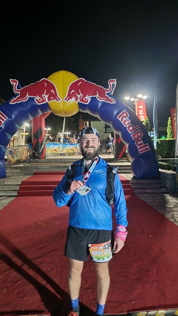
Later that week I emailed the organiser of WSER to see what the situation would be regarding qualifiers. They quickly responded saying they’d still accept the GGUT as a qualifier IF I’d reached GloreHutte before it was cancelled. Sadly I didn’t and was probably still a few hours away from that point. So I immediately went off looking for another qualifier. I looked at several options and begrudgingly signed up to run the North Downs Way 100, again. Logistically it was the easiest and most sensible option. The race is next week… yeah, a 100mile event at a week’s notice can be ‘sensible’ with this addiction!
Here we go then. The first ‘big one’ and real ultra test of 2025 – the Dolomiti Extreme Trail. 103km of trail running around the beautiful Dolomites. It wouldn’t be my first running adventure in the Dolomites – back in 2019 I ran the Lavaredo Ultra Trail – so when Matt messaged about joining him for the race, part of me thought ‘oh I’ve been there and done that’ but after looking into it I realised the race is in a completely different part of the region. So I was in, ready to explore some more of the beautiful Dolomites.
Leading up to the race, the organisation seemed top notch. There was a plethora of information provided and heaps of services for runners. For example, being in a small town, many runners would be staying in other parts of the valley and a bus service to transport you around, between registration and hotels and to and from the start and finish was provided. This would be great…
We were staying a little further up in the valley in Mareson and I flew in the night before Matt and stayed overnight near the airport in Venice. We rented a car and drove over the day before the race. We checked in to the hotel and were all set to use the bus service to head down and register. The hotel even called the organisers and confirmed the bus schedule for us. We hung around and waited for a bus that never came. The hotel owner’s son very kindly drove us down to the Forno di Zoldo to register. After registering we checked and asked about the buses (and also ‘booked’ our bus back to the town for the start the next evening) and were told ‘oh, the buses aren’t running today’. Despite them being advertised and the schedules being provided to all the hotels and confirmed over the phone a few hours earlier… this was frustrating. It also seemed unclear whether we’d be able to get a bus back in the early hours of Sunday morning when we were likely to finish. But that was a problem for two days time. As we left to find our own way back up the valley, It was at this moment we joked ‘Never trust Italians’. The phrase held true for the whole weekend…
Friday evening we were making our way down to the start line when we were talking to the hotel owner’s son again. He wished us well and said he’d be volunteering at a checkpoint. We didn’t recognise the checkpoint name and after a little discussion it became apparent from him that we’d be doing an alternate route due to high snow levels on the summit. We hadn’t been told this… he also mentioned that 8 out of the 10 years of the event the alternate route had been run (sounds like it is the main route rather than the alternate!). At the start line we confirmed and clarified this with someone from the organisation. With appropriate mental adjustments and re-calculations made, we were set. We left our drop bags off at the dedicated zone and waited for the race to begin. A little while later in the start pen, just a few moments before the race began, there was a medical emergency for a runner and the start was delayed whilst they received medical attention. Then, a little after 10pm we began…
Calm before the StartPenned in, ready and waiting
The race began quite quickly. 100s of runners running fast down the wide main road. A gradual decline, the pace was excessive for the first few kms of a 100km mountain race. We were caught up in the moment trying to maintain our place in the pack. We ran down and through the tunnel we drove in through on the way in the day before. The tunnel seemed so much longer on foot! Leaving the tunnel we left the road and hit the trails at Le Bocole. Loads of runners stopped to ‘water’ the piles of gravel and aggregate. Then we had the greatest ever bit of support from a local (I assume) as they rev’d a chainsaw above their head in the darkness of the night “Vrrr Vrrr Vrrr”. It was different and made us laugh and a real talking point!
Legging it down the road
My memory of the course was a long single track climb that lead to a real dense forest where it was very soft underfoot. The floor was covered with pine needles and bounced and wobbled under our weight. Through the forest we climbed higher and higher in the humid night. It was hot and stuffy. Very hot. Somewhere the trails opened up and we had some enjoyable runnable descending for several kms mixed with a few short technical descents and bottlenecks at each. One technical section had quite a pile up as runners had to cross a fast moving river. Volunteers lit up the river with massive fires and helped ensure we all crossed safely.
One of many bottlenecksRiver Crossing
The other side of the river led us back up a very steep long climb and back into the humidity of the night. The forests around us smelt so fresh and the night was so peaceful despite the sounds of runners huffing and puffing their way upwards. Once more what went up must come down and so we did once again on an enjoyable descent that was a joy to run down. It lead to the first aid station, a water only stop where we quickly refilled and moved on.
Looking back, this first section was probably one of the easier bits of the course but also gave the first insight into the route. Throughout, and what followed was long and steep, very steep climbs. Each one caught us out and we moved slowly. The terrain however changed and the ground became softer and wetter and harder to move through. A few days of relentless rain and storms had saturated the mountains and made them far muddier than I was expecting. Our pace on the climbs dropped as we moved more slowly. The descents too became rockier and more technical. Gone were the lovely runnable descents we’d first encountered.
As we continued the theme of the night became persistent. It was hot, very hot, yet we were very cold with the sweat of the humid night and gentle breeze. When the mud subsided, it gave way to big rocky sections and boulders to climb up. The combination was exhausting. We ran through forests, passed lakes and broke out into lightly coated snowy trails on the side of the mountains. Despite the steep climbs, we weren’t hitting summits and were skirting around the side of them. As we descended back into forests the day light started to break through the darkness and we could see the shape of the magnificent landscape around us. It was early in the morning and the birds were bringing the music and soundtrack to the trails.
Reminiscing, the trails of the first 50km have all blurred into a series of tough climbs, muddy trails and rocky technical sections. At one point there was a particularly technical descent with a safety rope/chain. Runners were tentatively making our way down when the lead runner of the 50km zipped passed. He flew down, barely touching the ground. No chain or support, no fear. He descended effortlessly and out of sight in the time it took me to cover a few meters of the descent. It was so impressive.
Step descentRocky and technical
After a few aid stations it became apparent that the information on the distances and tracks between them was a bit… iffy… some aid stations would come around far quicker than expected one was even 3 or 4kms earlier than we thought. We stayed high for a while and had some pathed road sections that climbed between aid stations. After one we could see runners far off ahead going up a ski track. Soon we followed. It was short but steep. Naturally after a while we had to drop the equivalent on a steep descent down.
By now it was close to midday. The temperature had soared and the humidity persisted. I was looking forward to a change into dry clothes and tending to my ‘personal’ needs at the half way mark. It wasn’t long before we were making our way to the half way mark where we’d have our drop bags. It was at a refuge we’d visited in the car the day before. We recognised the trails and we happy to arrive.
The aid station was chaotic. A big marquee was full of runners from the 100km, the 70km and the 50km. Supporters and families of the runners filled the tent and we struggled to find a place to sit down and make space for ourselves. We bunched some others up on a table and also identified a volunteer who was sorting the drop bags. We gave her our numbers and she said she’d get our bags and bring them to the table for us. Great. But this is where things went a bit rogue. Remember, never trust and Italian!
As we set about our ‘break’, we were a bit deflated by the lack of hot food or variation to food at the aid station and settled in for some more of the very bland and tasteless ‘soup’ with some small bits of noodles which had been available at most aid stations. It was by far the worse ‘soup’ I’ve had at a race. We stripped off our wet clothes and sat topless in our pants, sweating away in the busy tent. Time was passing by and we still didn’t have our drop bags. We had to ask again 3 or 4 times over the course of about 20 minutes. The woman kept saying they were coming, she also came a few times to re- ask our numbers. It was irritating. Eventually Matt’s bag showed up. But mine didn’t. God knows how much more time had passed when she started bringing other people’s bags to me. It didn’t make sense. Finally she told me they couldn’t find my bag and to put my shirt on and go look for it myself. Not what I wanted to be doing…
Annoyingly the drop bags were located a little distance away from the marquee. And this is where I could see the problem. It was essentially a human chain, like ‘Chinese whispers’. Volunteers passing numbers verbally between them. Then telling kids who’d run off and collect the bag and return it. No wonder she was bringing the wrong numbers and having to keep asking what was our number. It was just chaotic confusion!
At the bag location the volunteers all spoke little English. One German lady was very helpful and also very traumatised that they couldn’t find my bag. Sadly, regrettably, she was getting the blunt end of my frustration. She was explaining that they didn’t know where my bag was, and suspected it had been sent to the finish line. I could see the pain she was experiencing as her ‘system’ had failed and she couldn’t explain or account for why my bag was there. My issue though was that it was all guesses. I wanted clarity, if they could confirm where my bag was, my mind would be at ease. With a late night finish expected, and an early wake up to drive to the airport, I wouldn’t have the time to go looking for my bag the next day. It took a bit of persuasion from me to get get them to call the finish line and look for my bag. The lady also roped her husband in to translate as he spoke more English (and I spoke no German nor Italian!). This was helpful as the volunteers were planning on getting my bag brought back to the aid station if they found it at the finish! Through him I was able to express that this was not going to be helpful – I was cold from the wet clothes and needed to get moving again. I didn’t have the time to wait for the bag to be found and driven back up the mountain!
I went back to eating and waited a little longer whilst they tried to confirm where my bag was. The man kept providing me updates – it wasn’t at the finish line either, so they suspected it was now in a van on the way to the finish – but it got to the point where we had to leave. We’d been at the aid station for over an hour now. As we left, crossed the road back to the trails, the man came running after us. They’d found the bag, confirmed it was in the van and now at the finish line waiting. I thanked him. At least my mind was at ease now knowing where my bag was.
Despite knowing though, my mind had ‘gone’. For God knows how long I moaned about the experience. Much to Matt’s annoyance, I couldn’t let it go. I moaned endlessly about how it shouldn’t happen, the process had failed, what I didn’t have (my preferred hydration/personal effects etc.), that every runner I recognised that we ran near had changed into fresh clothes and I hadn’t… everything. I just moaned. I made bold statements about the harsh words I’d have with the race organisers at the finish, the regret I had for the frustrated tone I’d spoke to the very helpful lady with etc. for kms after the aid station and throughout the next 50km I moaned and moaned and moaned.
The only flipside was it lit a bit of a fire in me. I was very uncomfortable with chafe, wet itch clothes and worrying about how my energy levels would drop as I’d now be reliant on the horrible soup and weak isotonic drinks at the aid station, so I was pushing us an moving quicker with the single aim of getting it over with as soon as possible. Matt occasionally would have to reign me in and stop me from burning us both out, we did have plenty of time after all!
This first section of the second half the race was a long 11km stretch between aid stations. It was mostly the very familiar gradual climbs through woodlands and dense forests and long dirt gravel tracks. In our minds we would have a course split around this point and no longer have the masses of 70km and 50km runners with us. But our understanding of the course was off and we were ‘in with the masses’ for far longer than we expected. This made the trails busy and frustrating. There was a very long descend on the same terrain down into the next aid station which was in another town in the many valleys of the area. Matt saw an opportunity to visit the town hall and I waited for him at the aid station a little further along the main road. Here I had the cheekiest reminder of my bag drop situation. A volunteer saw my number and said “ahhh, you are the runner who didn’t get your bag / are waiting for your bag”. I said “yes, that is me!”. To which they politely but bluntly stated it wasn’t here either. I had to laugh. It was meant in the most helpful and supportive way, but with the language barrier it came like a slap to the face. Almost like hey you, guess what… I was able to see the funny side of this interaction at least.
After a short break we moved on. We were straight onto a pathed road. It was pretty much following this road for about 5km to the next aid station. Whilst not particularly scenic or enjoyable, the road did bring a bit of a change to the terrain and relieved a bit of the pressure on the feet and ankles which were now very sore and blistering.
At the next aid station we arrived to a mountain hut to the biggest welcome from the Lady running it. In broken English she reeled off all the things she could give us, including “Meat Soup”. She couldn’t understand our excitement when we repeated and clarified that she had soup with meat in it. She was saying everyone was reacting the same and she didn’t know why. We tried to explain how everywhere else the soup was terrible and even the thought of something more substantial was a blessing. Matt took one look at the meat and changed his mind (he did get a coffee, albeit a terrible one, it was the only aid station of the race that had hot drinks!). I took extra meat and enjoyed it with other runners like it was a last supper!
Steep climb ahead
We were soon back out on the course heading to the highest point of the race. We were joined by an American called Paul and spent the next few kms together chatting away. It was a very long and steep climb ibn the forest. One of the biggest of the course. The foliage here was so different to what we’d experienced previously with massive leafy plants covering the ground as we hiked up slowly. The higher we got, the steeper it became. We were leapfrogging with many other groups of runners who we’d spent most of the race near. Eventually the path broke out of the forest and up onto the mountain top. Way off in the distance we could see runners climbing higher and higher. There were many false summits as climbed to a museum on the summit. Around us the clouds were forming, darker and darker and the wind picking up. It was cold and a downpour felt imminent. We knew from here, once we reached the museum we would back track and descend quickly on a road.
a moment to breathesomewhere to the summit
There would be no time to stop and enjoy the view, we wanted to get lower before we got caught if the weather was going to change. I did however need to stop as I found a tick on the side of my lower leg. As I sat and tried to get it out I started cramping and needed Matt’s assistance. It was a big one, even with a tick removal tool and Matt pulling hard and me holding my skin tight it was putting up a fight. Then with a loud popping sound it came out. It was the biggest tick I’ve ever seen. Thankfully it came out intact! Matt went on (as it was cold) whilst I re-packed my bag and then ran after him.
It was a long but fast descent. We dropped about 600m over 4 km. First on switch back pathed roads, then switch back gravel trails before into a steep drop in the muddy forest. We made it down though before any weather changes hit us. It was a good mental boost. The afternoon was drawing to a close and before long the sun would start to set. The lower we could get before darkness the better and we were into the last 16 or so kms of the race now with only one more big climb left to do. We had a new mission to get that through before dark and get to lower altitude (below 1,500m) before needing our head torches for the final push.
The climb came and went. It must have been like all the others we’d encountered (the race profile has it as one of the more prominent climbs of the course!) but my memory of it was over shadowed by the descent that came next…
spectacular landscapes
We were about 1,900m up and had to drop about 600m. Way way down below we could see a dried up glacier bed. In it was a tent. It wasn’t an aid station but we guessed some volunteers/mountain support. It was a dot way off below, and we couldn’t see any obvious way down. It looked like we would just be dropping off the side of the mountain somewhere. And so we did. It was a very technical descent. Often we were scrambling on all fours. We were tired and it felt quite dangerous (it absolutely wasn’t though!) in our exhausted state. It was a real bruiser on the fatigued legs and ankles. Day light was quickly disappearing as we navigated our way down, being thankful that we weren’t doing this in the darkness guided only by our head torches. After descending about 600m in 2km we reached the rocky glacier bed. We were so glad that was over! A quick stop and chat with the volunteers and we headed across the rocky terrain into the forest again.
Down to the tent we headed
We now had a very short but mighty steep climb in the darkness of the forest. Our watches were telling us the gradient of the climb was over 40%. It was pitch black and we struggled to see and navigate the course through the wall of soil that we faced into. It was a very slow and tiring climb which we were glad to get to the top of. There was a lady as we exited onto some farm land. She gave us conflicting information as to the distance to the next aid station. The volunteers at the Glacier bed, this lady and our own understanding of the course all came up with radically different distances as to the location of the next aid station. it was confusing but ultimately didn’t matter, we had to keep moving forward.
We had another steep descent through dark slippery forest trails. we were moving pretty freely downhill and Matt did a terrific job of navigating through the darkness. Somewhere in front of us we could here a lady’s voice talking away. As we neared Matt could tell she was on the phone speaking Dutch. There was a rocky section navigating over and along a river and we caught up with the lady who was chatting to her dad for company in the loneliness of the forest. Matt could here she was a little uncomfortable on her own and that she’d told her father there were some other people around her now which made her feel safer. Still, we held back a little bit and gave her space. We then found ourselves arriving at a cabin in the forest and the final aid station.
From here we still somehow had 12km to go to the finish. That last section felt so much longer than it was. At the aid station there was more confusion. We believed we still had two climbs on the course before the descent back to Forno di Zoldo. The route profile displayed at the aid station suggested that the aid station was located after these two climbs we thought we had. Another runner and the aid station volunteers were also saying it was all downhill now with no more climbing. It didn’t feel right, but we took their words for it. The lady asked if she could run with us through the forest sections for company and the three of us set off chatting away. I think she was pleased to hear Matt speak Dutch and find out he lived in the Netherlands. It turned out this was her first 100km event (incredible effort!) and her dad was at the finish line waiting for her.
We ran down further back into the dark, dense forests before we found ourselves climbing (yep, we knew it!) on a very long grassy climb. No more climbs my arse! The trails were twisting and turning and our orientation was completely messed up now. We had no idea where we were going and would catch up with other runners who were stopping and checking their navigation. The trail markings were few and far between now and difficult to spot in the darkness. The grassy trail did lead us back up onto the side of a mountain where the terrain quickly become very rocky as we traversed a path around the mountain. To our left a sheer drop in the darkness. We plodded along as quickly as we could move over the rocks, determined to get this over an done with. The enjoyment had left us many hours earlier! I kept moaning “why are there always rocky sections so close to the end of races to torture us?!”. The rocky path then led steeply downhill as we found ourselves heading back into a forest.
We were on it now though. We were hustling with a decent pace as the forest trails become more substantial and gravel tracks started to dominate. We knew that we must be close now and sooner or later we’d hit a main road that would lead us back into the town. Then, it did. In the distance a head torch. It was the Dutch Lady’s father waiting for her. We ran on and were power hiking along a road when he whistled and called after us. We were just about to miss the turn on the road. It was a huge, wide turn but not obvious in the night. The markings were chalk arrows drawn on the road and easily missed in our tired state. Thankfully he was there to ensure we didn’t continue in the opposite direction to the finish!
The road was long and climbed a little as we found ourselves crossing fields and farm land of smaller residential areas behind the main town. Then we could see and here the lights just below us. We rounded the bend and had a few metres to the finish line which we crossed just as the heavens opened and the rain started hammering it down! Damn we were glad that was over!
Moments before Matt broke his medal
After the race we collected our Medals (which Matt dropped and broke 5 minutes later), were given a finishers jacket (although similar we later found ours are both different from one another – we suspect different versions/models of the same jacket) and then tried to get a “finishers gift from the sponsors” only to be told there were none left as they’d only provided them for half the runners. As suspected, there was confusion about buses and if any were running (we weren’t the only ones trying to find one) so decided to go have a shower, get into warm dry clothes (thankfully my Drop bag was indeed waiting for me!) and then get some food whilst we figured out how to get back to the hotel. After the shower Matt had his broken medal replaced whilst I went off and found out that there was no more food available (great). The only success was when Matt proactively went and flagged down a bus driver who personally took us back to the hotel.
Looking back… I did enjoy the race and having another adventure in the Dolomites but the experience was dampened by the few organisational mishaps we encountered. Since day one the confusion over the buses left a sour taste in my mouth. The frustration over the drop bag going missing made my run harder than it needed to be and meant I ran with a dark cloud in my head for half the race. The continuation of a poor experience at the finish line just reemphasised how crappy the organisation was. Why they stop serving hot (any!) food when runners are still out on the course and finishing blows my mind. I was also cheesed off that the organisers/sponsors provided some additional ‘gifts’/merchandise for only some runners. The number of gifts seemed to vary from social media posts and information at the finish and it also seemed like volunteers were reserving gifts. Everyone enters and participates in the same way, so to then offer extras on a first come first served basis whilst the race is still happening immediately puts the slower runners at an unfair advantage. Either provide enough for everyone or make it first come first served the day after the finish. I sound bitter, but it is the principle and the frustration of the wider experience I had on the Dolomiti Extreme Trail.
Of the two events I’ve done in the Dolomites, the Lavaredo Ultra Trail is by far the better of the two. Not just because of the experience, but the Lavaredo trail does take you through far more scenic parts of the Dolomites.
I was looking at this race by Embrace Ultra, the Three Castles 50k last year. I couldn’t make it so added it to the to do list. A year later I was able to join their second edition. By this point I was living a lot closer to Kent and have access to a car, so logistics were pretty straight forward for me. I had a 20 mile drive to the finish line where I could get the organised bus to the start.
Leading up to the event the organisers provided a load of helpful information and guidance for runners. It was a great start! Come the morning of the event, I arrived at 7am to the school in Tonbridge ready to get on the bus by 7:20 as instructed. We were waiting at car park/school for the buses and it all felt a little bit of a rush (we were told ‘don’t be there before 7 but be on the buses to leave by 7:20’). As we waited though, there were no buses, soon enough we could see them arrive and park up on the other side of the school. By the time they came over to us and we boarded it was 7:45 before we left the school grounds. This was quite good for me as I was in the second starting wave so would have less time waiting around at the start near Rochester Castle.
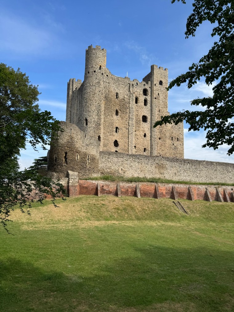
Rochester Castle, the backdrop to the startline
Registration was straightforward. After a short wait I had my number and tracker and started walking down to the start line. I was there with plenty of time and sat and listened to the wave 1 briefing and watch their start.
First wave of runners assembling
The race director gave plenty of information in the briefing and I heard him mention that the initial few miles of trail had single track. I made a note to try and start near the front of my wave and not get caught in a bottleneck. The waves were split roughly by expected finish time with under 5 hours in the first wave and over 5 hours in the second. I was thinking I’d get to the finish in about 6 hours, so didn’t want to get too caught up on the single tracks if I could help it.
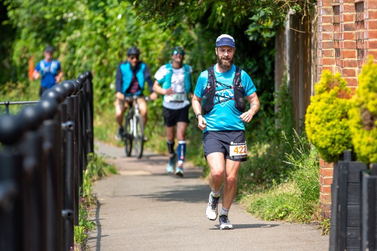
Positioning myself towards the front of Wave 2
As we started I soon found myself running in a breakaway group of about 10 people. That worked out well for me. After a few kms it became a group of about 5 of us. We covered some road kilometres before hitting some trails as we ran under the M2 bridge. I recognised the bridge as the crossing you use on the NDW100. It made me smile now running under it.
After about 5k I was very surprised that we already caught up with a group of about 10 runners walking the route. I expected to catch up with some runners from the first wave throughout the day, but not this soon considering they started approximately 30 mins before us. They were very cheerful as we passed. I was doing the math in my head and thinking that they wouldn’t make the cut off at that pace…
The trails alongside the river were scenic as we made our way through the village of Wouldham and on towards Aylesford. They were hard packed underfoot and very dry and uneven in places. After about 13km we had our first aid station. I made a quick stop. There was plenty going on. Loads of sweet and savoury foods and great vibes and support from the volunteers. By this point I’d passed loads of runners from the previous wave too. I was moving up the field! I didn’t stop for long and got back out on the course and kept moving. The course was pretty much pancake flat so I thought I’ll keep running until I inevitable tire somewhere between 30 and 40k then switch to a run walk strategy.
Somewhere
After Aylesford we were back running along the river to Maidstone. I think we passed the second of the ‘three castles’ here but I can’t remember. It was very hot now and closer to midday. There were loads of riverside cafes and bars and plenty of cheers and support for runners. We crossed over to the other side of the river at Maidstone. Somewhere a volunteer was informing runners of what position they were in (as in how many had passed him anyway). He said something 130-odd as I went passed. If true, I really had been passing lots of people and the wave set up wasn’t that accurate/strict.
Somewhere else
Come the second aid station I was thinking I hadn’t seen another bib from the second wave for a while. But I was constantly around other runners. I took a bit longer at the second aid station and ate a few jam sandwiches to keep me fuelled. From here the rest of the route blurred in my memories. We basically ran all the way to Tonbridge following the river. Sometimes in the open on canal paths, sometimes on single track and forest trails. There was a third aid station in a camp site somewhere and I remember thinking it seemed to be a nice area for river sports. There were people swimming, kayaking and paddle boarding all day long.
As we reached Tonbridge it was getting busier and we ran a little bit through the town and by the castle. It was lovely and I made a mental note to come back one day and explore the area more. We then left the river for a loop of about 5km out and around the town to make our way back to the school. By now I’d slowed a fair bit. From 30ish km in my pace had dropped as I aimed to keep running. Over that last 5km I walked a few times to break it up. Specially as we had a few road sections. The last km or so along with he busy B road. By then I’d lost all interest in running.
Could be anywhere
I got back to the school and jogged around the track to the finish line. Job done. I was way ahead of my 6 hour target and actually closer to the 5 hour mark. I grabbed a hot dog and alcohol free beer and headed back to the car. Rather than faff with a drop bag for the finish I left my changes of clothes in the car. And rather than walk back to the school changing rooms I thought I’ll strip down in the car park. Little did I realise that I parked over looking the trail. Hopefully no one was greeted by my bare buttocks on that last climb to the school grounds!
Overall an excellent day out with great organisation by Embrace Ultra. Got my eye on their 100km loop in Kent later in the year now…
After a long week of travelling ‘up North’ with work, I dropped by Nick’s on the way back through London, borrowed his car and drove to Carl’s and then back to mine. A quick pizza, unpacking the week’s bag and hastily packing a bag for the run (including ripping the zip off my Salomon pack) and it was straight to bed ready for an early wake up.
We left home just before 6am to get to Queen Elizabeth Country Park for 7am, a whole hour before the race was due to start. To our frustration we were told the car parking was already full and we needed to use the public parking a few hundred metres away. When we got there that too was full and we had to drive further along and park near Gravel Hill. It was a whole 30 mins later by the time we got back to register. I was a little frustrated by the situation. The race organisers did email and mention parking could overflow and that we’d need to use the public parking. But to have both car parks already full an hour before the start wasn’t expected. Clearly they haven’t secured enough for the size of the event.
Carl is there too I promise!
Anyway… moaning aside, onwards. Registration was brief and we now only had to wait a short while in the ice cold morning before the race started. It was a small group of runners in the 50km, as it was the 50mile race that started 30 mins before us. We started right at the back of the group as we ran through the start arch and back down towards where the car was parked. Here in QECP we went up into the forests near the main visitor centre before crossing over to and up Gravel Hill and the first of many many climbs of the day.
As we ran through QECP the trails were mostly gravel and hard packed. As we left the park we had a number of long road sections connecting between short trails. We both started to regret our choice of aggressive footwear expecting more mud and softer ground conditions.
Hard packed trails
It was a nice start though and whilst cold, the short sharp hills helped us warm up quickly as we made our way slowly through the pack. Time moved quite quickly in the cold, grey misty mornings as we talked away and caught up on the months of life changes since we last saw each other. After about 10km we passed the first (last) 50 mile runner who was walking slowly with the sweepers a few paces behind him. We assumed he was injured and pushing on to the next aid station as he was moving so slowly. The course had 4 aid stations and the first was 11 miles or so in. I liked this. It’s always nice to get a good chunk of the race done before the first stop!. We left the trails and out into the village of Rowlands Castle. In a small hall the aid station gave us warmth, albeit little else. The event emails talked fondly of the quality and quantity of food options that would be available at aid stations. This one certainly didn’t reflect that. A solitary portion of cake, small paper cups (think sauce portions at a fast food chain size) of two or three crisps, a few skittles and singular wrapped ‘celebration’ chocolates (why these were separated into paper cups I do not know!). It was a poor show. I assume the 50 mile runners had feasted well before us. Thankfully we didn’t have long, just 4 miles, to the next one. We ate a few snacks, refilled waters and headed off.
Carl setting the pace
The stop cooled us down so the gloves were on and we moved with purpose again to warm up as we traced back through the village. We passed Jamie, who I’d met on several other events too. He was braving the elements for the 50miler. My memory of the course soon becomes as blurry as the race conditions. I recall the route becoming much more trail and less road and our aggressive footwear came in more favourably. We passed many runners who were moving more slowly with the muddy, slippery conditions. The next aid station came so quickly and was much better with many savoury options and was better stocked than the previous. We took a few moments and chatted with the volunteers before moving on as it was outside and cold.
The next section was 7 miles long and we made it longer with a bit of a navigation mishap. We’d been running through a big open space passing many 50 miler runners and were discussing how we hadn’t reached the course split yet. We talked about the extra 30km loop they had to make and whether we were glad we weren’t doing that course. Shortly after the fields, on a single track we came to a trail cross road and the path opened up. We followed runners straight and up the hill ahead. I remember looking at walker with their dogs to our right as we crossed the trails. We were deep in conversation. Further along as the hill levelled out we caught the attention of the runner ahead who missed the turn and helped him back on track. At this point we realised we were ourselves off track. He confirmed that there was a turn a while back for the 50km. Doh. Damnit. We back tracked, passing loads of runners we’d passed before walking up the hill in the opposite direction. And there it was, a little over half a km back, at the damn cross Road in the trails where the dog walker was. We’d missed two very big and clear direction signs for the course split. Back on track we laughed at our mistake and carried on down the trail on a lovely descent. We caught back up with many of the 50k runners we’d passed previously. One even comment how we kept overtaking her. Our explanation made her laugh.
The next aid station at Compton came about and once again we were indoors and had a chance to warm up. Here there were all the promised goods and various sandwiches too which were very much needed. We ate a few then headed back out in the now very wet day. The misty rain had been getting progressively heavier throughout the day and soon we had to make the decision to cover our wet bodies with a waterproof coat. Whilst we wouldn’t be dry, we did start to get warmer finally. Here the course took us up higher onto the South Downs and visibility was piss poor. It was hard to spot the trail markers so we followed our gps instead and were soon running down a very wet, slippery steep hill. There were loads of slid marks from runners who’d clearly slipped their way down. Our great grippy trainers kept us upright though. We were on the last stretch now and the final 10 miles ticked off quickly as we continued chatting non stop all day. The undulating terrain forced us to a run walk approach which I was most grateful for. For hours we hadn’t caught up with any other runners but knew we had a group not far behind us.
Awesome views
We kept a pretty decent pace and passed through the final aid station at South Harting, after winding our way through the village streets, quite quickly, keen to get finished and make our way home. A few km later we passed through the lovely little village of Buriton and began a long climb back into forests and realised we’d made our way back to QECP. Before we knew it we were tracing our steps from earlier in the day.
The last few kms were longer than we’d remembered. We came down near Grave Hill, passed the parked car and onward to the finish where we came into the event space to cheers from a few volunteers, we took our medals and headed straight into the tent to get warm. A warm soup with bread and zero % beer perked us up before we had the cold 10 min walk back to the car. With freezing hands we got changed outside before driving home with the heating on.
It was a great day out with Carl. The conditions and weather made for a tough day and it took longer than I thought. It was a decent event and whilst well organised I thought a few things could have been improved (the parking situation annoyed me and the course markings could have been better for a ‘fully signposted’ course). That was the first race of the year and I’m excited now for the planned adventures that await!
This year, I took on the challenge of the Lakes in a Day ultra marathon – 50 miles of rugged terrain, iconic peaks, and unpredictable weather, tracking from Caldbeck in the North of the Lake district to Cartmel in the South. The Lake District threw everything it had at us, and yet, the rewards were, unsurprisingly immeasurable…
I ran the race with Paul, Darryl, Matt, and Matt Buck. Paul and Darryl have both run the race in previous years and were the instigators for this adventure. They took great pleasure in the weeks leading up to the event to scare us with stories of the weather conditions we could expect and recalling their previous experiences.
We travelled up to the Lake District on the Friday, collecting Matt from Manchester airport on the way and stayed over in a converted, large (stately?) home in Grange-Over-Sands just outside of Cartmel. We had some questionable moments in the accommodation that seemed almost supernatural. I had great fun gamifying this and turning random lights on and off to play tricks on the others. I was easily entertained.
The night before the race, we had a pub meal near by and then headed to Cartmel to register at the local school, where the race would finish the following day. The registration area was buzzing with energy as runners queued in the cold outside, eager to register for the adventure ahead. We went through registration and kit checks, ensuring we had all the mandatory gear (although the checks seemed to be on random participants not everyone), and collected our trackers. The excitement was palpable, though there was also a tinge of nervousness in the air as we left.
On race morning, we were awake way before dawn to drive back to Cartmel to get the bus to the start. The bus ride to Caldbeck was filled with chatter and laughter as runners were squeezed into a coach that could sit 5 people per row (a new one on me). There was a very amusing and memorable moment when one runner, sitting at the back with Paul, joked about some runner he had seen carrying a “bum bag,” poking fun at the size of the pack he was carrying his mandatory kit in. We burst into hysterics as he didn’t know that the ‘bum bagger’ happened to be Paul (and we love making fun of his bum bag!). The humour lightened the mood, even though it was cold and dark in the early hours. It also meant Darryl avoided much of the stick for his highly fluorescent orange attire that made him look like he worked in B&Q!
After getting off the bus, as we waited in the rain for the race to start, I bumped into Andrew, an old colleague I hadn’t seen in years. It was a surreal moment of briefly reconnecting, though I never saw him again during the race. He had a fantastic race, finishing hours ahead of me with a very impressive time. Back at the start line, with minutes to spare, the race director briefed us on the course, safety and expectations of runners. Then, without notice, he started counting down from 3 and started the race.
The first major climb up to High Pike was long, wet, and shrouded in mist. We started on a few kilometers of road as we weaved through Caldbeck and then joined the trails. A huge snake of runners lining up on the trail. Here the visibility was low, and the trail was slick. The wet ground and steep climb was an indication of the journey ahead. Slowly we climbed higher and higher in single file as morning fought its way through the darkness. The rain eased but the wind kicked in the higher we climbed. In the mist the trig point of High Pike slowly came into view. Up top the wind battered us and we set off to conquer the undulating fells ahead. After a while we were ready to descend. Thankfully on this side of the fells we had a little shelter from the wind. The rain coats remained on though, keeping us warm and protected. The descent on single-track paths was a welcome relief. They were very runnable and for the most part on clearly defined paths at a steady gradient. The path led us down to the river crossing, which, to my surprise, was lower than in previous years – making for a smoother crossing. Paul and Darryl began to tell us how bad it was previously. The rest of us continued to make fun and count how many times they mentioned it! As we crossed over, volunteers were standing in the river to help guide runners across safely.
The river crossingnot very deep!
Next came the long ascent to Blencathra. It was bigger than the previous climb and was slow going – our legs already heavy from the initial climbs and soggy ground. We weaved our way up muddy gullies which made getting a grip and pushing off difficult, even with big lugged fell shoes on. The higher we climbed the more the fells dried out but the more the wind started to pick up and batter us again. Up top more trig stones came into view as we pushed on, head down fighting against the head on winds. Volunteers cheered us to the summit and wished us well for the descent down Halls Fell into Trekhold. Here runners who didn’t feel confident on the ridge could divert down to Trekhold via the less technical Blease Fell.
Hunched over fighting the wind
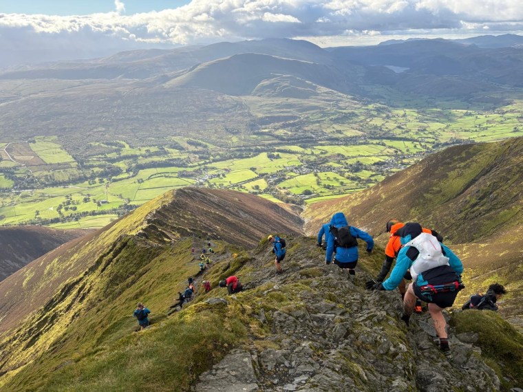
The ridge line descent of Halls Fell into Threkhold was exhilarating. It lived up to the hype from Paul and Darryl’s’ stories. The clouds had cleared and the views were breath-taking, but the terrain was challenging. It is a ridgeline stretching for a few hundred metres as you descent on sharp and slippery rocks. Volunteers were placed at a few points to ensure participant safety and a photographer perched on more stable ground slightly below. We traversed the ridge and the rocky descent down into Trekhold and the first of three aid stations.
The aid stations on the course are quite something. You hear about them from other runners (Did I mention Paul and Darryl had done the race before?) and you get an itinerary of the available foods at each station in the pre-event emails. This one was great. Full of fresh sandwiches of multiple varieties, an endless amount of cakes (including good ol’ swiss rolls) and pastries and more sweets and chocolates than I could name. We took some time to fill our bellies, knowing that it would be a long time until we ate substantially again (the next section is almost 30km long, mostly on top of the fells). We laughed as Matt (Buck) traversed the food tables filling up an A4 size ziplock bag with food like he was intending on never returning into society again. We then left pretty abruptly as we started to get cold, even inside the aid station.
We ran a few fairly flat kilometers as we left Trekhold. First on roads leaving the village, then footpaths crossing the main road and back out towards the trails. After which the tarmac gave way to wet boggy ground again near the quarry. Leaving the aid station it started raining heavily and we were already soaked through before reaching the trails. Starting the climb towards Clough Head I had a few niggles that were concerning me. My left foot was in pain around the metatarsals and I loosened my shoe laces several times to try a release the pressure a bit. But also I’d noticed that I’d begun to loose sight in my right eye. This is an experience I’d faced twice before, once on the Tea Round in the Lake District and the second time in Norway on the Lofoton Ultra Trail 100. On both occasions in similar gloomy weather conditions. At this point there was nothing I could do about it and I knew it would get worse before it got any better.
As we continued towards Clough Head, the trail took a sharp and sudden incline towards the summit. We could see the odd runner with high visibility clothing climbing along the side of the mountain. As we too reached the climb it was apparent just how cold and wet it now was – I had three pairs of gloves on which, together with the weather conditions was making it difficult to eat and drink to maintain fuelling. We climbed in almost silence as the wind also made it hard to talk and hear each other. Increasingly we were spreading out and I couldn’t see Paul or Matt (Buck) anymore ahead of me.
Once on top we covered about 10km of undulating trails, crossing the ‘Dodds’ towards Hellvelyn. The trails led us up and down various climbs, each with different terrain and challenges. The ground was a mixture of wet, muddy bogs, defined paths and more rocky sections. It took a while and I was glad of the company of Darryl and Matt, even though we could still barely hear each other as we tried to talk. Only as we neared Hellvelyn the rain did ease up and the clouds started to clear. We could see Hellvelyn way off in the distance now, but first had the rocky, difficult climb to get there. I feel that the wind picked up even more here and I personally found it hard going to keep walking in a straight-line. I was walking almost diagonally, head down, to keep on track and every time I lifted my poles they would be blown to the side. It was a good, but unwelcomed, core workout!
On the way to Hellvelyn
It was nice to reach Hellvelyn as it was only the second time I’d been there and this time we would descend in a different direction from my previous trip. We now headed off towards Grisdale Tarn and Ambleside. The steep descent to Grisdale Tarn wasn’t an enjoyable relief from climbing. The wide pathed path was wet and slippery and I took to running the steeper trails that ran along side them. This caused my foot and ankle to hurt but felt like a safer way to descend down for me. We crossed over to the other side of the tarn and followed the descent with a steep ascent straight back up towards Fairfield. I don’t think we could have climbed any more slowly. Our legs, which were already aching, were now pelted by a painful hailstorm that stung our bare skin. It didn’t relent the whole time we climbed and our legs were red by the end of it. My eyesight had indeed deteriorated and I made sure Matt and Darryl both knew I had some issues seeing. I estimated that in my right eye I was down to about 10% visibility now. It was all blurry and I could make out shapes close to me, but not distinguish colours or the human form! With both eyes open this affected my overall visibility, so from time to time I’d try and close the right eye. I was reluctant to take any further action though until I reached the next aid station.
Once we’d climbed to Fairfield it was quite rocky in places as we crossed straight over the horseshoe. I really wish I could have stopped and taken pictures as the clouds had once again dispersed and we could see some amazing views. There was no way I was faffing with my gloves and phone in the high winds though.
The next section to Ambleside was a bit of a drag. Matt had vanished from my (admittedly limited) vision and Darryl stuck with me throughout this section to make sure I was ok, helping me navigate the best paths along Fairfield and down into Ambleside. Here it was quite rocky in places and his support made a significant difference calling out objects as I struggled a little with my depth perception. I’m grateful for his presence during those tough moments.
Darryl finding the quicker route
After a few kilometers we did catch back up with the others and for the first time for hours were together again as a group as we continued down and into Ambleside, running through the streets of the town to the next aid station. Like Trekhold before it, we were welcomed by amazing volunteers and huge amounts of food including pizzas, hot soups, pastas and warm drinks. But first though, a change of shoes…
At Ambleside we were allowed a bag with just a pair of trainers and socks for the second ‘half’ of the race. We would now no longer go up high on the fells, so a change into less aggressive trail shoes was most appreciated. My feet were begging for a change and I was relieved to swap my fell shoes for more comfortable trail shoes, which made a noticeable difference for the next section and certainly made my left foot feel better. It was very organised if not a little limiting in the aid station. When you arrive you are shuffled into a dedicated area for changing your shoes. You either have to change your shoes straight away or take little protection covers on your shoes to enter the area with food and seating. I would have liked to have sat with my shoes off for a few minutes whilst I ate.
After a decent stop and plenty of food, we regrouped and left Ambleside together with our head torches out ready for the night to begin. As I promised myself, I ‘did something’ about my eyesight. The only fix I have is to wear a buff diagonally across my head to force the eyelid to stay closed. I’ve found from experience that having the eye closed not only improves my overall sight, but gives the eye a chance to rest and recover. ‘One-eyed Willie’ Darryl called me as we reminisced about the Goonies.
We now had a much more manageable ’14 mile’ section that include some roads and lots of small undulating trails. There were a few noticeable climbs but none of any significance. We ran and walked along the road sections, weaving on and off the paths that ran alongside and connected the trails. We passed a few runners and a few runners passed us too. For now though, as darkness set in, we were very much ‘in our place’ in the mid pack of the field of runners. On the single tracks and forests we mostly ran in two groups. Those in a ‘three’ and two behind. From time to time we’d switch places and conversations. My self and Matt (Buck) chatting away mostly whilst the others continued with the usual word games to distract and fight off the fatigue. As always it was a fun way to bond and keep our spirits high and so nice to be able to talk to each other again with out the wind.
We covered the ‘flatter’ part of this section quite quickly and soon overcame the largest climb of the second half which was mostly on country lanes, a refreshing change! From here we navigated back to the footpaths running along side Lake Windermere. The water was glistening in the moon light. We were quite fortunate as we continued through the night that it was mostly dry apart from a few short showers. The wind had also significantly dropped at the lower altitude so we weren’t too cold (the rain coat and 3 pairs of gloves stayed on throughout though!). At one point, in a long forest section, there was a surprisingly steep forest climb that caught us all out. It was frustratingly tough despite how short it was, we lumbered up the steep steps and climbed and slipped in the wet and muddy earth. We were all relieved to get over that one!
This whole section just dragged on. The darkness made it feel so much longer and tougher than it was and our feet were cold and drenched from wet, boggy paths near the lake. I moaned a lot (as I always do) as each stone, tree branch and rock caused my feet to react in pain. There was definitely some trench foot and blistering going on, but nothing I would do now until we finished. I just had to suck it up and put it to the back of my mind. Throughout this section the buff and eyesight was irritating me and I constantly needed to make adjustments to keep it comfortable.
We came across the final aid station at Finsthwaite around 23:00. The sight of a dry, warm and well lit aid station was so welcomed. By now I was out of water so was ready for some refreshments! I removed my buff as I entered the aid station and was happy to confirm that, with some rest, my eyesight has started to comeback. I could now make out the human form and brighter colours so was confident it would recover completely before the race was over. The volunteers were absolutely top here, the lovely ladies and gents inside entertaining the crowds of runners sitting in the warmth. Endless amounts of warm food was leaving the kitchen directly into the hands of waiting runners. Melted cheese on ham and toast a particular favourite. One lady was calling out variations of soups and warm rice puddings and custards that they could prepare. After a few warm soups I did take a “boring” plain rice pudding which was delightful.
We did sadly have to eventually leave the comforts and complete the remaining 7 miles. The last 7 miles were a little more lumpy as we made our way towards and over Newby Bridge and Speelbank. Unlike the lakeside and forest trails before, we spent more time here on tarmac roads, fields and low hills. We pretty much walked this entire section as a group. Certainly I had no inclination to put any effort into running anymore (not that I had much for the previous 10 miles either!). Throughout, with less tree coverage here, we had great views of the spectacular large and orange moon. Eventually we emerged onto what we were certain was the last road. Albeit we’d be on this stretch of road for a few kilometres. First completing the final climb, then the long straight descent towards Cartmel. Somewhere here the road flattened out and we had 2kms left to run. We ran passed the carpark and ‘racecourse’ where other runners would be camping for the night. We were all so glad that we’d found a parking space in the town near the school and didn’t have to hobble all the way back out here later on.
Onto the last stretch we could see the school lights up ahead. We walked to that finish line ever so casually, most of us with our hands in our pockets (keeping them warm) and barely managing a smile for the photo finish.
The casual walk. Photo by Andy Upton
The finish line was brilliant. The photographer took loads of photos of us and we were relieved of our trackers and given tokens to get a warm meal. The food van had many variations of chips to satisfy our hunger (I went for the chilli on chips option). Inside we sat and ate, then changed into some warm and drier clothes for the drive home. Back at the haunted house, we showered and very quickly drifted off into a well deserved sleep!
Lakes in a Day 2024 was the furthest I’ve ever run in one go in the Lake District, and certainly the toughest run I’ve ever faced there. But every gruelling climb, every gust of wind, and every drop of rain was worth it. From the challenging weather to the glimpses of views to the camaraderie of fellow runners, this race will forever be etched in my memory. Already, I’m looking forward to planning the next adventure.
In a day!
On the subject of eyesight, I’m not worried at this stage (and hence the calmness I had during the race – admittedly the first time I experienced it a few years back I was pretty freaked out!). There are many documented events of participants in endurance events experiencing loss of sight and similar symptoms. There are even quite a few publications on the topic of ‘Ultramarathon Associated Visual Impairments’. This article is particularly informative – https://www.irunfar.com/vision-loss-in-ultramarathons-looking-at-the-research and explains known links to Corneal Edemas, which results in painless clouding of vision due to stresses (like altitude, cold, dehydration, debris, wind, etc.). Interestingly, there are known links to refractive surgery which, yep, I had a few years ago! Anyway, it is on the list to discuss for next time I get my eyesight checked out…
Many years ago I signed up to a race in Bulgaria, the Wild Boar Ultra, but due to travel restrictions (remember those Covid years…) I never made it to Bulgaria. Fast forward to 2024 and I was finally travelling to Bulgaria, with a group of friends, for a different race, the Pirin Ultra. Specifically the 66km ultra race. As part of the event there are different distances including the very wild 100 mile race and the very technical 38km ‘Extreme’ race. The pictures and videos of the Extreme 38km race dominate the advertising for the Pirin Event. It looks incredible, but a little terrifying too with very long ridge sections and strict entry and participation criteria. The 66km is probably the tamest of the events on offer, but tough in its own way. So we all signed up to the same race.
Running towards somethingA thingPosers
Our adventure began on Friday in Sofia with plenty of food and a little sight seeing on foot on Saturday morning. I say ‘little’ as it is not somewhere I thought there is a great deal to see. I’m being ignorant to the history and culture of Sofia but I honestly thought the city was just ‘meh’. We’d rented some cars and made our way to Bansko for Saturday evening where we we instantly realised there was plenty more to see and enjoy there. We began to get excited that, soon enough, we’d all be running around the Pirin mountain range.
Our evening was a little time pressured as we arrived in town just before 6pm, checked into the hotel then headed straight for registration and then dinner. Registration was smooth with a full and thorough kit check, but disappointingly a ‘ravaged’ participant pack with left over sized tee shirts and no ‘freebies’ that had all gone. We faffed a bit finding somewhere suitable to eat (only so much meat and ‘Big Knuckles’ could be handled pre-race!) and were back at the hotel for 10pm with not much time to pack and get ready for the early wake up call.
Race registered
Just before 6am on a bitterly cold morning we were checked into the race starting pens with our trackers attached and activated. We had a short but chilly wait until we were given the signal to begin our adventure and we, along with about 230 other runners, found ourselves running through the cobble streets of Bansko in the direction of the main road through the town. Once on it, we followed the road up toward the mountains. Very early on Carl and I stopped to take our jackets off as we started heat up and instead of running started walking.
Freezing cold in the morning
The route of the 66km race would see us make three ‘chunky’ climbs to different peaks. The first about 1500m, the second 1300m and the third a more modest 900m. Of course between each we’d need to descend too. So basically the course went ‘up’, ‘down’, ‘up’, ‘down’, ‘up’ and ‘down’ again like some computer cheat code from the 90s’. This did mean though that it would be easy for us to keep track of where on the route we were at any point!.
The first climb was the longest and, over 15km, took us up the main road then into some forests before we started ascending on the mountain. On the road we’d already removed a layer as it was hot, but in the forest we began to feel the icy morning cold quite quickly in the shade of the trees. At this point I was with Carl and Ale, Vanna and Gif were just behind us and further up ahead were Reka and Jon. The morning grew lighter but colder as we slowly climbed, passing a few parking spots and ski resorts. I refrained from layering up but made sure I would do so at the first aid station which we reached after about 10km.
At the aid station I did just that, adding arm sleeves and gloves. My fingers were numb and took a little while to warm up, I was so glad to have the Montane Prism gloves though as they were a bit thicker and warmer. Prior to the race I had heard that the aid stations were ‘crap’ on this event and now I had the first sample of the limited options available. It was crap, but at 10km in I wasn’t bothered and I ate a few pieces of bread with tomato paste spread on them. Different to what I’ve encountered before, but it did the job and satisfied my early morning hunger.
Early morning views back over Bansko
Whilst at the aid station we’d all regrouped with the exception of Jon who was gone. Reka, Carl, Ale and I all then left together as the route first continued into the forest and then left the mountain roads behind as we made our way onto the mountain. We made a very small wrong turn but were soon back on track and pausing to look back at the incredible sunrise back over Bansko. The ground around us frosty and glistening as the sunshine started to fight its way through and break the darkness of the morning. As the sun light hit us we instantly warmed, it was a great feeling. We ran along side some rivers and could see the ridge lines that the 38km route would take (the more technical course) on the other side of the mountain range. The trails smelt beautiful with local herbs (I forget what we were told they were, but similar to lavender) dominating the air and I was amazed how silent it was as we climbed higher and higher. It was truly surreal and peaceful. As we began to climb the steeper, rockier section to the first summit we found ourselves behind a blind runner with his guides. I was amazed. It’s incredible that this man was able to navigate this terrain without sight. There were rocks everywhere as we clambered over boulders and rocky paths, yet he was moving with a quick pace. We were in complete awe (we later found out he’s very experienced endurance athlete for many disciplines. What a remarkable man!).
Once we summited the views were spectacular. 360 degree panoramic views with mountains all around us as far as we could see in all directions. In front of us the descent was pleasant looking as we’d now traverse along the side of the peaks. Carl started running and the rest of us couldn’t keep up. Before we knew it he was a spec in the distance getting further and further away. Reka, Ale and I ran a fair bit and passed many hikers out on the trails who’d woken early to enjoy the sunrise. At the end of the path there was a sharp turn and we began to descend. The first climb was over and now it was time for the first descent. Here we met a runner from the 100 mile route who’d started the morning before us. He stuck with us as we moved swiftly down the mountain path and into the forests below.
We were moving well and passed a load of runners in the forest as we followed the trail markings down. Ale was setting the pace despite his struggles and not feeling well. When Ale isn’t enjoying the down hills you know something isn’t right with him! The forests we ran through were dense and lush with pine needles covering the floor and the sunlight squeezing its way through the gaps in the tree tops. As we neared the bottom there were streams and the trails were a little wet and muddy in parts. Overall though the descent was smooth. I remembered thinking this was a very kind way to descend from a summit at 2,600m. It was no where near as rocky as the ascent was. I was relieved. On the way down we passed a a tap and quickly filled another bottle and then had a short gentle incline on a wide gravel track before we finished descending. We’d now done the ‘first’ mountain and had two more to go…
As quickly as that we were climbing again. We reached a small collection of (massive!) houses in the forests as the gravel track became an asphalt road and, after a short climb on the road, entered the forests once more. The start of the climb was rocky and steeper than the first climb we’d done. The three of us were now spread out a little and I found myself alone with my head down focusing on the terrain and climb. It was warm and sweaty but far more comfortable than the cold from hours earlier. This section to the second aid station was the longest part of the course at 19km. I’d filled a third bottle at the first aid station and was so glad we found the extra tap along the way. I was drinking plenty as I pushed up the climb. After a while of lunging over large boulders as we climbed through the forest there was a break in the treeline and the next aid station appeared – the Begovista hut. It seemed large but wasn’t really. There were two tables set up outside for runners (although you could go inside I didn’t). The spread was the same as the previous aid station – salami, goat cheese, bread with tomato paste, bread with chocolate spread, Turkish delight, banana and cucumber with as much salt as you wanted. Annoyingly the water was all in big (15L) containers that were difficult to tip and fill yourself (and no one was helping). I filled my bottles and then sat and ate some bread and chocolate. They’d already run out of coke at the aid station which was annoying as I was looking forward to some sugar! As I was sitting, Reka soon came in followed by Ale who was determined to stop here. This seemed inevitable and he’d been talking about it for a while so I was not going to try and convince him otherwise. I offered to stay with them both but ended up leaving alone.
Somewhere on the second climbSlowly tracking to the second summitViews back over the mountain range
By this point we’d climbed less than half of the total elevation of second climb and still had close to 900m to go. The rest of the climb was a lot harder than before. We started weaving through the dense forests, which was a little more tricky to navigate (I thought the course marking was a little sparse here) and the climb was much, much steeper and rockier. It took more effort to push up with a consistent pace and I was definitely moving more slowly. After what felt like an eternity we emerged from the trees, high up on the mountain side with more incredible views all around. The mountain started to flatten out a little and we navigated across it through low level bushes with no clear path. In the distance I could see the real summit with the outline of runners making the way up and onto it. It was slow progress crossing the mountain and starting the climb which was all off track. The flag markings were clear but there was no defined way to follow them without a track, so I just headed in the most direct way I could. The higher we went, the more rocky the ground became. We climbed the last 300 or so meters over a few kms.
There was a short ridge line section with a sheer drop to our left but a spectacular view looking back over the mountain range we’d ascended a few hours earlier. To our right the drop was much more gradual and there was a path to follow. Along the path I went enjoying the views and wondering where the sounds of people were coming from. It soon became clear as we started to descend quite sharply along a boulder section and the voices could be heard from below. The little scramble caused my legs to wobble a little as we traversed a few 100m using all fours to descend. Once down, we turned back and would begin the big descent off the mountain and down to the next aid station.
The descent was quite fast. Pretty much all of it was off track and straight down. It was steep, but doable at a good pace. I fast walked as the rocks persisted and moved more quickly with a jog when the ground allowed. I felt good and found myself overtaking runners, skipping over lumpy tuffs of ground, streams and large boulders that were now more sporadically scattered over the mountain. The further down we went we ran back into forests. Here we crossed many streams and in places the track was quite slippery and a little muddy too. I was so glad it was a beautiful day with dry conditions for the run. It wasn’t too steep in the forest and I was able to maintain a run and navigate the terrain without too much difficulty passing more and more runners along the way. We broke free of the forest and onto a dirt track, rounding a bend to the delight of the third aid station which marked the end of a 10km section that took over 3 hours. It was definitely harder than the first climb! I’d now covered about 40km and two of the three climbs so was ready to enjoy a quick break…
I hated this aid station though and it wasn’t the rest I needed or wanted. As soon as I walked in the smell of cigarettes hit me. It was like a wall of filth slapping me in the chops. There were people sitting and smoking in the hut. The section of the hut segregated for the runners was small and cramped and the foul smell of smoke lingered above the food. The small space presented the same food offerings on two tables and two more tables for runners to sit/eat. The tables were wet and dirty and I contributed to the mess by spilling more water when trying to fill my bottles from the big 15L containers. I took a few minutes to drink and eat but desperately wanted to leave as quickly as I could. I found Bulgaria as a whole on this trip quite unpleasant because of the attitude to smoking. It’s culture and behaviour is stuck in the past with smoking allowed indoors and people inconsiderately chain smoking every and anywhere. I found it very off putting. In this environment it’s not something I want to encounter. I’m out enjoying nature and pushing my physical and mental capacity enough without the intrusion of other people’s disgusting habits. So I swigged some Coke, filled a third bottle of water and left quickly.
The next section began with a short stint back in the forests before what I dubbed as the valley of 1000 cows and 100 streams as the third climb started far more moderately that the previous two. Through the valley we hiked pretty much in a straight line for probably about 7 kilometres. There were vague paths and sporadic marking that we roughly followed in a straight line. The vague path that had been eroded in places and was narrow and difficult to stay in without tripping over your own feet, so I found myself hopping from side to side along the edge of the path. All along this section were cows grazing, loads of them. Some small and skinny some large and healthy. A few had calves and some had horses for company or dogs guarding them. None of them were phased or bothered by the runners though. At one point a large cow came out of the trees directly in front of me and looked quite shocked to see me walking towards her. They were all very placid.
ValleyStill the ValleyWay out of the valley
The navigation through the valley also meant crossing loads of small streams back and forth. I was quite surprised how wet wet and boggy in places it was, although I shouldn’t be with the majestic mountains on either side of me! For the most part I managed to keep my feet dry and kept pace with the runners ahead and behind me. Along this section I started talking to a Bulgarian, David, who we’d been leaping frogging each other for a few kms. We chatted away and wondered together where the valley was taking us. Up ahead the peaks came more and more into view and it started to become a guess as to how we’d be making our exit from the valley. The valley started to gradually disappear and the higher we climbed, the larger and more prominent the mountain peaks became. However we would exit was going to be tough! Eventually you could see the runners climbing to the left, little dots on the side of the mountain. The marshy grassland became drier and the rocks and boulders started to appear again. After part of the climb we passed a lake with incredible reflections and then began to turn towards a saddle in the mountains, this was our exit route. It looked steep. The closer we got the clearer it became, we’d be climbing a rock slide to escape!
One mountain lakeAnother mountain lake
I don’t think this section was as bad as it looked. Really it wasn’t that long, although it was fairly steep. The main problem was that my body was tired. We’d done probably close to 4000m of vertical gain by now so my legs were understandably fatigued. So this last push required some hard graft and deep breathes. We climbed around the side of the rocks to the right, pretty much straight up and then traversed the rock slide to the other side. Once over we followed short switchback paths back and forth to the top, which were a little more pleasant and much easier. The silence of the mountains was occasionally broken with a cheer/yell from every runner before me who reached the summit. When it was my turn I think I just said ‘wow’. The view was something else, in all directions, it was spectacular. It was about 7pm and the day was starting to end. Behind us the sunset created incredible shadows on the mountains, ahead of us many lakes sparkled in the dying daylight and many more mountains were still visible in the orange sky. I took a load of pictures and then descended. Running where I could as we passed the lakes and headed to the final little incline.
Escape route from the valleySunset viewsMore sunset viewsEven more sunset viewsSunset views in the other direction
Not all the climbing was done just yet though and we had one final climb to get up and over the mountains. The climb itself wasn’t as memorable as the previous one. The rocks were loose but the path was defined and gradual. From the summit we descended a scree slope with twisting switchbacks swooping down steeply which was a bit painful on the feet and ankles. Ahead of us lay more rocks as far as the eyes could see in the diminishing light of day. I was hoping that the final descent would be better than the two previous ones (it looked a bit more gentle on the route profile) and I was keen to get the rocky section over with quickly. I caught back up with David and two other runners just as the remaining sunlight faded and had to stop and take out my head torch (I was optimistically hoping I’d make it to the final aid station before I needed my head torch). I fell into line behind them and we all walked briskly together in the darkness. I could have run but quite enjoyed the pace being set. The trails were still very rocky and not the most forgiving on the feet after over 50km. My ankles were quite sore and I hoped the trails would improve the further down we went, so I stayed in line with the others. Everyone was eager for the last aid station but it never quite seemed to appear. Frustratingly I don’t think we’d covered as much distance on the long climb as we’d like to believe we had. We probably moaned for a good few kms before lights eventually appeared further up on the trail and the aid station became visible.
Start of the final descent
I was feeling the evening chill now and was hoping we’d be inside so I could layer up and not get too cold whilst refuelling. Annoyingly, despite there being a hut, we were once again cramped into a small space outside and once again served the same limited options. Getting water here was also painful as the large bottles had some hand pumps on them that weren’t really working and the volunteer was trying to fix them and tip the half empty one into the other so I couldn’t access the water when I wanted (he seemed to prioritise this over filling people’s bottles). Whilst waiting I heard the others suggest we continue together as a group. I’ll admit I wasn’t really interested in the idea and was ready to be alone and wanted to now ‘run it in’. There was a bit over 10k to go. I told them I was cold (which I was) so wanted to get going sooner. Despite it all though, we did end up leaving together (I must have faffed a bit!). So I made sure to be at the front of the pack and upped the pace, walking faster than before as we moved over the rocky ground.
As the rocks turned to gravel I started running. The group of four then became two groups of two as David joined me running. He agreed he wanted it to be over now sooner rather than later. He ran fast though, faster than me. I kept up as much as I could and he was a great pacer for me. For the next 10k we ran when we could. Through fire tracks, gravel tracks, down roads and more forest paths. After about two thirds of the final section, we left the gravel tracks behind and alternated between the main road (which I think led to all the ski resorts) and the forest paths that cut a straight line through the hairpin bends. The marking was a bit hard to follow at times but we pretty much got through it without error thanks to the headtorches picking up the reflective tape in the pitch black darkness of the night. Before long we left the wooded areas for good and followed the main road all the way back to town. We had about 4kms left to run and now re-joined the road we started climbing on some 16 hours earlier.
Despite running at a healthy pace, it was still a long way into town and the finish line. The long straight down hill to town was about 2kms, the stretch through the town another 1km then we had the cobble streets to the finish. We passed many runners from the 38km, 66km and 160km races as we pushed to the end without stopping. At the finish line David’s family met him and then I followed across the line to be greeted by my friends (except for Vanna and Reka who were still out on course). I was glad to be able to stop!
Finisher!
At the finish I sat and layered up with my spare clothes and joined the others as we waited for Reka to finish and Vanna to return. Unfortunately Vanna, Gif and Ale had to stop their races. But each had an adventure of their own getting back from the aid stations where they stopped. Overall I had a great time on the Pirin ultra. The route is tough, technical and challenging. The landscape is breathtakingly beautiful. It’s such an incredible place to run and one I won’t forget any time soon. What an experience it was!
The downside of this adventure is that there are elements of the race organisation that could (need to) be dramatically improved. For an established event the simple changes seem obvious from a runner’s perspective. The aid station offerings really are quite poor. The limited and repetitive options were drab. Nothing sweet and very little variety in the savoury. No hot food or drinks and cramped set ups at half of the aid stations. Providing some additional basics (crisps? candy? another fruit option?) would make a huge difference. As would something hot. It wasn’t really a problem on the 66km course (I could carry enough of my own supplies not to be impacted) but I was speaking to a British guy doing the 100 miler and he made the same comment. They had no hot drinks, not even hot water, for them and only once he had some hot soup. Some of those runners were out on course for 50 hours! Also, stop the smoking at the aid stations!
The biggest criticism I’d have though is the strange stance/approach to DNFs (Did Not finish – retiring from the race) the organisation seems to have. They have cut offs so you can get timed out and you can also DNF at your own decision, but it seems that there is no provision to ensure participants get back to Bansko from the other side of the mountain range safely… Ale and Gif spent many hours getting back from the second aid station. They were told their choices were to continue or cut the route short by walking 10km (with 1000m elevation) directly to the third aid station (but with no directions) and then hitch hike from the town. How is that safe for someone who has judged themselves not in a suitable condition to continue?! They only managed to get back as another participant dropping out offered them a lift from their partner, but they had to walk 5km back to the main road to meet them.
Vanna’s experience is even more wild with a group of 10 drop outs at the third aid station told there is no way to get back to Bansko and they would have to stay the night. Eventually, the hut manager (?) reluctantly agreed to get them a taxi from a nearby town but charged them an extortionate 300 Bulgarian Lev to drive them off the mountain to the main road, Squeezing 8 of them in one car. There he’d arranged for two associates to drive them back to Bansko, again at an additional inflated cost. The race director eventually intervened (only after one of the participants called an ambulance after feeling unwell) and drove to intersect them at a petrol station where he argued with the drivers and made the runners change vehicles. Vanna eventually got back to Bansko around midnight but there still seems to be an expectation that he is going to pay a few hundred pound to someone for the privilege?! Mental.
I think as a race organiser you have to ensure the safety of your participants. You have to accommodate participants dropping out. If not ensuring transportation back to the start, making it clear that if you do drop out, you won’t be given transport and will be expected to find your own way back. As I finish writing this it seems there is a change in organisers taking place, perhaps with it improvements will follow…
The Shere Marathon is organised by the Surrey Trek and Run shop. A few friends had mentioned it and so I signed up with short notice with Carl and Natalia as a team. It would be a good chance to run together before out next event. We arrived early into Shere for an easy start with a small field of runners and a modest start line which we joined right at the back after saying hello to some other friends at the registration area.
ready to roll
The start saw us run a lap of the playing field, following someone with a smoke/flare, before joining the trail and beginning the first climb out of Shere up to the North Downs Way (NDW). A lot of the route would be along the NDW and the Greensand Way trails. Both are trails I know pretty well and I was certain I’d run all of the route before at different times previously. On this occasion we’d be running a loop clockwise, Initially along the North Downs then dropping off and passing through Wotton towards the Greensand Way.
From Wotton the route is very similar to that of the Freedom Racing Hurtwood 50 as we tackle the three hills of Leith hill, Holmbury hill and pitch hill. Unlike Hurtwood though we carried on to Chilworth and back towards the North Downs Way. The final climb on this course takes you up the ‘drain pipe’ path to St Martha’s and then we run along the NDW to Newlands Corner (which was very busy!) and back to Shere.
Over all the day was great with perfect weather, if maybe a little on the warm side. It had been a while since I’d run many of these trails but the memories soon came back. The three ‘peaks’ of Surrey we navigated fairly quickly and easily. Then the more rocky terrain started to slow us a little as we made our way through Paature wood and Hurtwood. We made one small navigation area but otherwise made it round without any issues. Personally I don’t like the section of the NDW after St Martha’s as it’s flat and runable, getting back to this section reminded me its my least favourite part of the route. So it was a bit of a slog back to the finish and then subsequently going down the narrow hill back to the recreation ground was hard going on the tired legs.
Overall we had a great day and it was a lovely little day out ahead of the next race in Bulgaria…
A few years ago Paul did a solo adventure along the Hardergrat Trail in Switzerland. Ever since he’s been eager to go back with us to do it with him. We started scheming and found the time to form a plan and incorporate another visit to the Eiger Ultra Trail alongside the Hardergrat Trail. Paul, Matt and I did the E101 100km Eiger Ultra Trail back in 2022. Darryl and Natalia wanted to do the race too so it was perfect timing, to combine the Hardergrat with the E51 50km race the following day.
The plan seemed simple enough, fly to Switzerland on the Thursday, Do the Hardergrat Trail on the Friday, do the race on the Saturday and fly home on the Sunday. Efficient, although not the recommended approach for a race and a bunch of early mornings were for sure going to be tiring! We based ourselves out of Interlaken to take advantage of being closer to the Hardergrat Trail and more options for accommodation. We also had one shot at the Hardergrat Trail so were very dependent on the weather/ground conditions, which thankfully, were perfect…
Hardergrat Trail
The Hardergrat is a popular and well known hiking trail that runs along side the Brienzersee lake between Interlaken and Brienz. Although I say hiking trail, I don’t believe it is an official waymarked and maintained Swiss trail. Depending where you read, it is often described as one of the most dangerous hiking trails in the world. Whilst I don’t believe that myself and think there might be some dramatisation (I’ve felt less safe on some other trails I’ve done!), the risk is very real and it is well known that people have fallen, in some cases fatally, from the trail (there are many memorials and crosses along the trail!). It also isn’t for the faint hearted though and can be quite terrifying in parts. So if you are considering it, consider it carefully and plan appropriately!
The Hardergrat Trail (Seen from the other side of the lake)
All that said, we didn’t go into this lightly and had planned it very meticulously. Firstly we had Paul leading the way and he had completed the trail before. So we collectively knew the route and dangerous points and what to expect from first hand experience. Secondly we were only going to start if it was safe to do so. If it was wet, or indeed had been wet in the days leading up to our adventure, or windy, or any risk of the forecast changing unexpectedly for the worst, we wouldn’t be starting. We also planned to begin at 5am. The trial is over 25km long and has close to 3000m of elevation gain in total and finishes high up in the mountains where you either get a train back down, or descend over 1000m by foot. We didn’t want to feel any time pressure so we planned to start the hike from Interlaken up to Harder Kulm as early as possible (note, there is a vernacular that covers the ~1,000m climb to Harder Kulm, but this doesn’t start running till about 9am). We also planned to stop towards the end of the ridge and descend to Planalp and get the train to Brienz from there rather than continue all the way to Brienzer Rothorn. These trains finish around 4-5pm so you need to be ready to reach the end destination in time or face that huge descent on foot back to the lake (also worth noting it was about 40CHF for a single ticket down from Planalp!). Besides all that, the four of us consider ourselves to be well experienced on mountain trails and conditions and look out for one another. So we felt we were suitably prepared…
Our one concern was water. Given it is only really safe to attempt this trail in summer, and it is completely exposed along the top so was was going to be very warm, we wanted to carry as much water as possible, a minimum of 3 litres each. With the Harder Kulm being closed so early in the morning, there is no where along the trail to get water for pretty much the duration of the trail. Around Augstmatthorn I believe you could descend and then retrace back to the trail, but you’d be adding hundreds of metres of elevation and hours to your time, so you only really leave the trail here to start or finish a hike. We’d carry as much as we can and be sensible with the rationing.
We woke at 04:00 when our alarms disturbed our slumber. Had a quick breakfast and made our way outside around 04:30. It was a short run to the vernacular station where the trail to Harder Kulm starts. It is a forest trail winding up narrow switchbacks pretty much the whole way. I popped two Energy Bytes (caffeine sweets) here to help wake me up a bit and give me energy on the climb. It took us about 1 hr and a half to make the climb through the forests to Harder Kulm which was about 800m over 5km. From the restaurant and viewpoint here there is probably about another 300m or so along 2 km through the forest before the mountain ridge becomes visible. On the way, as we stopped and ate some sandwiches, a few others passed us including two brothers from America who we would see at various points as we leapfrogged each other along the trails.
It was beautiful seeing the sunrise through the forest and the morning mist giving way to these epic summits stretching way off into the distance. A long way below to your right, the lake looking like a gigantic hole in the ground. The mountain kept climbing until we reached Augstmatthorn around 14km in at some 2,100m up. Getting here we had our first taste of the ridge and some narrow sections. Many hikers stop at Augstmatthorn and make their way off the ridge. Another hiker we were talking to told us the route becomes much harder and more dangerous after this point (he had hiked it many times himself when he was younger he said). Somewhere along here there were also electric fences to one side of the trail to keep the cattle on the mountain side to the left. I know they are electric as at one point, whilst sitting down and resting, I brushed my arm against it and felt a tingle in my opposite ankle. This amused the others!
We carried on knowing we were a little under half way along the route we’d planned. What lay ahead now was a series of 7 or 8 mountain climbs. Each short (in comparison to what we climbed to Harder Kulm!) but very very steep. Some sections were rocky and had ropes and chains. Some sections had very clearly defined paths, but were right on the ridge and were very narrow underfoot. Some of the climbs were like walls and we scrambled our way up. It was very slow progress and we stopped atop of each summit to sit and enjoy the views and eat food. The views around us were pretty static. The view down and across the lake remained unchanged throughout the hike. The view to the left did change as the valley climbed through a mountain pass alongside the ridge. The view in front however was spectacular. With each summit we climbed, the descent became visible and the ridgeline curved off with a different perspective into the distance. Up and down we went…
It was a long slog as each climb was exhausting and we rationed our water more and more. Unlike when running in a race with aid stations, I was taking small sips to ensure I saved the water and had plenty for later on. Each big climb though would quickly empty a bottle. I played a strange game with myself where I was committing to not finishing a bottle before some point I picked in the distance. This felt counterintuitive but, the longer we progressed, the less water we had and the more it become problematic. One by one we were calling out just how many bottles we had remaining and the numbers were dropping quickly!
It’s hard to say for certain which memories and pictures correspond to which peak on the ridge. I do recall though that we passed plenty of hikers along the way, many doing it in reverse having taken the train up from Brienze and hiking back towards Augstmatthorn. One couple were lovely to chat with and I had a great conversation with the lady about the vibrant wild flowers all along the ridge. She told me to “take as many as I could and keep them in my heart”. I thought this was a beautiful sentiment. I also recall one particularly difficult descent which required scrambling down on all fours. For much of the ridge I kept my poles tied away in my pack and relied more heavily on my hands and having more points of contact with the ground.
Towards the end, the ridgeline was far narrower which caused the legs to feel more wobbly despite the clear and flat footpath we were following. Way off in the distance though we could see the Hotel Rother Kulm / Brienzer Rothorn Station which is the true end of the route. We weren’t going the whole way here but instead would escape down the side of the mountain and get on the train at another station at Planalp. For us, continuing to Brienzer Rothorn wouldn’t add much to our experience other than making it more dangerous – it would be quite a few more kms and probably two more hours or so, which we weren’t able to accommodate with water to sustain us. It wasn’t the timings that concerned us, but carrying enough water!
As we neared the trail junction where we could begin descending off the mountain we were all pretty much out of water. By now we’d ‘adopted’ the Americans who had made great progress but ultimately weren’t prepared for their adventure (think lack of training and deciding to do the hike whilst on a family holiday) so together we all descended. Even the downhill was tough going as our legs were now tired and our throats dry. We had about 600m of elevation to drop and about 4kms to go. In the distance we spied a water trough, however when we got closer it was a static one without a tap filling it up. We carried on. Paul had disappeared into the distance and Matt was somewhere between us and Paul. Thankfully after about 3km and 500m of descent we caught up with Matt at another trough that did have a fresh water supply. We stopped and drank about a litre each and refilled our bottles. A few hundred metres further on we all felt the groans of our stomach as the sudden intake of water and bouncing movements unsettled us!
Eventually we made it down to the Planalps station where Paul was nowhere to be seen. He’d mentioned there was a restaurant at the station which we couldn’t see. We soon found it further down the road with Paul sitting happily in the garden waiting for us and a cold panache! We stocked up on drinks of all kinds whilst we waited 45 mins for the next train (which we just squeezed onto) down to Brienz. Here we headed straight to the lake for a lovely cold dip to relax before making our way back to Interlaken. What an adventure! Now time for the Eiger Ultra Trail…
Eiger Ultra Trail E51
After a restless sleep and another an early wake up call we made our way to the station at Interlaken Oost to get the first train to Grindelwald along with a load of other runners. The train was quick and easy and we arrived 20 mins before the race started. We made the dash to the registration centre in the sports centre (we’d taken advantage of the opportunity to request registration on the morning of the race to save another trip to Grindelwald on the Friday!). The ice rink in the basement of the sports centre was gone and it wasn’t cold this year as we waited in the short line, collected our race numbers and dropped our bags off before making the way back to the start line. There were only 5 minutes to go before the race started so we settled into the back of our wave 1 start and then gently ran the 2km or so to the trails. We had maybe 10 runners around / behind us for those first few kms. As we got to the trail there was a big bottle neck as we queued to cross the river. We waited a few minutes at a stand still before we made it through.
Startline
Shortly after we began the first climb to Gr Scheidegg, the memories from the E101 a few years ago started to come back to me as we wound our way slowly up the switch backs. Last time we did this in the darkness so it was refreshing this time that I could see the trails and experience them, and the views, around me. We steadily climbed and enjoyed the short break after about 6km where the trail levelled out and we ran the undulating trails before the remaining climb to the first aid station. As we arrived, it was just as I remembered – a narrow set up that doesn’t really accommodate space for the runners. Navigating through the checkpoint in single file we grabbed some snacks and water and waited out the other side. We spent a while here eating and drinking and enjoying the early morning views of the Eiger before carrying on. I popped another Energy Byte to give me a kick and wake me up a bit.
Early views from the first aid station
From here to the next aid station, at First, was great. It is a short section of about 6km that has some runnable trails and gentle descents and climbs. All along it are panoramic views of the mountains surrounding the Eiger. The Eiger itself was standing magnificently proud in the cloud cover across the valley. Towards the end of the section we began the long, but gentle, slow ascent to the viewpoint and aid station. As we reached the top, the route markings took us across the trail and towards the viewpoint and the walking platform. This was Natalia’s first time experiencing such a long and exposed platform so we slowly walked along it to the sanctuary of the aid station, after getting some pictures of course! At the aid station I had my own party as I sat and ate loads whilst singing to the 90s pop anthems blaring out. Even though we’d only done less than 15km I tucked into the soups and bouillon available (it’s a popular feed station on the E101 route!). Eventually though we had to carry on.
I remembered the next section as we left First and made our way towards Feld. The trails were similar to before and led us towards some amazing lakes of Bachalpsee, naturally as we ran around the lakes the views were incredible. It really is a beautiful place. I pointed out Faulhorn to Natalia, the highest point in the race way off in the distance, a tiny speck on the mountain. Along here we met some other British runners who were part of a group running from Wild Trail Manchester, the group I spent a lot of time running in London with. After the lakes we encountered a small amount of snow on the trail which made it slippery, so we climbed slowly and carefully. Some smart arse behind us tried to rush past us and slipped in the mud and slid back down the hill. Not sure what he was trying to gain. He didn’t try to go past again.
Lakes at Bachalpsee
I knew the next section was quite rocky and technical (It’s even marked as such with ‘danger’ signs from the organisation). That much I could remember. I told Natalia to go slowly as it was rocky and now wet and slippery too. As we progressed we found ourselves near a lady who was clearly uncomfortable on the technical terrain. Knowing it was a short section I told her not to worry and to go at her own pace safely and we’d all follow behind. We stuck with her. Naturally a queue formed as we slowly progressed along the single track. After a while some prick behind us made a comment “it’s called trail running not trail walking”. I couldn’t hold my tongue. My usual polite and refrained manner was overcome and I snapped back to tell him that clearly there are runners who are not comfortable and that their safety is important. I told them that if they wanted too they could find an alternative route past and if they were such good trail runners then they wouldn’t be way back here in the race with us ‘trail walkers’ after 20km. No one said anything. No one tried to get past us. Go figure. It wasn’t long after that the technical trails gave way and the ground became more firm. The lady kindly stepped aside for people to pass her. We went past and started running. A few moments later I looked back, no one was keeping up with us. Says it all. Sometime later, on the next section after the aid station, we past the guy who made the comment as he was sitting on the side of the mountain on the next climb, clearly knackered. I was tempted to make a sarcastic comment then…
Anyway… After a short stop at the next aid station, Feld, we started the climb to Faulhorn. Before the race I couldn’t remember this climb. As soon as I saw it though I remembered. Like years before it was a warm day so a very hot and exposed climb. It is steep and slow going, a snake of runners slowly dragging themselves up to the top. In the sun it felt like it went on for ever. All the way up you can see the restaurant at Faulhorn, sitting way up high and ever so slowly getting closer and more in view. We kept pushing without stopping and made our way over the saddle and onto the last short climb to the restaurant were the trail takes you around to the back/top of Faulhorn. We stopped for a picture by the archway then joined the queue of runners waiting to get in and fill our water. Like many of the aid stations it is a tight fit (although this one on top of the mountain is justifiable with its limited space). I had a few cups of Coke that had been expertly whisked to a flat state by the willing volunteer. It was so refreshing in the heat.
With the Hardergrat in the distance!Hardegrat Trail
We began descending and all the memories I was so sure of started appearing to have holes, giant black holes. As we left Faulhorn I was chatting to another British lady and I told her it was all nice runnable trails from here. It isn’t. I’d completely forgotten about the next section. First there is a short, sharp descent down from the summit. Then you make your way over rocky ground before the real descent began. This one is long and very rocky. There were a few short snow field crossings thrown in the mix too. As you make your way down you are descending on lots of large steep steps in the rocks, then further down we went, past the restaurant, on trails covered by snow burying the rocks beneath. I slid down on my bum as my shoes had no grip (I was very aware that they are now excessively worn but I thought would be ‘fine for the lovely runnable trails’ I falsely remembered!). Like the climb before it, the descent felt like it went on forever. As the trails started to re-emerge my head started piecing together the memories better as we made our way up a little incline to the water stop that is ‘Egg’.
It was actually this next section from Egg to Schwand that I recalled the best. My memories just made me believe the whole section from Faulhorn was like this. There are some lovely trails for the most part as you ran along the exposed mountain tops. Lots of tourists and walkers out enjoying the hike from Schwand to Faulhorn in he opposite direction. The mountains are exposed and you have these Epic views over the valley to the Eiger on the other side. Way off in the distance you can see another mountain restaurant perched on the side of the mountain. Below it, somewhere, the next aid station. It was a long way to go by sight, but not that long now you can move more quickly with the even terrain underfoot. We made a quick stop in some shade to apply more sun cream as it was getting pretty hot now.
Before getting to the end of the path, there was the ladder/step climb I’d completely forgotten about too. I piggy-backed on to a group of runners half way up and thanked the hikers waiting patiently to come down. After this it was a gentle hike up before we eventually reached the turning point where the downhill started. Pretty much from here it was all down hill to the final aid station. First we descended on lots of switchback trails to the aid station ‘Schwand’ though. This I remembered quite well as two years earlier Paul and I had stopped at a trough and desperately filed our bottles and relaxed, only to then see the aid station a few hundred meters further along. I recognised the trough (now covered up!) and pointed out the aid station to Natalia. We were ready for a break from the sun.
On the way to Schwand
After a little break in the shade and a ‘little douche’ from a volunteer with a hose pipe we departed. The trails led downhill into the forest. It was more technical than I remembered with roots causing the descent to be painful on my now very tired quads and ankles. The ground below was very spongy between the roots. This year I was prepared knowing that there was a sizeable climb during the descent. This caught us out back in 2022. It started in the forest then took us up as we crossed over a waterfall and then climbed further through a hamlet. I didn’t recognise the hamlet and it turns out that we went a slightly different route this time and climbed further. See, not all my memories are wrong! Eventually it was back into the forest as we began descending again and continued down towards the valley. We spent most of the descent in a train of people slowly making their way down gingerly. At some point the single tracks opened and we squeezed passed the group and were able to run at our pace. As the trail became switchback roads Natalia opened up and sped ahead. I couldn’t keep up. We could then smell (literally) the final aid station. We ran passed so many people in the short field as we ran down and into Berglauen. We took a few mins to refuel, deciding against the potatoes on offer, then set off. The final 7km to go back to Grindelwald.
As final 7kms of races go this is ace. It’s pretty much flat the whole way following the river back to Grindelwald. Over the 7km there is 225m of ascent and 100m of descent. Mostly this is grouped into three ‘climbs’ towards the end as you near the town. We ran/walked the whole way passing many runners as we jogged along the river. We then passed through a small village with incredible wood carvings (I now wish I stopped to take a picture!) and welcoming signs before crossing the river and running through the train station and over the train tracks for the Eiger glacier train (which we had to wait for and got a huge thumbs up from the driver). From here it was almost the final stretch as we stated to climb into the town and along the footpath to the point where the E101 joins from the opposite direction and we make our way up the final climb into the town. Its a short steep climb on paved road which everyone climbed so slowly. Once done, it was over! We we ran the few hundred metres down the town to claps and cheers from both sides of the road, round the final turn into the finish line area and down the familiar steep ramp to the finish line.
with our piece of the Eiger
Just like that it was over. We quickly escaped the busy finish area and went to collect our bags, change into fresh clothes, before meeting up with the others and making our way to the train back to Interlaken. It felt like a very long day by the time we had food and made our way back to the accommodation!
What a weekend! The Hardergrat was an incredible experience and it was special to see the mountains around Grindelwald again and share the race with Natalia. I don’t remember the race being as difficult as it was (and I won’t blame the run the day before!), it was certainly more technical than I remembered. We all agreed we wouldn’t want to do the 100k after experiencing the 50 nor could we believe that we’d done it previously!
The Hampshire Hoppit is a marathon (and half and 10km distances) event in its 9th (as of 2024) iteration. I think I saw it advertised on Facebook and thought “I’ll have a bit of that”. Even though it’s a week before one of the more daunting events I’ll run in 2024, I roped some mates in and signed up…
We made the drive over in the morning and arrived at the start line with about 15 mins to spare. The event seemed a little larger than I expected (a very detailed 25 page pre-race document containing all the race information was the first sign that this wasn’t a small event!) and there were loads of people gathered around the tents at the start line (which was beautifully located on the side of a hill). We registered, repacked our bags and began attaching our bib numbers as the race director wished everyone well and stated the race.
The group of 300 or so runners slowly crossed the line as Carl and I hurried Nick along as he thumbed about with his race number. We joked with a lady before we crossed the line as she flashed her ‘last runner’ vest and told us she can’t start until we do. Finally Nick got his shit together and we crossed the start line.
Back with the pack
The main group of runners were plodding along at a very conservative pace and we caught up with the pack after a few hundred metres as we began the gentle climb away from the start. We proceeded to make our way up the field slowly as we passed the first photographer of the day. Up ahead we could see the lead runners disappearing in the distance. As we chatted away, the time passed by so quickly. Before we knew it we’d done 10 miles, then half a marathon and then passed the 20 mile marker. The race was over so quickly.
From start to finish our adventure was uneventful (thankfully!). We ran together and chatted the whole way without problems. Towards the end Nick got struck by a case of cramp in the hamstring which almost immobilised him, but otherwise we made great progress and finished in about 5 hours, which was quicker than planned.
Wide paths
The route was delightful with amazing rolling hills and green fields. We joked that the fields here felt posher than those back home! If it’s possible for a field to be posh?! There were plenty of single tracks through forests, wider trails through ploughed fields and the occasional short road section. Despite the heavy rain the day before the ground was solid and a joy to run on. Towards the end of the race we briefly ran a narrow path alongside a river and had to run through a deep puddle in the last mile. We groaned at having wet feet so late in the race.
Sun and smiles
The aid stations were numerous (alternating between water only and water with snacks) albeit basic, and there were an abundance of volunteers marshalling along the whole course. They were almost at every turn and intersection cheering us on and directing us. Road crossings were also manned with highway maintenance stopping traffic to allow runners to pass. It was very well organised and everyone was so friendly and helpful. I remember joking with one volunteer in the last km on our way up the final climb as I asked her why she was laughing and she said back “because you three have been jabbering away the whole time”. She wasn’t wrong!
Down to the finish
As we crossed the finish line (which is back where we started – its a looped course) we were greeted by volunteers who gave us our medals and a finishers pint glass. We also got a ‘goody bag’ with crisps, sweets, chocolate, popcorn, a coaster and a pen with the race logo on it. There was a finishers tent too where we could use our pint glass to get free beer! I think it is fair to say you get your monies worth with this one! We sat down and enjoyed the views from the side of the hill as we regained our energy.
Overall, what a great event. Low-key and all about the local community and runners. The trails are beautiful out in Hampshire.