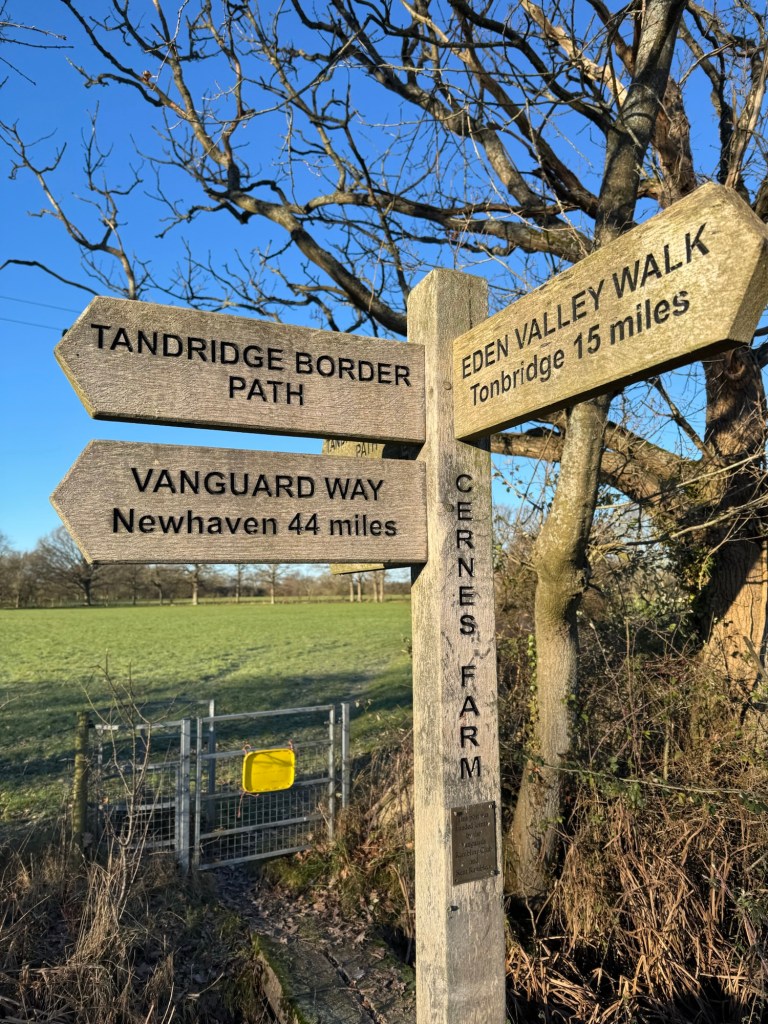
Moving to Caterham a year ago, I came across the Tandridge border Path signs on many of my runs. I came up with the plan to run the loop in one go. Originally, I was planning on doing it in the summer, but life got in the way. So, one year to the day I moved I set off to run the border path…
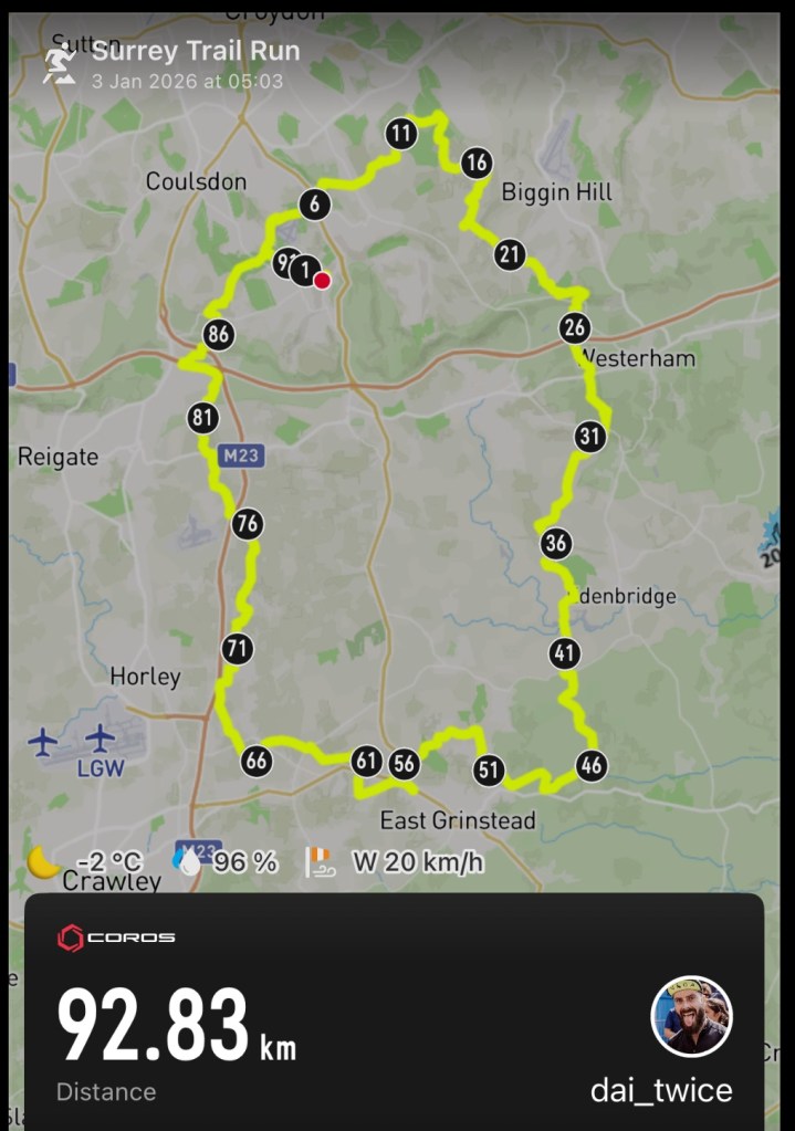
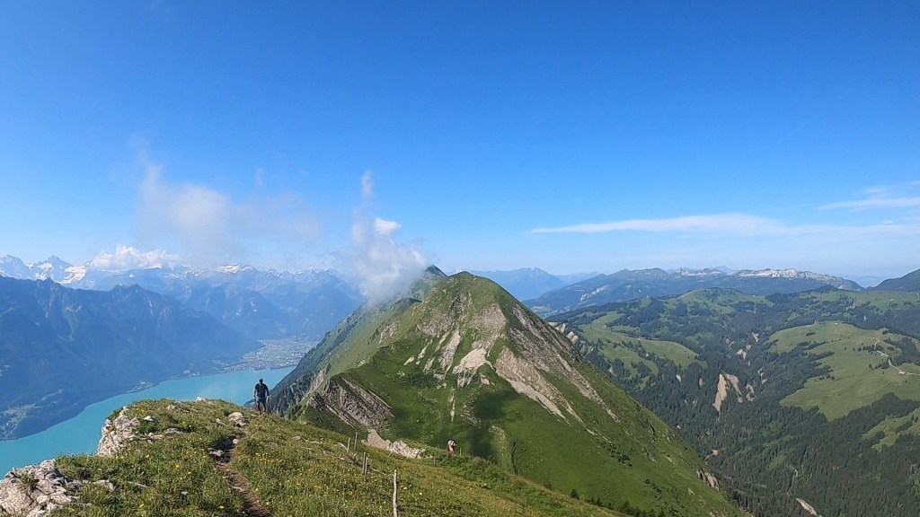
I added a few km to the route so that I could start and finish at home. With this in mind I choose the edge of Coulsdon as my starting point for the loop and then to run it in the clockwise direction (there is no official start or end or intended direction to the loop). This seemed to be the closest and most direct place for me to join the path from home. Having plotted the route and the extra to join it, I was off on a 93km adventure.
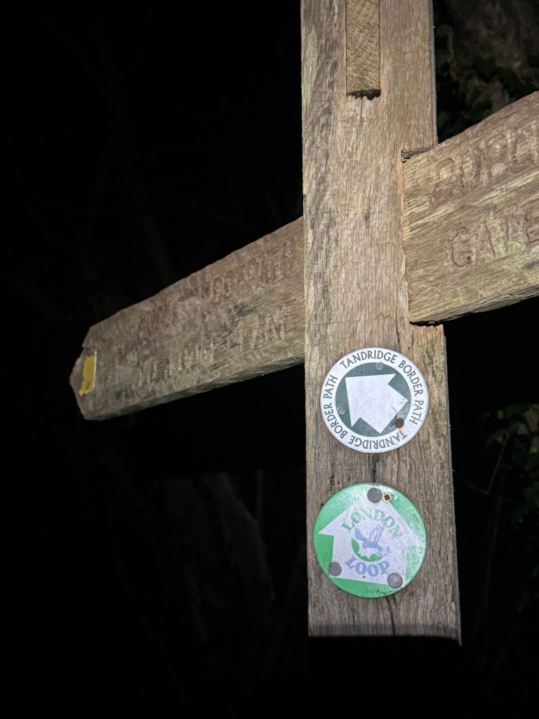
Rydons Lane at the start of the TBPTBP signs
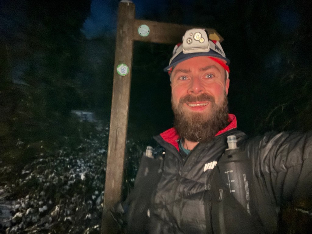
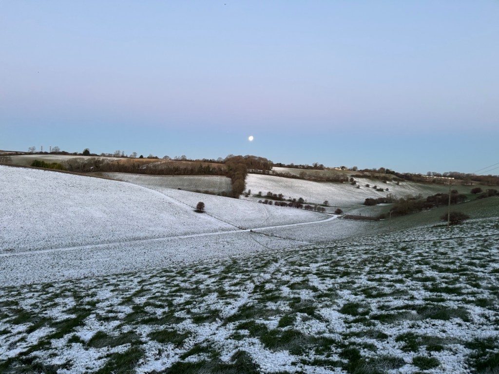
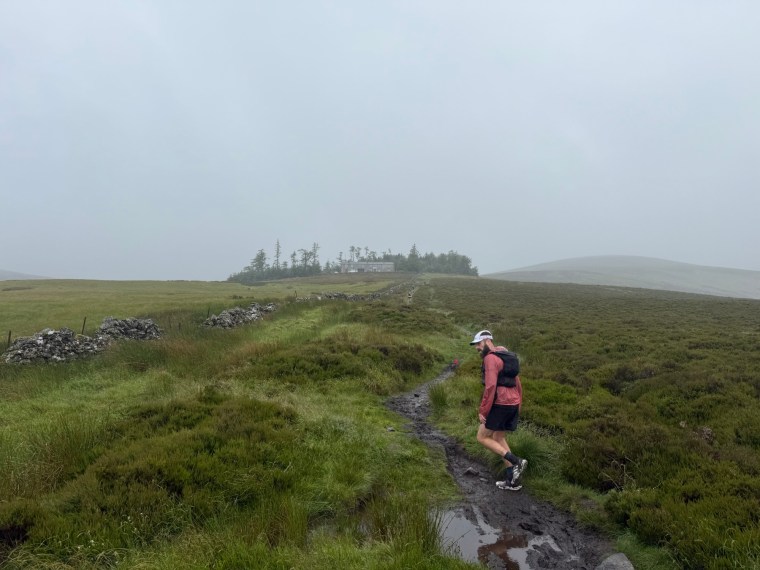
I set off in the darkness of the first Saturday of 2026 at around 05:00 and reached the first signs for the Border path in Coulsdon Common just before it loops around Kenley airfield. It was approximately 05:30 now as I started navigating the path from Rydon lane, initially on a section of the London loop. The roads to get here were covered in ice and I proceeded slowly with caution not to slip.
Immediately I took a wrong turn and hopped over a gate into a field where I was confronted with a large black animal charging at me. In my sleepy state I didn’t see it until the last minute. Thankfully it was an excited horse. I think it wanted help escaping. Shortly after I realised my mistake and I back tracked over the fence and onto the correct path.
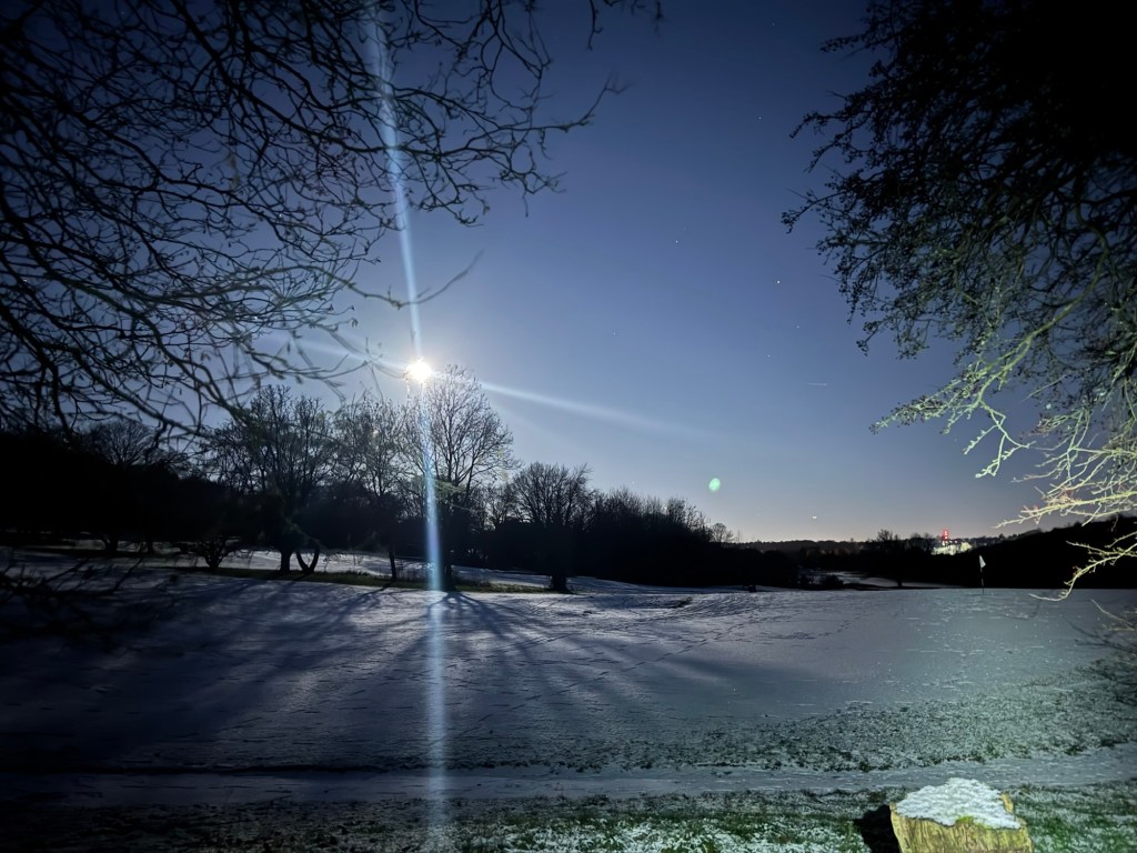
Mentally I’d broken the route into roughly 20km sections. I hoped to get to Tatsfield and the near the North Downs way for day break. Most of the initial section was very familiar to me as the path takes you Through Whyteleafe, up near Riddlesdown (where I enjoyed beautiful views of London way off in the distance and the big moon glowing above me) then over to Farleigh and Fickleshole. These first paths were backed with a soundtrack of owls and pheasants in the dark forests. As I ran through some fields tens and tens or pheasants shot up into the sky like numerous missiles being launched.
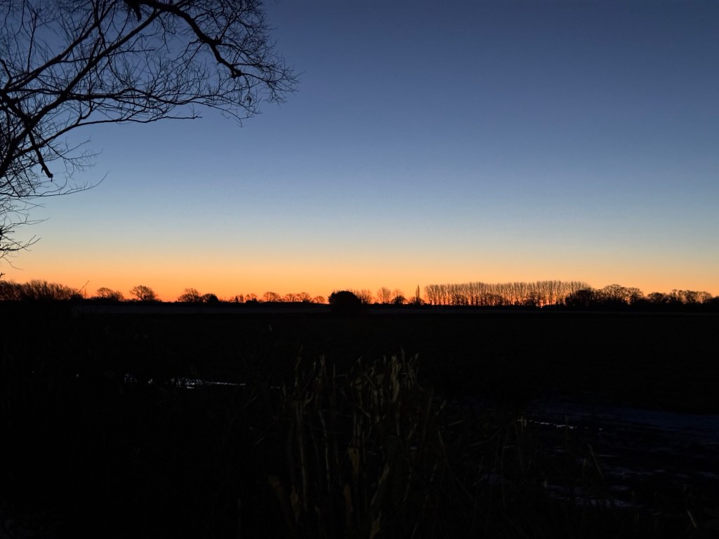
Sunrise near the North DownsFields at night
I had another dodgy animal encounter as I crossed into a footpath running through a farm at Chelsham. Previously here I’ve been chased by some very territorial geese as the footpath crosses the farmland. This time it was a big black dog barking deeply, and with feet on the stile I needed to cross. I took a few minutes staring him down and reassuring him. Surprisingly once I was in the farm, he stopped barking, although I was still on alert. Then, as I neared Tatsfield the sky was starting to warm with glowing orange and red colours of daybreak. My first section was done!
Snow covered fieldsClearest sign for the TBP
The path takes you very briefly along the North Downs Way at Chestnut Avenue before a long stretch of road down Clacket Lane sees you cross the M25 as you make your way towards Limpsfield Common and High Chart. Here daylight took over and the darkness of night gave way.
I found kms 20-40 slower going as the path takes you through a lot more farmland. The terrain was uneven and at times difficult to more quickly on. The fields were snow covered and hardened with the frost beneath. Tentatively I couldn’t tell if there was frozen sections that would give way as I trudged along. Much of this section is along the Vanguard Way before you leave it and head West just North of East Grinstead. But not until after one of the larger, longer climbs on the route by Dry Hill.
As you Navigate around East Grinstead the route takes you towards Dormans Park where you pass the train station (a good potential place to join the path if travelling from elsewhere!). After Dormans the route heads towards one of the more built-up areas near Felbridge. I was around 55km in at this point. I’d planned a diversion to a petrol station, deviating from the path for a km to reach it. This was the only viable place for me to fill up with water and access more food if needed. There are no public taps along the route that I could identify when planning and the few pubs/village stores you pass weren’t options for me due to opening times. I was glad to reach the petrol station and top up on water (I had more than enough food with me), however the stop made me cold, very cold, so I tried not to stay for too long and carried on.
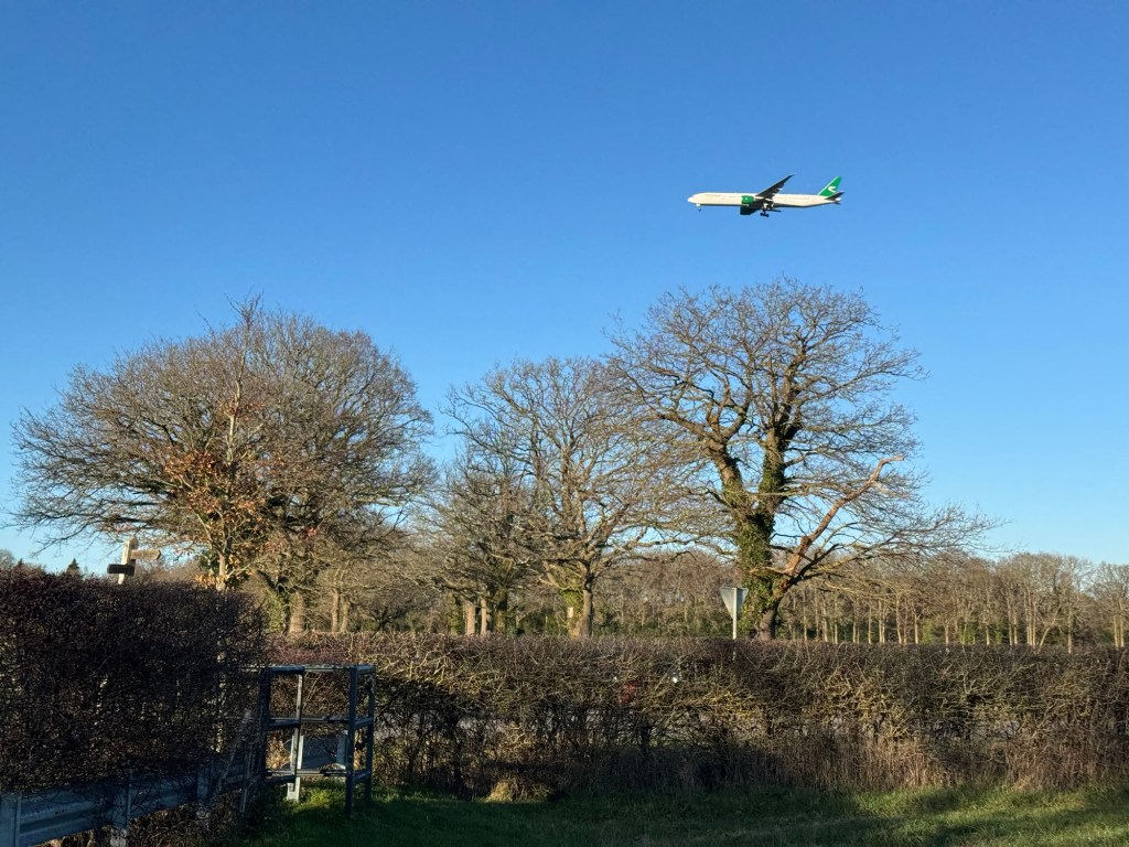
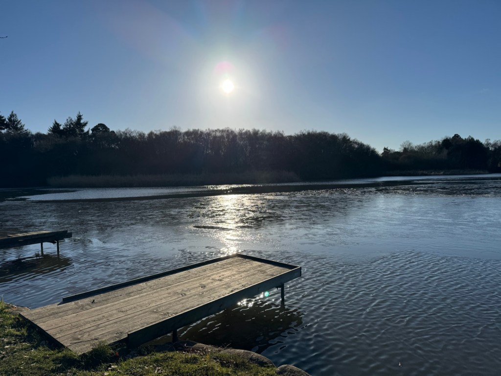
Planes landingFishing Lake
With the detour and navigating around Felbridge there were quite a lot of icy road sections. Then, from 60-70km the paths were much wetter, saturated with water and mud. My feet were now wet and freezing. There was a nice section just after Felbridge as you ran around a lake set up for fishing activities. Here the path is still heading West as you near Gatwick and head directly under the flight path of landing planes. Somewhere around the 65km mark (for me) the path edges closer to the M23 and you start heading North as you pass through Burstow. Here the path was unidentifiable and I trudged through frozen, waterlogged fields. The ground was almost indistinguishable as the water had frozen. My shins were shredded by overgrown thorns sticking out and from breaking through the ice layer as I waded through the field, some points almost knee deep in the water. I was glad to eventually find my way out of these fields and back to more obvious paths.
A few km later you near Smallfield (there is another option of a short detour to a Co-Op here if needed) and then shortly later I was back on familiar territory as I reached Outwood, another place with loads of trails and places to run/walk. I pretty much knew my way from here. The path heads North, passing by Redhill, crossing the M23 (note that there is clear access along the marked public footpath through then through the Kings Lodge Care complex) and heading North through Nutfield and up to Merstham (through/around Mercers lake). This felt like a long stretch.
London Way off in the distanceSunset looking South from the North Downs
As I reached the M25 crossing and rejoined the North Downs Way again I was presented with a glorious sunset. It felt quite fitting to see the sun rise and set over the North Downs Way! Passing back through Chandon there was a short detour (the footpath was diverted for animal grazing) before I entered Happy Valley and ran back through Coulsdon Common to where I completed the Tandridge Border Path loop at Rydon’s lane. I kept running and made it home just inside 13 hours covering just under 93km. Happy with that!
Back at Rydons Lane
Overall it was a great day. The icy roads made for slow progress and, despite the frozen fields being difficult to run at times, I was glad it was dry and not muddy like these trails could be in worse weather. It’s a great way to explore and see more of Tandridge whilst connecting some trails I’ve become so familiar with.
Another week, another race. I almost didn’t sign up to the inaugural Tea & Trails ultra as I thought the cost of an entry was far too steep (I think it was about £150 for a 50km!!). However, after Jon got a discounted entry for a friend, I decided it was more reasonable and jumped on board, ready to explore a little more of the Lake District.
We travelled up on Friday morning along with Ilona and Phil and would meet Shirin and a few others in the lakes. As part of the event there was camping and various talks and stuff happening over the weekend. Thankfully though Jon isn’t fond of camping and neither am I (when running anyway!) so we dropped the others off in the field in the rain and made our way to the hotel to check in.
The next morning we arrived bright and early to register and spent a short while chatting with the others before deciding to just start. Yep, just start we did – the organisers had a rolling start for an hour before the mass start. We’d planned to join the mass start at 8:30 but thought there was no point hanging around for another 45 minutes when we could just get going. Besides, Jon had a plan to deviate from the course and ‘tag’ a few more Wrainwrights, so the extra time would be put to good use.
Dry and warm before the start…
After a quick kit check and receiving our trackers, we spent a few mins explaining to the tracking/safety team our plan to go off route. It was better to let them know in advance rather than panic if they saw our trackers go ‘off route’. Then we casually walked over the start line and out of the field…
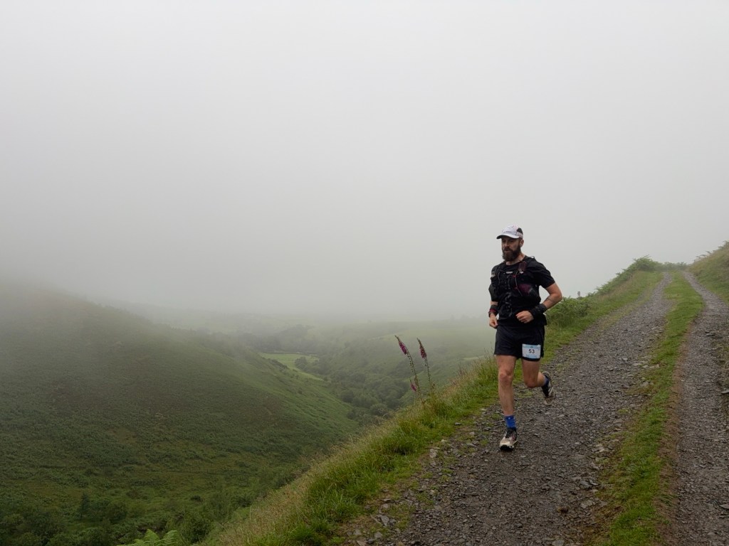
It started with a bit more faffing as I forgot to start my watch and didn’t have my heart rate strap on (great fun trying to get on without taking my jacket off in the rain) which I did as we slowly jogged along the country lane upon leaving the field. It was already wet and miserable as we slowly walked the long road and made our way up to the car park at the bottom of Skiddaw. Despite this, it was way too hot so I peeled my jacket off half way up. From the car park we had a nice gentle single track descent and, momentarily, the clag lifted and we could see a glimpse of a view back down through the valley.
Runnable trails after the first climbA slight moment when the clag lifted
We passed some Marshall’s before continuing down on a slippery and wet section before seeing some of Jon’s friends who were volunteering out on the course. Next up came a wide and gentle climb as we made our way along the other side of the valley and towards Blencathra. By now we’d passed a few others from the rolling start and could see the masses from the main start making their way along the other side of the valley we’d just traversed. The front runner already had a significant lead and we suspected he’d be passing us very quickly.
We had a short descent into another car park before heading onto some single track to begin the first of two big climbs on the route. It was straight up to Blencathra from here. We were on the gravel switch back climb when the first runner did indeed come speeding passed us, running the steep climb effortlessly. It is always so impressive to see lead runners running, not something I get to experience in a mass start!
Climbing Blencathratogether…
As we reached the top the summit was completely covered in clag and visibility was just a few metres. It was windy, but a decent temperature and not cold at all. After a quick summit photo we made our way across Blencathra (I was trying, unsuccessfully, to see were Halls Fell ridge was, which we descended down on the Lakes In A Day last year) as we passed.
Visibility up BlencathraDescending Blencathra
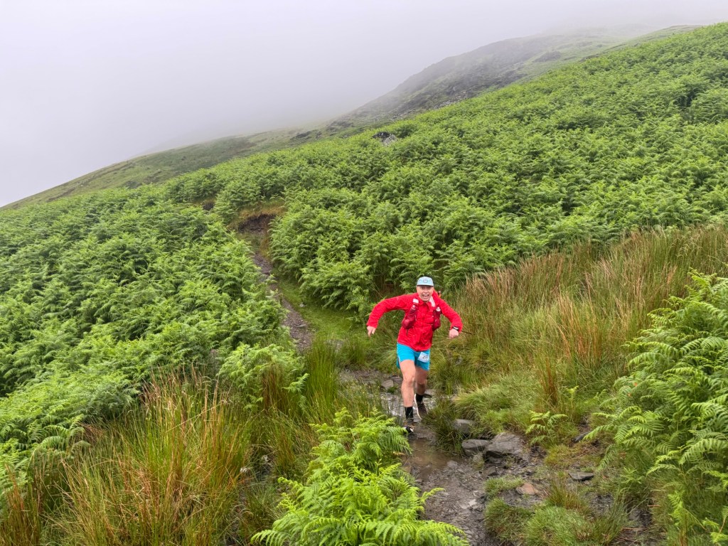
It wasn’t long before we were descending again with initially nice wide trails and a little bit of off-track running. It was enjoyable and the further down we went, the better the visibility became. Off in the distance we could see other runners and where the route would take us. It was probably about 45 mins since the lead runner went passed and now more and more runners were following in his footsteps.
We continued to descent in a lovely single track that very quickly became a stream. The relentless rain for a few days (whilst the rest of the UK was experiencing a heatwave, It had been pouring down in the Lake District!) meant there was a lot of water running off the mountains and temporary streams were forming as the water followed the shape of the footpath. We embraced it and the descent was still enjoyable even with cold and wet feet.
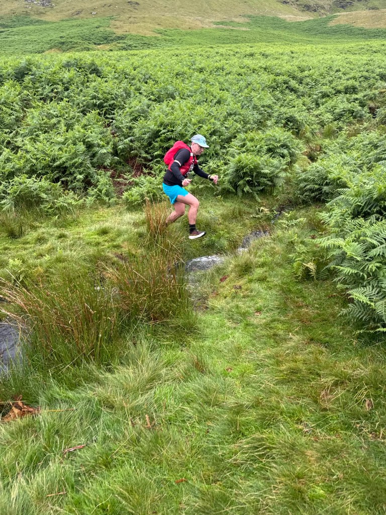
As we continued, so did the build up of water. There were puddles galore and some were quite deep. Despite mocking my choice of footwear (they were far from aggressive on the grip front) it was Jon who slipped and fell (not once, but twice) and had a small mud bath. I almost joined him when I stopped to take a photo and almost slipped whilst standing still!
Tentative trails before the fallnimble footwork
We made it to the first aid station after about 20km and were glad for a quick fuel stop. The aid station was quiet but exceptionally prepared inside the Mungrisdale village hall. The lovely volunteers pandered to my constant requests for sandwiches (first jam and then cheese and pickle) and afterwards stocked me up with wonderful cakes (the salted caramel brownie was delicious) before we left. As we walked on, I tried to eat all the food I was carrying, but had to stash a bit of brownie in my soft cup which I was just to stuffed to finish. I forgot about it later and found it all mushed up in my cup after the race!
We started seeing more and more people now and Jon became more and more recognised too. Besides being recognised from his (brilliant!) adventure on the Northern Traverse (organised by the same race director), Jon is a bit of a Tea & Trails super fan and featured as a guest on one of the episodes. A handful of people recognised him along the day! Much to my amusement as I mocked him each time (think “oooh podcast friends” and “I’m kind of a big deal”).
In the midday rain we continued along the undulating road section to Mosedale (this was pretty dull and a little tiring with the small inclines and descents) before re-joining the trail that leads to Skiddaw House (the next aid station). From here I knew the next few kms as we’d run the same trail years back (with Jon!) on the Grand Tour of Skiddaw race. As we reminisced about previous races the Tea & Trail hosts popped up on course, much to Jon’s delight and my amusement. I said Jon was like Troy McClure from The Simpsons – “hi, I’m Jon Zincke, you might remember me from such adventures as the Northern Traverse and the Tea & Trails Podcast”). After a quick chat we carried on.
Up to Skiddaw House
It wasn’t long before we reached Skiddaw House (the highest hostel in the UK) and stopped to refuel (or chat Northern Traverse with fellow runners/volunteers in Jon’s case!). As I mocked him a little more, I stuffed my face with more cheese and pickle sandwiches (Pickle me up!) in the rain. It was good proper soggy weather now!
From here we’d have our first course deviation to ‘bag a Wrainwright’. After a few kms of lovely runnable trails we left the trail and headed straight uphill on a vague track. It was steep and slippery and slow going. We added a few hundred extra meters of elevation here to see a pile of rocks before turning round and heading by back down to re-join the route. This was the biggest deviation we’d do and I was quite glad when it was over!
This could have been taken anywhere along the route!
The trails took us along a gentle track back down through the valley and we joined a road we once again recognised from the Grand Tour (it was a different experience that day which was very hot and sweaty!). The next few kms took us through several fields and trails as we made our way to the bottom of Skiddaw. Here there was the final checkpoint (no more sandwiches as it was just a water stop) before we would start the biggest climb of the course.
And climb we did. We’d be climbing Skiddaw the way we descended on the Grand Tour up (along Ullock Pike I think). I thought I remembered it well, but clearly I didn’t. The initial part had a few longer and steeper climbs than I remembered. Nothing too bad but a few slightly technical sections and it was slow going on tired legs. Before we reached the steep ‘scree’ part of the climb we took another diversion. A very short one as we extended a corner to a tighter angle to bag another Wrainwright. Passing the pile of rocks (so memorable I can’t even recall its name) we re-joined the course and began the toughest part of the course.
Here you climb steeply along the side of the mountain with small loose rocks underfoot. By now the wind and rain was pummelling us. It was very much a case of head down, keep breathing and keep slowly moving forward. It was far longer than I remembered and the legs were screaming out for it to be over! We kept going and made it to the top where the wind really kicked in. Strong winds were blowing runners around and making it difficult to traverse the short out and back to the actual summit point where we’d turn around. We thanked the volunteers who were braving the elements for us and headed back. The mission now was to get down as quickly as possible to get out of the wind. We were cold and wet as we tried to run whilst holding our hoods and hats on our head and hold our race numbers to our shorts. I was leaning back into the wind as it pushed against me, pushing me upright and vertical. The whiplash of my hood flapping violently against my ear was annoying and I was so glad when we’d descended enough to get out of the wind and clag.
We made a decision to skip our planned, short detour to Skiddaw Little Man as we really just couldn’t be bothered now (it’s an easy one for Jon to access and tick off this Wrainwright another time) and kept with the momentum of running down the descent off Skiddaw. The descent was tiring. A quad buster for sure. I’d only ever ascended on this route before and once again had forgotten how long it was. Running down hill was quickly exhausting. The legs had had enough now!
Eventually we made it back to the car park (the one we’d passed first thing in the morning) and confused some spectators as we detoured again and left the route. We were off for the short detour to Lattrig. We took a slightly different path than we’d initially planned and it turned out to be much nicer (longer but less steep!). We had a brief chat with some hikers at the view point (not knowing that we hadn’t actually made it to the summit point!) and then turned around, ready for the last few kms to the finish line.
Glad to be finished and ready to have a shower
The descent was nice and gentle as we ran single tracks before joining some flatter fields that headed back to the country road we started on. It was a short few hundred meters back into the campsite and over the finish line, through the human tunnel the volunteers created as they cheered us in. We were given our finisher’s mugs and we played around as we had our photo taken. We then met up with the others and also cheered in Shirin who finished just behind us. After the finish we had a quick dry off and change in the car park before driving back to the hotel for a lovely warm shower and fish and chips. We later headed back down to the campsite to watch a live recording of the podcast.
It was a brilliant weekend and adventure with a great organisation of the first Tea & Trails ultra. It might have been typical to get blown about and soaked through in the Lake District. Certainly true that races in the Lake District always have the best aid stations and food!
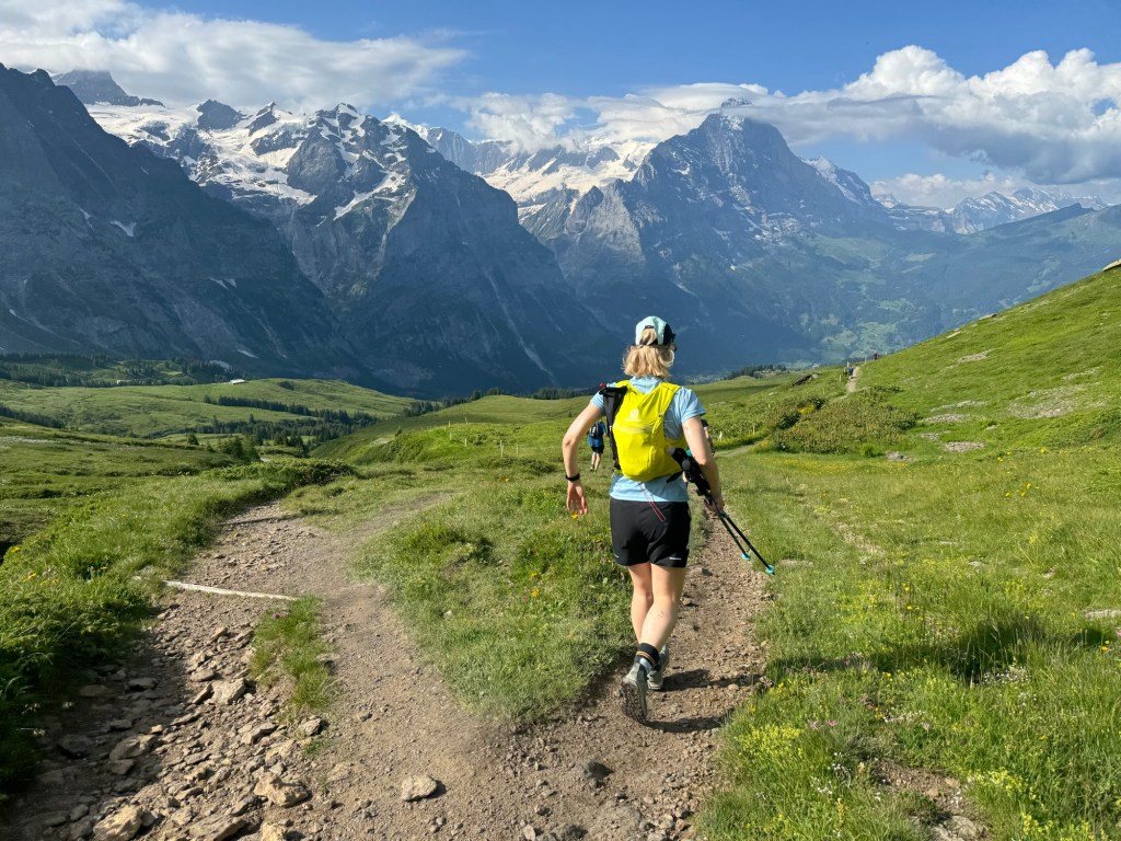
A few years ago Paul did a solo adventure along the Hardergrat Trail in Switzerland. Ever since he’s been eager to go back with us to do it with him. We started scheming and found the time to form a plan and incorporate another visit to the Eiger Ultra Trail alongside the Hardergrat Trail. Paul, Matt and I did the E101 100km Eiger Ultra Trail back in 2022. Darryl and Natalia wanted to do the race too so it was perfect timing, to combine the Hardergrat with the E51 50km race the following day.
The plan seemed simple enough, fly to Switzerland on the Thursday, Do the Hardergrat Trail on the Friday, do the race on the Saturday and fly home on the Sunday. Efficient, although not the recommended approach for a race and a bunch of early mornings were for sure going to be tiring! We based ourselves out of Interlaken to take advantage of being closer to the Hardergrat Trail and more options for accommodation. We also had one shot at the Hardergrat Trail so were very dependent on the weather/ground conditions, which thankfully, were perfect…
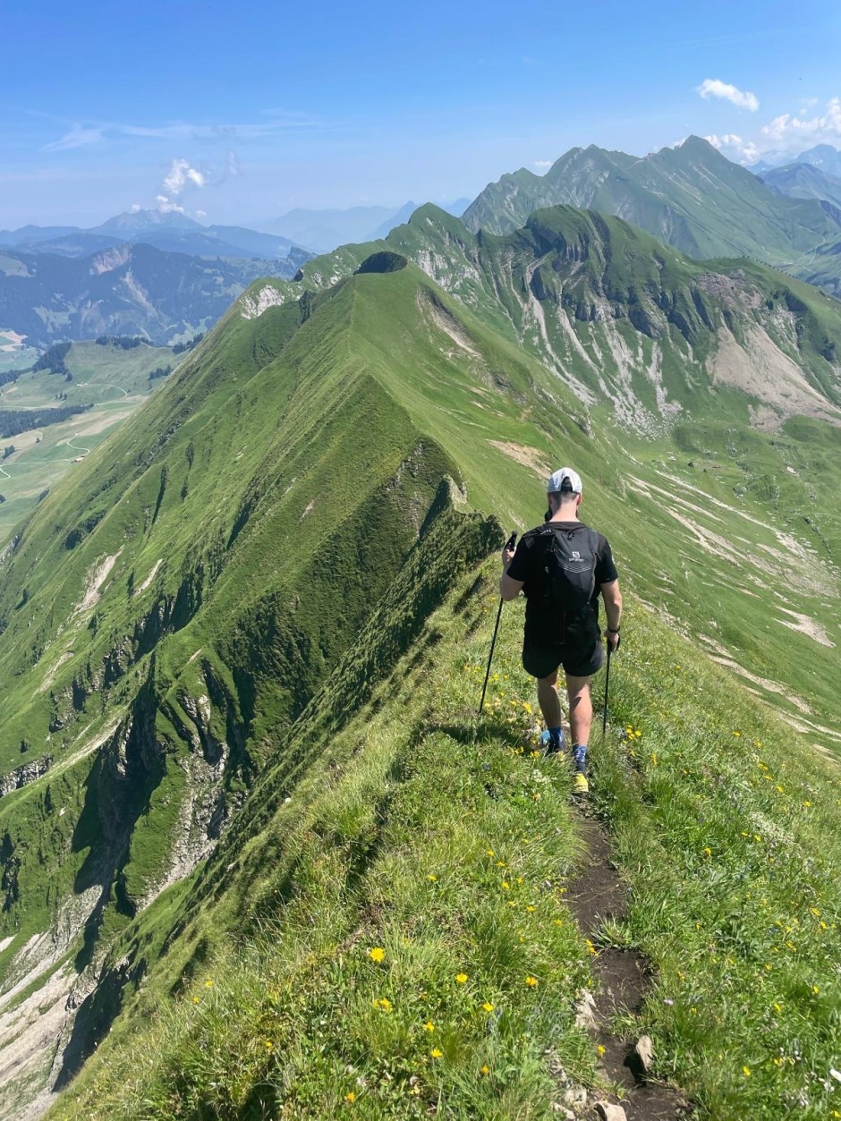
Hardergrat Trail
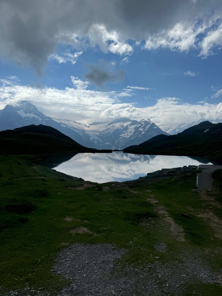
The Hardergrat is a popular and well known hiking trail that runs along side the Brienzersee lake between Interlaken and Brienz. Although I say hiking trail, I don’t believe it is an official waymarked and maintained Swiss trail. Depending where you read, it is often described as one of the most dangerous hiking trails in the world. Whilst I don’t believe that myself and think there might be some dramatisation (I’ve felt less safe on some other trails I’ve done!), the risk is very real and it is well known that people have fallen, in some cases fatally, from the trail (there are many memorials and crosses along the trail!). It also isn’t for the faint hearted though and can be quite terrifying in parts. So if you are considering it, consider it carefully and plan appropriately!
The Hardergrat Trail (Seen from the other side of the lake)
All that said, we didn’t go into this lightly and had planned it very meticulously. Firstly we had Paul leading the way and he had completed the trail before. So we collectively knew the route and dangerous points and what to expect from first hand experience. Secondly we were only going to start if it was safe to do so. If it was wet, or indeed had been wet in the days leading up to our adventure, or windy, or any risk of the forecast changing unexpectedly for the worst, we wouldn’t be starting. We also planned to begin at 5am. The trial is over 25km long and has close to 3000m of elevation gain in total and finishes high up in the mountains where you either get a train back down, or descend over 1000m by foot. We didn’t want to feel any time pressure so we planned to start the hike from Interlaken up to Harder Kulm as early as possible (note, there is a vernacular that covers the ~1,000m climb to Harder Kulm, but this doesn’t start running till about 9am). We also planned to stop towards the end of the ridge and descend to Planalp and get the train to Brienz from there rather than continue all the way to Brienzer Rothorn. These trains finish around 4-5pm so you need to be ready to reach the end destination in time or face that huge descent on foot back to the lake (also worth noting it was about 40CHF for a single ticket down from Planalp!). Besides all that, the four of us consider ourselves to be well experienced on mountain trails and conditions and look out for one another. So we felt we were suitably prepared…
Our one concern was water. Given it is only really safe to attempt this trail in summer, and it is completely exposed along the top so was was going to be very warm, we wanted to carry as much water as possible, a minimum of 3 litres each. With the Harder Kulm being closed so early in the morning, there is no where along the trail to get water for pretty much the duration of the trail. Around Augstmatthorn I believe you could descend and then retrace back to the trail, but you’d be adding hundreds of metres of elevation and hours to your time, so you only really leave the trail here to start or finish a hike. We’d carry as much as we can and be sensible with the rationing.
We woke at 04:00 when our alarms disturbed our slumber. Had a quick breakfast and made our way outside around 04:30. It was a short run to the vernacular station where the trail to Harder Kulm starts. It is a forest trail winding up narrow switchbacks pretty much the whole way. I popped two Energy Bytes (caffeine sweets) here to help wake me up a bit and give me energy on the climb. It took us about 1 hr and a half to make the climb through the forests to Harder Kulm which was about 800m over 5km. From the restaurant and viewpoint here there is probably about another 300m or so along 2 km through the forest before the mountain ridge becomes visible. On the way, as we stopped and ate some sandwiches, a few others passed us including two brothers from America who we would see at various points as we leapfrogged each other along the trails.
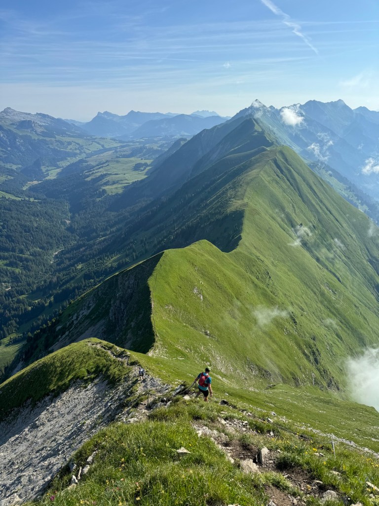
It was beautiful seeing the sunrise through the forest and the morning mist giving way to these epic summits stretching way off into the distance. A long way below to your right, the lake looking like a gigantic hole in the ground. The mountain kept climbing until we reached Augstmatthorn around 14km in at some 2,100m up. Getting here we had our first taste of the ridge and some narrow sections. Many hikers stop at Augstmatthorn and make their way off the ridge. Another hiker we were talking to told us the route becomes much harder and more dangerous after this point (he had hiked it many times himself when he was younger he said). Somewhere along here there were also electric fences to one side of the trail to keep the cattle on the mountain side to the left. I know they are electric as at one point, whilst sitting down and resting, I brushed my arm against it and felt a tingle in my opposite ankle. This amused the others!
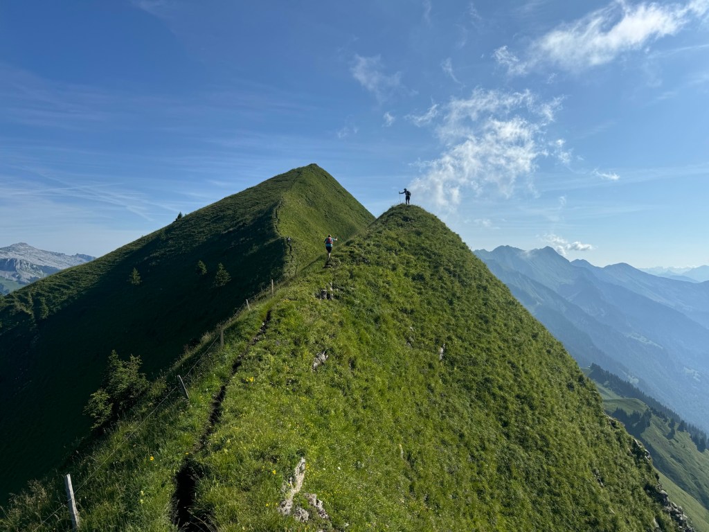
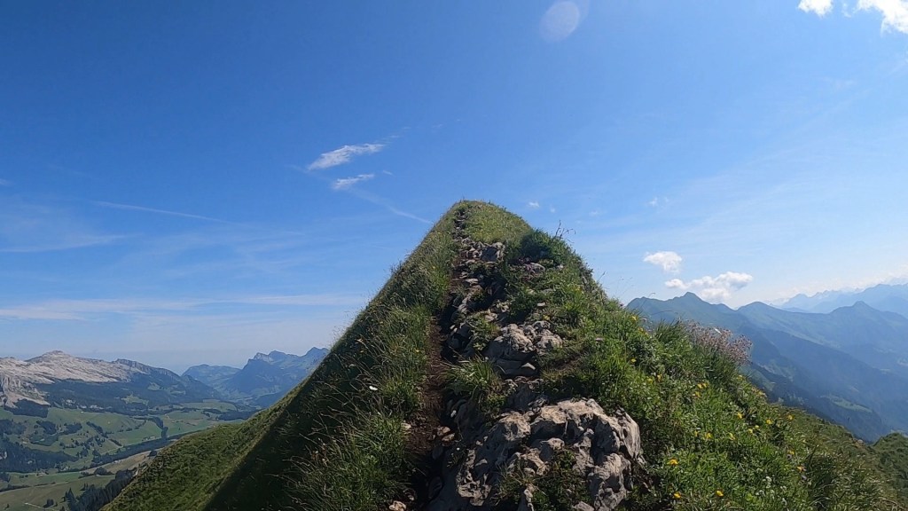
We carried on knowing we were a little under half way along the route we’d planned. What lay ahead now was a series of 7 or 8 mountain climbs. Each short (in comparison to what we climbed to Harder Kulm!) but very very steep. Some sections were rocky and had ropes and chains. Some sections had very clearly defined paths, but were right on the ridge and were very narrow underfoot. Some of the climbs were like walls and we scrambled our way up. It was very slow progress and we stopped atop of each summit to sit and enjoy the views and eat food. The views around us were pretty static. The view down and across the lake remained unchanged throughout the hike. The view to the left did change as the valley climbed through a mountain pass alongside the ridge. The view in front however was spectacular. With each summit we climbed, the descent became visible and the ridgeline curved off with a different perspective into the distance. Up and down we went…
It was a long slog as each climb was exhausting and we rationed our water more and more. Unlike when running in a race with aid stations, I was taking small sips to ensure I saved the water and had plenty for later on. Each big climb though would quickly empty a bottle. I played a strange game with myself where I was committing to not finishing a bottle before some point I picked in the distance. This felt counterintuitive but, the longer we progressed, the less water we had and the more it become problematic. One by one we were calling out just how many bottles we had remaining and the numbers were dropping quickly!
It’s hard to say for certain which memories and pictures correspond to which peak on the ridge. I do recall though that we passed plenty of hikers along the way, many doing it in reverse having taken the train up from Brienze and hiking back towards Augstmatthorn. One couple were lovely to chat with and I had a great conversation with the lady about the vibrant wild flowers all along the ridge. She told me to “take as many as I could and keep them in my heart”. I thought this was a beautiful sentiment. I also recall one particularly difficult descent which required scrambling down on all fours. For much of the ridge I kept my poles tied away in my pack and relied more heavily on my hands and having more points of contact with the ground.
Towards the end, the ridgeline was far narrower which caused the legs to feel more wobbly despite the clear and flat footpath we were following. Way off in the distance though we could see the Hotel Rother Kulm / Brienzer Rothorn Station which is the true end of the route. We weren’t going the whole way here but instead would escape down the side of the mountain and get on the train at another station at Planalp. For us, continuing to Brienzer Rothorn wouldn’t add much to our experience other than making it more dangerous – it would be quite a few more kms and probably two more hours or so, which we weren’t able to accommodate with water to sustain us. It wasn’t the timings that concerned us, but carrying enough water!
As we neared the trail junction where we could begin descending off the mountain we were all pretty much out of water. By now we’d ‘adopted’ the Americans who had made great progress but ultimately weren’t prepared for their adventure (think lack of training and deciding to do the hike whilst on a family holiday) so together we all descended. Even the downhill was tough going as our legs were now tired and our throats dry. We had about 600m of elevation to drop and about 4kms to go. In the distance we spied a water trough, however when we got closer it was a static one without a tap filling it up. We carried on. Paul had disappeared into the distance and Matt was somewhere between us and Paul. Thankfully after about 3km and 500m of descent we caught up with Matt at another trough that did have a fresh water supply. We stopped and drank about a litre each and refilled our bottles. A few hundred metres further on we all felt the groans of our stomach as the sudden intake of water and bouncing movements unsettled us!
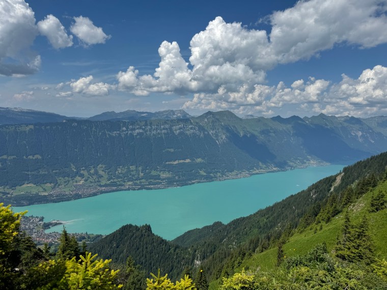
Eventually we made it down to the Planalps station where Paul was nowhere to be seen. He’d mentioned there was a restaurant at the station which we couldn’t see. We soon found it further down the road with Paul sitting happily in the garden waiting for us and a cold panache! We stocked up on drinks of all kinds whilst we waited 45 mins for the next train (which we just squeezed onto) down to Brienz. Here we headed straight to the lake for a lovely cold dip to relax before making our way back to Interlaken. What an adventure! Now time for the Eiger Ultra Trail…
Eiger Ultra Trail E51
After a restless sleep and another an early wake up call we made our way to the station at Interlaken Oost to get the first train to Grindelwald along with a load of other runners. The train was quick and easy and we arrived 20 mins before the race started. We made the dash to the registration centre in the sports centre (we’d taken advantage of the opportunity to request registration on the morning of the race to save another trip to Grindelwald on the Friday!). The ice rink in the basement of the sports centre was gone and it wasn’t cold this year as we waited in the short line, collected our race numbers and dropped our bags off before making the way back to the start line. There were only 5 minutes to go before the race started so we settled into the back of our wave 1 start and then gently ran the 2km or so to the trails. We had maybe 10 runners around / behind us for those first few kms. As we got to the trail there was a big bottle neck as we queued to cross the river. We waited a few minutes at a stand still before we made it through.
Startline
Shortly after we began the first climb to Gr Scheidegg, the memories from the E101 a few years ago started to come back to me as we wound our way slowly up the switch backs. Last time we did this in the darkness so it was refreshing this time that I could see the trails and experience them, and the views, around me. We steadily climbed and enjoyed the short break after about 6km where the trail levelled out and we ran the undulating trails before the remaining climb to the first aid station. As we arrived, it was just as I remembered – a narrow set up that doesn’t really accommodate space for the runners. Navigating through the checkpoint in single file we grabbed some snacks and water and waited out the other side. We spent a while here eating and drinking and enjoying the early morning views of the Eiger before carrying on. I popped another Energy Byte to give me a kick and wake me up a bit.
Early views from the first aid station
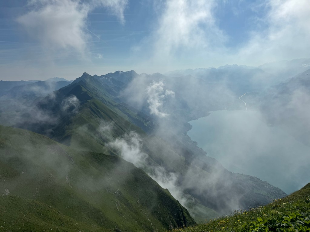
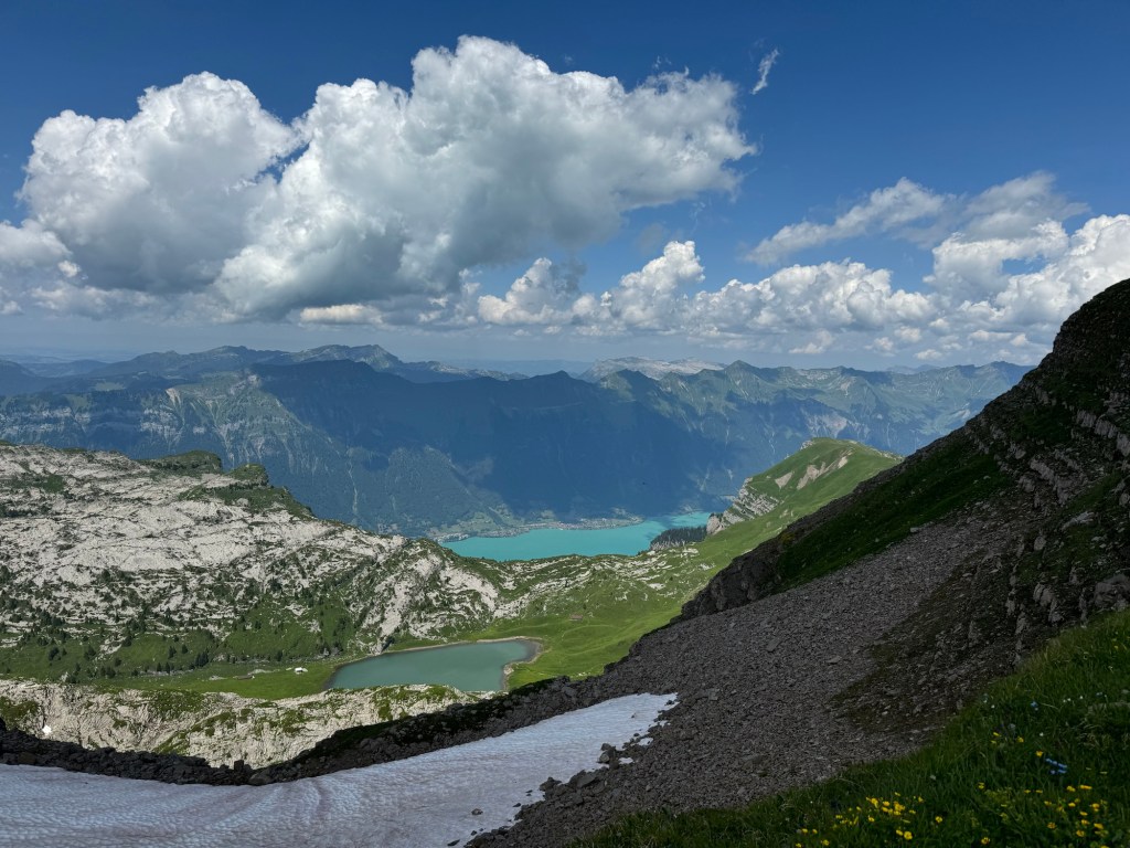
From here to the next aid station, at First, was great. It is a short section of about 6km that has some runnable trails and gentle descents and climbs. All along it are panoramic views of the mountains surrounding the Eiger. The Eiger itself was standing magnificently proud in the cloud cover across the valley. Towards the end of the section we began the long, but gentle, slow ascent to the viewpoint and aid station. As we reached the top, the route markings took us across the trail and towards the viewpoint and the walking platform. This was Natalia’s first time experiencing such a long and exposed platform so we slowly walked along it to the sanctuary of the aid station, after getting some pictures of course! At the aid station I had my own party as I sat and ate loads whilst singing to the 90s pop anthems blaring out. Even though we’d only done less than 15km I tucked into the soups and bouillon available (it’s a popular feed station on the E101 route!). Eventually though we had to carry on.
I remembered the next section as we left First and made our way towards Feld. The trails were similar to before and led us towards some amazing lakes of Bachalpsee, naturally as we ran around the lakes the views were incredible. It really is a beautiful place. I pointed out Faulhorn to Natalia, the highest point in the race way off in the distance, a tiny speck on the mountain. Along here we met some other British runners who were part of a group running from Wild Trail Manchester, the group I spent a lot of time running in London with. After the lakes we encountered a small amount of snow on the trail which made it slippery, so we climbed slowly and carefully. Some smart arse behind us tried to rush past us and slipped in the mud and slid back down the hill. Not sure what he was trying to gain. He didn’t try to go past again.
Lakes at Bachalpsee
I knew the next section was quite rocky and technical (It’s even marked as such with ‘danger’ signs from the organisation). That much I could remember. I told Natalia to go slowly as it was rocky and now wet and slippery too. As we progressed we found ourselves near a lady who was clearly uncomfortable on the technical terrain. Knowing it was a short section I told her not to worry and to go at her own pace safely and we’d all follow behind. We stuck with her. Naturally a queue formed as we slowly progressed along the single track. After a while some prick behind us made a comment “it’s called trail running not trail walking”. I couldn’t hold my tongue. My usual polite and refrained manner was overcome and I snapped back to tell him that clearly there are runners who are not comfortable and that their safety is important. I told them that if they wanted too they could find an alternative route past and if they were such good trail runners then they wouldn’t be way back here in the race with us ‘trail walkers’ after 20km. No one said anything. No one tried to get past us. Go figure. It wasn’t long after that the technical trails gave way and the ground became more firm. The lady kindly stepped aside for people to pass her. We went past and started running. A few moments later I looked back, no one was keeping up with us. Says it all. Sometime later, on the next section after the aid station, we past the guy who made the comment as he was sitting on the side of the mountain on the next climb, clearly knackered. I was tempted to make a sarcastic comment then…
Anyway… After a short stop at the next aid station, Feld, we started the climb to Faulhorn. Before the race I couldn’t remember this climb. As soon as I saw it though I remembered. Like years before it was a warm day so a very hot and exposed climb. It is steep and slow going, a snake of runners slowly dragging themselves up to the top. In the sun it felt like it went on for ever. All the way up you can see the restaurant at Faulhorn, sitting way up high and ever so slowly getting closer and more in view. We kept pushing without stopping and made our way over the saddle and onto the last short climb to the restaurant were the trail takes you around to the back/top of Faulhorn. We stopped for a picture by the archway then joined the queue of runners waiting to get in and fill our water. Like many of the aid stations it is a tight fit (although this one on top of the mountain is justifiable with its limited space). I had a few cups of Coke that had been expertly whisked to a flat state by the willing volunteer. It was so refreshing in the heat.
With the Hardergrat in the distance!Hardegrat Trail
We began descending and all the memories I was so sure of started appearing to have holes, giant black holes. As we left Faulhorn I was chatting to another British lady and I told her it was all nice runnable trails from here. It isn’t. I’d completely forgotten about the next section. First there is a short, sharp descent down from the summit. Then you make your way over rocky ground before the real descent began. This one is long and very rocky. There were a few short snow field crossings thrown in the mix too. As you make your way down you are descending on lots of large steep steps in the rocks, then further down we went, past the restaurant, on trails covered by snow burying the rocks beneath. I slid down on my bum as my shoes had no grip (I was very aware that they are now excessively worn but I thought would be ‘fine for the lovely runnable trails’ I falsely remembered!). Like the climb before it, the descent felt like it went on forever. As the trails started to re-emerge my head started piecing together the memories better as we made our way up a little incline to the water stop that is ‘Egg’.
It was actually this next section from Egg to Schwand that I recalled the best. My memories just made me believe the whole section from Faulhorn was like this. There are some lovely trails for the most part as you ran along the exposed mountain tops. Lots of tourists and walkers out enjoying the hike from Schwand to Faulhorn in he opposite direction. The mountains are exposed and you have these Epic views over the valley to the Eiger on the other side. Way off in the distance you can see another mountain restaurant perched on the side of the mountain. Below it, somewhere, the next aid station. It was a long way to go by sight, but not that long now you can move more quickly with the even terrain underfoot. We made a quick stop in some shade to apply more sun cream as it was getting pretty hot now.
Before getting to the end of the path, there was the ladder/step climb I’d completely forgotten about too. I piggy-backed on to a group of runners half way up and thanked the hikers waiting patiently to come down. After this it was a gentle hike up before we eventually reached the turning point where the downhill started. Pretty much from here it was all down hill to the final aid station. First we descended on lots of switchback trails to the aid station ‘Schwand’ though. This I remembered quite well as two years earlier Paul and I had stopped at a trough and desperately filed our bottles and relaxed, only to then see the aid station a few hundred meters further along. I recognised the trough (now covered up!) and pointed out the aid station to Natalia. We were ready for a break from the sun.
On the way to Schwand
After a little break in the shade and a ‘little douche’ from a volunteer with a hose pipe we departed. The trails led downhill into the forest. It was more technical than I remembered with roots causing the descent to be painful on my now very tired quads and ankles. The ground below was very spongy between the roots. This year I was prepared knowing that there was a sizeable climb during the descent. This caught us out back in 2022. It started in the forest then took us up as we crossed over a waterfall and then climbed further through a hamlet. I didn’t recognise the hamlet and it turns out that we went a slightly different route this time and climbed further. See, not all my memories are wrong! Eventually it was back into the forest as we began descending again and continued down towards the valley. We spent most of the descent in a train of people slowly making their way down gingerly. At some point the single tracks opened and we squeezed passed the group and were able to run at our pace. As the trail became switchback roads Natalia opened up and sped ahead. I couldn’t keep up. We could then smell (literally) the final aid station. We ran passed so many people in the short field as we ran down and into Berglauen. We took a few mins to refuel, deciding against the potatoes on offer, then set off. The final 7km to go back to Grindelwald.
As final 7kms of races go this is ace. It’s pretty much flat the whole way following the river back to Grindelwald. Over the 7km there is 225m of ascent and 100m of descent. Mostly this is grouped into three ‘climbs’ towards the end as you near the town. We ran/walked the whole way passing many runners as we jogged along the river. We then passed through a small village with incredible wood carvings (I now wish I stopped to take a picture!) and welcoming signs before crossing the river and running through the train station and over the train tracks for the Eiger glacier train (which we had to wait for and got a huge thumbs up from the driver). From here it was almost the final stretch as we stated to climb into the town and along the footpath to the point where the E101 joins from the opposite direction and we make our way up the final climb into the town. Its a short steep climb on paved road which everyone climbed so slowly. Once done, it was over! We we ran the few hundred metres down the town to claps and cheers from both sides of the road, round the final turn into the finish line area and down the familiar steep ramp to the finish line.
with our piece of the Eiger
Just like that it was over. We quickly escaped the busy finish area and went to collect our bags, change into fresh clothes, before meeting up with the others and making our way to the train back to Interlaken. It felt like a very long day by the time we had food and made our way back to the accommodation!
What a weekend! The Hardergrat was an incredible experience and it was special to see the mountains around Grindelwald again and share the race with Natalia. I don’t remember the race being as difficult as it was (and I won’t blame the run the day before!), it was certainly more technical than I remembered. We all agreed we wouldn’t want to do the 100k after experiencing the 50 nor could we believe that we’d done it previously!
After a less than fruitful sleep, we were all crammed into the minibus for our transport to the start of the Borneo Ultra Marathon. I had two strategies for this race (1) keep hydrated (2) try and regulate my temperature as much as possible. I wasn’t sure how this race would pan out but I knew to have any chance of surviving the heat of Borneo I’d have to get this right!
Surviving the heat wasn’t the only concern amongst participants of the BUTM. Despite the carnage and ongoing concerns of the Covid19 virus that was sweeping the world, BUTM 2020 was going ahead. I felt bad for the race director. He was in a difficult position. 3 weeks prior they’d advised they were proceeding. Then the global situation intensified. The Sabah region had stayed pretty much virus free until pretty much the day before the race when. So, despite last minute updates to government’s advice the race was still going ahead. This did cause some stir and there was some noise as other races in the following weeks were cancelled. But what can you do, how do you cancel and international event at a few hours notice? It’s a lose lose situation for the RD. Some last minute provisions were made and as we queued up to enter the registration hall, all runners had their temperature scanned and our hands were sanitised. There was advice provided to for social distancing where possible (but let’s remember in the grand scheme of things this is a low key event and it doesn’t draw a crowd of spectators!).
After registering we made our way to the start line which was just a short walk away. This is also where the race would finish as we cross the final wooden suspension bridge across the water. We did the usual pre-race photo rituals and those of us doing the 100km or 50km made our way to the front of the start pen (the 30km has a later start). With little fanfare we were off and started running back through the small town and passed the hall where we registered.
We soon began the first of many long climbs and I settled in near Meghan and Carl as Spencer and Jake ran off in the distance. It wouldn’t be long before I’d turn off and begin a different route for the 100km. First though we began the steep road climb. The pace immediately slowed to a bimble in the darkness of the early morning. The sun was starting to shine and I was hoping to experience this sunrise again in 24 hours time.
A few km in and the 100km runners broke away, turning left away from the 50km runners who’d continue the climb a little further. I had this to look forward to later on where the later half of the 100km follows the same 50km route. For now though, a small quad buster of a trail descent. The ground was lumpy and hard, but my attention was drawn to the views of the surrounding area as the day broke. I briefly chatted to a Canadian woman doing her first 100 mile race and an Irish man from Wexford also doing the 100km (who’d go on to finish 2nd!). I stopped to capture a few pictures and ran on when the roads flattened and became gravel trails. Already the field was thinly spread and I found myself running alone. At the end of the descent I saw a 100 mile runner running back towards me. I assumed we’d gone wrong but he explained the river crossing was ahead and he didn’t want to get his feet wet so was going to cross the suspension bridge. I agreed with him, in the week before my feet took a beating from running in wet shoes and socks as I cooled in the rivers. I promised myself that if I stopped at a river to immerse myself I’d removed them first. It was too early to need to cool in the river though so I followed him across the scariest bridge I’d ever been on. The suspension bridges in Sabah are essentially rusty old wire fencing (think chicken coop wire) with wooden planks along them, not always attached! This one however was missing one side of the wire ‘rail’ as it was broken and hung loose and flaccid along the bridge. The planks in many places didn’t exist and the wire was full of holes. We shimmied across with two hands on the existing rail and sidestepped it. The bridge swinging and bouncing with the movement of runners. I was sure we’d fall in the river!
Shortly after the bridge fiasco, We crossed a concrete road section breaking up the river and even before 8am I was realising just how hot it was and how hot it would get. It was scorching and I was dripping with sweat already. After climbing some more gravel roads we ran into a field where we were scanned before crossing the field and running a trail path along the river. We then began the first of the ‘bigger’ ascents which was a mix of gravel roads and more hard and dry packed trails. Here the heat of the morning really struck and I noticed a number of the local runners would stop whenever there was a bit of shade from the trees. I decided to adopt this technique and grab a few seconds breather also. This would help my goal for regulating the body temperature. It was relentless. I soon realised I’d be stopping a lot on these climbs and taking it slowly so I made my peace with that. As we climbed I also started to think about my liquids. I was getting through my 1.5ltrs (I had an additional 500ml bottle to add to the hydration for later in the day) and I was wondering where and when I’d come across the first water stop. I changed my watch screen to check the distance and somehow I was on 15km already. I was confused as I’d not seen the water station. I thought it must have been in the field where I was scanned (I remember reading about that field in the race notes), but I didn’t see anything. It was a good thing though, it meant that I wasn’t far from the second water stop and had made good early progress.
The second water stop came just before the next big climb and I was glad. I was ready for some food and water. As I arrived I was more confused than ever though. I couldn’t see any water and the only food options (fruit) and fizzy drinks had prices on them and a woman telling me it was RM3 (less than a pound) for a coke, 100Plus or bottled water. What?! I wasn’t going to buy liquids in a race in the high 30degrees out of pure stubbornness. Thankfully I was eventually directed to massive water butts on high platforms with hoses coming from them for drinking water. This made more sense and no wonder I missed it at the last stop. As I refilled my bottles I realised I’d made a kit packing error – in my haste packing the night before I’d put all my caffeinated Tailwind in my race pack rather than the drop bag for the second section at night. Great. I’d be buzzing with caffeine throughout the day now. I decided to try and ration it and water it down a bit to save some for when I’d need it most when I’m tired at night.
As I left the water station we began the first jungle/trail section which was quite technical but also short before the wider trail climbs. Just like the climbs before, this was completely exposed and I was seeking out the shadows to cool down. It was a slow slog to the top but I was able to run a bit as we descended into the next water station. All along the climb and descent there were locals at the side of the road, in cars, outside their houses selling fruit and drink. I didn’t like it. It didn’t seem right to have to buy essentials (yes I class coke and isotonic drinks as essentials in ultras!) during a race.
During this section I recognised several trails from our runs the week before. I ran a familiar ridge and passed a house where we saw a monkey and a pig before passing a place which had amazing views of Mount Kinabalu. Some trails looked so familiar but I wasn’t sure if I’d been on them too! I then arrived at the third water stop and things became a little bit clearer. A volunteer asked me if I wanted fruit and when I asked if I needed to pay he replied saying “no, fruit is free for runners”. I ate so much pineapple my tongue went funny from the acidic goodness. It was ace. I filled all 4 bottles of water and set back out.
And so onto the biggest climb of the race. I was aware this one would be tough and the 14km section (straight up and back down the other side) would take about 4 hours. It was so exhausting. As the sun rose higher in the sky, with it the temperature began to sore. I was looking for the shadows. They were pure temptation. Like a voice calling you over. Come to me. Rest a while. Sit down and take the weight off your feet. Maybe stay a while, stay here all day if you like. I had to challenge myself not to succumb to the relief but to keep moving. I made a pact. I’d stop every time an opportunity presented itself, but not the first shadow, always the second or last one. Make some progress up the climbs and break it up. Each time I’d stop I’d count to ten with deep breathes, resting my hands on my knees and my head lowered to the ground. In and out. I’d watch my heart rate decrease in those ten breathes. Sometimes dropping 30+ BPM. I was working hard in the heat despite moving slower than I’ve ever climbed before.
Eventually I began to reach the top and there was a woman selling drinks. I knew there was a false summit but the trail descended quickly so I asked here if this was the top and she replied ‘yes, all downhill to the next water stop’. I packed away the poles, composed myself and cracked on. She was wrong. It was the false summit and we still had 300m of climbing to cover. I was annoyed! As we began the descent I saw a runner turn right but I saw the markings go to a trail to the left. I stopped and was about to call after him when I saw markings that went the other way too. Another runner also stopped and we debated which was right. We followed the first runner and saw more markings further on, we hoped it was right!!
When we weren’t far from the end of the descent we reached the 4th water stop. We were now 40km in. I filled my bottles and went and sat in the shade in the hut. It was quiet here with only one other runner doing the 100 miler. I sat with my head between my legs and necked a lot of water. A woman asked if I was ok. I felt fine, just too hot. She told me I was 11th. Just outside the top ten and the 10th runner just ahead. I laughed at her. That’s crazy I said and I told her I need to slow down then. I sat back and chilled out. That might have spurred people on, but not me. I went the other way. Top ten?! That’s not me. So I decided to stay here for at least ten mins and recover from the exhaustion of the climb. I eventually got up and went to another hut full of fruit and gorged on more pineapple and watermelon. I tried chatting to the women who prepared it all but they just kept laughing at me. Some sweaty white guy stuffing his chops and not stopping to chew.
I carried on. It was only 4km to the next water station and I now felt recharged and fuelled after the lack of food earlier in the morning. I was able to run a little and the ground was quite forgiving. The next water station was a confusing one as it was also one I’d revisit later in the race. I sat down for another 10 mins and applied more suncream and had some more fruit and water. The exit to this station was a massive suspension bridge and we were then running on some undulating trails heading back towards town. About halfway along the trails the runner I was following stopped. He said he didn’t see any trail markings any more. He was right, I’d stopped paying attention and now also didn’t see any. I ran on a bit but still didn’t find any. I loaded the GPX on the watch and it seemed like we were ok to continue. It wasn’t on the track but it looked to run parallel. We both sat on the floor and composed ourselves. Even thinking in the heat was draining!! The trails did indeed meet once more and we crossed several more suspect bridges. We then ran passed a junction in the race I recognised from the morning (which I’d also visit once more later in the race) and along some road. I was plodding along and before I realised it I was back at the start. Halfway. Time for my drop bag, food and a good sit down and rest.
I was about two and a half hours ahead of my predicted time so I messaged the group. They’d all finished their races now and were still in the area so they came to see me. I was a beautiful sight for them. Half baked with a wet towel draped over me, feet up and chewing on potatoes and other veg (I wasn’t fancying my chances of keeping the chicken curry down!). I was sweating so much. It just wouldn’t stop. I tried to relax and cool down but to no avail. As we talked I found out they’d all smashed their races. We had first female in the 30km, second female in the 50km and several winners in their age categories. Incredible. They went off to collect their podium prizes before leaving back to Kota Kinabalu. Spencer was staying with Jess to crew her sister on the 100 miler and she was flying, she’d arrived and left the aid station. I was getting comfortable. I was content with how the race was going so decided I’d stay for at least an hour. I ate more, bandaged my feet and kept trying to stop sweating. Eventually Jess and Spencer started packing my stuff up and kicked me out, back on my way. Cheers guys.
The next 50km would be broken up. Two big climbs and descents. A bit of flat/undulating trail. A tough trail climb and descent then two small hills and a fairly flat but slightly inclined 8km to the finish line. I was focused.
I started the first climb at a steady paced hike. The temperature had now dropped and the suns heat was diminishing. The climb was immediately easier than those in the morning/midday heat and I no longer needed to stop as I hiked. I felt good. The descent was quite runnable and I plodded on consistently.
I reached the next water stop and took another ten mins to relax. The next climb was tougher than I expected as it was through trail and jungle forest. There were some very steep sections. As I started to climb, it began to rain. Thankfully in the forest I was quite week sheltered so I let the rain cool me. I was also not worried about getting wet because the temperature was still high twenties and I was already soaked through with sweat still.
I summitted as the sun was setting and I took a moment to enjoy the views of surrounding mountains In the twilight. Quite surreal. As I continued along the ridge it soon became dark and I had to put my head torch on. The next descent was a little harder than I expected as the darkness settled quickly and the ground was very muddy and slippery from the rain. I almost stacked it a few times!
At the end of the descent I arrived back at the water station (with the big suspension bridge) from earlier in the day. I cracked into some noodles and rested again. Too my surprise, four 100km runners then showed up (one woman running in some flimsy rubber sandals!) and I was a little shocked. I’d seen only a handful of runners since I started the second loop and most of those were doing the 100 miler. I thought I’d been making better progress now. Clearly not though! I followed them out and we retraced the undulating trails from a few hours earlier. This time I walked behind them. Then, I lost sight of them. I noticed some head torches lights just above me and realised this was were I had to look at the GPX route earlier. I quickly ran back and found the actual root this time and soon caught them up again. We next arrived back at the intersection of all the routes for my third time and I started to veer right. The other runners carried on straight. Aaah. I hadn’t been caught up after all, they were still on their first loop. I was at least 20km ahead of them. That made me feel better.
I was happily walking the next section when I once more realised I’d done this route earlier in the day. I crossed the concrete road through the river again (disoriented and thinking I was going the opposite direction this time – I wasn’t). Despite looking at the route and the elevation I hadn’t quite noticed how many paths I’d duplicate. I knew what lay ahead though. Gravel and pathed roads, climbs and a small descent. Then I’d be at the water station I missed on my first pass (the very first one!). I was getting sleepy now though. I thought about sleeping for ten minutes when I arrived but I settled for coffee instead.
It was back out through the field and along the river before somewhere I turned off on to new trails I’d not yet experienced. Next it would be the biggest and most technical section of the last 50km. Spencer had warned me about how technical this but would be in the dark so I felt prepared.
I don’t really remember the climb. But I do remember the descent. It was brutal. It was very steep and very rocky and rooty. The ground was covered in wet leaves and slippery earth. I was going slowly. I was also feeling it in my feet and the they were hot and raw. I couldn’t wait for this to end.
It was quite surreal being in the jungle at night. The noises were very relaxing and the floor was moving, crawling with insects. I saw so many armies of giant ants, big ugly spiders (eyes glistening in the torch light!) frogs and bats. A few times I stopped and turned off my light to enjoy the darkness and look up at the clear night sky. It was peaceful out here on the mountain with the stars shinning through the gaps In the trees. As the trail flattened out I realised how tired I was actually becoming. I was definitely beginning to fall asleep as I ran and wobbled from side to side. At one point I saw Spencer laying on the ground next to me. I jumped awake as I almost stepped on him. He looked up and said “you alright mate?”. I was beginning to hallucinate and needed more coffee!
I stocked up on caffeine and more noodles at the aid station and carried on for the final two lumps of the race. It was working. The warm food and caffeine enabled me to run the down hill sections which were gravel tracks and road. We crossed many more suspension bridges (quite a few in dire need of repairs!) and I even passed a few runners. Before I knew it I’d covered the 10km of trail and was at the final water stop. I felt good. It felt like a long time since I’d finished a race actually running a bit. Normally I’m resigned to just walking by now! I promised a quick final stop. More coffee and I ate a whole pack of PowerUp sweets I’d had for over a year. A resealable pack, I chewed them all down. This would give me that final kick of energy. And it did. After a quick turn around I was running. I was now churning out some sub 7 minute kilometres as the watch ticked passed the 100km mark. I even ran some of the small inclines and kept the moment going. Partly I didn’t want the people I overtook catching me up. I did now wonder how far off I might be from the top ten all these hours later.
The final section felt quite disorienting and I felt like I was running around in circles. Constantly crossing bridges and looping around. As the kms ticked down I could sense the end. One volunteer I passed (checking bib numbers in) congratulated me. I smiled. He was right. I’d done this. The few km ahead were a formality. I was feeling it. Smiling. Running with confidence again.
Up ahead I saw the bright lights on the other side of the river. All very quiet, but this must have been it. The final bridge crossing. I’d read about it. You finish this side of the bridge and walk across to collect your medal. It wasn’t exactly as climatic as that for me though. There was no one there. I crossed the bridge and ran under the finish arch to total silence. At the finish line two volunteers. One checking all the mandatory kit. The other handing out the tshirts and medals. Very subdued at 05:00 in the morning! Which is always to be expected. I’d come in under 24 hours, I was very happy with that.
I walked back to the registration hall, collected my drop bag, found the driver Joanne had arranged for me and headed back to the lodge to get some sleep. In 12 hours time I’d be on a flight back to the UK and in 24 hours time I’d be heading to work, and my adventure would have sadly come to an end! What an adventure it has been though!
Joanne and Richard from Adventures in Borneo had prepared an incredible two weeks of running and adventure for us. The Planning and organisation and support from them and their team was incredible. They’d supported us through the race too. Not only with the logistics and organisation but through their advice, experiences and getting us exposed to the trails and climate beforehand. The group, now friends, who’d done the adventure all performed incredibly. When I found out the results at the half way point I was amazed. So strong and everyone had such a great time. I too had a great run and did squeeze into tenth place in the end. Unreal.
The race itself was enjoyable. I started off mentioning the difficult circumstances surround the event and I am so glad I was able to run the BUTM. The trails and route was pretty epic and the volunteers and organisation were great and helpful. The pre-race information was, if anything, too informative (detailed route instructions that you’d struggle to visualise) and as far as I could tell the whole event ran smoothly. The trail markings and directions were great and any fears I had of running through the jungle at night were not valid. I also mentioned about having to buy drinks. This was the biggest negative for me. I believe it’s intended to support the local communities but I think this can be achieved via the entrance and registration fees. It’s great that people are out providing extra support to runners, but I don’t think this should be at the expense of the provisions at the actual aid stations. This was the first ‘supported’ race I’ve done where I’ve eaten most of my own nutrition stash. There just wasn’t much at the aid stations to have (pineapple and noodles aside!). I’d definitely recommend this event and do now have my eye on their sister race ‘TMBT’ (Interpreted as either ‘The Most Beautiful Thing’ or ‘The Most Brutal Thing’ depending who you speak to!) held in August each year…
When I planned a little visit to Bali, there were a few things that really interested me. Climbing and running around Mt Rinjani, Mt Agung and Mt Batur. Sadly my research suggested that Agung and Rinjani weren’t possible without longer, organised treks with guides and my short time in Bali just wouldn’t accommodate it. Mt Batur however seemed very reasonable. Rather than do a day trip with a 4 hour round trip in a car, I planned to stay nearby and go solo, if I could…
I say if ‘I could’, because my research also suggested this wasn’t really possible. The only reviews you’ll find are for tour guides and organised treks. I did find a few limited reviews suggesting it was possible to do without a guide, but that it would be difficult. You see, there seems to be a bit of a racket going on. You’ll read about access being ‘mafia’ controlled and that the Association of Mount Batur Trekking Guides are all supposedly a part of it. I took it with a pinch of salt. This wouldn’t exactly be like the Godfather! Before I continue, don’t get me wrong – I wasn’t trying to avoid paying, supporting the local community or being disrespectful to the authority. It just doesn’t seem legit. Spending a few days in the area, every single person seemed to be a guide, a taxi driver, a tourist information point and an excursion brooker. Even kids in the street were offering to be my guide if I paid them.
The day before I planned to do the hike and see the sunrise, I went for a little recce to check it out. I’d plotted a few routes on the Suunto App and went to see if the paths were exactly that, paths, and what sort of checkpoints I might encounter the next day.
I first entered the tourist car park where the tours began. This was also next to the office for the Association of Mount Batur Trekking guides. I say office, it was more a hole in the wall. As I followed my route through the carpark, a lady outside her house stopped me. “Where are you going?”, “Need guide?!”. Little did I realise at this point that it would be the soundtrack to my adventure. I chatted with her politely. She told me her son would take me up for 500,000idr (about £25). Meet her tomorrow at 3am at her house she said. Yeah sure!
I carried on for a little while, passed some temples and disused buildings. No checks. All good. I didn’t walk for that long and reckon I was over a third of the way to the top already. It was mostly dirt paths. I didn’t plan on doing the actual climb or steeper parts though. I did pass two Russians on my way. They were hiking up in flip flops and ponchos. It then started pissing down. Torrential. I turned around. I’d seen what I needed too and was confident. I was also soaked through instantly so I found some shelter and waited. A while later the Russians returned. They’d given up in the rain.
That night I read more reviews about the guides and the so-called ‘mafia’. Some were quite intimidating. I vowed to continue with my plan though – stubborn bastard and all that. I thought maybe I can just spend a few 100,000idr to bribe my way up if I got stopped. Some reviews referred to people getting asked for ‘tickets’, so I thought to myself I’d pay for that if I had too. I decided I’d go earlier than I’d planned. Originally I thought 04:30 to 05:00. Now I planned to go earlier and beat the guides and tourists and just wait at the top for the sunrise.
03:00, I got up. 03:20 I was out the door. I had my route. I took the short cut I’d seen the day before and which was indicated on the maps. I put the low level red light on from my head torch. Stealth mode. I got to the end of the track and had successfully bypassed the trekking office and car park. I was feeling smug. Then some hikers appeared from the adjoining path. Shit. I thought I’d be ahead of the game at this time. I cracked on.
Soon I was rounding the temple I’d passed the day before. Maybe just shy of a third of the way and then, Bam! I was stopped. Two 4x4s parked across the route and two guys blocked my path. “Where are you going?!” came the all too familiar sound as they directed me to a guy in official looking clothing (sure he wasn’t anything official) sitting at a desk. He questioned me further and insisted I had to have a guide. It’s a conservation area he told me. Both bullshit but I wasn’t getting out of this one. I was annoyed. This desk wasn’t here yesterday. I thought I was early enough to avoid this crap. He wanted 500,000idr. I said 300,000. We met half way at 400,000idr. Again, if this really was an official operation then I don’t think they would be negotiating with a tourist at 04:00. He was ok thought really. We made some small talk. I hated it. But we were pleasant to each other. He called a guide on the phone. He let me continue with one of the men and said that the guide would catch up. I appreciated that much at least.
The Darkness of night
Soon the guide arrived on a motorbike. Wayan was his name. Hilarious as that was the fake name I’d prepared if I was approached and asked where my guide was. He didn’t speak much English. He asked the same old questions. “What’s my name?”, “Where am I from?”, “How much did I pay?”… More bullshit. I tolerated it. I tried to be nice. I knew it would wear off and I’d soon be a grumpy fuck with him.
As we walked on he kept telling me to slow down. I wasn’t going that fast, just walking. After he had to ask me a few times, he then explained he was tired and wanted a cigarette. Brilliant. I let him. I’m nice like that. We caught some more people. A big bunch of maybe ten or so Russians. I powered past. I couldn’t be doing with their noise – they were playing music. We climbed on and on and another thing struck me. Something that had been lingering for a while. The smell of petrol. So many motorbikes kept speeding up the man made tracks. No care for the hikers. Honking their horns and revving their engines as they struggled up the inclines. Conservation area my arse. A Beautiful volcano, one of nature’s wonders. One polluted with smoke and fumes. I moaned to Wayan, said they should stop the motorbikes going up. He said nothing.
Another motorbike driving up the ‘Conservation area’
As we pushed on we began to speak less and less. The questions he asked were repetitive. Over and over, “What’s my name?”, “How much did I pay?”. I could see where this was going. He wanted money. I eventually told him I paid 600,000idr. That I’d paid to go round the crater. He was shocked. “Long walk” he said (it isn’t a long walk!). “Yep” I said. That’s why I paid so much. He was hesitant.
A few more essential cigarette stops later we reached the sunrise viewpoint. He pointed to a bench and said to sit and watch the sunrise from there. I checked my watch, I had about an hour a half to wait. I sat for a few minutes. I could see streams of head torches climbing. I was getting fidgety. I went to the hut where he was and told him I’d sit just the next level up. He said ok. When I got there I was amazed by the volume of benches. Clearly set up for a tourist trap. Constantly I was nagged and pressured to buy bracelets and Bintang (beer, yep at 05:00 in the morning on a volcano crater!) and soft drinks. All for 5x the price you could buy just an hours walk earlier. Don’t be fooled by people saying they walk that stuff up everyday. Nope. The motorbikes are bringing them.
Layers of benches for tourists
I sat a bit longer. More and more people started arriving. I was noticing that very few had any kit like warm jackets or waterproofs or even water with them. Some were even wearing plimsols. It was quickly becoming unbearable. The noise. The inane bullshit chat and music again. I overheard some crap that made me wince. In a short space of time I noted the following being said from one group of Australians:
“We are so inspo”
“I’m going to open my insta fitness page now. “
“That climb was so shocking”
“I probably look so disgusting, I’m all sweaty”
“Where does the sun rise, in the west?”
“Do you know why I was a fat child? because my daddy used to make me put the butter inside the jacket potato”
Thankfully Wayan came and found me. He said to sit and wait here. I said no. “Let’s go walk the crater now” I said. He was hesitant. Again asked how much I paid. I told him the same story. He asked if I didn’t want to see the sunrise. I told him that it’s cloudy. That we won’t be seeing any sunrise today, that we should walk the rim whilst everyone else waited. That way we’ll be back around before the sun rises and might get lucky then we can go straight back down. He said ok.
A glimmer of hope. The sun rising over Mt Agung
The walk round the crater was quick, it’s not far. It’s mostly loose sand like dirt. Hard and sharp lava stone in some places but nothing too technical. We were almost back to where I sat before by 06:00. We’d briefly stopped at the Mount Batur summit point at 1,717m. Other than that we only stopped once all the way around for him to show off. To show me the steam from the rocks. It was pointless really, the steam was venting all around us, you couldn’t not see it, in fact it made navigating by torch light a little difficult! This was were they cooked eggs and bananas for the tourists though. Clearly it was also where they liked to smoke. The ground was covered in cigarette butts. For some reason he then started smoking, yet again, and blowing the smoke into the vents. “Look”, “look” he explained like an excited child. He was blowing smoke into a rock that was already venting natural steam. Wow, I was so impressed.
Filth and cigarette butts from left in the ‘conservation area’ by the ‘Trekking Guides’
Back near where I sat we stayed at another ‘viewpoint’ to see if the sunrise would show. I knew we wouldn’t see any sunrise today. It was still so cloudy. We stayed there maybe 20-30 mins. We had a brief chat where he told me we’d done a long walk, big effort. Then the moment we’d both been waiting for, that ‘people tip the guides’. I told him I had no more money (lie). That the checkpoint guard took all my money to make him come with me. He repeated, “no money?”. I repeated “no money!” We were in a dance now. And so the conversation continued for a few mins. “No money!”. He also asked if I had money at hotel. Cheeky fucker. I told him no – all paid on card. I almost left him there and then. We sat in silence the rest of the time we spent at the point. We were joined by more Russians who’d ‘lost’ their guide. I suspected they’d ditched him too.
As the clouds thickened and became gradually lighter, The main noise of the morning consisted of people screaming and yelling into the volcano’s crater. I think it was mostly the guides. Wayan did it once as we walked round. Why they did this I do not know. There was no echo. It’s far too big.
We then started to walk back down. I started walking faster this time. Almost running. He kept telling me to slow. I’m sure only because he wanted more cigarettes again (I’d been in his company for maybe 2 hours and I’d counted he’d lit up 9 times. I despise smoking). It didn’t take us long to get down. We’d jumped the rush that would no doubt start as the masses began to descend. We arrived back to where I got stopped a few hours earlier – the desk now deserted like it was the day before. I’m adamant that you could climb all the way during the day unobstructed. Clearly they target the tourist times. We said our goodbyes at the bottom. Me given directions to the fake hotel I’d repeatedly said I was staying at. Wayan jumping back on his bike and speeding away. Probably equally pleased to get away from me as I was from him.
Wayan, with Cigarette number 9 on the go
The Desk where I was stopped a few hours earlier
As I continued alone, the morning was bright back down in the village. I stopped off at the two temples along the way and caught some good views of the morning sun over the lake. I was also barked at by some stray dogs in a pack, I thought to myself, these are the real mafia of the mountain. I was back at the hotel by 07:00, too early for breakfast so I got straight to washing the smelly kit – it was a very humid climb. All in all it wasn’t that bad. I climbed the volcano as I wanted too and got to see the day break (no sunrise). I covered about 10km and 700m elevation. Maybe 3 / 4km and 300m less that I’d planned and hoped for but I had no desire to carry on any further. That was beaten out of me.
Lake View
Temple View
Another Temple View
Mountain Mafia
Would I recommend it? Naaa, I wouldn’t. I Guess that’s why I’m writing this. There’s a few honest blogs and reviews out there but one more to add to the pile of reality won’t be a bad thing for anyone who might stumble across it.
My fav view of the trip – the ridgeway leading to Mt Abang across the lake
If you’re into the touristy thing of paying for something you don’t have too, being crowded in, not having your personal interests or safety looked after and like to be pestered and nagged to buy overpriced items whilst listen to other people’s music and motorbike engines and breathing in cigarette smoke and motorbike fumes, sure, do it. On a summer’s day when it’s not cloudy I’m sure the view and sunrise is actually magnificent, but then it is in so many, many places. This won’t be a lasting memory I’ll treasure.
The dirt path terrain, fresh with motorbike tracks