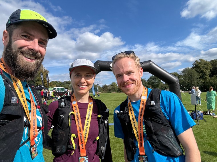
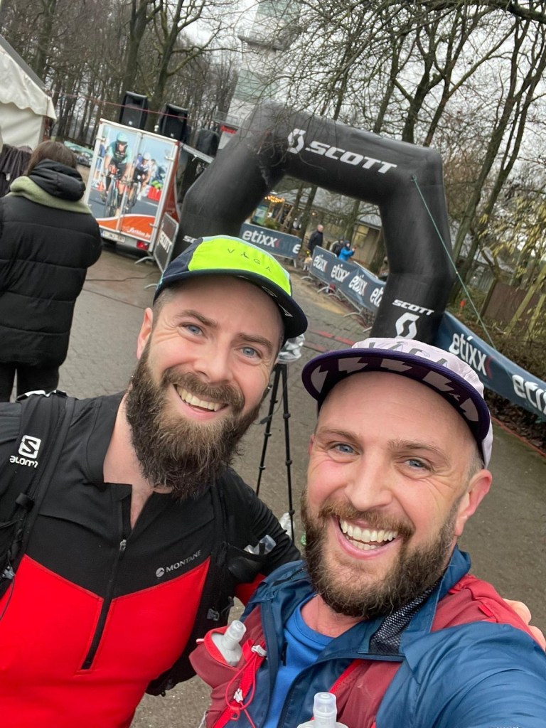
The Shere Marathon is organised by the Surrey Trek and Run shop. A few friends had mentioned it and so I signed up with short notice with Carl and Natalia as a team. It would be a good chance to run together before out next event. We arrived early into Shere for an easy start with a small field of runners and a modest start line which we joined right at the back after saying hello to some other friends at the registration area.
ready to roll
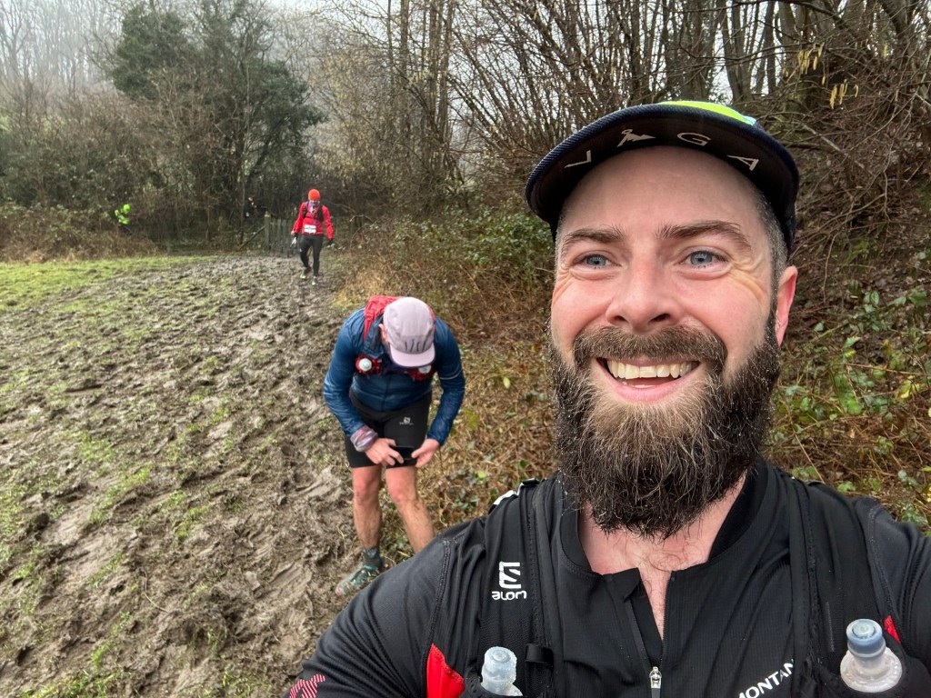
The start saw us run a lap of the playing field, following someone with a smoke/flare, before joining the trail and beginning the first climb out of Shere up to the North Downs Way (NDW). A lot of the route would be along the NDW and the Greensand Way trails. Both are trails I know pretty well and I was certain I’d run all of the route before at different times previously. On this occasion we’d be running a loop clockwise, Initially along the North Downs then dropping off and passing through Wotton towards the Greensand Way.
From Wotton the route is very similar to that of the Freedom Racing Hurtwood 50 as we tackle the three hills of Leith hill, Holmbury hill and pitch hill. Unlike Hurtwood though we carried on to Chilworth and back towards the North Downs Way. The final climb on this course takes you up the ‘drain pipe’ path to St Martha’s and then we run along the NDW to Newlands Corner (which was very busy!) and back to Shere.
Over all the day was great with perfect weather, if maybe a little on the warm side. It had been a while since I’d run many of these trails but the memories soon came back. The three ‘peaks’ of Surrey we navigated fairly quickly and easily. Then the more rocky terrain started to slow us a little as we made our way through Paature wood and Hurtwood. We made one small navigation area but otherwise made it round without any issues. Personally I don’t like the section of the NDW after St Martha’s as it’s flat and runable, getting back to this section reminded me its my least favourite part of the route. So it was a bit of a slog back to the finish and then subsequently going down the narrow hill back to the recreation ground was hard going on the tired legs.
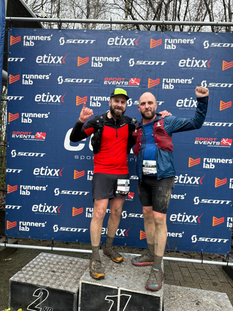
Overall we had a great day and it was a lovely little day out ahead of the next race in Bulgaria…
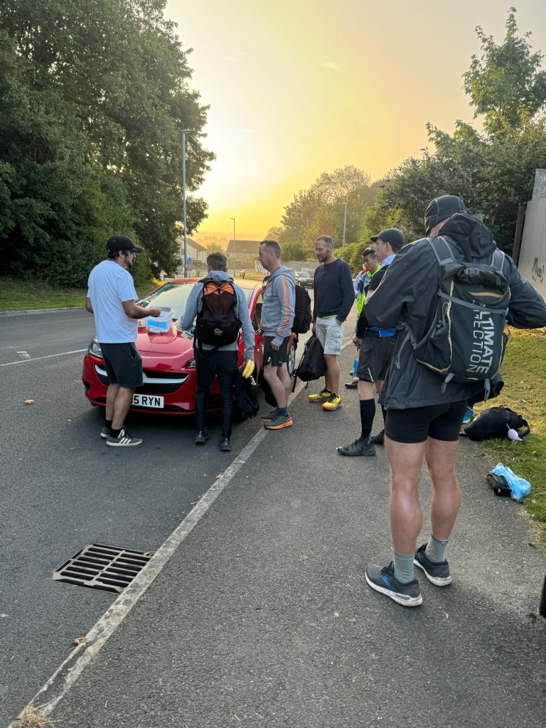
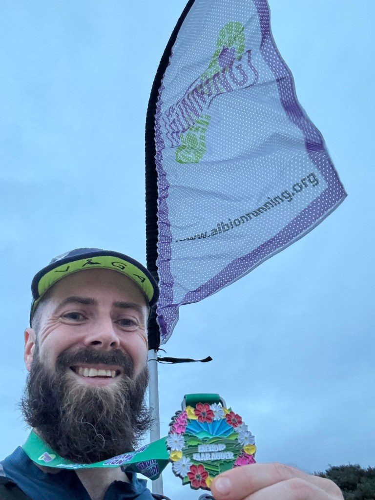
In my search to fill a gap I came across the ‘Mendip Marauder’ which is a 50 mile event along the Mendip Way from Frome to ‘Weston’ (Weston-Super-Mare) organised by the excellent Albion Running. I signed up and planned a weekend getaway to Weston… The organisers arranged for transport from the finish to the start which made the logistics very easy. I’d stay overnight on Friday, get the bus to the start and run back to Weston.
At 6am on the Saturday I was sitting comfortably at the front of the bus with a modest number of other runners. We had about an hours journey and the time passed by quite quickly as I tried to sleep a bit more whilst occasionally chatting with the runners around me as we talked about the races and events we’d done and, joked with the driver, who was getting frustrated at the sensor on the bus that was telling him he was ‘over the white line’ on the country roads (no way he wouldn’t be over the line in a bus!). One of the runners was a chap called Dan whom, unbeknown to us both at the time, I’d spend the whole day with.
Bonnet briefingStartlineInitial fields in Frome
When we arrived, we alighted the bus on quiet side street in Frome where Dave, the race director, was waiting for us. From the bonnet of his Corsa (I think) he preceded to register the runners and hand out race numbers. It made me chuckle as it couldn’t get more lowkey than that. It was super efficient though (who needs a table when a car bonnet will do the job) and he greeted each one of us with humour, telling runners their number was their finishing position (unfortunately for the number 49 runner!). After this we hung around for about an hour until the race briefing. Here Dave continued to entertain and had the 49 runners and few spectators in stitches as he told jokes of the calibre you’d find in a wedding speech. As he said, there wasn’t much to say about the race, and he just kept on cracking jokes for ten minutes (do you know the one about what ‘Love’ in tennis means?) before concluding with “I’ll leave you in silence now until we start”. About a minute later he’d counted us down and set us off on our adventure along the Mendip Way.
We began with a jog up a slight hill and along some fields as made our way onto the East Mendip Way and out of Frome. After the fields the pack of runners started separating as we ran in single file alongside a river which felt enchanted. Really dark, atmospheric woodlands weaved along an old river with stone formations. I loved it, I love that initial feeling of freedom in a race when I run somewhere new to me.
Somewhere along here in the first few kms I caught up with Dan (remember him from the bus…) and we started chatting again. Dan is a local to Weston and this was his second time running the race. Besides being excellent company throughout, he doubled up and played the dutiful tour guide for me for 11 hours. Throughout the day Dan would tell me where we were, where we were going, what we could see, pointed out landmarks in the distance and gave me insights and history for the many points of interest we passed along the Mendip Way. It was brilliant! It was amazing to find out and hear all this information as I otherwise would have had my head down looking at the trails and not really absorbed where I was and the scenery around me! Thanks Dan.
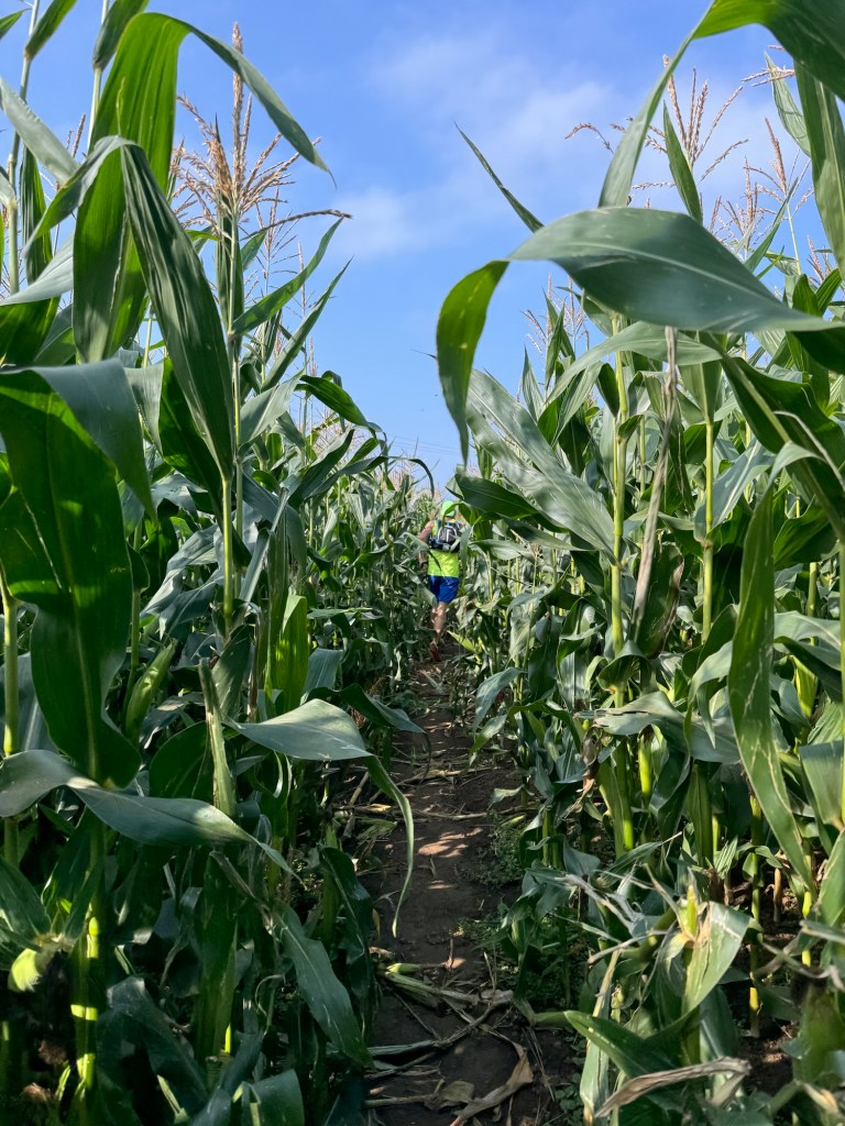
Fields and cowsfields and cornhills (later in the day)
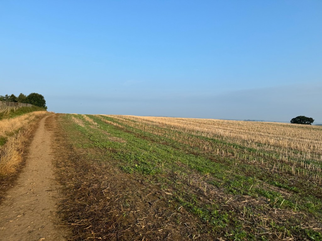
For the first 20 miles or so of the race we followed the follow the East Mendip Way. The trails took us through fields (including a huge corn field) and forests, ascended up onto the Mendip hills and gave us spectacular views of the surrounding area. Like that first few kms, it all felt very old and ancient. It was also super peaceful with hardly anyone about other than the occasional dog walker. The trails where ours for the day! After what felt like no time at all we’d passed through the first aid station (outside the Poacher’s Pocket pub in Shepton Mallet) where we were supported by fabulous volunteers and made our way around the market town. The race markings started to get a bit ‘iffy’ here and we followed one off in the wrong direction. the direction we were heading did not align with the GPX route so we back tracked to the marking we’d followed. Through a hedge I could see another marking in the other direction. I went and adjusted the rogue marking and it had clearly been moved, it was loosely tied on a tree branch and you could see that the tape had previously been tied in a knot (probably on something else). Back on track we followed the route towards Wells.
Wells Cathedral
Wells, despite being small, is a city. As Dan pointed out to me, historically settlements needed to have a Cathedral to gain city status (although this is no longer a requirement). And Wells has a cathedral. We ran down into the city, alongside and around the Bishops Palace and Gardens into the city centre. Here there was a market on and the streets were bustling with activity as we passed through the city walls to the Cathedral. It was, as most Cathedrals are, spectacular with Morris Dancers outside doing their thing. I made a mental note to come back here one day and explore the city. Outside the Cathedral we stopped for a quick photo and then carried on to the next aid station where we had the full service from the volunteers as we were the only runners there. We stuffed our faces before making the short climb back to the trails.
A few kms later we were running by the Wookey Hole which is a series of caves and adventure activities. Dan told me all about them and the legend of the Witch of the Wookey Hole, whom as legend goes was blamed for any and everything that went wrong in the area. The whole area was full of interesting places and next up we ran through Ebbor Gorge and woods with fascinating rock features as we began to climb back up to the Mendip hills and the West Mendip Way. The West Mendip Way is more ‘lumpy’ than the East Mendip Way and the route now had us running up and down along the hills.
After a nice long descent we passed a few runners and made our way to Draycott, Cheddar, the 3rd of the 5 Aid stations along the route. Like the two before this was expertly staffed and incredibly well stocked with a huge range of sweet and savoury options. The volunteers were all fantastic, full of energy and enthusiasm and even tolerated my terrible jokes and humour. We rested a little longer here to make sure we’d eaten plenty and I spent a few minutes taping up some patches on my feet that were feeling a little sore. After I gorged myself on many jam sandwiches and prawn cocktail crisps I set back out and could see Dan ahead of me on one of the biggest climbs of the day.
Climb out of Draycott
From here the route took as along the hills just outside of Cheddar and we passed through Cheddar Gorge and near the famous rock formations. Naturally here it started to get a but busier as we encountered more tourists and walkers out on the trails as we made our way up and down on the Mendip hills. Now the weather was cooler and the sky a little grey and overcast, but up on top of the hills the breeze was very welcomed as it cooled us down in the muggy temperatures. The trails here were beautiful and there were plenty of view points that Dan pointed out to me including Glastonbury Tor way off in the distance and Cheddar Reservoir below us. We were still chatting the whole way about our lives and all things. We had a good ol’ grump about life, challenges and people. We aligned on many things especially people’s inconsiderate and entitled nature. Those ‘bastard people’ we kept saying and chuckling to ourselves. Throughout I was amazed at how calm and happy Dan was. He has such a cool head on his shoulders and positive outlook to dealing with challenges that life throws at you.
ViewsMore viewsEven more views
We dropped off the hills at Shipham and were greeted with the penultimate aid station, where I had the special service of having jam sandwiches tailor made for my liking! The next section was the shortest of the route as we made our way to Webbington. Like much of the course before it though it was very scenic and had plenty of ‘ye olde style’ boundary walls and stiles to climb over. I swear as we progressed these became higher and higher and increasingly more difficult to clamber over (nothing to do with my agility I’m sure!) At the last aid station we were greeted with photographs and the most systematic and organised aid station you could find. Leaving the aid station we made our way across the M5 motorway and started the climb up to Badger Hill, the last of the big climbs on the route. Up top Dan made sure I took a moment to admire the view of Weston and the sea (finish line!) in the distance, but to also turn back and look and appreciate the ‘ridge’ of the Mendip hills we’d run along. He was right, it was great to take a moment and let it all sink in. Even in the cloudy evening, it was a beautiful view back over Somerset.
Final AidstationArriving into Uphill
We continued our journey over the last few km of the Mendip hills from Badger Hill the route was mostly downhill as the track slowly became gravel paths which became tarmac road and eventually the sand as we arrived at Uphill beach and the very modest finish ‘line’ (sign). A small crowd clapped us in and Dave handed us our medals and congratulated us. He offered us both a lift back to the car park where we’d taken the bus from in the morning. We declined though as, with my expert tour guide, I now knew it was quicker to walk the few kms back along the beach to the hotel.
Dan!Another colourful medal
The Mendip Way is absolutely beautiful with incredible views, varied terrain and lovely villages and towns along the way (and many excellent pubs according to Dan!). I really, really enjoyed this run and thought that Dave and Albion Running were bloody fantastic and put on an incredibly well supported event. I’ve got my eye on some of their other events in Somerset now!
The come down from some epic adventures this year has hit me hard. On returning from the Eiger Trail I had 6 weeks before my next event (The Pirin ultra trail in Bulgaria). So I went looking to ‘fill the hole’. I found two events that were reasonably priced, logistically easy to get to by train, on weekends when I had nothing planned and would take me running in places I’d not run before. So I signed up for both. The first being the Big Pilgrimage…
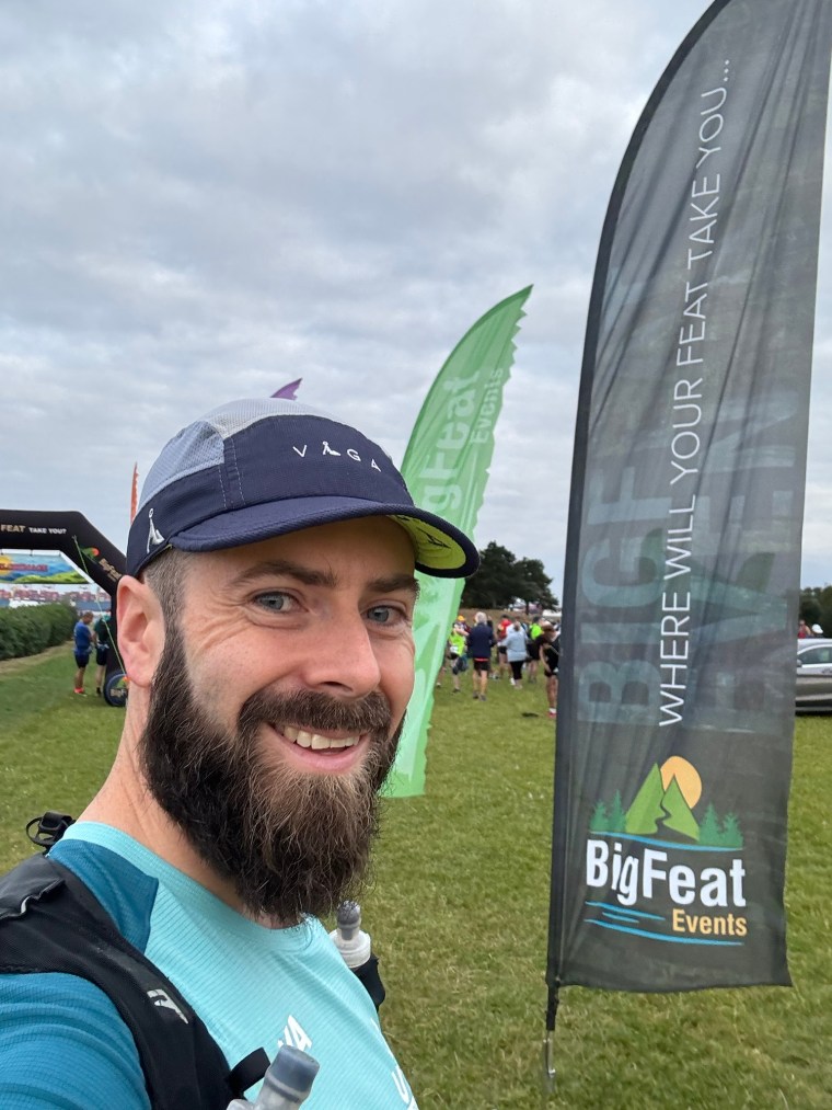
The Big Pilgrimage is run by Big Feat Events. I’d not done one of their races before. There are different distances on offer, but I signed up to the 54k which started in Southampton and finishes at Fort Nelson just outside of Portchester.
The night before the race I stayed over in Southampton. I’d never been to Southampton before. What a shit hole. It makes Swansea look fancy! Glad I now know that I’ve never any need to go to Southampton! The next morning I made the short walk to the start line for 7am and arrived just as the buses were unloading runners who’d parked at the finish and taken the extra option of a bus to the start. Registration was rapid and we were handed our first sticker. Sticker? Yep, the niche thing about this race is that your race number has boxes and you collect stickers along the way to place on your race bib. Each sticker is at one of the points of interest along the route. I quite like that idea and it provides the information to go back and learn a little about where you’d run.
Startline selfie
All stickered up we went to the start line, had our race instructions and then set off. The first few kilometres were all road as we made our way passed the ports for cruise ships and the Isle of Wight ferries and made our way out of Southampton. We crossed over the Itchen bridge (grabbing another sticker) and made our way to the coast.
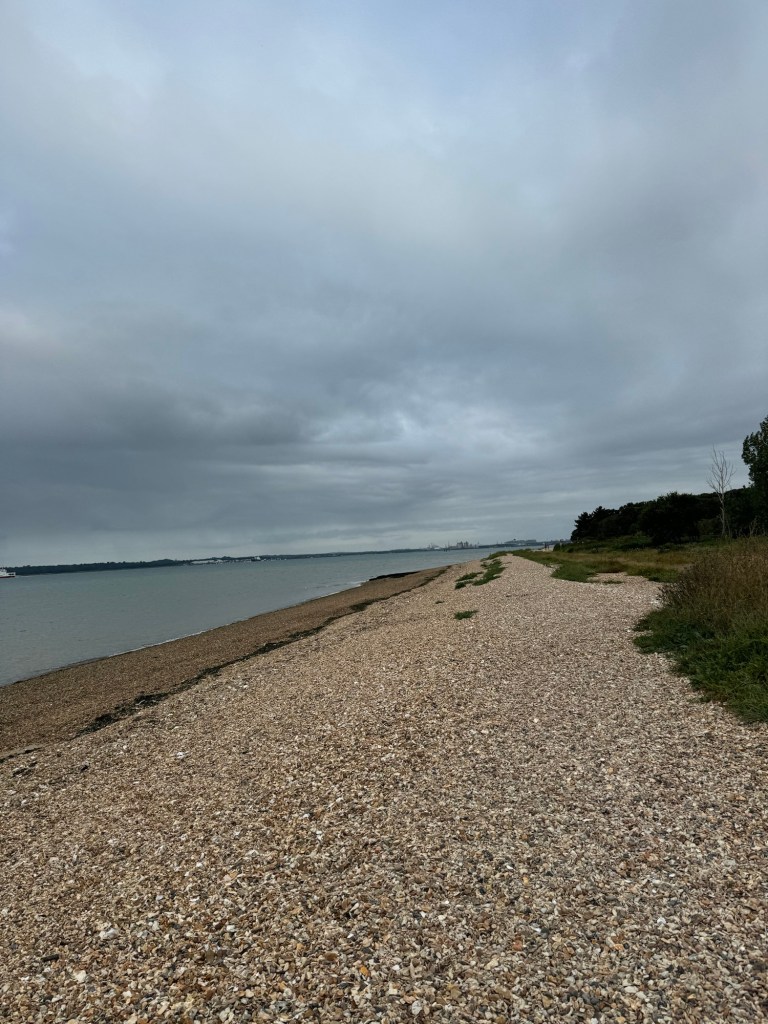
As we reached the coast we had a short paved section before finally hitting the trails. Not long after two speedy marathon runners ran passed. Geeez they were quick (they started ten minutes after us). From here the trails weaved through woodlands passed Netley Abbey and Victoria park, where Royal Victoria Country Park chapel is, with more stickers added to the bib. A few more marathon runners passed (after a big gap from the front two!) as we passed through more woodlands and made our way back to the coastal path. Before long we were running along a shingle beach. That sapped the energy and tired the legs pretty quickly. It was refreshing though running alongside the water, hearing the calming sounds of the sea. Not many of my runs take me along coastal paths!
Shingle beachthe Sea!
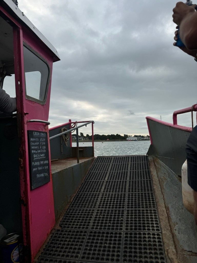
After another few kilometres we reached the first aid station at the river crossing. I’d been expecting and waiting this. Another feature of the race is that you need to cross the river on a boat. Oddly not that niche for me as I’ve had a boat crossing on my first 100 miler – the Tarawera 100 in New Zealand. I also had to get a boat across the fjords in Norway for the start of the Lofoten Arctic Triple. Still it was pretty fun. The organisers had hired the small pink ferries to ship runners across the river Hamble to the other side.
the ferryPink Ferry!bye bye little fella
Once over it was more running along the coastal path. After a few kilometers there was a confusingly placed event marker. I followed another guy up what admittedly I too thought was the right path. As we started climbing a small hill though I sensed we’d gone wrong. There is very little elevation on the route (just 400m total) and pretty much all of it is in the second half, a quarter of the race elevation is in the last 2k to the finish! I checked my watch which confirmed my thoughts. I yelled after the other runner but he was lost in his music. I screamed so loud maybe 5 times and he still didn’t hear. Thankfully he eventually heard me. We made our way back down and stopped a few more runners who’d made the same mistake.
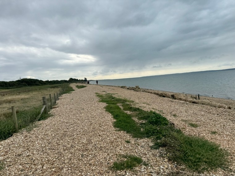
We were then back on shingle beaches for a while. I was leading with a small group of 3 or 4 behind me when there was another suspect marker. I chose the wrong path, but persisted as I could see on my watch that it ran parallel and there were points to rejoin not far ahead. I kept going, then, when I went to rejoin there was a photographer. He said a few others had made the same mistake. I carried on, now on the correct route but noticed I was alone. The others must have stuck to the other path which I could now see didn’t rejoin anywhere else and would turn off in a different direction.
Back on the shingle beach
I soon came out on a water stop at about a half marathon distance and the marshal directed me along a footpath. After a while I was catching some other runners when I realised it was all those who had been behind me. That path must have cut a shortcut on the corner I’d made along the actual route. We were now running alongside the marshes of Titchfield Haven and leaving the coast behind as we headed inland. The next few km to Titchfield Abbey was tough going. So flat and straight. I told myself to keep going to 30k then I can relax the pace a bit. At Titchfield was the next aid station then a few kms of road, crossing the M27 before back into some woodlands and fields for a few km. It all started to blur in my memories but I know I hit that 30km mark and stuck with it and didn’t let up on the pacing too much. I wasn’t feeling too bad, albeit all the running was starting to make my legs ache. I kept going and soon came across a marshal who directed me up a steep hill. Bless, so many people were trying to be helpful and warn of hills etc., but nothing on this route was actually a hill. This one was about 2m high and just a verge to join a footpath. Not long after the ‘hill’ the third aid station appeared. I was glad of some coke and watermelon. Here the ultra and marathon routes separated.
On the ultra route it got a little dull and much harder. We were on a flat footpath that was straight. It was where kilometers come to extend their life. Each km seemed to grow in length. On and on it went. It was exhausting. Thankfully despite a hot sunny day, this was all sheltered in the trees. I kept going though and I only took one short walking break but otherwise ran the whole 8km of the footpath section. When we left it, and had a short incline I was very pleased for the walk. I was now 40km in and ready to do a run/walk to the end. I was optimistic that the change in terrain would force this approach for me.
Never ending flatness
We were now heading back south towards the finish line. There were varying sections of narrow woodland footpaths. Overgrown sections. Open fields and recently ploughed fields. It helped a lot having the variation of terrain. I collected more stickers along the way and passed another water stop where I had a good chat with the volunteers about tattoos. The varying terrain continued and I walked regularly. Since starting the footpath of doom I’d been pretty isolated but I was enjoying the peace on my run. Before I knew it I arrived at the final aid station, on the side of a narrow road with a sole lady tending to our needs. She was lovely and so helpful. Two other runners then showed up and joined me. I stayed a bit longer here eating loads of orange slices as the two others sped on.
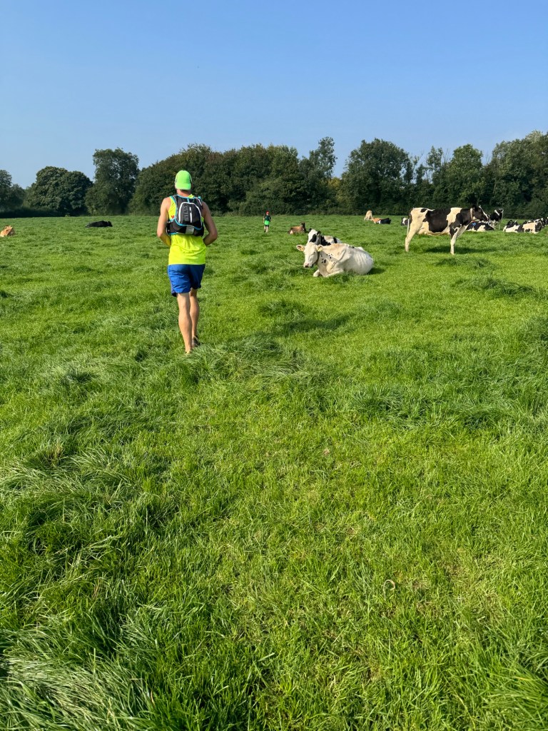
After leaving the aidstation it was back onto single track paths and fields as we made our way along the remaining 9km of the race. At one point we had a climb through a field that was actually an incline, it was really taking us uphill! I enjoyed that. We also crossed several fields with cows and electric fences. This part of the run was much more enjoyable (with the exception of the few km of road before the field with the incline). A steady walk/run was seeing me through at a decent average pace just above 6min/km.
Kind of went uphill a little!
As we reach Southwick I caught up with one of the runners who had passed me and another lady whom I had no idea where she came from. It completely threw me before I realised she was on the marathon and the routes had rejoined. After collecting the penultimate sticker the guy politely asked my age. He was wondering about age categories and hoping to podium in his category. Cheeky fucker though, as Nick would say “he’s three days older than God”. I thought he was much older than me and he was pleased to hear I was only 40 and that he could let me go without a fight.
The final ‘ascent’the Finish line
We had about 2 km left now and one last ‘climb’. To be fair, this was a whopping 80m of elevation over a kilometre. I know, punishing. Once I reached it, it was nice to walk pretty much to the end. The climb was diagonal across a recently plough field so the terrain underfoot wasn’t exactly pleasant. After the climb there was a short few hundred metres of dry footpath to go. The tower at Fort Nelson came into view and then behind it the flags of the finish line. At the finish we got our last sticker ‘Fort Nelson’ and a very colourful medal.
Finish!Gotta catch ’em all
I had a great time despite the race being somewhat flatter than I’m now more accustomed to (and enjoy). The flatness certainly made it tough going and my legs were aching afterwards (thankfully no wobbly walk though). The organisers were incredible and have put on a really excellent event. There were so many marshals throughout. I’ll definitely have to try some of their other events!
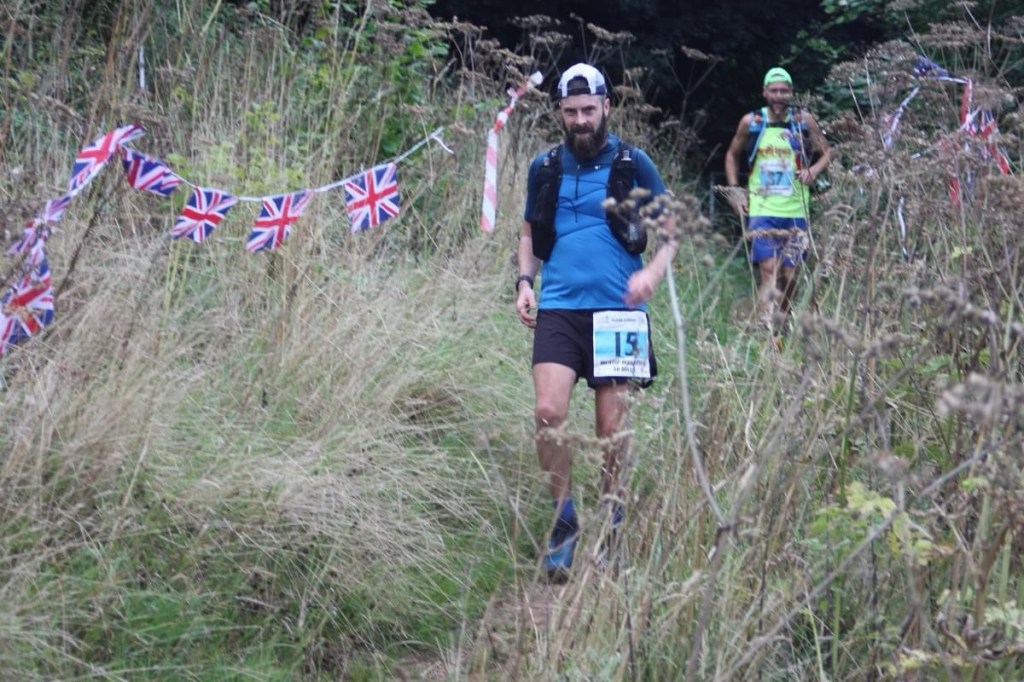
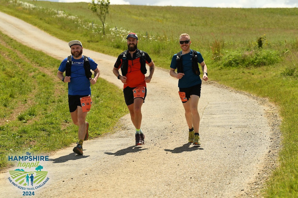
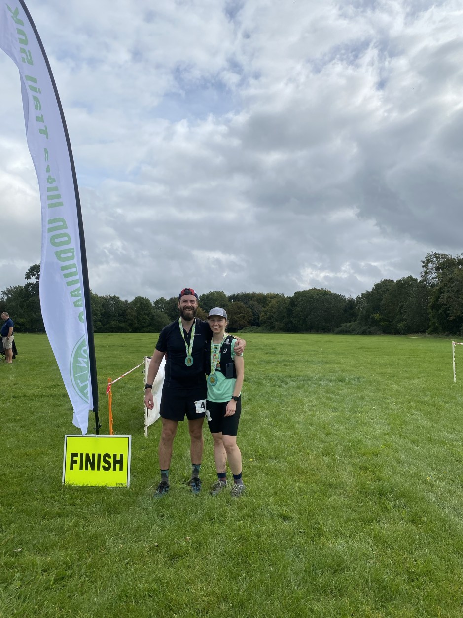
The Hampshire Hoppit is a marathon (and half and 10km distances) event in its 9th (as of 2024) iteration. I think I saw it advertised on Facebook and thought “I’ll have a bit of that”. Even though it’s a week before one of the more daunting events I’ll run in 2024, I roped some mates in and signed up…
We made the drive over in the morning and arrived at the start line with about 15 mins to spare. The event seemed a little larger than I expected (a very detailed 25 page pre-race document containing all the race information was the first sign that this wasn’t a small event!) and there were loads of people gathered around the tents at the start line (which was beautifully located on the side of a hill). We registered, repacked our bags and began attaching our bib numbers as the race director wished everyone well and stated the race.
The group of 300 or so runners slowly crossed the line as Carl and I hurried Nick along as he thumbed about with his race number. We joked with a lady before we crossed the line as she flashed her ‘last runner’ vest and told us she can’t start until we do. Finally Nick got his shit together and we crossed the start line.
Back with the pack
The main group of runners were plodding along at a very conservative pace and we caught up with the pack after a few hundred metres as we began the gentle climb away from the start. We proceeded to make our way up the field slowly as we passed the first photographer of the day. Up ahead we could see the lead runners disappearing in the distance. As we chatted away, the time passed by so quickly. Before we knew it we’d done 10 miles, then half a marathon and then passed the 20 mile marker. The race was over so quickly.
From start to finish our adventure was uneventful (thankfully!). We ran together and chatted the whole way without problems. Towards the end Nick got struck by a case of cramp in the hamstring which almost immobilised him, but otherwise we made great progress and finished in about 5 hours, which was quicker than planned.
Wide paths
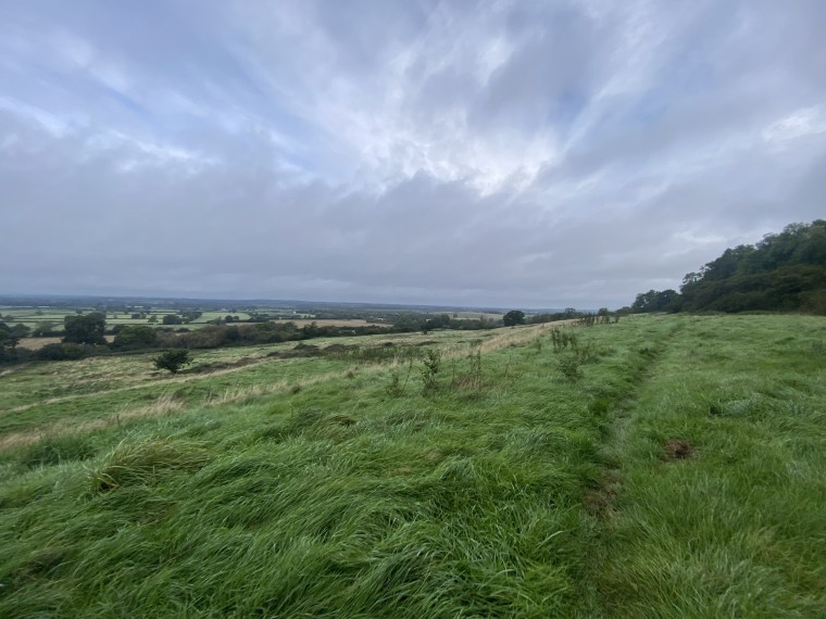
The route was delightful with amazing rolling hills and green fields. We joked that the fields here felt posher than those back home! If it’s possible for a field to be posh?! There were plenty of single tracks through forests, wider trails through ploughed fields and the occasional short road section. Despite the heavy rain the day before the ground was solid and a joy to run on. Towards the end of the race we briefly ran a narrow path alongside a river and had to run through a deep puddle in the last mile. We groaned at having wet feet so late in the race.
Sun and smiles
The aid stations were numerous (alternating between water only and water with snacks) albeit basic, and there were an abundance of volunteers marshalling along the whole course. They were almost at every turn and intersection cheering us on and directing us. Road crossings were also manned with highway maintenance stopping traffic to allow runners to pass. It was very well organised and everyone was so friendly and helpful. I remember joking with one volunteer in the last km on our way up the final climb as I asked her why she was laughing and she said back “because you three have been jabbering away the whole time”. She wasn’t wrong!
Down to the finish
As we crossed the finish line (which is back where we started – its a looped course) we were greeted by volunteers who gave us our medals and a finishers pint glass. We also got a ‘goody bag’ with crisps, sweets, chocolate, popcorn, a coaster and a pen with the race logo on it. There was a finishers tent too where we could use our pint glass to get free beer! I think it is fair to say you get your monies worth with this one! We sat down and enjoyed the views from the side of the hill as we regained our energy.
Overall, what a great event. Low-key and all about the local community and runners. The trails are beautiful out in Hampshire.
It has taken far too long, but finally I got around to visiting Matt out in the Netherlands for a run on trails more local to him. Over the weekend Matt and Lara treated us like royalty, putting us up for the night, feeding us, driving us to the race and putting up with our tourist commentary.
The race was the 50km Drielandenpunt Trail in Vaals, in the southern part of the Netherlands, in a park area known as Drielandenpunt, which is the three country point. This is where the three borders of the Netherlands, Belgium and Germany meet. The race is mostly in the Netherlands but the course twists and weaves its way into Belgium at several points and also tracks along the border with Germany.
The night before we stayed nearby and had the shittest risotto known to man. It was a real talking point that someone is capable of making such a bad risotto. Alas, being the non confrontational type we ate it and kept our mouths shut. After all it did serve the purpose of a meal and it’s not like we need high quality food before running an ultra. In the morning we made the short drive up the ‘hill’ to Vaalserbeg which is the highest point in the Netherlands at about 322m, near the three country point. Here is where the race would start and finish. I suppose not many running races will both start and finish at the highest point in a country! We registered and messed around taking pictures on the tri-point where the borders of the three countries meet, crossing between the countries and back in a matter of seconds. We then said goodbye to Natalia who’d start her 30km race an hour later. After the quickest starting line up ever, Matt and I set off.
Within minutes of starting the run I was overheating. It was a wet day with a constant drizzle of rain, but, with just the wind jacket on I was too hot, so opted to continue the run in just the t-shirt and sleeves (I probably gave myself a cold as a result, but it was very stuffy in the forests). It was instantly noticeable how, muddy the trails were, how narrow the forest paths were and how surprisingly hilly it was. With a total elevation of 1400m elevation across the course, it was very much a series of short steep climbs and descents with very few flat bits in between. The course, mud aside, is rather runnable although my fitness levels meant I didn’t run a single one of the hills! The first part of the course was a 14km loop to the south. We had some great views of some very grey, overcast skies (‘m sure on a better day there are views to be enjoyed) and made the first of numerous dips into Belgium. This was my first time visiting Belgium. I think it counts as a visit!
Towards the end of the loop we left the forest and ran (trudged!) through some very muddy fields. I laughed as the person ahead kept falling over whilst my Inov8 X-Talons were excellent for ensuring I stayed on two feet, I was so glad with my choice of shoe! We then had a one of the bigger climbs (at just shy of 100m) back up to Vaalserbeg and the start line which would now serve as our first aid station.
From here it was more of the same with forest trails undulating as we ran alongside Germany. Drielandenpunt is a beautiful area with many, many intersecting trails for hiking and biking. It reminded me of the Surrey Hills area with endless twists, turns, short sharp descents and muddy climbs. Overtime the trails all blurred into one and it wasn’t long before I was completely disorientated and had no idea where we’d come from or which direction we were heading in.
After another 13km or so we arrived at the second check point where we were spoilt with ham and/or cheese sandwiches. These went down a treat and we both stuffed our faces and enjoyed a few moments of rest (although standing around we got very cold very quickly). By now we had been passed by a lot of runners. It felt like nearly the whole field had passed us as well as many of the 3okm runners. We were enjoying the day though, chatting our way round the whole course and catching up (some how it had already had been 8 months since our last run together in Lofoten).
Throughout the day Matt was sharing all his knowledge and facts, particularly at key points on the course like when we ran through the vineyards and he gave me a crash course in the history of Dutch wine production. It was a welcome distraction from the muddy trails! Throughout the run I recall the course being fantastically marked and sign posted, the aid stations being well stocked and the ground being a slushy mud fest – there were several more fields that were really muddy and a few little picturesque towns that we weaved through connecting the trails together. After another 15km or so we’d made our way back to the second aid station location for our final stop. With a quick top up and refuel we set back out.
King of Facts
We were on the home stretch now and had finally stopped being overtaken by runners. We commented that we didn’t think that we overtook a single person in the race. Towards the end of the course that changed with a steep muddy descent causing a few other runners to have trouble descending. We sped and slid our way down and claimed about 4 places in one short movement. From here it was a gentle jog into the finish line where we passed with an American we’d shared a few moments with earlier in the day. The ‘international finish’ as the MC dubbed it as an Aussie, American and Welshman crossed the line together.
We opted to skip the ‘city wash’ showers and just throw on dry clothes to start the long journey back to Amsterdam as quickly as possible. This was hindered a little bit by the inaccessible finance system in the Netherlands where many stores don’t accept Visa or credit cards as a payment method. To buy a portion of chips we needed to call Matt and have him come pay for us!
Overall a thoroughly enjoyable weekend in the Netherlands and a great adventure in the forests. Drielandenpunt is worth a visit! Personally, after a few months of inactivity it was good to finally be back out and running long distances. Now I just need to find the fitness before the bigger events that are fast approaching….
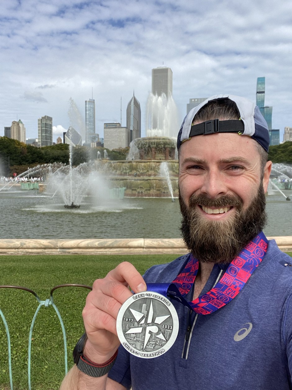
Here we go then, a road marathon. Chicago Marathon 2023. My first roadie since 2019 which is when I signed up to this and got a ballot place to run in 2020. Then the Covid cancellations and deferrals and all that stuff still lingering on…. Here I was though, 4 years later in the Windy City.
I travelled out with Coren and Jules. Frustratingly our AirBnB cancelled on us the week before the race so we ended up staying way out of town on the end of the green line in an area called Cottage Grove. So it was a 4am wake up to get the first train into Downtown Chicago on the morning of the race. We’d experienced the ease of the transport system the day before when we had a similarly early wake up to get into town to run the 5km event. It was worth it for the trip to the excellent Yolk for pancakes after the event. The bobble hat is alright too.
Bobble hat party5km race. way too much effort for 30mins!
When we arrived for the Marathon, it was very easy after the train journey and we breezed through the infamous security (it is pretty tight with snow ploughs blocking the roads and bag checks for all runners entering Grant park) in no time at all. Coren and I then sat on the floor and waited for an hour before wishing each other well for the race and heading off to drop our bags and make our way to the starting corals.
We were in Coral B. I felt like a fraud in the this starting coral with all the 3 hour pacers and every runner around me wearing their super shoes – Either Nikes or Adidas – It was a sea of expensive footwear. I was a long way from my 2018 marathon pace which I used to qualify for this race! I felt uncomfortable waiting and I thought that the coral was full of wannabe alpha males. Pumping their chests and fists out psyching themselves up. Trying (and failing) to get the crowd going with primitive roars and fist pumps. I found it awkwardly odd.
After the elite start we walked forward and then we were given our own klaxon to begin. We stared off and headed up the main road out of Grant park and straight into a tunnel. Here my watch beeped as it lost signal, as expected. It felt like I was passed by about 10,000 runners in the first 2km. I ignored the crowds rushing forward and just did my own thing. I promised myself before hand that I’d just run whatever felt comfortable. I had years to prepare for this and made a conscious decision after the ultras earlier in the year that I wasn’t bothered nor interested in training and spending time running roads for it. I did do one 30km road one in August and I found it hard to hold the pace. So I kept remembering this promise to myself, to enjoy it for what it was.
The support was good from the start and a welcome distraction. I cheered and clapped back, laughed at the signs, hi-fived kids and gawped at the dogs lining the streets. I had arm sleeves on which were covering my watch and I decided not to bother looking at my pace either. Before I knew it I’d hit the 5km marker. The timer said about 30 mins. I assumed my time would be about 5 minutes less factoring in when I would have shuffled across the start start line. I felt ok. Felt good even. So I didn’t change anything and I carried on at that pace. Told myself to get to 10km before the hour ticked by on the timer.
The process repeated. Each timing mat on a 5km marker I seemed to pass about 25-30 mins for the 5km. So I repeated to myself the time for the next marker and seemed to hold steady. I expected a crash at around 30km like that one training run I did where I struggled to hold the 1hr 10km pace and had to walk at 27km. It didn’t happen here though. I did slow down for the last 6km, but not drastically. I was moving well enough with no difficulties so I was fine with that and reminded myself not to push or put the effort in.
There was a slight incline (it was less than 10 m) in the final 400m of the course as the finish line came into view. I did an evil chuckle to myself as i passed people and imagined how many PBs would be ruined by this incline. I crossed then line with a 3:35 time. I was elated with that time. I genuinely thought it would take over 4 hours and had been verbalising that to everyone. I was planning on running 1hr 10ks. I guess it felt good and so I kept running to how it felt. Of course the thoughts then passed my mind of ‘what it’. What if I did train for it? Yeah the distance is no problem. But holding a pace is. What if I didn’t do an ultra the week before… yeah, it all made me think maybe I could have pushed for a Boston qualifier time again. But the thoughts quickly went away. I said I’d do it the way I did and that was the plan. I chose this. I made a conscious effort not to train for road running. I promised myself not to try or push. That I’d run such that I can walk afterwards (and that I could – No aches. No pains. No funny walking. Job done).
I have some very vivid memories from that 42km (and the trip as a whole). Firstly, Chicago stinks of weed. You can smell it everywhere, on every train and every street. I Smelt it out on the course and even after collecting our race bags, sitting down on a bench in the park a few people sitting near us sparked up joints!
The Course is great although I did fine it a bit disorienting – long straights as we weaved the grid of Downtown Chicago. The towers of downtime were visible from most directions. I do remember running through Little Italy, Old Town, the gay district, The Mexican area and China town. Oh to be a Mexican running in this race, the support and shouts of “Mexico!” Were constant. I remember running passed a Korean running group and an old man in a Boston t shirt body popping away too.
The support was excellent. Early on I spent time cheering and clapping to the crowd and reading the signs. There were lots of the common ones ‘tap for power up’, ‘don’t trust a fart’ and ‘this is a lot of work for a banana’. A few others made me laugh, especially one encouraging runners to ‘crop dust the field’. That was original.
The aid stations were so frequent, maybe every 2 miles or so. I took Gatoraid at each one. Conscious that I’d normally be running with my own bottles and snacks. I missed my snacks. I also relied on two Gatoraid gels picked up along the route. That was enough to see me through. I’ve now idea why people need to carry so many gels, it seems excessive to me.
The finish line was busy, very busy. There was a constant stream of runners walking and collecting post run treats of cliff bars, fruit and donuts. The bag drop queue was ridiculous. I erroneously joined it half way down after coming in from the ‘wrong side’. I got chatting to a guy who told me the end of the queue was way back. I looked back and boldly said ‘fuck that. I’ll stay here.’ I also switch queues (As I then genuinely thought I was in the wrong one) and skipped further down. It barely moved. Coren then appeared and together we moved over to the correct queue again together. Even though we were fairly near the front we still queued for almost an hour to get our bags. That’s the one bad thing I’d say, the bag drop wasn’t very well organised (they’d put the bags into big cardboard boxes they then had to fish through!).
I didn’t enjoy the masses of people. There’s some 45,000+ runners in the event, but, thankfully the roads were very wide and when running it didn’t feel too crowded. But it was busy enough. I also didn’t like how everyone gravitates to the ‘blue’ racing line like they are elites. Causing groups at corners and when the crowds following pacers come along. As always human nature showed its shit side too with runners being unaware and inconsiderate of others. Walkers on the line (come on, step to the side to walk) and dropping litter and cups rather than using the bins or throwing the rubbish to the side of the course.
The other thing I didn’t enjoy was ‘being in the moment’. In a road race you’re so aware of where you are. What distance with markers every km and every mile. You’re focusing on each section. Constantly switched on and focused. Constantly repeating the same thoughts. I missed being able to switch off. Lose myself and enjoy the distance without the constant reminders. I told you I’m a different runner now than I was a few years ago. I’m basically moaning about everything that makes a Road marathon so good!
Finally, it was great to experience the race with Coren who picked up her six star medal (running all the current six major marathons). It’s impressive and one day maybe I’ll try for those remaining for me too (Boston, New York and Tokyo)… maybe…
Back in the summer I wanted to enjoy some smaller, local ultras and those in areas I’d not run before. in my search I came across the Swindon Ultra Trail by OnlyFootPrints Events and signed up with Natalia. It was a week before Chicago but I wasn’t concerned about that. Chicago felt like a ‘just because’ seeing as I booked it so many years ago. I wanted to explore Swindon (yeah, who says that!).
We stayed overnight in Swindon and walked 2 miles or so to the start for a 07:00 start. It was pitch black in Lydiard park and we found the small gazebo tent, picked up our numbers and waited patiently for it to begin. Come 07:00 Matt, the Race Director, welcomed us and gave a simple “three, two, one, go!” and we were off.
Lydiard Park start line
From Lydiard park we crossed the M4 and were straight into some fields. It was damp in the morning dew and our feet were instantly wet. The course weaved us along some wonderful green spaces interlinked with paths connected by stiles. Lots and lots of them, and they always seemed to come in pairs. Even early on my legs ached from clambering over them. It was also very humid and I was dripping with sweat from early on.
The first half of the course was the toughest and we had a few little climbs. Nothing major, the biggest was maybe 80m or so and started off muddy and slippery before turning into a sweat fest as we climbed. After about 13 km we reached the first aid station at Broad Hinton before carrying on into more fields and green space.
one of the few hills early on
Up top we passed the site of Barbury Castle and then I think we joined a section of the Ridgeway trail, for a short while which had amazing views over the Wiltshire countryside. From here it was mostly down hill as we gradually made our way back to the M4. Coming into the second aid station we were greeted by a golden retriever on her walk. She took great pleasure in seeing us and rolled over for some tummy rubs. She was beautiful and embarrassed her owner with her cheekiness. We left the aid station and crossed the M4 back into Swindon. We enjoyed the looping bridge crossing here.
near or on the ridgeway?!
The second half of the course took us more ‘into’ Swindon and away from the trails. It was also very flat. Now we followed mostly the Millennium trail/path which connected parks and open spaces in Swindon include Broome Manor and Lawns Park which was very scenic. After a few connecting road sections we were then on the long ‘Old Town Railway Path’ which was quite peaceful to run on. We passed a few runners on this section and were glad when the final aid station appeared at a Swindon Bowls club. We’d walked alongside this path the previous evening on the way to the hotel. We refuelled and set back out for the final 12km or so.
There was a fairly long section along a canal path (North Wilts Canal) and we broke it down into a run walk strategy. We also missed a turn and had to back track a few hundred metres. It was annoying as we both saw the turn (which was obvious and well marked) and commented on the signage, but still we carried on passed it! The last 5km section of the course saw us loop back out of town and into more fields (and more stiles!!) following the Millennium trail back to the start. It was a bit more sturdy underfoot here though compared to earlier in the morning when trudging through fields.
Fields
We finally came back into Lydiard park and could see the finish line tent where we started. Only, the markings directed us off to the right and we had a 2km loop of the park to go before we finished. We both moaned. We were more than ready to finish now, even though we knew this loop was coming!
Not long later we did cross that finish line. We grabbed our medals, thanked Matt for a great little event and day out and set straight off to begin the journey home.
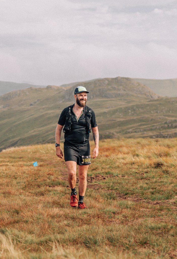
It had been a while since I’d toed the line at a Maverick race. Here, on an overcast summers morning I found myself at the Grasmere Showground pinning on a bib for the X-series Lake District…
Image by Jake BaggaleyImages by Jake Baggaley
After the usual detailed race intro from Ben, we set off out of the showground, turned off the main road, through Grasmere village and started making our way towards the first climb of the course up to Easdale Tarn… The road soon became trail and the fresh damp summer smells filled the air. We settled into a rhythm and a stream of runners on both the long and ultra distances. Already with the heat and humidity I was soaked through with sweat as we ambled round countryside tracks and began climbing. The first climb was slow and gradual. Up into the Misty mountains approximately 300 m high. As we approached Easdale Tarn we crossed a small river and had the Tarn to our right. The pool of water blended effortlessly into the misty grey skyline. It looked like an impressive infinity pool where there was no distinction between the water and the sky. Almost Eerie in the spectacular early morning. Jake was on hand to snap our photos as we gawped at the scenery.
Jake capturing the epic views behind us at Easdale Tarn
From here the climb increased as the soft ground gave way to rocky paths and then steeper on slight scrambles over the barren mountain face. We huffed and puffed our way up further into the clouds as we climbed to the equally impressive Stickle Tarn (Overlooking Harrison stickle, which we couldn’t see). Up top we levelled out and began our descent. Now the trail was feint and the blue course marker flags were hidden in the clouds. We followed shadows, glimpse of flags and wet footprints to find our way down. It was a nice gentle descent from the summit that later became steeper with wet rocky steps on a defined path. Tanya captured more pictures on the descent before we came out at the bottom at the trail head and the first aid station
Tanya capturing the rocky descent from Sickle Tarn
Refuelled, we had a fairly flat and slightly undulating section through lanes and alongside stone walls. Epic views of stone quarries and riverside tracks entertained us as we made our way towards Great Langdale and on to the next aid station. Here familiar faces volunteering and supporting us could be found. Fiona marshalled us back along the river, her husband Graham and Leo at the next aid station cheering us in just before Skelwith Bridge where we’d turn and head towards Loughrigg Tarn.
From here we’d run through ancient forests with a short climb and descent before crossing to the other side of Grasmere and Rydal Waters. We’d now began making our way to Rydal Hall. There were plenty of views as we ran alongside the rivers through country parks with loads of walkers now out and enjoying the morning. We crossed the road and joined a trail path (the Coffin Trail) back on the mountain base where the course split from the medium route. Already I’d been passed by speedy front runners on the medium route who now headed back to the start and the finish line. We on the other hand turned the opposite way and continued off to Rydal Hall. It was A shortish section from here and one I was already overly familiar with. I was staying at the Rydal Hall so had walked 3 km along the race route to the start earlier in the day. Now I found myself back on the ‘Coffin Trail’ navigating back to Rydal Hall.
From the Coffin Trail (later in the Evening)
Arriving at the Hall the aid station was a welcomed sight, although one like a scene from a war movie with runners sitting and laying all around it. I joked with Steph who was volunteering what had happened. Everyone was feeling the heat and humidity.
We were approximately halfway through now with a loop up the Fairfield Horseshoe to go. I knew the second half of the course was the tougher part and we had longer between aid stations and bigger climbs to overcome. So I filled and extra bottle of water to help keep hydrated. With potatoes in my hand I set back out and soon found myself walking and talking with Matt who was on his first ultra. We’d end up running the next 20km or so together.
After a little climb and descent (with no views over Ambleside sadly) we then began the climb to Kirkstone Pass. It was gentle and easy going through fields, trail paths and the latter few hundred m on the windy, steep road. As we reached Kirkstone pass the clouds cleared and the sun came out. Stopping at the aid station Leo and Justin were on hand to support us and provide the entertainment and laughs. I took a can of Tenzing and applied some sun cream. Maybe too much as they joked I looked like I was covered in mayonnaise. Once we’d rested a little we set back out and to climb too Red Screes.
The climb was steep and slow going. Me and Matt plodded on gently consistently moving onwards and upwards thanking the marshal as we went. We were passing runners who were struggling in the heat, although thankfully the cloud cover prevented the sun penetrating us and the mountain wind provide a beautiful cooling sensation. Up top we descended. It was long and steep but far nicer than the earlier descent from Stickle Tarn. It wasn’t too long either as we had another little climb followed by some undulating trails and false summits before we reached Fairfield (Turning off just before the summit). Along the way Jake popped up once more, this time at least the clouds started to clear a little.
Heading up to Fairfield by Jake
Her it was all, mostly, downhill. With less than 10k to go I left Matt and powered on. I had plenty of energy and felt strong. I passed more runners moaning about the false summits and the heat. I wished them well and continued. The descent I enjoyed up until we left the mountain and started traversing the side of it near Stone Arthur. Here the trails narrowed and became a little more rocky underfoot. I bounced on and soon found myself cramping badly. It was strange, it came out of nowhere and hit me in both legs simultaneously in the calves and inner quads. I ground to a halt and tried to stretch. There wasn’t much I could do and found the rocky steps of the trail triggered y cramps as I hopped down. I felt well hydrated and thought I’d been taking on enough salts but clearly not. Thankfully I passed some more Marshall’s just before the narrow descent and were informed that there was an extra water station at the bottom. So I welcomed this news.
I arrived at the the extra water stop and found Fiona once more supporting us with water and Tenzing. I took the opportunity to take two cans hoping it would combat the energy drain/cramping. I necked one and put the other in my bag ready to use if needed. From here we had just 4 km to go. To the shock of some runners we had another 200-300 m climb to go up to Alcock Tarn. I’m not sure why this shocked people as the route and profile was well advertised. It was a fairly straightforward climb for me and I eased passed more people in the way to the summit and passed the Tarn. From here we had clear views over Grasmere and a clear sight of the finish line
I trotted on as the downhill took us from the mountain, through the forests and back out at the end of the Coffin Trail. Now it was a short job along the road and back into the Showground. I ran across the finish line with a big smile having enjoyed possibly my favourite Maverick of them all. It was a great course and challenging in the temperature humidity of the late summer.
X-Series Lakes, Done
I grabbed some food (sadly no pizza left but I did have the best white chocolate rocky road) and stuck around to cheer some runners I passed and ran with and I also got to see Matt enter the showground as I was leaving. All was left for me was to once more walk the length of the coffin trail for the third time that day as I made my way back to the Rydal Hall.
This race for me epitomised Maverick race and the inclusivity of their events for all. I shared some 20km with Matt who was doing his first ultra (what a way to start!). Here he was running his first ultra whilst I was running the distance for the 77th time!. Two complete ends of the spectrum. But very littler differentiated us. You wouldn’t know. He led the way and ran and covered the course strongly. He enjoyed the experience in the same way I did. The only difference was my greater experience for noticing when there were gates we could open rather than stiles to climb, which of course I waited until he’d climbed before I went through the gate. Other than that, my legs were probably a bit more accustomed to the fatigue at the end of a race and how I was able to descend quicker than him. Great going on your first ultra Matt!!!
As always the Maverick team were brilliant. I heard so many positives from runners about the routes, the organisation and the brilliantly stocked aid stations. These guys nail it every single time!
I had the urge. The itch. I needed a little day out, something to feed the adventure beasts inside and keep them happy…
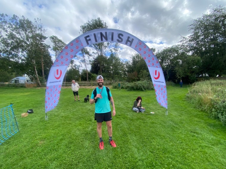
I saw an advert for the Hangman Ultra when I was looking into the Test Way trail. It looked perfect – the date worked and logistically it was feasible and at 50km it could be done in a day without too much disruption. I signed up.
It’s a small little event from the folk behind Ultra Magazine, capped at 100 runners, although there were only 26 sign ups this year (the event was returning after a two year hiatus for various reasons). I liked the smallness of the event. It felt personal and friendly. It is so low-key that they don’t even bother with race bibs or timing. You get an allocated a number and call it out when you pass through a checkpoint/the finish. Nice and simple.
Race briefing
Arriving at the village hall for registration, the runners formed up. It was a real smorgasbord of runner clichés. Within the small group there was someone I knew, someone I knew of, UTMB tee shirts, Centurion tee shirts, and many friends meeting again. I overheard a runner talking about their Marathon Des Sables experience and a reply from someone else saying they had another race the next day. It wasn’t surprising when Andy (the Race Director) asked during the briefing if this was anyone’s first ultra and not a single hand went up. There was some collective experience in the room for sure! Throughout the day the conversations would typically cover up and coming races, training plans and previous triumphs. Trail runners are a little predictable, we do like to talk about running!
With Jamie at the start
The route was a simple out and back route along the northernmost section of the Test Way trail. We had a checkpoint approximately halfway to the turnaround point where there was another. So three stops in total. After the race briefing we walked round the side of the village hall to the start arch. Andy wished us well and sent us off. The pack barely moved and it was a very conservative start which led to jokes about finishing together as a big group and jokes about winning. Momentarily I believed that I too could myself win the race and started to overtake runners as we plodded along the single track. Barely minutes later, when I couldn’t catch the front runners, I snapped back into reality of where I belong!!
The lead runners early on in the race
The first section was undulating with two little climbs. We tracked through farms, side roads and dirt tracks. There was a little farm we passed through with goats, piggies and chickens which amused me before a lovely section of redwood forest followed by a sharp descent down into the town of Hurstbourne Tarrant and the first aid station (at the George and Dragon). I took delight and enjoyment in devouring a Tunnocks caramel, a classic bit of confectionary, before continuing along the road and back onto the trails. Up until now I’d mostly been running with a guy called Matt as we were in 5th and 6th place.
Oink Oink
After the aid station I was slightly ahead of him now and then took a small wrong turn at the next farm before getting quickly finding my way back on track. There was a long slow walk uphill before some quicker downhill sections on gravel tracks before another slow road climb. The descent from here was very over grown and the nettles attacked our legs from all sides. It wasn’t a fun descent and I wasn’t looking forward to the return climb here! After more ups and downs and a good bit of consistent running I then caught up with the next runner ahead of me.
Combe Gibbet
We chatted for a bit about running and races as we climbed the biggest of the ‘hills’ on the route together out of Combe Wood before he then left me for dust on the climb up towards Combe Gibbet (A historic structure used for the ‘gibbeting’ of murderers back in the 1600s. It stands on the Berkshire-Hampshire border). I walked most of this track through the farms and fields. As I rounded the bend I could see the Gibbet off in the distance and 3 runners already looping around it and heading back. I cracked on knowing the aid station was in reach. A few minutes later, when they passed me, I still had about a km to go to reach the Gibbet and back to this point. I guessed they were maybe 10-15 mins ahead of me.
Reaching the next aid station we ran passed, reached the Gibbet, ran around it and then went to the aid station. I took a few mins here to eat some food (loved a bit of pineapple!) and refreshed on coke. I was glad to be turning around and heading back now. The good news was that the course overall was slightly more down hill on the way back to Longparish and we’d experienced the route so knew what to expect for the next 27kms.
I left Matt at the aid station and started heading back. Shortly after reaching the fields a little further on I saw Jamie, then, not far behind him I started passing other runners. Everyone was so friendly and cheered each other on.
Heading back to the first checkpoint (or now checkpoint 3) the hills we climbed were far more enjoyable to run down in this direction. I found this section went by quite quickly (except the climb back through overgrown nettles!) as I walked the hills and ran the downs and flat. I even made sure I didn’t take a wrong turn again towards the end of the section. I was hot now and drinking more so was very pleased to reach the checkpoint. I had it all to myself. I had a good chat with the volunteers, took on more Coke and pineapple then left. 14km to go. The race felt like it was passing quickly which I was glad of, despite enjoying it.
I walked from the aid station knowing that after a little road section we’d climb through the fields and the forest again. I couldn’t be bothered to run the road so just walked. The forest was just as delightful even climbing through it rather than running down it. The dense forest also provide shelter from the midday sun and a cooling breeze. I did start cramping in my calf though, no idea why. I thought I was well hydrated and had the usual amount of salty foods etc. Either way, I kept moving and before I knew it I had less than 10km to go.
some field somewhere
I think I did find the run started to get harder here. Fatigue was setting in and it felt more hilly then I remembered during the first section. There was lots of walking, lots of long gradual climbs. So the run/walk strategy was in full swing. For some reason I was feeling the pressure and kept looking over my shoulder to see if I was going to be passed. Silly really as I say I don’t care about times and position. Something competitive was twitching in my head though and I didn’t want to drop the 5th place spot. So I ran when I could and felt confident that as long as I kept running in parts that wouldn’t be caught and I assumed everyone else would walk these hills too.
The tiredness and ‘looking over my shoulder’ continued as I counted down the kms. Soon it was 5km, then 3km, then 2km. The knowledge of the impending finish was a great feeling. Soon I was on the single tracks again and less than 1km remaining. One last turn, back into the field and the finishers arch came into sight. The 4th runner was there and helped cheer me home. Medal in hand I posed for a photo and then headed off to the village hall for some refreshing soup and planned my journey back home.
finish!
I’ve been talking with mates about our love of the smaller events. The desire and attraction to the ‘big boys’ events is starting to fade. Like everything, commercialisation takes the spirit away. Whilst this is far smaller than what we have talked about, it was exactly what I needed. The organisation was spot on. From the pre event details, informative race briefing, relaxed vibes, awesome volunteers and a meaningful welcome at the finish and chats afterwards. If you want to experience a great friendly ultra atmosphere then go give the Hangman a try!
This feels like a diary now, writing about races so frequently in a short time. It’s almost as exhausting as the runs themselves!
Last time I wrote about how my feet had recovered in rapid time between Transylvania and Lofoten. Well miracles don’t happen twice. After Lofoten it was a slow recovery. I’d done nothing except sit at my work desk and move from there to the sofa. Despite the little bit of rest, flying out to Salzburg for the Mozart 100 I had three health issues on my mind. My feet – delayered and with fresh, raw baby-like pink skin on the pads and around my heels on both feet. My right knee after the twisting pain from Lofoten. And my left big toe/metatarsal – I hadn’t been able to bend the big toe for two weeks. These weren’t going to stop me though. Mozart 100 has been one of my bucket list events for a while and I wanted it. I was out here with Natalia and she was running the Mozart marathon which was the last 40km of the route I’d be doing (a sort of figure of 8 route from Salzburg through St Gilgen and back).
Just like Lofoten I prepared the feet before the race with a combination of Duo Derm (hydrocolloid dressings) and KT tape I. The hope of substituting for the missing skin layers. The knee and toe would just have to be dealt with mentally if they caused me issues. I was quite casual in the morning and had less than 5 mins to the start of the race after I dropped off the drop bag for St Gilgen. By the time I walked back to the start line, I found myself right at the back. I couldn’t even fit in the starting pen!
Arriving with minutes to spare
The plus side was that, within minutes of arriving, the race had started and I was running under the start arch. I made a decision to try and gain some places whilst I could and whilst it was flat. This was a good, but questionable decision. It turns out that the first 7km of the race was flat road and gravel tracks. The route took us through the old town, out and along the river. I kept running. Speeding passed people until I was only keeping pace with those around me. I was gassed. I wasn’t expecting to be running so fast for so long. Thankfully though, 8km in we hit the single track climb into the forest and the pack of runners came to a complete stand still at the bottleneck. People were moaning and trying to push passed around the sides. I was glad though. I needed the breather!
After a few short minutes we were on the move with gentle trails in the forest and smooth roads taking us up little climbs on switch backs. In no time at all we arrived into the first aid station. From here we’d head to the town of Hof. We’d visit Hof later in the day on our way back to Salzburg too.
This section was more of the same really with the route following smooth roads and wide gravel tracks. The small climbs were gentle switch backs and the downhill sections were sweeping tracks at a pleasing gradient that was pleasant to run. I was feeling good. My feet stung a little bit from all the pounding on hard ground when running the downhills. But I couldn’t feel any knee issues and my toe was only mildly uncomfortable when running downhill. This was good.
We crossed little villages and a few streams over small wooden bridges. We ran Into forests that had that fresh damp smell (there were thunder storms the day before) and it smelt divine. After a few small climbs and descents with plenty more running, I arrived at the aid station in Hof. It felt quick and my average pace over this first 22km was close to 7mins per km. Plenty fast for a 100km ultra! I hadn’t really eaten much and wasn’t endeared by the offerings at the aid stations, so I took a Naak energy bar. It was quite nice. Different to what I’m used to eating.
Leaving Hof I recalled two ‘lumps’ in the course. The first on road up through a little village and down as we left it. Then the second taking us back up this time through grass and fields behind houses and we passed a little farm and across a main road. I remember a volunteer / marshal sitting outside a house directing us. An old man with a big smile on his face.
From here the climbing began… the first of three chunky ascents in the first half of the race was upon us. It was a steep climb. It seemed to go Just straight up. No switch backs or winding trails to ease us up. Just a straight line through the forest packed with runners. It was fairly Technical in the sense that it was was very rooty. I thought to myself that this could make my tender feet very sore so tried to be consistent with my foot placement to minimise any rolling movements. I was glad we were ascending and not descending on this trail. Every now and then the trees would open up and present amazing views of the surrounding mountains and towns.
Once we reached the top it was rocky. We had a short traverse before beginning our descent. It was similar in that we pretty much ran straight down with few twists in the trail. It was steep and rocky at first before becoming more steady underfoot with smaller loose rocks and then gravel tracks. It was a long descent and I could feel my quads starting to burn. My legs were understandably tired after recent adventures and I was feeling it in my body now. We bottomed out and arrived at the next aid station. I treated myself to some Coke (Red Bull cola) as I felt I’d been running well up to now. Just under 4:45hours and 32km distance covered.
Cows enjoying the views
From here we climbed again. The course was very similar now and followed the pattern of long sweeping roads and wide dirt tracks on gentle climbs. This one we covered about 600m over about 5km. It was tiring but not too taxing. Up top was another aid station and a chance to take on more water. There were plenty of cows chilling at the aid station and a café with hikers sitting outside it. I wet my hat in a mountain trough and made the short, single track descent before the next climb where we’d continue up to Zwölferhorn. This was another big climb to Zwölferhorn . It started the same manner as the others – on roads and gravel tracks. Then became steeper as we hiked up in the forest. Once more the tree line breaking to provide amazing views of the lakes way down below on either side.
Eventually up top we broke out of the forest to a peak with a cross marking its summit. Loads of hikers were sitting enjoying the views. I started taking pictures then realised the real summit was further along passed the next aid station, the flags flapping in the distance. I carried on and ran over into the aid station. I made a short stop to refill water knowing that St Gilgen and my drop bag awaited after the descent the other side. The descent to St Gilgen was the longest and steepest yet. We ran along a mixture of rocks and rooty forest paths. Some very steep as we traced a path down under the cable cars. The views during the descent were beautiful with constant panoramas of the lakeside town. My quads were on fire now from all the steep down hills but I kept on running until we stopped descending. A young boy was cheering runners with a loud cowbell. He then ran passed me with his mother and the cowbell cheering her all the way into the aid station.
Beginning the descent to St Gilgen
The aid station was a bit chaotic. It served both the 100km and the 80km races and also acted as an aid station at two different points on the course (we’d now run a loop out of St Gilgen and then back). So there were a lot of runners coming and going. The benefit was we could access our drop bag twice. First here around 50km and then again around 67km. My plan was for a quick stop now and a longer stop on the way back. I grabbed a can of Coke and my drop bag and sat down. I gave myself 10 minutes to refill my tailwind. Eat some of my bars and drink the Coke. I also rubbed some cold gel on my quads and calves. As I left I saw some noodle soup and wished I’d seen it on my way in!
Leaving St Gilgen we ran along the Lake Wolfgang (great name!). It was absolutely beautiful, if a little busy. Loads of tourists out walking but also runners running back against us towards their second pass at the aid station. It was a little demoralising seeing so many 100km runners that we 17km ahead of us.
The incredible Lake Wolfgang, looking back at St Gilgen
I started talking to Marie, a Swedish lady living in Cork I’d met earlier on. We were both enjoying the stunning views that the course had to offer. As we talked we began climbing. I remember thinking how good the trails were. Typical well maintained Western European trails. You know you’re on ‘princess trails’ when there are families with small kids and prams walking the same route!
The climb was broken with a short down hill. I was running again and passing some runners on the 80km route. This was a little buzz and mental pick me up. My toe started hurting from something underneath. It felt like a thorn or something. I was running awkwardly to avoid putting pressure on my toe. After a while I blocked it out. (The next day I found a sizeable splinter stuck deep in my toe through the tape!).
After the down hill we began the big climb. This 10km section (including the last climb and descent) had 1000m of elevation to climb. Most of it now lay ahead. It was a big and slow climb. It was just straight and rocky underfoot. I powered on and hiked steadily. Runners were stopping and resting. I challenged myself to not rest until the aid station at the top. It was very tiring and felt like it would go on for ages. I could here some runners were asking hikers ‘how long to the top’. They were clearly feeling it too. Nearer the top it was rocky and the tired legs had a bit more work to do. I was craving some more coke now and sugar (there wasn’t anything sweet besides chocolate at the aid stations). Every now and then I could hear a mechanical roar further up. Some sort of cable car I thought (it was a tourist train up the mountain). At the top my heart sank when I saw a building way off several hundred metres further up a peak way off in the distance. Thankfully though an aid station was hidden just around the corner and we were not heading all the way up there!
I was glad the climb didn’t continue up to the real summit!
Here the aid station was shit. Perhaps I’m being harsh (it’s 1300mup a mountain, although a very accessible one). But when we arrived it was decimated. There was no coke. Just water or isotonic. And very little food. Just gels and tomatoes left amongst the crumbs of other fruits and biscuits. It was shit. I needed something so took a gel. I then just left in frustration and planned a good raid and feed back at St Gilgen.
It was about 7km down hill back to St Gilgen. It was hard at first with the rocky terrain and gradient but soon the trails became less steep as we ran into the forests and on to switch backs. It was quite quick and I covered the descent and trail back around the lake from st gilgen in around 1 hour 15 mins. I was pleased with how I ran and kept running, passing many runners here.
Back into St Gilgen my frustrations continued. There was no coke here either. I couldn’t believe it. I was nowhere near the back of the pack. So many runners were being deprived of the expected levels of support with food and (non water) drink. I could hear everyone around me asking the same. I reluctantly took a red bull I was offered. I needed something sweet. I also went to get the noodle soup which I had to scrape the barrel for. Hardly any noodles, just the broth water.
I grabbed my drop bag, changed my t shirt, ate some food, refilled my Tailwind and got ready to leave. Maybe 20mins rested. I didn’t want to hang around now. I’d messaged Natalia and saw she’d completed her run in 6 hours! She was hoping for 7 so I was proud of how fast she’d run. It lifted me too at the thought that trails would be good – there were no more big climbs to go now. And I had 10 hours to the cut off. I was confident that 8 should be feasible. The cut off times seemed to be so skewed. I left with 45 mins to the cut off!!
I walked out from St Gilgen as the route took us through the town and up some back streets behind some impressively big houses. There was a steep up hill that was just a few hundred metres along a narrow dirt track skirting the side of a mountain. It led into some beautiful trails that were nice and wide and gently easing us down into some forests and along through beautiful little mountain villages. In no time at all I arrived at the next aid station and to my delight finally they had both coke and soup. I took a cup of both. It was real Coke out of small bottles. Not the sponsored red bull cola. Clearly they’d been out shopping! I was satisfied and energised now.
Leaving here a little more refreshed and buoyed on by the thought of maybe a little over 30km to go. I ran along some roads as the course took us towards the lake. Here scenic undulating gravel tracks took us for a few km around the beautiful lake with its clear water of different shades of blue and green. I wanted nothing more than to stop and dive in to cool off on the evening heat. This feeling intensified at the far end when we reached a popular café/swimming spot with loads of people in the water. Without tempting the dip it had been a consistent section of running and walking when it was slightly uphill.
Lake side trails
Evening was starting to set in and the sunlight was dipping as we reached a road crossing. Just after the crossing, a family were outside their house with a hose pipe filling up runners bottles. I took the extra water gladly as despite the evening drawing in it was still very hot. Shortly after we reached another road crossing and began a climb onto a grassy hill. I recalled it from the section maybe 60km earlier after Hof. Hof must be the next stop now! I Remembered the grassy incline, passing through the farm and forests. Then long roads through villages. The old man volunteering was still sitting in the same spot he was many, many hours earlier and still smiling away. I thanked him once more. Shortly afterwards I arrived back into Hof with the now familiar ‘sorry, no coke, just red bull’ response to my request for coke. I moaned silently into another cup of soup. Satisfied I was at least getting some warm food into me. I took my head torch out ready and carried on. 20km to go…
Amazing sunset!
What followed I had ran before. Much of it I don’t remember. Whatever I previously described as wide roads and gravel tracks through forests is probably about as descriptive as my mind would remember anyway! Somewhere in the forest we went differently though. I don’t remember the river crossing over a small grid platform balancing on a barrel from before. It was all very similar from here though with (yep, you guessed it) more forests and roads. We then started climbing again. My run had become a hike as we continued a long climb as darkness set in and the torch light came out.
Up on the hill a glow of an Aid station signalled the next break and the marker for the final 10km. Here at Koppl it was the same old story. The sugar I was craving wasn’t there. I did get a cup of alcohol free Steigel though. That was good enough for a bit of fizz and change in flavour. More soup too. I took ten minutes. The atmosphere was good and the soup piping hot! I steadied myself for the next section knowing there were a few sneaky climbs and descents still to go. I made sure to leave though before I got cold though as, all around me, runners were layering up. But I knew I’d be warm as soon as I started climbing again.
The 10km was split roughly into a 6k and a 4K section. It started with a 150m climb. It was fairly tough going. Single tracks and rocky in parts. We were climbing towards a tower on top of the mountain but wouldn’t get that high, peeling off around the side of the summit. We had incredible views of Salzburg bellow with the orange street lights shining brightly. I led another runner on and we chatted briefly before we started descending. It was steep in the forest and I used gravity to stumble forward slightly quicker than walking pace, excusing myself passed other runners. It was a long rooty down hill that was a little awkward and painful. I was feeling my toe/foot issue now with the constant pain ringing clear. The lower we got the harder it became as the trails became stairs. Steep steps made of wood at uneven angles. It was uncomfortable to traverse at pace. They kept going one after the other. Like death by a hundred steps. I hobbled on, out of the forest and over the train tracks. A small water station marked the end of the first 6km section. It was the home stretch now.
The Glow of Salzburg way down below
I knew what came next from both the route profile and Paul’s wisdom from his experience 4 years earlier. Now back in Salzburg, the route climbs another 200m up to a building on a hill. Then descends into the heart of town before we cross the river to the finish in old town. I had 30mins to cover the 4km to get a sub 19hour finish. I knew with the climb this wasn’t possible. But I was pleased to now be so close to the end.
I still couldn’t quite understand how/where a 200m hill existed in the city! It was very steep and mostly steps to climb. A right pain and torture after already covering 100km. It was frustrating more so because of the groups of teenagers hanging around up there and smoking. The fresh air smells polluted by the stench.
I reached the castle on the hill and began the slow descent. The trails of rocks and tree roots soon turned into stairs. Of course. The stairs became shallow angled steps closer to the old town and my foot placement became more pronounced. Reaching the bottom we came out onto a street of bars and pubs bustling with Saturday night vibes with loads of people out drinking and enjoying themselves. I walked around the corner and pressed the button to cross the main road onto the bridge and over the river. The green man signalling my safety. I walked the few hundred metres along the river promising myself I’d run what’s left through the old town. One more road crossing and I started jogging again. I was catching people with less than a few hundred metres to go. They were walking through the old town but then started running when I neared them. I’d either have to run faster or drop back to avoid finishing alongside or right behind them. I dropped back and got a clear pass at the finish line.
Printed finishers photo!
At the finish I got another alcohol free beer (no coke still) and was given a printed finish line photo. That was a nice touch. I was then directed back to the race office around the corner in the adjacent square to get my drop bag and finishers medal. Here I was also given a frame for the photo. That’s a new one for me! Never had a frame and a photo at a finish line before! I drank the beer then walked back to the hotel. Ready to wash and climb into bed…
I loved this event. Salzburg is a beautiful town and one I’ve wanted to visit for a while. The trails and scenery is beautiful. Overall the organisation was good but if you haven’t sensed it yet, there was a sour taste in my mouth from the aid stations. They were grossly under stocked. Only one aid station in the last 60km had coke and the food was scraps at many. And I was mid pack. With 5 different distances and thousands of runners, they really hadn’t enough food. Given the race is now under the UTMB banner, this isn’t good enough. For fully supported races, they have to provide enough food and water.