Interlaken planetary, Interlaken planetary

A few years ago Paul did a solo adventure along the Hardergrat Trail in Switzerland. Ever since he’s been eager to go back with us to do it with him. We started scheming and found the time to form a plan and incorporate another visit to the Eiger Ultra Trail alongside the Hardergrat Trail. Paul, Matt and I did the E101 100km Eiger Ultra Trail back in 2022. Darryl and Natalia wanted to do the race too so it was perfect timing, to combine the Hardergrat with the E51 50km race the following day.

The plan seemed simple enough, fly to Switzerland on the Thursday, Do the Hardergrat Trail on the Friday, do the race on the Saturday and fly home on the Sunday. Efficient, although not the recommended approach for a race and a bunch of early mornings were for sure going to be tiring! We based ourselves out of Interlaken to take advantage of being closer to the Hardergrat Trail and more options for accommodation. We also had one shot at the Hardergrat Trail so were very dependent on the weather/ground conditions, which thankfully, were perfect…

Hardergrat Trail

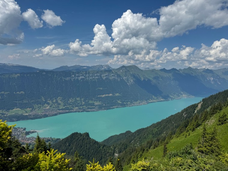
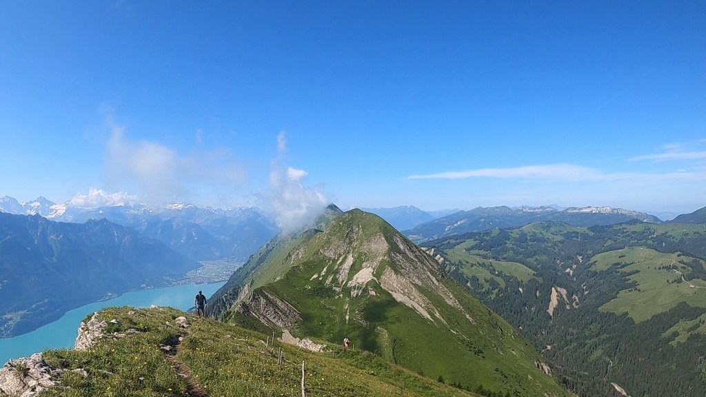
The Hardergrat is a popular and well known hiking trail that runs along side the Brienzersee lake between Interlaken and Brienz. Although I say hiking trail, I don’t believe it is an official waymarked and maintained Swiss trail. Depending where you read, it is often described as one of the most dangerous hiking trails in the world. Whilst I don’t believe that myself and think there might be some dramatisation (I’ve felt less safe on some other trails I’ve done!), the risk is very real and it is well known that people have fallen, in some cases fatally, from the trail (there are many memorials and crosses along the trail!). It also isn’t for the faint hearted though and can be quite terrifying in parts. So if you are considering it, consider it carefully and plan appropriately!

The Hardergrat Trail (Seen from the other side of the lake)

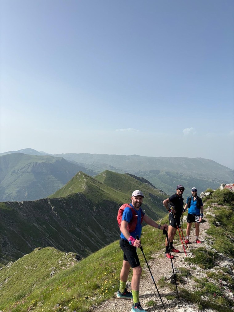
All that said, we didn’t go into this lightly and had planned it very meticulously. Firstly we had Paul leading the way and he had completed the trail before. So we collectively knew the route and dangerous points and what to expect from first hand experience. Secondly we were only going to start if it was safe to do so. If it was wet, or indeed had been wet in the days leading up to our adventure, or windy, or any risk of the forecast changing unexpectedly for the worst, we wouldn’t be starting. We also planned to begin at 5am. The trial is over 25km long and has close to 3000m of elevation gain in total and finishes high up in the mountains where you either get a train back down, or descend over 1000m by foot. We didn’t want to feel any time pressure so we planned to start the hike from Interlaken up to Harder Kulm as early as possible (note, there is a vernacular that covers the ~1,000m climb to Harder Kulm, but this doesn’t start running till about 9am). We also planned to stop towards the end of the ridge and descend to Planalp and get the train to Brienz from there rather than continue all the way to Brienzer Rothorn. These trains finish around 4-5pm so you need to be ready to reach the end destination in time or face that huge descent on foot back to the lake (also worth noting it was about 40CHF for a single ticket down from Planalp!). Besides all that, the four of us consider ourselves to be well experienced on mountain trails and conditions and look out for one another. So we felt we were suitably prepared…

Our one concern was water. Given it is only really safe to attempt this trail in summer, and it is completely exposed along the top so was was going to be very warm, we wanted to carry as much water as possible, a minimum of 3 litres each. With the Harder Kulm being closed so early in the morning, there is no where along the trail to get water for pretty much the duration of the trail. Around Augstmatthorn I believe you could descend and then retrace back to the trail, but you’d be adding hundreds of metres of elevation and hours to your time, so you only really leave the trail here to start or finish a hike. We’d carry as much as we can and be sensible with the rationing.

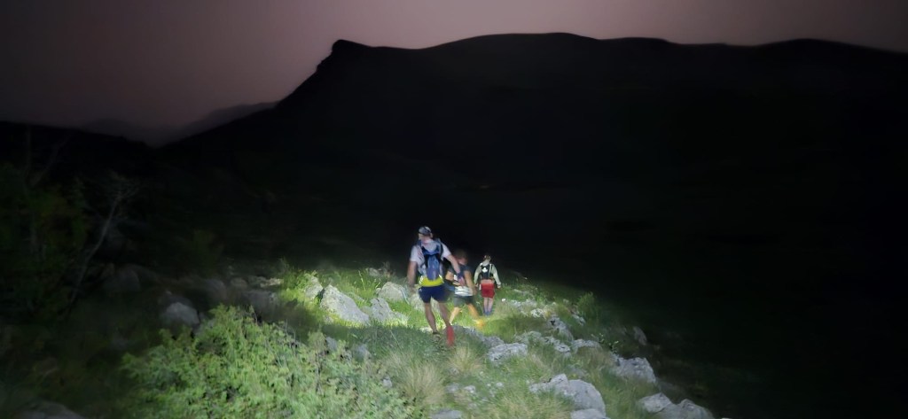
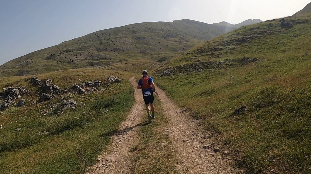
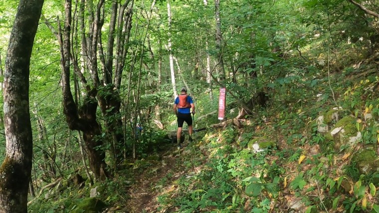
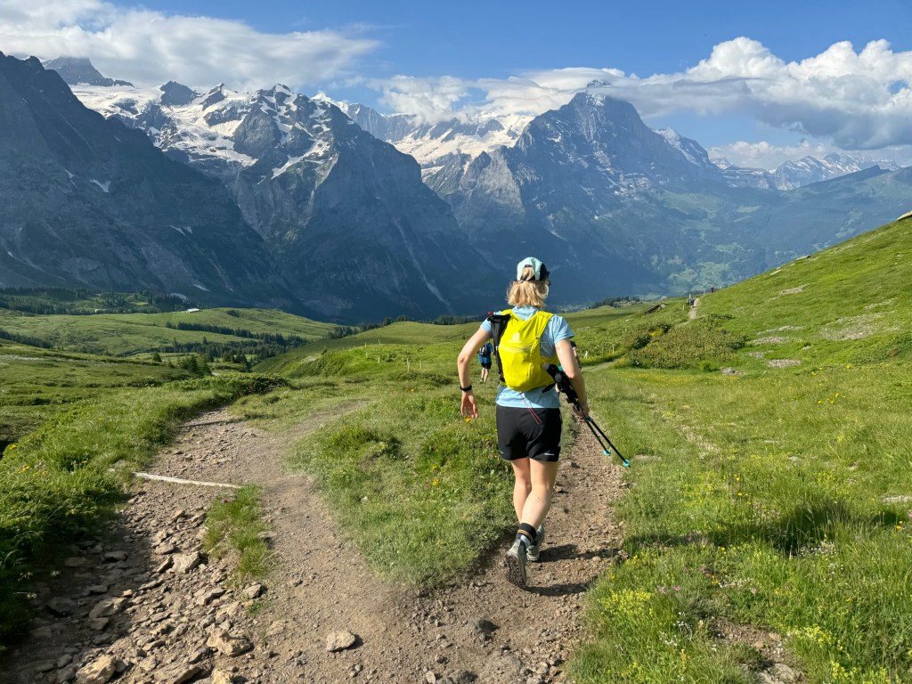
We woke at 04:00 when our alarms disturbed our slumber. Had a quick breakfast and made our way outside around 04:30. It was a short run to the vernacular station where the trail to Harder Kulm starts. It is a forest trail winding up narrow switchbacks pretty much the whole way. I popped two Energy Bytes (caffeine sweets) here to help wake me up a bit and give me energy on the climb. It took us about 1 hr and a half to make the climb through the forests to Harder Kulm which was about 800m over 5km. From the restaurant and viewpoint here there is probably about another 300m or so along 2 km through the forest before the mountain ridge becomes visible. On the way, as we stopped and ate some sandwiches, a few others passed us including two brothers from America who we would see at various points as we leapfrogged each other along the trails.

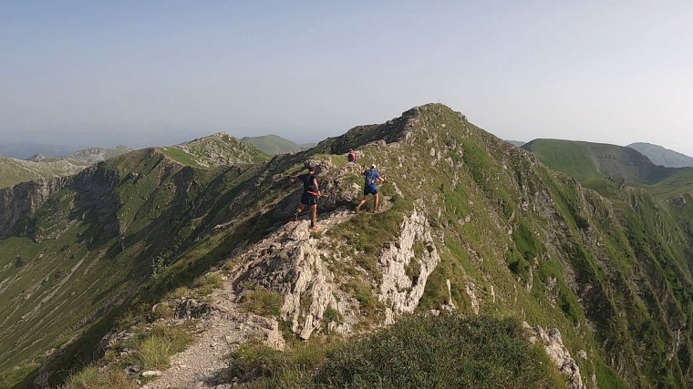
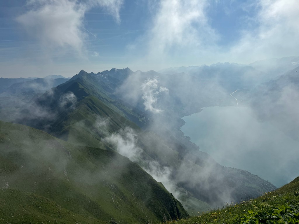
It was beautiful seeing the sunrise through the forest and the morning mist giving way to these epic summits stretching way off into the distance. A long way below to your right, the lake looking like a gigantic hole in the ground. The mountain kept climbing until we reached Augstmatthorn around 14km in at some 2,100m up. Getting here we had our first taste of the ridge and some narrow sections. Many hikers stop at Augstmatthorn and make their way off the ridge. Another hiker we were talking to told us the route becomes much harder and more dangerous after this point (he had hiked it many times himself when he was younger he said). Somewhere along here there were also electric fences to one side of the trail to keep the cattle on the mountain side to the left. I know they are electric as at one point, whilst sitting down and resting, I brushed my arm against it and felt a tingle in my opposite ankle. This amused the others!

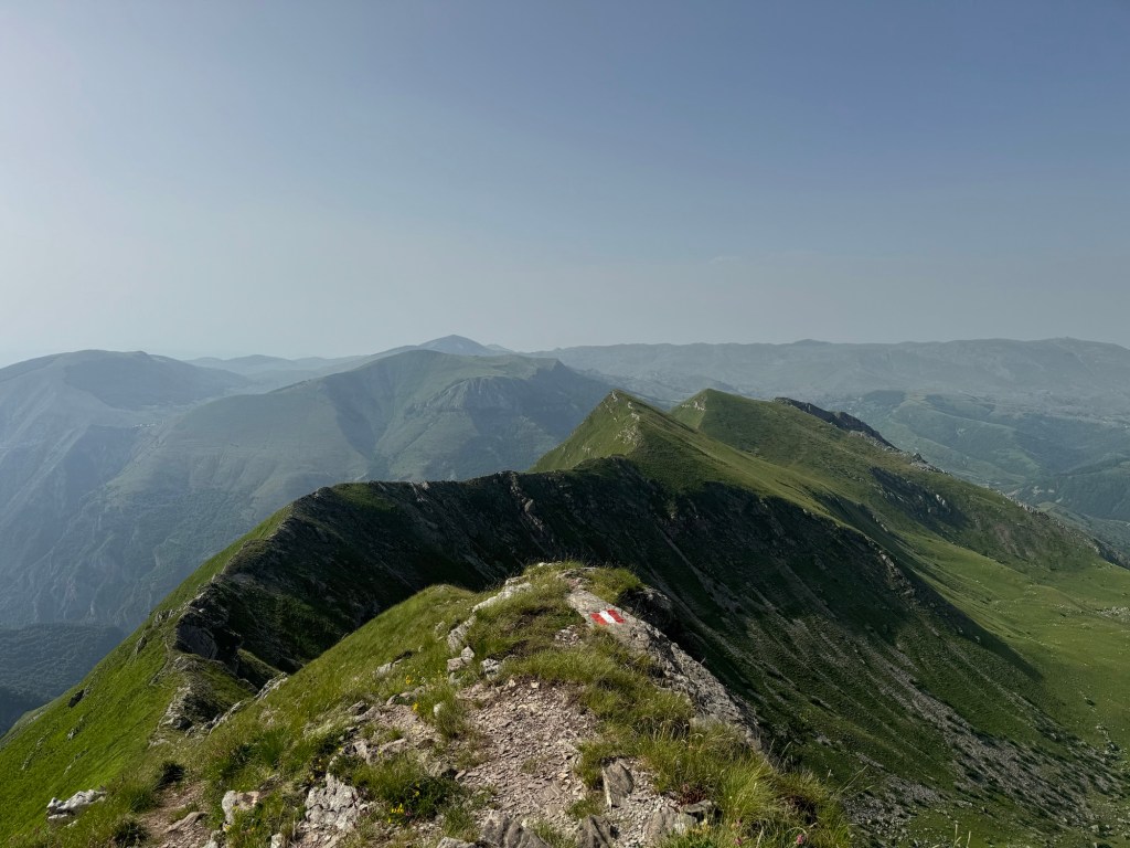
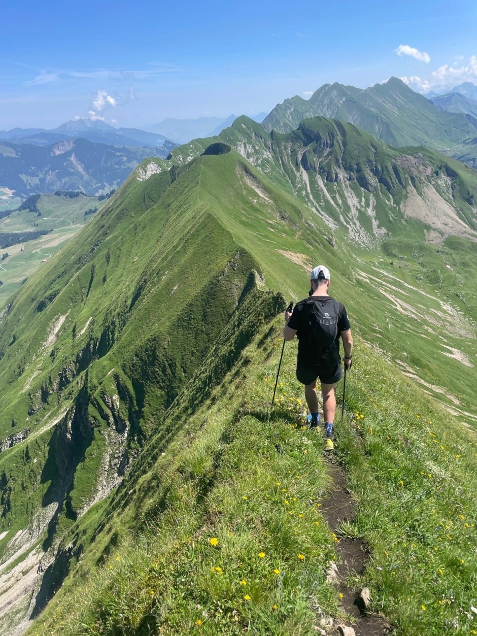
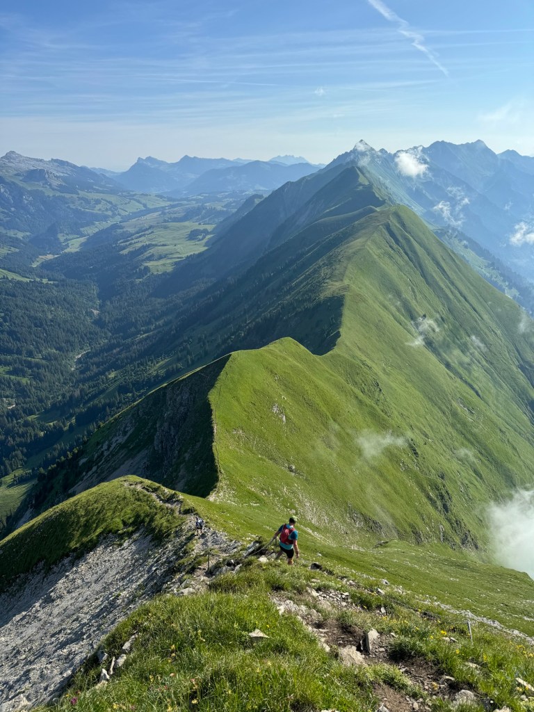
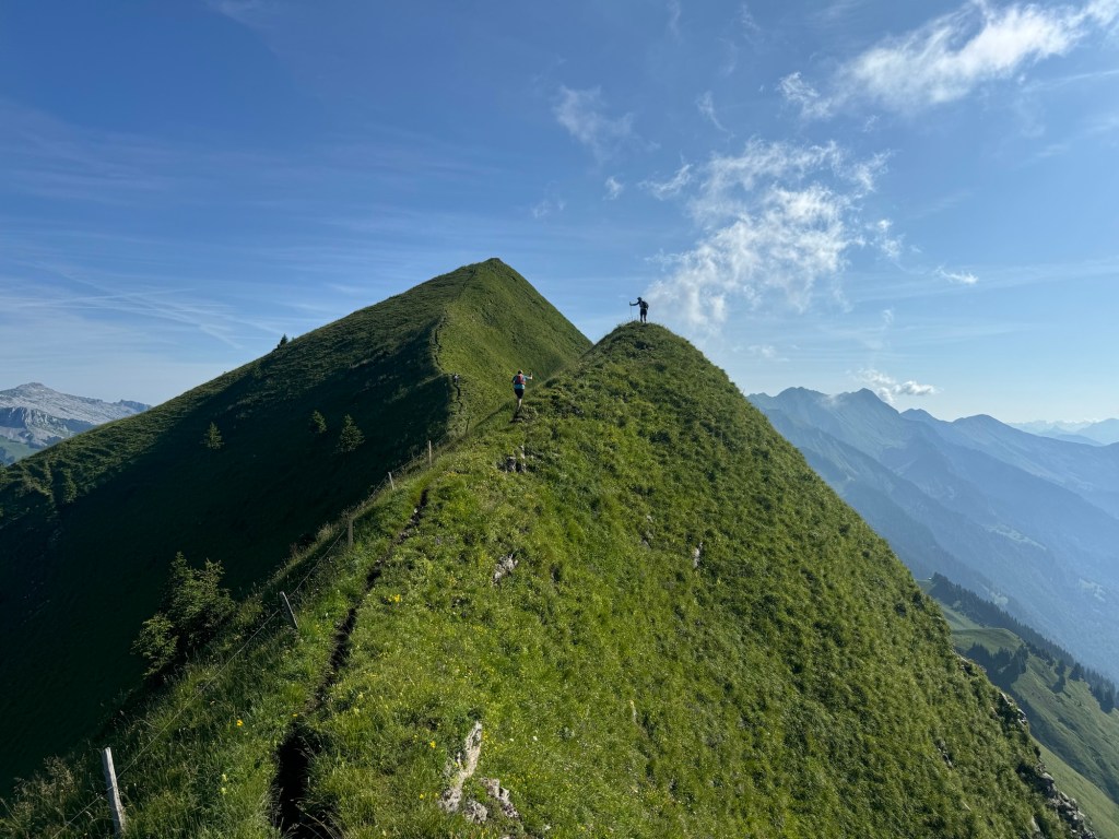
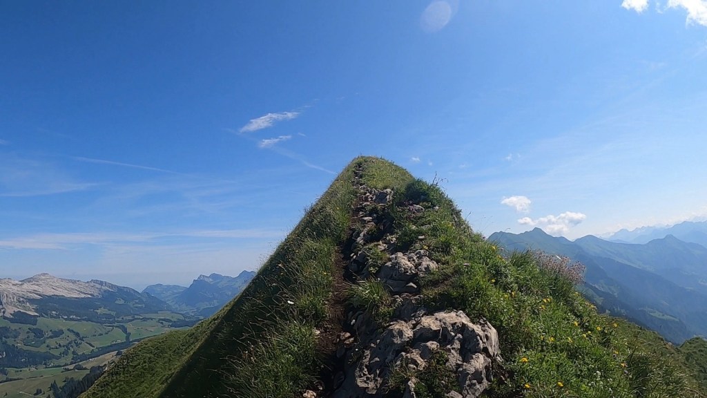
We carried on knowing we were a little under half way along the route we’d planned. What lay ahead now was a series of 7 or 8 mountain climbs. Each short (in comparison to what we climbed to Harder Kulm!) but very very steep. Some sections were rocky and had ropes and chains. Some sections had very clearly defined paths, but were right on the ridge and were very narrow underfoot. Some of the climbs were like walls and we scrambled our way up. It was very slow progress and we stopped atop of each summit to sit and enjoy the views and eat food. The views around us were pretty static. The view down and across the lake remained unchanged throughout the hike. The view to the left did change as the valley climbed through a mountain pass alongside the ridge. The view in front however was spectacular. With each summit we climbed, the descent became visible and the ridgeline curved off with a different perspective into the distance. Up and down we went…

It was a long slog as each climb was exhausting and we rationed our water more and more. Unlike when running in a race with aid stations, I was taking small sips to ensure I saved the water and had plenty for later on. Each big climb though would quickly empty a bottle. I played a strange game with myself where I was committing to not finishing a bottle before some point I picked in the distance. This felt counterintuitive but, the longer we progressed, the less water we had and the more it become problematic. One by one we were calling out just how many bottles we had remaining and the numbers were dropping quickly!

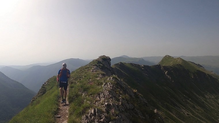
It’s hard to say for certain which memories and pictures correspond to which peak on the ridge. I do recall though that we passed plenty of hikers along the way, many doing it in reverse having taken the train up from Brienze and hiking back towards Augstmatthorn. One couple were lovely to chat with and I had a great conversation with the lady about the vibrant wild flowers all along the ridge. She told me to “take as many as I could and keep them in my heart”. I thought this was a beautiful sentiment. I also recall one particularly difficult descent which required scrambling down on all fours. For much of the ridge I kept my poles tied away in my pack and relied more heavily on my hands and having more points of contact with the ground.

Towards the end, the ridgeline was far narrower which caused the legs to feel more wobbly despite the clear and flat footpath we were following. Way off in the distance though we could see the Hotel Rother Kulm / Brienzer Rothorn Station which is the true end of the route. We weren’t going the whole way here but instead would escape down the side of the mountain and get on the train at another station at Planalp. For us, continuing to Brienzer Rothorn wouldn’t add much to our experience other than making it more dangerous – it would be quite a few more kms and probably two more hours or so, which we weren’t able to accommodate with water to sustain us. It wasn’t the timings that concerned us, but carrying enough water!

As we neared the trail junction where we could begin descending off the mountain we were all pretty much out of water. By now we’d ‘adopted’ the Americans who had made great progress but ultimately weren’t prepared for their adventure (think lack of training and deciding to do the hike whilst on a family holiday) so together we all descended. Even the downhill was tough going as our legs were now tired and our throats dry. We had about 600m of elevation to drop and about 4kms to go. In the distance we spied a water trough, however when we got closer it was a static one without a tap filling it up. We carried on. Paul had disappeared into the distance and Matt was somewhere between us and Paul. Thankfully after about 3km and 500m of descent we caught up with Matt at another trough that did have a fresh water supply. We stopped and drank about a litre each and refilled our bottles. A few hundred metres further on we all felt the groans of our stomach as the sudden intake of water and bouncing movements unsettled us!

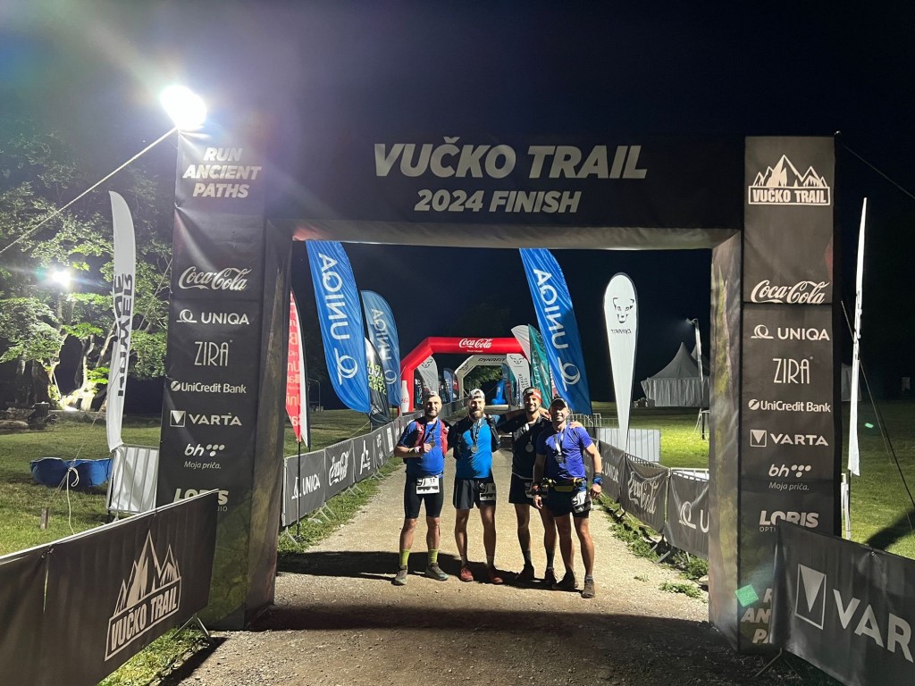
Eventually we made it down to the Planalps station where Paul was nowhere to be seen. He’d mentioned there was a restaurant at the station which we couldn’t see. We soon found it further down the road with Paul sitting happily in the garden waiting for us and a cold panache! We stocked up on drinks of all kinds whilst we waited 45 mins for the next train (which we just squeezed onto) down to Brienz. Here we headed straight to the lake for a lovely cold dip to relax before making our way back to Interlaken. What an adventure! Now time for the Eiger Ultra Trail…

Eiger Ultra Trail E51

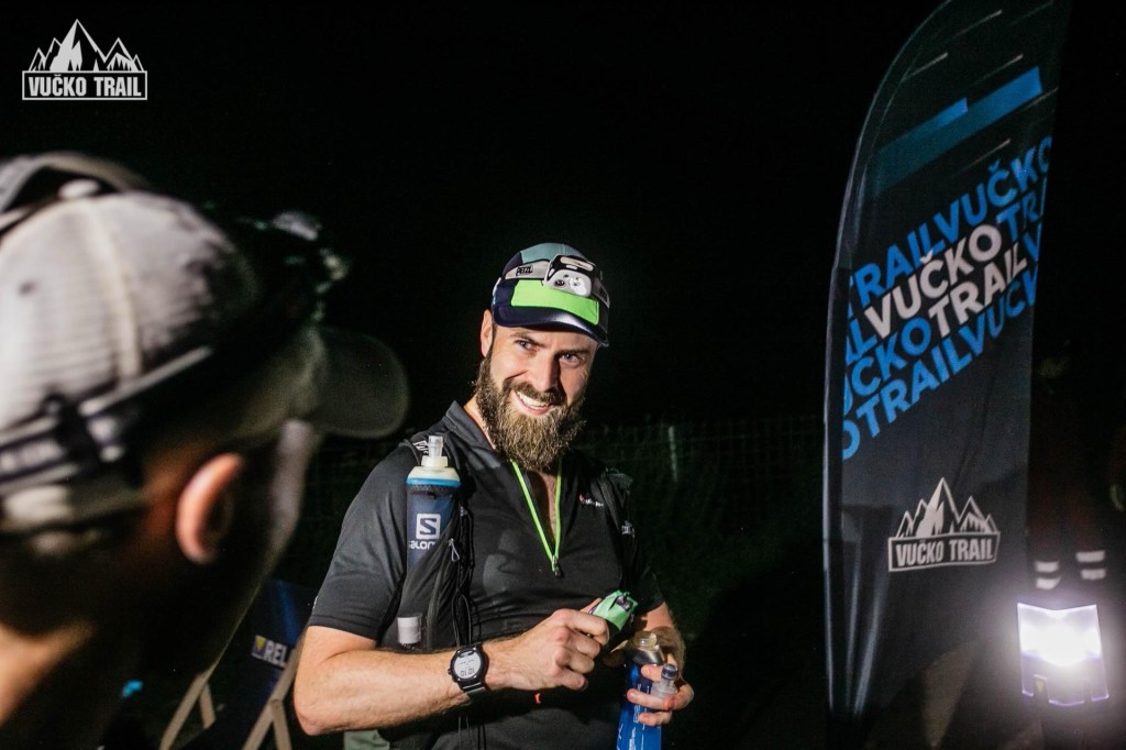
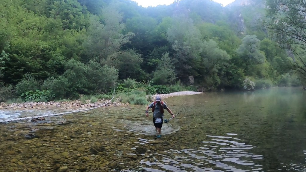
After a restless sleep and another an early wake up call we made our way to the station at Interlaken Oost to get the first train to Grindelwald along with a load of other runners. The train was quick and easy and we arrived 20 mins before the race started. We made the dash to the registration centre in the sports centre (we’d taken advantage of the opportunity to request registration on the morning of the race to save another trip to Grindelwald on the Friday!). The ice rink in the basement of the sports centre was gone and it wasn’t cold this year as we waited in the short line, collected our race numbers and dropped our bags off before making the way back to the start line. There were only 5 minutes to go before the race started so we settled into the back of our wave 1 start and then gently ran the 2km or so to the trails. We had maybe 10 runners around / behind us for those first few kms. As we got to the trail there was a big bottle neck as we queued to cross the river. We waited a few minutes at a stand still before we made it through.

Startline

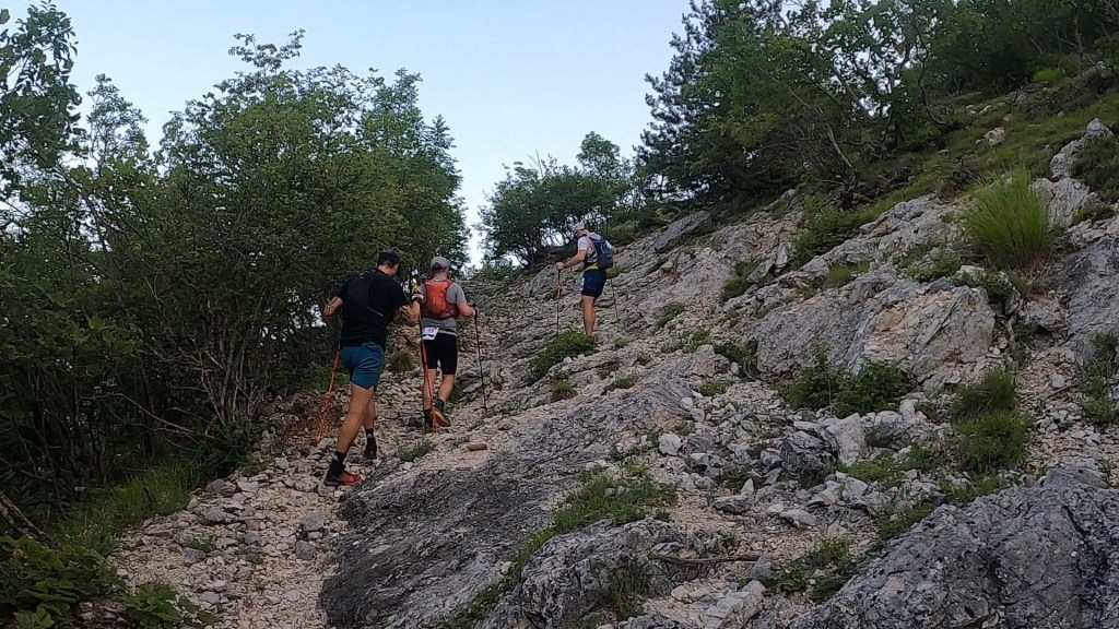
Shortly after we began the first climb to Gr Scheidegg, the memories from the E101 a few years ago started to come back to me as we wound our way slowly up the switch backs. Last time we did this in the darkness so it was refreshing this time that I could see the trails and experience them, and the views, around me. We steadily climbed and enjoyed the short break after about 6km where the trail levelled out and we ran the undulating trails before the remaining climb to the first aid station. As we arrived, it was just as I remembered – a narrow set up that doesn’t really accommodate space for the runners. Navigating through the checkpoint in single file we grabbed some snacks and water and waited out the other side. We spent a while here eating and drinking and enjoying the early morning views of the Eiger before carrying on. I popped another Energy Byte to give me a kick and wake me up a bit.

Early views from the first aid station

From here to the next aid station, at First, was great. It is a short section of about 6km that has some runnable trails and gentle descents and climbs. All along it are panoramic views of the mountains surrounding the Eiger. The Eiger itself was standing magnificently proud in the cloud cover across the valley. Towards the end of the section we began the long, but gentle, slow ascent to the viewpoint and aid station. As we reached the top, the route markings took us across the trail and towards the viewpoint and the walking platform. This was Natalia’s first time experiencing such a long and exposed platform so we slowly walked along it to the sanctuary of the aid station, after getting some pictures of course! At the aid station I had my own party as I sat and ate loads whilst singing to the 90s pop anthems blaring out. Even though we’d only done less than 15km I tucked into the soups and bouillon available (it’s a popular feed station on the E101 route!). Eventually though we had to carry on.

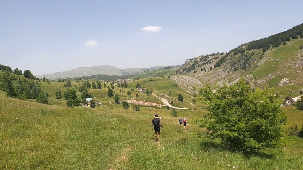
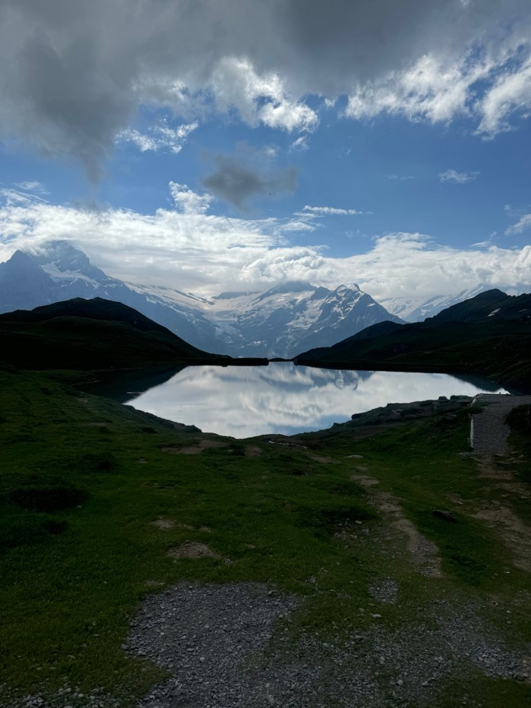
I remembered the next section as we left First and made our way towards Feld. The trails were similar to before and led us towards some amazing lakes of Bachalpsee, naturally as we ran around the lakes the views were incredible. It really is a beautiful place. I pointed out Faulhorn to Natalia, the highest point in the race way off in the distance, a tiny speck on the mountain. Along here we met some other British runners who were part of a group running from Wild Trail Manchester, the group I spent a lot of time running in London with. After the lakes we encountered a small amount of snow on the trail which made it slippery, so we climbed slowly and carefully. Some smart arse behind us tried to rush past us and slipped in the mud and slid back down the hill. Not sure what he was trying to gain. He didn’t try to go past again.

Lakes at Bachalpsee

I knew the next section was quite rocky and technical (It’s even marked as such with ‘danger’ signs from the organisation). That much I could remember. I told Natalia to go slowly as it was rocky and now wet and slippery too. As we progressed we found ourselves near a lady who was clearly uncomfortable on the technical terrain. Knowing it was a short section I told her not to worry and to go at her own pace safely and we’d all follow behind. We stuck with her. Naturally a queue formed as we slowly progressed along the single track. After a while some prick behind us made a comment “it’s called trail running not trail walking”. I couldn’t hold my tongue. My usual polite and refrained manner was overcome and I snapped back to tell him that clearly there are runners who are not comfortable and that their safety is important. I told them that if they wanted too they could find an alternative route past and if they were such good trail runners then they wouldn’t be way back here in the race with us ‘trail walkers’ after 20km. No one said anything. No one tried to get past us. Go figure. It wasn’t long after that the technical trails gave way and the ground became more firm. The lady kindly stepped aside for people to pass her. We went past and started running. A few moments later I looked back, no one was keeping up with us. Says it all. Sometime later, on the next section after the aid station, we past the guy who made the comment as he was sitting on the side of the mountain on the next climb, clearly knackered. I was tempted to make a sarcastic comment then…

Anyway… After a short stop at the next aid station, Feld, we started the climb to Faulhorn. Before the race I couldn’t remember this climb. As soon as I saw it though I remembered. Like years before it was a warm day so a very hot and exposed climb. It is steep and slow going, a snake of runners slowly dragging themselves up to the top. In the sun it felt like it went on for ever. All the way up you can see the restaurant at Faulhorn, sitting way up high and ever so slowly getting closer and more in view. We kept pushing without stopping and made our way over the saddle and onto the last short climb to the restaurant were the trail takes you around to the back/top of Faulhorn. We stopped for a picture by the archway then joined the queue of runners waiting to get in and fill our water. Like many of the aid stations it is a tight fit (although this one on top of the mountain is justifiable with its limited space). I had a few cups of Coke that had been expertly whisked to a flat state by the willing volunteer. It was so refreshing in the heat.

We began descending and all the memories I was so sure of started appearing to have holes, giant black holes. As we left Faulhorn I was chatting to another British lady and I told her it was all nice runnable trails from here. It isn’t. I’d completely forgotten about the next section. First there is a short, sharp descent down from the summit. Then you make your way over rocky ground before the real descent began. This one is long and very rocky. There were a few short snow field crossings thrown in the mix too. As you make your way down you are descending on lots of large steep steps in the rocks, then further down we went, past the restaurant, on trails covered by snow burying the rocks beneath. I slid down on my bum as my shoes had no grip (I was very aware that they are now excessively worn but I thought would be ‘fine for the lovely runnable trails’ I falsely remembered!). Like the climb before it, the descent felt like it went on forever. As the trails started to re-emerge my head started piecing together the memories better as we made our way up a little incline to the water stop that is ‘Egg’.

It was actually this next section from Egg to Schwand that I recalled the best. My memories just made me believe the whole section from Faulhorn was like this. There are some lovely trails for the most part as you ran along the exposed mountain tops. Lots of tourists and walkers out enjoying the hike from Schwand to Faulhorn in he opposite direction. The mountains are exposed and you have these Epic views over the valley to the Eiger on the other side. Way off in the distance you can see another mountain restaurant perched on the side of the mountain. Below it, somewhere, the next aid station. It was a long way to go by sight, but not that long now you can move more quickly with the even terrain underfoot. We made a quick stop in some shade to apply more sun cream as it was getting pretty hot now.

Before getting to the end of the path, there was the ladder/step climb I’d completely forgotten about too. I piggy-backed on to a group of runners half way up and thanked the hikers waiting patiently to come down. After this it was a gentle hike up before we eventually reached the turning point where the downhill started. Pretty much from here it was all down hill to the final aid station. First we descended on lots of switchback trails to the aid station ‘Schwand’ though. This I remembered quite well as two years earlier Paul and I had stopped at a trough and desperately filed our bottles and relaxed, only to then see the aid station a few hundred meters further along. I recognised the trough (now covered up!) and pointed out the aid station to Natalia. We were ready for a break from the sun.

On the way to Schwand

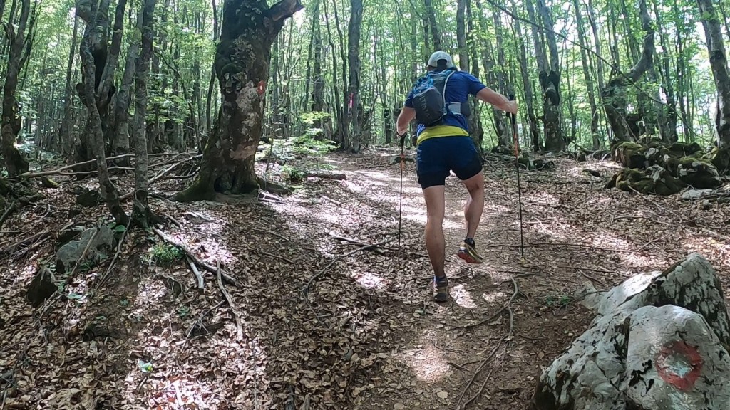
After a little break in the shade and a ‘little douche’ from a volunteer with a hose pipe we departed. The trails led downhill into the forest. It was more technical than I remembered with roots causing the descent to be painful on my now very tired quads and ankles. The ground below was very spongy between the roots. This year I was prepared knowing that there was a sizeable climb during the descent. This caught us out back in 2022. It started in the forest then took us up as we crossed over a waterfall and then climbed further through a hamlet. I didn’t recognise the hamlet and it turns out that we went a slightly different route this time and climbed further. See, not all my memories are wrong! Eventually it was back into the forest as we began descending again and continued down towards the valley. We spent most of the descent in a train of people slowly making their way down gingerly. At some point the single tracks opened and we squeezed passed the group and were able to run at our pace. As the trail became switchback roads Natalia opened up and sped ahead. I couldn’t keep up. We could then smell (literally) the final aid station. We ran passed so many people in the short field as we ran down and into Berglauen. We took a few mins to refuel, deciding against the potatoes on offer, then set off. The final 7km to go back to Grindelwald.

As final 7kms of races go this is ace. It’s pretty much flat the whole way following the river back to Grindelwald. Over the 7km there is 225m of ascent and 100m of descent. Mostly this is grouped into three ‘climbs’ towards the end as you near the town. We ran/walked the whole way passing many runners as we jogged along the river. We then passed through a small village with incredible wood carvings (I now wish I stopped to take a picture!) and welcoming signs before crossing the river and running through the train station and over the train tracks for the Eiger glacier train (which we had to wait for and got a huge thumbs up from the driver). From here it was almost the final stretch as we stated to climb into the town and along the footpath to the point where the E101 joins from the opposite direction and we make our way up the final climb into the town. Its a short steep climb on paved road which everyone climbed so slowly. Once done, it was over! We we ran the few hundred metres down the town to claps and cheers from both sides of the road, round the final turn into the finish line area and down the familiar steep ramp to the finish line.

with our piece of the Eiger

Just like that it was over. We quickly escaped the busy finish area and went to collect our bags, change into fresh clothes, before meeting up with the others and making our way to the train back to Interlaken. It felt like a very long day by the time we had food and made our way back to the accommodation!

What a weekend! The Hardergrat was an incredible experience and it was special to see the mountains around Grindelwald again and share the race with Natalia. I don’t remember the race being as difficult as it was (and I won’t blame the run the day before!), it was certainly more technical than I remembered. We all agreed we wouldn’t want to do the 100k after experiencing the 50 nor could we believe that we’d done it previously!

Night of the Full Moons

Oh how we’d been looking forward to this one. Many, many years ago I had a short trip in Bosnia when I was travelling around the Balkans with friends. We took a few days to travel to Bosnia and visited Mostar. It was stunning and I’ve been wanting to go back and visit Sarajevo ever since. When I came across a 105km ultra trail race near Sarajevo, I knew I’d sign up and that Paul, Darryl and Matt would come too.

After a few logistical mishaps leading up to the summer we flew in to Sarajevo the day before the race. On Friday we made the short journey into ‘town’ from where we were staying and did a bit of sightseeing. As we made our way back to the accommodation chaos descended on the town when a major power cut (affecting much of the Balkan region!) hit. We spent the next few hours in the increasingly hot accommodation, preparing for the race that would start at 10pm whilst wondering if it would go ahead – with no power surely the event was a safety risk. Alas, a few hours later power was restored and we were on our way.

On the way to Javorov do, Bjelašnica, where the race would start and finish, we stopped off for food at a lovely restaurant Lisa had found. They weren’t too impressed when we turned up in full running kit but reluctantly let us in. With full bellies we then continued to the start line to register. Bjelašnica might be familiar to some as this is where some of the events of the winter Olympics of 1986 were held. Now the surrounding area has many new and modern ski resorts set up.

The Vucko ‘Black’ trail starts high up in in the mountain resort Jorovano Do which is about 1,250m up in the mountains. The Black trail starts at 10pm and we arrived just before 9pm to register, have our kit checked and attend the technical race briefing. The race briefing was very thorough and detailed as every section of the race was talked-through. We chuckled when we were told to watch out for bears, snakes and other animals. After the race briefing we made our way outside to the start line along with 40 something other runners. We had our full mandatory kit checked and soaked up the atmosphere where many supporters lined the starting arch to send us off.

10pm start line at Javorov do

It was an excellent start line and we ran off onto the trail, quickly hitting a climb in the forest. The trail gradually became steeper as the single track led us away from the start line. The soft soil led us up and we crossed a road where loads of people cheered from their cars as they waited for us to pass across the road where we went straight back onto the forest trails. The smells were fresh. The ever so familiar feeling of calm washed over me. I love this feeling at the start of a race for the first few kms where all my anxiety and stresses flow out of me and the excitement of what is to come replaces them. My kind of freedom!

The clarity of the full moon at night

The night was warm. Very warm. Sarajevo was experiencing higher than normal temperatures and there were reports of high 30s being reached during the day. We weren’t going to be cold, that we knew for sure. Even as we climbed higher the temperature was warm and the air was still. The path led higher and we emerged from the forest onto trails that skirted along the side of the mountains. They were rocky underfoot and had a slight camber. Above us, dominating the night sky, was a full moon glowing orange. The night was hazy and light and I imagined having no head torch that I’d still be able to see enough. The night sky made beautiful silhouettes of the surrounding mountains which were visible. The mountain trails took us off the path, descending and ascending the undulating trails in a most direct fashion. Beneath us the gravel tracks gave way to lumpy grass and big rocks to skip along.

We passed through the first two aid stations, in what felt like no time. The first was a simple tent in the middle of nowhere after a steep and slightly technical descent. From which the mountain paths continued as we reached the second aid station which was at Lukomir, Bosnia and Herzegovina’s highest populated village at almost 1,500m. As villages go it is very small, just a tiny settlement of old stone houses and I believe a small number of families living there. At the aid station we talked and joked with the volunteers and tried all the food combinations they offered which it seems other runners weren’t interested in (Chocolate spread on bananas was a firm favourite for the boys). We then set off with strong vibes and encouragement to ‘enjoy Herzegovina’. That I was sure we would do!

The trails into Herzegovina where rocky and undulating. More skirting around the side of steep mountains and the vast emptiness as we traversed along the top of them. With the warmness and stillness of the night, we were sweating a lot and my shorts were soaked through. By now we were mostly alone though. At some point Darryl had quite an ingenious idea to combat the wet clammy buttocks that we were experiencing – just pull your pants down. So we did. For short bursts we ran with our ass cheeks out, bare to the world. Now it was a night of many full moons! Wow it was refreshing though. I’m not sure how in all the running I’ve done I haven’t thought to do this sooner. The dry air evaporated the sweat and our bums felt free and liberated. It may not have been pretty but it sure was effective. This was going to combat any chaffing for sure. Thankfully no one came running up behind us in the night!

Out in the wildness of the mountains we found ourselves on a slightly more rocky section here as we descended then climbed again. After which we found ourselves near Ivana, A runner from Croatia we’d shared some kms with earlier in the night. She was nuts, in a good way. She was so full of good energy and vibes, happy to talk and laugh her way along the course with complete freedom. We stuck around her for as long as we could keep pace through the night. At one point her scream of “Fuck you Paul Martin!” had us laughing as something was misinterpreted.

Daybreak over Dubočani

Somewhere on a decent, the calm night gave way to the freshness of morning and darkness started to recede. We arrived at a small aid station on the side of the road that was Dubočani. We tucked into some warm some soup for breakfast. We needed it. At 05:00 the sun was already breaking through. We could have stayed here a while if only it wasn’t for the amount of flies buzzing around. Little did we know they’d soon become the most irritating thing about this race. We swatted them away whilst we devoured the soup and then finished the descent down towards the river crossing where we would make our way to the other side of the Rakitnica River.

We were excited for this. From what we’d heard, and from the pictures we’d seen, it seemed like quite a wide crossing. Last year, with high levels of water, the crossing was relocated. This year we were fine though. We were ready to wash off and cool down. When we did reach the river it was surreal. So beautiful with a morning mist layer covering the crystal clear water. It was however absolutely freezing. We were contemplating a full on bath, but just after 05:00 it was just a little too cold for us to commit. So instead we went up to our thighs and washed our faces, hair, arms and legs and decided against that sit down wash! A scream from above drew our attention as we looked up to see Ivana high up on the climb out of Dubočani, we waved at her and enjoyed a few more minutes before making our way across and starting the big ascent of the route. We had about 900m to climb in one go and then another 300m or so further on.

The climb started off wet and muddy, steeply climbing through the forest before we broke free onto some dirt tracks leading to a small village. Sheep dogs were barking, protecting their herds as we neared the farms. We then zig-zagged our way up as the terrain became steeper and more rocky. It was a slow climb, which was annoying as the flies were loving us. They were so irritating. Many of them bashing into our heads, flying into our ears and in Matt’s case tens of them enjoying a free ride on his head/hat. We tried to mask our sweaty smells with sun cream, which worked if only for a short while. Despite this, the climb and early morning gave us the first real glimpse of the incredible environment we were in. The silhouetted mountains now showing in all their glory. Layer after layer for as far as the eye could see. It was quite a sight! We even saw a snake!

Eventually the climb levelled out a bit and we found ourselves on a long dirt track with a very gradual climb, the start of the 300m section. We had no interest in running this, as runnable as it was. We knew that we were close to the next aid station now – Grušča polje – and here we’d have our transition bags.

At just short of halfway, here we were greeted by the aid station in a small building. We were so glad to be able to go inside and escape from the heat (yes at 7am!) and the flies. We sat down and loads of friendly volunteers started helping us as we ate and changed our clothes. We talked with them about the route and experience so far and showed the picture of the snake we saw. Consensus seemed to be a viper (can’t recall what they said) but not one of the venomous ones or something to be concerned about. A viper though, that’s exciting! We were served big pasta dishes with lumps of tender meat and noodle soups. There was so much food and drink. Darryl even had some medical support for his feet. I dried mine off, re-taped them and applied fresh socks and dry shoes. It was bliss after the soaking at the river crossing, so glad I had a spare pair of shoes.

We spent a long time here and many runners came and went. We weren’t bothered though. We were so far ahead of the schedule we expected. Eventually we did leave though and began a long walk as we re-joined the dirt track with its gentle climb through the villages. Now we had about 15km to go to reach Puzimsko groblje.

The gravel tracks soon disappeared as we reached the highest point on this section and we went off track again. It was grassy, it was open. We passed through a section with stone circles where we took a rest and saw a hiking group in the distance. We were weaving around the high mountains, along the basins and up through a saddle. We started descending again and it was a little tricky underfoot as there were more rocks and we weaved our way down and into the valley below. Much of this section followed the same – off track, lumpy grassland scattered with rocks. Weaving around and through mountain passes. It was beautiful but tough. This was the longest section and there was little variation and no shelter from the increasingly brighter sun. Our focus was to just get through it as we’d then be around 60k in, a decent milestone.

There was a small road crossing and a very twisty section where I powered ahead. Every time we thought it would be nearing an end we’d see flags/markers way off in the distance. We’d reform together and crack on then over time spread out a little. We’d been moving for over 12 hours now and we were feeling it.

We skirted a rocky section around a mountain that had plenty of loose scree underfoot and we could then see the aid station up in a verge/layby in the distance. When we eventually reached it we all collapsed into the seats and started stuffing our faces with watermelon. The watermelon out here was so fresh and juicy! We felt that. That section, being the longest, with naff all shade and increasingly warmer temperatures of the morning drained us and we all looked exhausted. Copious amounts of Coke and watermelon were consumed. We needed the break but probably spent too long here. Loads of runners came through and they all hardly stopped and left quickly. We were the only ones that hung around. Not that it bothered us, we were enjoying it.

After sitting down and leaving the aid station I decided to check my phone signal and my emails and messages. I’m in the process of trying to sell and buy a house and over the course of the morning I had received an offer through that met my expectations. My brain snapped into focus. The run became my second priority and as we left the aid station I was head down in my phone pinging off emails to different estate agents and telling them “I’m up a mountain in Bosnia!!”. It was stressful but I was buzzing. A wake up call that gave me energy.

Once I was done I put the phone away and chased after the others whom I’d told I’d catch up. It was surprisingly muddy and there were lots of little trip hazards as we ran through a forest section. No wonder I was all over the place when I wasn’t looking at anything other than my phone. I caught them up just as we came across a weird little climb that diverted us around a fence to re-join the path through a long grass area. We’d seen pictures of this as the organisers had ‘cut’ a path out through the grass. We tried to move with more pace but it was so damn hot now that our pace and effort didn’t make a damn bit of difference.

This was a slightly shorter section but it still took us ages. Almost 3 hours to cover less than 8km. I can’t remember much else as my mind was distracted. But here Matt started to really feel the heat. There were some smallish climbs in the forest and they just zapped his energy making it very slow going. Darryl was sticking alongside with him and managing regular rest breaks, Paul was pulling us up, setting the pace. Team work. The goal now was the aid station at Bobovica. Get to this aid station and rest again before tackling the big section with the ridge lines. Matt was a little worried about the next section due to the heat but stuck with it. Into the aid station we went. Darryl and Paul had a little lay down. Me and Matt tried to eat and drink as much as we could as we talked with the volunteers and got more info about what lay ahead. It was going to be long. Another runner on our race arrived into the aid station after completing this section (it’s a loop back to here via a different path). He said it took him 4-5 hours. So it was going to take us a lot longer. Matt was rejuvenated though knowing the total elevation was broken up slightly and that there was now an extra water stop before the descent – about 6.5k in.

As we set out and started the climb there were two other runners from the red course (66k) who set out just before us. We followed them slowly as the climb led us into the shade of the forest. We played leap frog with them for the whole climb. They were up against a different time limit on their race and knew they wouldn’t make it, but were going to finish the section anyway. We were just exhausted. We all took breaks fairly regularly, to stop and manage the heat the best we could as we climbed through the forest which was steep and hot with more flies. Eurgh. We made slow but steady progress as it wasn’t too bad in the shelter of the forest but that wouldn’t last. We left the trees behind and continued up on the increasingly steeper and rockier paths. There was a short sharp climb that opened onto the side of the ridge line. We sat and enjoyed the spectacular views. I was with Matt and he desperately needed some shade. But there wasn’t any. We carried on up where we found Paul and Darryl spread out on the summit. What a place to lay down and relax. It was just missing the shade. The view showed us everything that lay ahead. A horseshoe of ridgelines with maybe 4 or 5 summits we’d navigate along the way around too the other side of the valley. Somewhere over there we’d descend. Somewhere…

We carried on with trepidation. Up close though the footpaths were clear and solid. Nothing to worry about here. Despite the heat it wasn’t so bad either as there was a glorious wind to keep us cool. For the next hour or so we traced forward, following the dots in the distance that were the other two runners. After the biggest climb on the ridge we all got momentarily angry. We thought the water would be here. We’d been climbing for about 2 hours and drinking like there was no tomorrow. We were worried the water station had left without us. Surely not. Thankfully it was just our minds and fears. In the distance, at the end of the horseshoe we could see the structure of a bivouac shelter and people. This drove us forward as we enjoyed a nice descent on the mountain side down to where the water actually was. Somehow this whole section was only 6.5 km but had taken us over 3 hours.

With the ridge attacked, overcome and the spectacular views enjoyed, we stopped here too for a little while with Matt resting in the shade of the shelter. We refilled our water and talked and joked with the other runners and volunteers. We could have stayed here happily for hours. The view really was really something special. Alas, we clambered to our feet and all set off together, there was a long way to go back to the aid station to finish the loop.

As we set off it was mostly downhill, we had climbed a long way after all. We had about 900m to descend in total and the route set off steeply. It went straight down the side of the mountain then onto some switchbacks as we headed for a lush green ‘lump’ on the mountain side. Over it we went and further down as we started weaving towards the forest. It was here that I started to fade. I had to call a time out and sit in the shade because I was so hungry. I’d not eaten for the whole section, probably for over 4 hours by now, and hadn’t been managing my fuelling at all. I think I was fine but just hadn’t fully considered how long the ridge would take. I devoured a chocolate/nut bar and we set off again before all the flies swarming us bit us to pieces.

The forests here were incredibly dense and the smells sensational. All sorts of fauna combining to give the forest its scent. It was a completely new experience on this run with much of the route being exposed to suddenly be in what looked like a tropical rainforest. We enjoyed it. After some time, with lots of little climbs and further descents in between, we clambered across a boulder field. I hated that stuff. My feet were aching now and every boulder caused my feet to move in awkward positions and rub more and more. I was glad to traverse it and get to the other side!

Dense forests

Even after the boulder field the route seemed to continue on more and more. We were still weaving and winding around the mountain we’d descended for so long. After what felt an age we did eventually get back to the aid station almost 6.5 hrs after our first visit. That was a long section. We took soup and prepared our head torches for the next part as it would now be dark. Paul did his duty and gave Matt a good talking to, ensuring his mind was set for what was to come. He was ready. We estimated another 6 hours before we’d finish, a long way to go but gladly broken up into 3 sections. We said good bye to the other two runners and set off.

We now had 3 sections all about 7km or so in length, so a little more than half marathon remaining and the bulk of the elevation was done now. We’d always said we would get to the 70km mark and know when we’d finish. That momentarily lifted our spirits. The first section was mostly down hill and rocky. It was tough on my now very sore feet as we left the aid station off track down some steep and uneven paths to the river. The darkness set in very, very quickly as we bushwhacked our way along the path, following the sound of the water. After a short while we had the suspension bridge crossing which was… interesting. To get on it we had to climb some largely spaced ladder rungs and then make our way across some wobbly planks which weren’t connected to the guide ropes we held on to. It made for a mini test and adventure for our tired legs!

The trails were largely off track on this section. A few climbs and descents later we emerged from the darkness above a village with street lights glowing in the darkness. It was very loud here and we assumed we were at the aid station. Only it wasn’t and instead there were a group of guys partying loudly at 1:30. Music pumping and screaming and shouting. Darryl was adopted by them and almost lost to their party. I think they even offered him a lift home if he stayed and drank with them. We climbed up a road, leaving the village, and almost Darryl, behind. Then we saw the aid station.

Another aid station stop and another round of soup for everyone. Despite being the last runners, they were keen to put the kettle to use and get us warm drinks! The night was cooler than the night before and we took the moment to layer up as we left. This ‘second’ section felt long and hard. It started with a descent and climb in the darkness. Then our tired minds played tricks with us using the squished route profile on our bib numbers. We’d interpreted the section appeared to be flatter than it was. Only all around us were mountains. We were very close to where we’d run some 90 km and over 24 hours earlier – in the valleys, off track running along lumpy grassy areas. The terrain felt all to familiar but there didn’t feel like there was anyway out with out climbing! The feint glimmer of reflective trail markings confirmed this as they seemingly lead us upwards, climbing to the heavens. We had no choice but to follow. We did however have a choice to vocalise our dissatisfaction and confusion and we chose to moan like hell. Thankfully by now Matt was seemingly well recovered from the heat exhaustion of the day. The cooler night had certainly made things easier. But we were all tired, all so very tired. More times than I can remember we curled up on the floor and turned our head torches off to try and sleep. Sometimes we did, mostly we didn’t, every time we complained about the flies! It was very stop start as we slowly navigated to that last aid station.

From here we knew we just had 7km left to go. We were glad it was one of the shorter sections and not a race with a large section at the end. I was struggling though. The tiredness had gripped me hard. We continued what remained of a short climb before descending. Each step causing me to curse with the pressure on my sore feet. After the descent we found ourselves crossing the open mountain side, a gentle camber underfoot, Even in the darkness it was breath-taking. Looking down it only got darker and darker like an abyss. I remember thinking about the grass beneath our feet was that was wet with dew. It felt so different to the previous night.

After sometime, lights up ahead caught our attention, and then the sound of people. We were at a road crossing and volunteers cheered us in. 3km to go they told us (it felt like it should be more and it was indeed slightly more). From the road we descended sharply in the forests. The guys were spurred on, but I couldn’t keep up. The steepness and loose soil aggravating my feet. I called after them to slow down. It felt like the same forest paths we ran through as soon as we started way back on Friday night. It was close but, not the exact same paths. We had multiple conversations about the paths and debated whether we were retracing our steps.

After the descent we broke out onto a gravel track road. We had to climb again. Not far or high, and at a very respectable gradient, but our pace slowed. It felt like an eternity as we trudged onwards. I was hallucinating now. I remember asking Darryl if he “wants lemon with that” (seems that I was dreaming that I was working in a bar) and telling Matt to “Put the kettle on”. Darryl stayed with me, trying to keep me talking and awake as we plodded on. I probably spent more time walking side to side than walking forward!

Finally after the road and a further km or 2 through the forests we saw the lights of the finish line. The guys huddled up and we crossed that line together to the raucous cheers of a few volunteers who remained and clapped us in, telling us they’d been waiting for us and that we’d missed the party! We were indeed the final finishers. Lisa was there too, to look after us and drive us home. We sat for 10 mins and chatted with the organisers. 10 minutes later I was fast asleep in the back of the car. In 3 hours time we’d be awake and heading to the airport to go home.

We thoroughly enjoyed this event. It was tough, probably more so than we expected given the heat, but beautiful. The mountains and the route are incredible and the organisation of the event was spot on. Highly recommend this is added to your ultra trail bucket list!